NYISO Agreements --> National Grid and Luther Forest EDC
Effective Date: 9/9/2010 - Docket #: ER10-2634-000 - Page 1
NYISO Agreements --> National Grid and Luther Forest EDC
Service Agreement No. 1631
PURCHASE AND SALE AGREEMENT
By and Between
Niagara Mohawk Power Corporation d/b/a National Grid, as Buyer
And
Luther Forest Technology Campus Economic Development Corporation, as Seller
Dated as of September 9, 2010
- 1 -
Effective Date: 9/9/2010 - Docket #: ER10-2634-000 - Page 1
NYISO Agreements --> National Grid and Luther Forest EDC
Service Agreement No. 1631
PURCHASE AND SALE AGREEMENT
THIS PURCHASE AND SALE AGREEMENT (the "Agreement") is made and entered into as of September 9, 2010 by and between Niagara Mohawk Power Corporation d/b/a National Grid, a New York corporation (“National Grid” or “Buyer”) and Luther Forest Technology Campus Economic Development Corporation, a New York State not-for-profit corporation (the “Seller”). Seller and Buyer are each a “Party” and are, collectively, the “Parties” hereto.
WHEREAS, Seller is the owner of the Property (as defined below); and
WHEREAS, Upon the satisfaction of, and subject to, the terms and conditions set forth in this Agreement, Seller has agreed to sell or otherwise transfer the Property to Buyer, and Buyer has agreed to purchase the Property from Seller;
NOW, THEREFORE, in consideration of the foregoing recitals, the mutual covenants set forth in this Agreement, and other good and valuable consideration, the receipt and sufficiency of which is hereby acknowledged, Seller and Buyer agree as follows:
ARTICLE I
PURCHASE AND SALE
1.1Sale of the Property and Acceptable Title
(a)Sale of Property. Subject to and in accordance with the terms and conditions
contained in this Agreement, Seller agrees to sell, assign, convey, grant, bargain, release, deliver, confirm and transfer to Buyer all of Seller's right, title, and interest in and to the following real and personal property (collectively referred to herein as the "Property"), and Buyer hereby agrees to purchase and accept the Property:
(i)Land. Subject to all Permitted Exceptions (as defined below), fee title to the
real property more particularly described in Exhibit A attached hereto and incorporated herein (the
"Land").
(ii) Assets. All fixtures, assets, equipment, systems and improvements, if any,
owned by Seller and located on or used in connection with the Land and Easements (as hereinafter defined) as identified on Exhibit B attached hereto and made a part hereof (the “Assets”).
(iii)Appurtenances.All rights, privileges, covenants and declarations
appurtenant to the Land and the Easements (as hereinafter defined), all development rights and air
rights relating to the Land and the Easements, and any and all easements, rights-of-way and other
appurtenances used in connection with the beneficial use and enjoyment of the Land, including all
of the right, title, and interest, if any, of Seller in and to the land in the bed of any public street, road
or avenue, in front of or adjoining the Land, to the center line thereof, and all water, water rights,
water stock, minerals, and mineral rights of every kind (including without limitation, oil, gas, and
other hydrocarbon substances) on or under the Land owned by Seller and not previously conveyed
or reserved of record, all of the foregoing, only to the extent that such rights and privileges can be
conveyed.
- 2 -
Effective Date: 9/9/2010 - Docket #: ER10-2634-000 - Page 1
NYISO Agreements --> National Grid and Luther Forest EDC
Service Agreement No. 1631
(iv) Awards. All right, title, and interest to any unpaid awards for damages to the
Land and/or Easements and/or Improvements resulting from any casualty, taking in eminent domain or by reason of change of grade of any street accruing after Closing (as defined herein) to the extent not credited in reduction of the Purchase Price or otherwise assigned to Buyer.
(v)Personalty. All personal property, if any, owned by Seller located on the
Property (collectively, the “Personalty”).
(vi) Easements. Subject to and in accordance with the terms and conditions
contained in this Agreement, Seller shall grant, convey and assign to Buyer, its successors and
assigns forever, one or more permanent and perpetual easements and rights-of-way (individually
and collectively referred to as the “Easement”) on, over, under, across, through and along certain
portions of land as more particularly described in Exhibit C (collectively, the “Easement Area”),
attached hereto and incorporated herein as approved by Buyer. The Easement shall provide Buyer
with the right, privilege, and authority to (i) construct, reconstruct, relocate, expand, add, operate,
repair, maintain and, at its pleasure, remove overhead, underground, and grade level electric
distribution, transmission, and/or substation facilities, and for transmission of intelligence and
communications, including but not limited to poles, towers, manholes, conduits, cables, switchgear,
and transformers together with the necessary appurtenances and accessories as Buyer may now and
from time to time deem necessary; (ii) attach to the electric system installed or to be installed
thereon other wires and appurtenant facilities in the locations within the easement area for the
purpose of providing electric to Buyer's other consumers; and (iii) access from the street over the
balance of the land described in Exhibit C as is necessary for the enjoyment of the Easement.
Subject to and in accordance with the terms and conditions contained in this
Agreement, Seller, simultaneously with the conveyance of the Property, shall grant and convey to
Buyer, its successors and assigns forever, one or more permanent and perpetual tree trimming
easements (individually and collectively referred to as the “Tree Trimming Easement”) to cut, trim
or remove, as necessary, all trees, limbs, brush, above or below ground structures or other
obstructions, either mechanically or by the use of approved herbicides, upon, over, under, through,
and across easement areas as more particularly described and shown in the attached survey and
legal description in Exhibit C (collectively, the “Tree Trimming Easement Area”) and to cut, trim
or remove, as necessary, trees outside the bounds of the Tree Trimming Easement Areas which, in
the sole opinion of the Buyer, may be likely to fall upon any Assets located on property adjacent to
the Tree Trimming Easement Area. The form of the Easement and Tree Trimming Easement as
incorporated into the Assignment of Easement Agreements and Grant of Easements (as hereinafter
defined), to be executed by all necessary parties, is attached hereto as Exhibit D and incorporated
herein.
(b) Acceptable Title. At the Fee Closing (as hereinafter defined), Seller shall convey and Buyer shall accept such title to the Property as is clear and marketable, as well as insurable (without special premium) by any reputable title insurance company licensed to do business in the State of New York (the “Title Company”), subject, nevertheless, only to the following matters (collectively, the "Permitted Exceptions"):
(i) Real estate taxes, assessments, water charges, and sewer rents, not yet due and
payable. All taxes and charges shall be brought current as of Closing and are subject to
- 3 -
Effective Date: 9/9/2010 - Docket #: ER10-2634-000 - Page 1
NYISO Agreements --> National Grid and Luther Forest EDC
Service Agreement No. 1631
apportionment. All Taxes (as defined herein) which are due and payable on or before the Closing
shall be paid by Seller on or before the date of Closing and any such amounts so paid which relate
to any period following the Closing shall be credited to Seller. All real property taxes for the
current year’s tax bill, not yet due and payable shall be prorated as of the Closing (based upon the
current year’s tax bill, if available, or the previous year’s tax bill if the current year’s tax bill is not
available) and the amount thereof which relates to any period prior to Closing shall be credited to
Buyer. All assessments, special assessments, and any other like charges actually imposed against
the Property, or any part thereof, by reason of roadways, utility lines, streets, alleys or other
improvements in existence, under construction or planned and which are due and payable as of the
date of Closing shall be prorated to such date. Prepaid water, sewer, and other utility charges
allocable to the period from and after the date of Closing (if any) shall be credited to Seller, and
accrued and unpaid water, sewer, and other utility charges allocable to the period prior to the date
of Closing shall be credited to Buyer.
(ii) Any and all covenants, restrictions, agreements, and easements of record affecting the Property (exclusive of liens of a monetary nature), provided same do not interfere with Buyer’s use of the Property and which do not render title uninsurable.
(iii) All zoning, building, and environmental laws, ordinances, codes, restrictions and regulations, and any amendments thereto heretofore adopted by any municipal, state, federal or other authority having or claiming jurisdiction over the Property, provided same do not interfere with Buyer’s use of the Property.
(iv) Any state of facts which a current accurate survey or personal inspection of the Property would disclose, provided such facts do not render title to the Property unmarketable.
(v)Standard exceptions and exclusions from coverage normally contained in the form
of the owner’s title insurance policy to be issued by the Title Company.
1.2Investigation, Due Diligence, Entry, Title, Survey
(a)Inspection. Both parties acknowledge that Seller has previously provided Buyer
with reports showing soil testing, and any other methods of investigation which would disclose the
presence of any Hazardous Materials (as hereinafter defined) which have been released on the
Property or which are present on the Property by migration from an external source, and which
existed on the Property prior to the transfer, and shall notify Buyer as soon as reasonably
practicable after learning of the presence of Hazardous Materials upon said Property. Seller agrees
to indemnify, defend and save Buyer, its agents and employees, officers, directors, parents and
affiliates, harmless from and against any loss, damage, liability (civil or criminal), cost, suit, charge
(including reasonable attorneys’ fees), expense, or cause of action, for the removal or management
of any Hazardous Materials which existed on the Property prior to the transfer to Buyer and relating
to any damages to any person or property resulting from presence of Hazardous Materials which
existed on the Property prior to the transfer to Buyer. Buyer shall have the right to inspect and test
the Assets, and, at no cost to Buyer, the right to inspect and/or audit any of Seller's or its affiliates’,
subsidiaries’, contractors’ or representatives’ records and accounts pertaining to the Property.
Prior to the Closing, Seller shall permit representatives of Buyer, at all reasonable hours, to have
full access to, and make copies of, all books, records, properties, abstracts of title, surveys, Phase I
- 4 -
Effective Date: 9/9/2010 - Docket #: ER10-2634-000 - Page 1
NYISO Agreements --> National Grid and Luther Forest EDC
Service Agreement No. 1631
and Phase II environmental assessments, and other matters to the extent that they relate to the Property.
(b) Investigation. Seller agrees that Buyer shall have the right to enter upon the
Property (i) prior to the date of full execution of this Agreement pursuant to a license agreement
(the “License”) to be executed by the Parties or (ii) between the date of full execution of this
Agreement and the date of Closing for the purpose of performing due diligence with respect to the
Property.
(c) Due Diligence. Within ten (10) days after the date of full execution of the License or this Agreement, Seller shall deliver to Buyer, to the extent available in its possession, any documentation pertaining to the Property.
Buyer may, at Buyer’s sole cost and expense, perform investigations, reasonably deemed necessary by Buyer in its sole discretion, to ascertain the environmental condition of the Property, including but not limited to a Phase I Environmental Assessment (the “Phase I”); easements; zoning; licenses; permits; approvals; geotechnical site assessment; and status of the title to the Property and the Easements (the “Investigations”).
In the event the results of the Phase I indicate, in Buyer’s sole discretion, that further investigation, including but not limited to a Phase II Environmental Assessment, soil borings or groundwater sampling (collectively, the “Phase II”) of the Property is required, Buyer may, at Buyer’s sole cost and expense, perform the Phase II.
Seller, at no cost or expense to Seller, shall reasonably cooperate with Buyer to the extent Seller’s cooperation is required, for Buyer to conduct the Investigations and/or Phase II. Buyer’s obligation to proceed to Closing is expressly contingent upon, and subject to, Seller’s compliance with this provision.
(d) Buyer's Right of Entry; Scope of Investigation. Buyer, its agents, representatives,
consultants, contractors, other business associates, potential lenders, investors and tenants
(collectively “Buyer’s Agents”) shall have the right at all reasonable hours and upon notice to
Seller to conduct, at Buyer's sole cost, expense and liability, the Investigations and Phase II. Any
testing or investigation which displaces, damages or otherwise adversely affects the Property shall
be repaired, remedied, and restored by Buyer. Buyer hereby agrees to defend (or at its option
assume the costs to defend), indemnify, and hold harmless Seller from and against any and all
losses, liabilities, damages, liens, claims, demands, costs and expenses to the extent arising out of
the activities of Buyer and/or Buyer’s Agents on the Property, except to the extent such losses,
liabilities, damages, liens, claims, demands, costs and expenses arise out of the negligence of
Seller.
(e) Title. Seller, at Seller’s sole cost and expense, shall order an examination of title
and shall cause a copy of the title report, and all updates, including surveys of the Property certified
to Buyer, to be forwarded to Buyer’s attorney concurrently with its receipt of same. At the time of
Closing, Seller shall provide a title insurance policy naming Buyer as the insured covering the
easement real property interests to be acquired in the Property with the amount of insurance for
each Closing being allocated as follows: $22,000,000 of title insurance for the Stillwater Assets and
- 5 -
Effective Date: 9/9/2010 - Docket #: ER10-2634-000 - Page 1
NYISO Agreements --> National Grid and Luther Forest EDC
Service Agreement No. 1631
Easements closing and $15,000,000 for the Malta Assets and Easements closing, the combined
premium for which shall be paid by Seller. At the time of the Fee Closing, Seller shall provide a
title insurance policy naming Buyer as the insured covering the fee real property interests to be
acquired in the Property, the premium for which shall be paid by the Buyer. Buyer may provide
notice to Seller that Buyer disapproves of one or more matters affecting title to the Property and
request that Seller correct such deficiency, provided, however, that the existence of the Permitted
Exceptions and the standard exceptions on Buyer's title commitment shall not be considered
unsatisfactory title conditions.
If Buyer objects to a title matter, Seller shall, in the exercise of its sole discretion, promptly
thereafter, advise Buyer in writing that Seller intends to correct the title objection prior to the
Closing. I n such event, the Closing shall be adjourned (in no event to exceed ninety (90) days in
the aggregate), to enable Seller to cure any title exceptions, defects or objections and to convey the
Property to Buyer in accordance with the terms of this Agreement. Seller shall be deemed to have
cured any title exceptions, defects or objections provided Seller arranges with the Title Company to
(i) insure Buyer against any monetary loss as a result of such exceptions, defects or objections, or (ii) to remove such exceptions, defects or objections as such from the policy of title insurance issued to Buyer. Seller shall be obligated to repay and satisfy in full any mortgage(s) encumbering the Property, subordinate pertinent mortgages to the rights set forth in the Easements and remove any lien or encumbrance of the Property created by the Seller subsequent to the date of full execution of this Agreement. Seller shall indemnify, defend, and hold harmless Buyer, its agents and employees, officers, directors, parent(s) and affiliates, and successors in interest, from all liens and encumbrances against the Property conveyed.
In the event the Title Company is unable or unwilling to insure to Buyer an ALTA standard owner’s policy of title insurance (the “Title Policy”) in an amount that conforms to Section 5 of the TIRSA Rate Manual, insuring Buyer’s title to the Property, subject only to the Permitted Exceptions and the standard printed exceptions to title in such ALTA standard policy and Buyer elects not to proceed with the Closing of this transaction, Buyer’s sole remedy shall be to declare this Agreement terminated.
If on the date of Closing there may be any liens or encumbrances which Seller is obligated
to pay and discharge, Seller may use any portion of the balance of the Purchase Price to satisfy the
same, provided Seller shall simultaneously either deliver to Buyer at the Closing instruments in
recordable form and sufficient to satisfy such liens and encumbrances of record together with the
cost of recording or filing said instruments or, provided that Seller has made arrangements with the
Title Company in advance of Closing, Seller will deposit with the Title Company sufficient monies,
acceptable to and required by it to insure obtaining and the recording of such satisfactions and the
issuance of title insurance to Buyer either free of any such liens and encumbrances, or with
insurance against enforcement of same out of the insured Property. Buyer, if request is made
within a reasonable time prior to the date of the Closing, agrees to provide at the Closing separate
certified or bank checks as requested, aggregating the amount of the balance of the Purchase Price,
to facilitate the satisfaction of any such liens or encumbrances. The existence of any such liens and
encumbrances shall not be deemed objections to title if Seller shall comply with the foregoing
requirements.
(f) Survey. Seller shall provide Buyer with an acceptable survey of the Property prior
- 6 -
Effective Date: 9/9/2010 - Docket #: ER10-2634-000 - Page 1
NYISO Agreements --> National Grid and Luther Forest EDC
Service Agreement No. 1631
to closing. Buyer may cause to be prepared a current survey of the Property. The cost of any survey shall be borne by Seller.
1.3 Purchase Price, Costs and Taxes. Buyer shall pay Seller at Closing One Dollar and
00/100 ($1.00) as the purchase price for the Property (the “Purchase Price”). Seller shall pay all
costs for delivering the Property to Buyer, all such amounts being deemed included in the Purchase
Price. The Purchase Price shall be paid to Seller by wire transfer in immediately available funds.
Buyer shall be responsible to pay the federal and state income taxes assessed on the difference between the Purchase Price and the fair market value of Property actually transferred at each Closing (the “IT Amounts”).
Seller shall indemnify Buyer for any other non-income taxes that may be assessed by any state or local taxing authority against Buyer based on the transfer of the Property by Seller to Buyer, including, but not limited to, use taxes, real estate transfer taxes or other transfer taxes imposed by reason of the transfer of the Assets hereunder.
1.4 Transfer of Title and Delivery. At the Closings (as hereinafter defined), Seller shall
convey the Assets to Buyer by delivery of one or more Bills of Sale in the form set forth in Exhibit
E attached hereto and made a part hereof (collectively, the "Bill of Sale") and, as applicable, shall
convey the Easements to Buyer by delivery of two Assignment of Easement Agreements and Grant
of Easements documents in the form set forth in Exhibit D attached hereto and made a part hereof
(the “Easement Agreements”) or shall convey the Property to Buyer by delivery of a warranty deed
with covenants against Grantor’s Acts containing the covenant required by Section 13 of the New
York Lien Law (the “Deed”), executed and acknowledged by Seller and in proper statutory form
for recording, sufficient to convey the Property to Buyer, subject to and in accordance with the
provisions of this Agreement. Upon execution and delivery of the Deed, applicable Easement
Agreements and/or Bill of Sale, and Seller’s receipt of the Purchase Price at each Closing, (i) title
to the applicable Assets shall vest in Buyer as contemplated in this Agreement and the applicable
Bill of Sale, (ii) title to the Property shall vest in Buyer as contemplated in this Agreement and the
Deed, (iii), rights to the applicable Easement Areas shall vest in Buyer as contemplated in this
Agreement and the Easement Agreements, and (iv) the Assets shall be delivered in situ.
1.5 Risk of Loss. Risk of loss or damage to the Property shall remain with Seller until
the Property is delivered to Buyer at each respective Closing. If any portion of the Property is
destroyed or damaged by any cause prior to the applicable Closing, Seller shall promptly give
notice to Buyer of such damage or destruction and the amount of insurance, if any, covering such
Property. Prior to the Closing, Buyer shall have the option (which shall be exercised by written
notice to Seller within ten (10) days after receipt of Seller’s notice or, if there is not ten (10) days
prior to the Closing Date, as soon as possible but not less than 24 hours prior to the Closing) of (a)
accepting the Property in its destroyed or damaged condition, in which event any insurance
proceeds payable to Seller with respect to the Property shall be assigned to Buyer, and the full
Purchase Price shall be paid for the Property, (b) not accepting the destroyed or damaged Property
and adjusting the Purchase Price by the value of the destroyed or damaged Property, or (c)
terminating this Agreement without incurring any liability whatsoever.
1.6Closing Documents. On the date of each Closing, Seller shall deliver, or cause to
- 7 -
Effective Date: 9/9/2010 - Docket #: ER10-2634-000 - Page 1
NYISO Agreements --> National Grid and Luther Forest EDC
Service Agreement No. 1631
be delivered, to Buyer the following fully executed documents and/or items, acknowledged where appropriate (together referred to herein as the "Closing Documents"):
(a) Transfer Taxes, Closing Costs. The requisite real estate transfer tax returns and the
applicable real estate transfer taxes and any other transfer tax due and payable and imposed by
statute on Seller in connection with the transfer of the Property. Seller shall pay and be solely
responsible for all costs associated with the transfer of real property rights to Buyer, including, but
not limited to, closing costs, subdivision costs, transfer taxes and recording fees. Seller shall
reimburse Buyer for all costs Buyer incurs in connection with transfers of the Property and any
associated permits and authorizations and in carrying out Buyer’s responsibilities as provided in
this Agreement.
(b)Non-Foreign Status Affidavit. An Affidavit of Non-Foreign Status executed by
Seller in the form of that annexed hereto as Exhibit F.
(c) Title Documents. Any affidavits and/or consents reasonably required by Buyer’s
Title Company to omit any exceptions, other than Permitted Exceptions, from Buyer’s Title Policy.
(d) Other Documents. All other documents, to the extent existing and in Seller’s possession, affecting title to or possession or operation of the Property (including, to the extent available, permits, licenses, certificates, authorizations or approvals, building plans, as-built surveys and reports, any unexpired warranties or guaranties issued or given to Seller by a manufacturer or supplier or contractor in connection with the Property or any part thereof, including HVAC systems and equipment, to the extent assignable) and necessary to transfer or assign the same to Buyer as provided herein.
(e) Punch List. In the event that any documentation or other item described in Article I of this Agreement shall not be delivered to Buyer on or before the respective Closing Date as contemplated by this Agreement (each, an “Undelivered Item”), Buyer and Seller may agree, in their respective sole discretion, that the same shall not be deemed an objection to closing and, in such event, Buyer agrees to give and Seller agrees to accept a written statement setting forth the Undelivered Items that need to be delivered, completed or repaired (the “Punch List”) with no escrow required to be held. Seller shall further provide a written statement setting forth a date acceptable to Buyer by which each of the Punch List items is to be completed. The Punch List and written statement and this paragraph (e) shall survive the Closing. Buyer and Seller agree that the items identified on Exhibit G to this Agreement shall be included on the Punch List and shall be delivered by Seller on or before November 1, 2010.
1.7Asset Documents. Seller shall deliver to Buyer at Closing all documents relating to
the Assets, including original purchase documentation and data, manufacturer’s trade prints and test
report, manuals, maintenance records, specifications, plans, drawings, warranties and
correspondence.
1.8Regulatory Approvals.
(a)If this Agreement or any transaction contemplated in connection herewith is subject
to or requires the approval of any regulatory body or bodies (each, a Regulatory Approval” and,
- 8 -
Effective Date: 9/9/2010 - Docket #: ER10-2634-000 - Page 1
NYISO Agreements --> National Grid and Luther Forest EDC
Service Agreement No. 1631
collectively, the “Regulatory Approvals”), including, without limitation, the Federal Energy
Regulatory Commission (“FERC”) and/or the New York Public Service Commission (“NYPSC”), Buyer agrees to make the required filings with each such regulatory body (the “Applications”) following execution and delivery of this Agreement. The Parties agree to use their respective commercially reasonable efforts to obtain all Regulatory Approvals.
(b) The terms and conditions of this Agreement are expressly contingent upon each of
the Regulatory Approvals being granted in form and substance satisfactory to each Party in its
respective sole discretion, and without material modification of the Agreement terms and without
condition, unless such modification(s) or condition(s) are agreed to by both Parties in their
respective sole discretion. If an Application is made and is denied, this Agreement shall terminate
as of the date that Buyer receives notification of such denial. If any Regulatory Approval is granted
containing terms or conditions that either Party rejects, in its sole discretion, as unacceptable, this
Agreement shall terminate as of the date that a Party notifies the other Party of such rejection.
(c) In addition to the foregoing, if the NYPSC does not allow the deferred tax asset
created by the Buyer’s payment of the IT Amounts to be included in rate base (“Tax Treatment”),
or if the form, terms, or conditions of any NYPSC authorization for, acceptance of, or action in
connection with, the Tax Treatment is or are unacceptable to Buyer (in its sole discretion), then, the
Buyer shall have no obligation to consummate any Closing, and may terminate this Agreement
effective upon notice to Seller. Buyer’s consummation of any Closing shall not prejudice or restrict
Buyer’s ability to exercise its rights under this paragraph with respect to any future Closing.
(d) In the event that this Agreement is terminated pursuant to this Section, the
obligations of each Party under this Agreement shall cease as of the effective date of termination
and such termination shall be without recourse to the Parties, provided, however, that, if this
Agreement is terminated pursuant to paragraph (c) of this Section, the obligations of each Party
under this Agreement shall remain in effect to the extent that such obligations relate to Property
previously transferred to Buyer at any Closing consummated prior to the effective date of such
termination.
1.9 Obtaining Necessary Licenses, Permits and Approvals. Seller shall be responsible for preparing applications for and obtaining all governmental permits, authorizations, licenses, certificates and approvals necessary to construct, relocate, repair and maintain the Assets. Said applications shall be prepared by Seller for submittal by Buyer and/or Seller, where appropriate. Seller and Buyer agree to comply in all material respects with all federal, state and local environmental and other laws, ordinances, rules, regulations, permits, licenses, approvals, certificates and requirements thereunder as may apply to each Party in connection with the activities each performs pursuant to this Agreement.
ARTICLE II
CLOSING AND CONDITIONS PRECEDENT
2.1 Time and Place of Closing. The consummation and closing of the transactions provided for
in this Agreement (each, a "Closing") shall occur at 1125 Broadway, Albany, New York, or at such
other place as the parties shall mutually agree at 2:00 p.m. on the later of (a) a business day within
- 9 -
Effective Date: 9/9/2010 - Docket #: ER10-2634-000 - Page 1
NYISO Agreements --> National Grid and Luther Forest EDC
Service Agreement No. 1631
ten (10) business days after all conditions precedent to the consummation of the transactions contemplated by this Agreement have been fully satisfied or waived or (b) the following dates (each, a "Closing Date"):
a.For the Stillwater Assets and Easements, September 10, 2010; and
b.For the Malta Assets and Easements, November 10, 2010; and
c.For the transfer of fee title to those properties described on Exhibit A hereto, July 1,
2011 (the “Fee Closing”).
2.2Conditions Precedent to the Obligation of Each Party to Close.The obligation of each
Party to consummate a Closing shall be subject to the satisfaction at or prior to the Closing of each
of the following conditions:
(a) the representations and warranties made by the other Party in this Agreement shall be
true and correct in all material respects at and as of the Closing with the same effect as
though such representations and warranties had been made or given at and as of the
Closing;
(b) the other Party shall have performed and complied in all respects with all of its obligations under this Agreement to be performed or complied with by it on or prior to the Closing; and
(c) the other Party shall have obtained all necessary licenses, permits, consents and other approvals of governmental entities, agencies, or bodies, and all other persons or entities, required for it to consummate the transactions contemplated by this Agreement.
2.3 Conditions Precedent to the Obligation of Buyer to Close. The obligation of the Buyer to consummate the Closing shall be subject to the satisfaction at or prior to the Closing of the following additional conditions:
(a) Seller shall have delivered to Buyer such fully executed Deed, Easement Agreements
and/or Bill of Sale and other documents and instruments of assignment, transfer, and
conveyance as, in the opinion of Buyer’s counsel, are sufficient in form and substance to
transfer all of the Property and all Warranties (as defined in Section 3.1(f) of this
Agreement) to Buyer in accordance with the provisions of this Agreement and free and clear of all encumbrances;
(b) the Property shall not have been, and shall not be threatened to be, damaged in any way, including, but not limited to, as a result of fire, explosion, disaster, accident, flood, vandalism, violence, terrorism or other casualty, ordinary wear and tear excepted;
(c) Seller shall have delivered resolutions of the Board of Directors of Seller authorizing the execution and delivery of this Agreement and the consummation of the transactions contemplated hereby, together with a certificate of its Secretary, certifying the adoption of those resolutions and the incumbency of the respective officers executing documents being delivered at or in connection with the Closing;
- 10 -
Effective Date: 9/9/2010 - Docket #: ER10-2634-000 - Page 1
NYISO Agreements --> National Grid and Luther Forest EDC
Service Agreement No. 1631
(d) Seller shall have delivered access to and possession of all of the Property; and
(e) at least seven days prior to the Closing, Seller shall have delivered to Buyer UCC
searches with respect to the Property, all of which shall be obtained at Seller’s expense.
ARTICLE III
REPRESENTATIONS AND WARRANTIES
3.1 Representations and Warranties of Seller. Seller hereby represents and warrants to Buyer that the following statements are true, correct and complete as of the execution date of this Agreement and as of the date of the Closing:
(a) Seller is a corporation validly existing and in good standing under the laws of the state in which it is organized and is in good standing and is duly qualified to conduct business in all of the jurisdictions in which it operates;
(b) Seller has all requisite power and authority to enter into this Agreement, execute and
deliver the Deed, the Easement Agreements and Bill of Sale, undertake its obligations
hereunder and consummate the transactions contemplated hereby; this Agreement
constitutes, and, as of the Closing, the Deed, the Easement Agreements and Bill of Sale will
constitute, the valid and legally binding obligations of Seller, and are or will be enforceable
in accordance with their respective terms, except as the enforceability thereof may be
limited by applicable bankruptcy, insolvency, reorganization or other similar laws affecting
creditors’ rights generally and by general equitable principles (regardless of whether
enforceability is sought in a proceeding in equity or law);
(c) neither the execution and delivery of this Agreement, the Deed, the Easement
Agreements or the Bill of Sale by the Seller, nor the consummation by the Seller of the
transactions contemplated hereby, will constitute a violation of, or be in conflict with, or
constitute or create a default under, or result in the creation or imposition of any lien,
security interest, or other encumbrance upon any of the Assets, pursuant to: the Certificate
of Incorporation, bylaws, operating agreement or similar organizational documents of the
Seller, each as amended to date, any agreement or commitment to which the Seller is a party
or by which the Seller or any of its properties (including, without limitation, the Assets) is
bound or to which the Seller or any of such properties is subject, or any statute or any
judgment, decree, order, regulation or rule of any court or governmental authority; no third
party has any right of first refusal or any non-competition agreement with Seller which
could in any way affect the transactions or other agreements contemplated by this
Agreement;
(d) Seller is the sole lawful owner of the Property and does not own the Property through
any other firm, corporation, or other entity or pursuant to any partnership, joint venture, or
other agreement or arrangement, has good and clear record and marketable title to the
Assets, and, at Closing, shall transfer to Buyer title to all of the Property, free and clear of
- 11 -
Effective Date: 9/9/2010 - Docket #: ER10-2634-000 - Page 1
NYISO Agreements --> National Grid and Luther Forest EDC
Service Agreement No. 1631
any leases, mortgages, pledges, liens, security interests, conditional sales agreements, consignments, and other charges and encumbrances of any kind or character;
(e) Seller holds all necessary approvals, authorizations, permits, licenses, consents, and other permissions, whether corporate, regulatory, or otherwise required to perform its obligations under this Agreement;
(f) the conveyance of the Property to Buyer will not render any of the Warranties (as
defined hereafter) void or voidable; Buyer shall have the benefit of all of Seller’s rights in
and to the Warranties upon transfer of the Property to Buyer; and Seller has provided true,
accurate, and complete originals or copies of the Warranties to Buyer on or before the date
hereof;
For purposes of this Agreement, “Warranties” shall mean any and all of the unexpired
warranties, guaranties, agreements, contract rights, or other benefits which Seller may have
received from contractors, manufacturers or suppliers relating or pertaining to the Property;
(g) there are no claims, actions, lawsuits, investigations, or other proceedings pending or
threatened against or relating to Seller or the Property, which in any way affect or could
affect the Property or the ability of Buyer to operate the Property, whether or not covered by
insurance, and there is no unsatisfied judgment, order, notice, writ, injunction, decree,
assessment, or other command of any court or any federal, state, local, foreign, or other
governmental department, commission, board, bureau, agency, or instrumentality which has
been entered against or served upon Seller or the Property which could affect the Property;
Seller is not in default under any promissory note, loan agreement, capitalized lease, or
other instrument or agreement evidencing or securing borrowed money or credit received,
relating to the Property;
(h) Seller has not received any written notification that it is in violation of any applicable
laws affecting the Property and all notes or notices of violations of law or governmental
ordinances, orders or requirements which were noted or issued prior to the date of Closing,
and all fines associated therewith by any governmental department, agency or bureau
having jurisdiction as to conditions affecting the Property and all liens which have attached
to the Property prior to the date of Closing, if applicable, shall be removed or complied with
by Seller;
(i) there has not been a Release (as hereinafter defined) or Threat of Release (as hereinafter
defined) of any Hazardous Materials (as hereinafter defined) in connection with the
Property, except as has been previously disclosed to Buyer with respect to the former Malta Rocket Fuel Area;
Seller has not received any notice that it is the subject of any investigation or proceeding pertaining to the presence of or the release or threatened release of any hazardous substance, hazardous waste, petroleum or petroleum product, or the compliance or noncompliance with any Environmental Laws, relating to, or in connection with, the Property;
- 12 -
Effective Date: 9/9/2010 - Docket #: ER10-2634-000 - Page 1
NYISO Agreements --> National Grid and Luther Forest EDC
Service Agreement No. 1631
Seller is in compliance with all Environmental Laws relating to the ownership and operation
of the Property and Seller has obtained all permits, authorizations, and licenses and caused
all notifications to be made as required by all Environmental Laws in connection with the
Assets;
For purposes of this Agreement, the following words and phrases shall have the following meanings:
"Environment" shall mean soil, surface waters, groundwaters, land, stream sediments, surface or subsurface strata and ambient air;
"Environmental Law" shall mean any environmental or health and safety-related law, regulation, rule, ordinance or by-law at the federal, state or local level, whether existing as of the date hereof, previously enforced or subsequently enacted, or any judicial or administrative interpretation thereof;
"Hazardous Materials" shall mean any pollutant, contaminant, toxic substance,
hazardous material, hazardous waste or hazardous substance, or any oil, petroleum
or petroleum product, as defined in or pursuant to the Federal Clean Water Act, as
amended, the Comprehensive Environmental Response, Compensation and Liability
Act, as amended, 42 U.S.C. Section 9601, et seq., the Resource Conservation and
Recovery Act, as amended, 42 U.S.C. Section 6901, et seq., or any other
Environmental Law;
"Release" shall mean any releasing, spilling, leaking, contaminating, pumping, pouring, emitting, emptying, discharging, injecting, escaping, leaching, disposing or dumping of any Hazardous Materials into the Environment;
"Threat of Release" shall mean a substantial likelihood of a Release that requires
action to prevent or mitigate damage to the Environment that may result from such
Release;
(j) Seller has filed all Tax Returns that it was required to file and all such Tax Returns (as
defined below) were correct and complete in all material respects; Seller has paid all Taxes
with respect to the Property that were due on or before the date of this Agreement; all
Taxes that Seller is or was required by law to withhold or collect with respect to the
Property have been duly withheld or collected and, to the extent required, have been paid to
the proper governmental entity; There are no encumbrances for Taxes upon the Property
except for the statutory encumbrances for current taxes not yet due; There are no actions,
suits, proceedings, investigations, or claims pending in connection with the Property in
respect of any unpaid Taxes;
For purposes of this Agreement, "Taxes" means all taxes, charges, fees, levies, or
other similar assessments or liabilities with respect to the Property, including
without limitation, gross receipts, ad valorem, premium, value-added, excise,
severance, stamp, occupation, windfall profits, customs, duties, real property,
- 13 -
Effective Date: 9/9/2010 - Docket #: ER10-2634-000 - Page 1
NYISO Agreements --> National Grid and Luther Forest EDC
Service Agreement No. 1631
personal property, sales, use, transfer, withholding, employment, unemployment
insurance, social security, Medicare, business license, business organization,
environmental, payroll, and franchise taxes imposed by the United States of
America or any state, local or foreign government or agency thereof, or other
political subdivision of the United States or any such government, and any interest,
fines, penalties, assessments or additions to tax resulting from, attributable to or
incurred in connection with any tax or any contest or dispute thereof;
For purposes of this Agreement, "Tax Returns" is defined to mean all reports, returns, declarations, statements, or other information in connection with the Assets required to be supplied to a taxing authority in connection with Taxes;
(k) Seller is not under audit, examination, or discussion with any governmental entity
relating to Taxes in connection with the Property nor has Seller been notified of any
threatened or contemplated audit, examination, or discussion; Seller has not waived any
statute of limitations with respect to Taxes or agreed to an extension of time with respect to
a tax assessment or deficiency; all Tax deficiencies which have been claimed, proposed, or
asserted against Seller have been fully paid or finally settled, and no issue has been raised in
any examination which, by application of similar principles, could be expected to result in
the proposal or assertion of a Tax deficiency for any other year not so examined;
(l) no broker, finder, or other person is entitled to any broker's, finder's or similar fees,
commissions, or expenses in connection with the transactions contemplated by this
Agreement [by reason of any action taken by Seller or its affiliates or representatives];
(m) Seller is now in compliance in all material respects with all statutes, laws, ordinances,
rules, regulations, orders, and directives of any and all governments, governmental bodies
and agencies, and public authorities whatsoever and in compliance with applicable
insurance underwriting standards pertaining or relating to the Assets or the operation
thereof;
(n) the Assets have been and are being constructed and maintained in compliance with Good Utility Practice (as defined below), the National Electrical Safety Code, and all applicable Federal, state, and local laws, rules, ordinances, and regulations, and are at this time in good and operable condition and useable for their intended purposes;
"Good Utility Practice" means any of the practices, methods and acts engaged in or
approved by a significant portion of the electric utility industry during the relevant
time period, or any of the practices, methods and acts which, in the exercise of
reasonable judgment in light of the facts known at the time the decision was made,
could have been expected to accomplish the desired result at a reasonable cost
consistent with good business practices, reliability, safety and expedition. Good
Utility Practice is not intended to be limited to the optimum practice, method, or act
to the exclusion of all others, but rather to be acceptable practices, methods, or acts
generally accepted in the region;
- 14 -
Effective Date: 9/9/2010 - Docket #: ER10-2634-000 - Page 1
NYISO Agreements --> National Grid and Luther Forest EDC
Service Agreement No. 1631
(o) Seller possesses all licenses, permits, franchises, and other authorizations, approvals,
and consents necessary for the ownership of the Assets (altogether "Licenses"), all of
Seller’s Licenses for the ownership of the Assets are transferable to Buyer, all of the
Licenses are valid, binding, and in full force and effect, and Seller has complied with all
requirements of the Licenses and no party is in default thereunder and no default thereunder
is threatened;
(p) this Agreement and all other documents, certificates, and instruments delivered to Buyer by Seller in connection with the transactions contemplated by this Agreement are, and will be, true and correct in all material respects and there is no fact known to Seller which is not set forth in this Agreement and which materially and adversely affects, or which could materially and adversely affect, the sale or condition of the Property, Buyer's ability to operate the Property following the Closing, or the receipt by Buyer of good title to the Property as contemplated by this Agreement; and
(q) no representation or warranty made by Seller in this Agreement or in any attachment, certificate, or other document or writing delivered to, or to be delivered to, Buyer pursuant to this Agreement, or in connection with the transactions contemplated hereby, contains or will contain any untrue statement of material fact or omits or will omit to state any material fact necessary in order to make the representation or warranty not misleading.
3.2 Representations and Warranties of Buyer. Buyer hereby represents and warrants to Seller that the following statements are true, correct and complete as of the execution date of this Agreement and as of the date of the Closing:
(a) Buyer is a corporation validly existing and in good standing under the laws of the state in which it is organized and is in good standing, and is duly qualified to conduct business, in all of the jurisdictions in which it operates;
(b) Buyer has all requisite power and authority to enter into this Agreement, execute and
deliver the Bill of Sale, undertake its obligations hereunder and consummate the
transactions contemplated hereby; this Agreement constitutes, and, as of the Closing, the
Deed, the Easement Agreements and Bill of Sale will constitute, the valid and legally
binding obligations of Buyer, are or will be enforceable in accordance with their respective
terms, except as the enforceability thereof may be limited by applicable bankruptcy,
insolvency, reorganization or other similar laws affecting creditors’ rights generally and by
general equitable principles (regardless of whether enforceability is sought in a proceeding
in equity or law);
(c) neither the execution and delivery of this Agreement by the Buyer, nor the
consummation by the Buyer of the transactions contemplated hereby, will constitute a
violation of, or be in conflict with, or constitute or create a default under: the Certificate of
Incorporation, bylaws, operating agreement or similar organizational documents of the
Buyer, each as amended to date; any agreement or commitment to which the Buyer is a
party or by which the Buyer or any of its properties is bound or to which the Buyer or any
- 15 -
Effective Date: 9/9/2010 - Docket #: ER10-2634-000 - Page 1
NYISO Agreements --> National Grid and Luther Forest EDC
Service Agreement No. 1631
of such properties is subject; or any statute or any judgment, decree, order, regulation or rule of any court or governmental authority;
(d) Buyer holds all necessary approvals, authorizations, permits, licenses, consents, and
other permissions, whether corporate, regulatory, or otherwise required to enter into this
Agreement;
(e) upon receipt of all Regulatory Approvals contemplated by Section 1.8 of Article I of this Agreement, Buyer will hold all necessary approvals, authorizations, permits, licenses, consents, and other permissions, whether corporate, regulatory, or otherwise (including any and all required approvals from the FERC and the NYPSC), required to perform its obligation under the terms of this Agreement; and
(f) no representation or warranty of Buyer made in this Agreement or in any attachment, certificate, or other document or writing delivered to, or to be delivered to, Seller pursuant to this Agreement or in connection with the transactions contemplated hereby contains or will contain any untrue statement of material fact or omits or will omit to state any material fact necessary in order to make the representation or warranty not misleading.
3.3 Required Notices. Each Party shall give prompt notice to the other of the occurrence, or
failure to occur, of any event which would be likely to cause (a) any representation or warranty of
that Party contained in this Agreement to be or become untrue or incorrect in any respect at any
time from the date hereof to the Closing or (b) that Party to become unable to comply with those
covenants or satisfy those conditions required to be complied with or satisfied at or before the
Closing.
3.4 Timing and Survival. The respective representations and warranties made by Seller and
Buyer in this Agreement shall be deemed remade as of the Closing with the same force and effect as if in fact made at that time. All representations and warranties made in this Agreement shall survive and shall not merge at Closing. Anything in this Agreement to the contrary notwithstanding, the effect of the representations and warranties made in this Agreement by Seller shall not be diminished or deemed to be waived by any inspections, tests or investigations with respect to the Property made by Buyer or its agents, contractors or employees. The provisions of this Section shall apply notwithstanding any other provisions of this Agreement, and shall survive termination, cancellation, or completion of this Agreement and Closing.
ARTICLE IV
LIABILITY AND INDEMNIFICATION
4.1 No Assumption of Liability. The Buyer shall not assume, and shall not be deemed to
have assumed or otherwise become liable for, any liability, debt, claim, or obligation of the Seller whatsoever, whether in connection with the Property or otherwise, known or unknown, accrued or contingent, other than as expressly set forth in this Agreement.
4.2Indemnity.To the fullest extent permitted by applicable law, Seller agrees, on behalf of
itself and any other person or entity acting on behalf of Seller, to defend with counsel satisfactory
- 16 -
Effective Date: 9/9/2010 - Docket #: ER10-2634-000 - Page 1
NYISO Agreements --> National Grid and Luther Forest EDC
Service Agreement No. 1631
to Buyer and to pay, protect, indemnify, release and save harmless Buyer and its direct and indirect
parents and affiliates and their successors and assigns and any of the officers, directors, employees,
agents, contractors, and shareholders of any of them (“Indemnified Parties”), from and against any
and all liabilities, damages, losses, costs, expenses (including any and all attorneys' fees and
disbursements), causes of action, suits, claims, damages, penalties, obligations, demands or
judgments of any nature, including death, personal injury and property damage, claims brought by
third parties for personal injury and property damage, or environmental damage or harm (including
for investigation, response, removal, clean-up, and/or remediation for any Release of Hazardous
Materials), (i) in connection with the Property and the Easements to the extent arising, directly or
indirectly, from events occurring prior to the Closing, (ii) to the extent arising from any breach or
nonperformance under this Agreement, the Easement Agreements or the Bill of Sale by Seller,
including any breach of Seller representations or warranties, or (iii) arising out of the failure of any
of the rights in and to the Property or Warranties to vest in Buyer upon the transfer of the Property
to Buyer as contemplated hereunder.
Notwithstanding the foregoing, Seller shall not be liable to the Indemnified Parties for punitive
damages or for damages due to lost profits (whether such damages are classified as consequential,
indirect, special, incidental, or multiple damages) in connection with or related to this Agreement,
whether or not Seller was, or should have been, aware that such damages might be incurred.
4.3 Defense and Costs. Seller shall take prompt action to defend and indemnify the
Indemnified Parties against claims, actual or threatened, but in no event later than notice by Buyer
to Seller of the service of a notice, summons, complaint, petition or other service of process
alleging damage, injury, liability, or expenses that may be subject to indemnification hereunder.
Seller shall defend any such claim or threatened claim, including, as applicable, engagement of
legal counsel satisfactory to Buyer, to respond to, defend, settle, or compromise any claim or
threatened claim. In the event that Seller (i) fails to promptly undertake such defense, (ii) fails to
pay said defense costs and damages, (iii) uses counsel not reasonably acceptable to the Indemnified
Parties or (iv), does not allow the Indemnified Parties to be part of the settlement or compromise
discussions, then the Indemnified Party(ies) shall have the right, but not the obligation, to undertake
such defense and settlement discussions. In the event an Indemnified Party undertakes its own
defense or pays any associated damages, whether by settlement or pursuant to judicial order,
judgment or decree, then Seller shall not raise or plead as a defense to a claim by the Indemnified
Party for reimbursement for all or any part of the expense so incurred that in doing so the
Indemnified Party acted as volunteer or waived its right to defense, indemnification, or insurance
coverage reimbursement in accordance with this Agreement. Seller understands and agrees that it
shall be responsible for any and all reasonable costs and expenses incurred by Indemnified Parties
to enforce this indemnification provision. Such costs incurred by the Indemnified Parties can
include attorney’s fees and expenses for litigation, accounting, consulting or engineering fees and
related expenses, judgments, liens and encumbrances arising from such lawsuits, actions or claims
whenever made or incurred. Furthermore, Seller shall, at its sole cost and expense, testify, as
required by the Indemnified Parties, at any judicial or administrative proceeding, or deposition, and
shall be responsible to reimburse the Indemnified Parties for any damages the Indemnified Parties
pays as a result of Seller’s failure to comply with its indemnification obligations under this Article.
- 17 -
Effective Date: 9/9/2010 - Docket #: ER10-2634-000 - Page 1
NYISO Agreements --> National Grid and Luther Forest EDC
Service Agreement No. 1631
4.4Survival.The provisions of this Article shall survive completion of this Agreement
and Closing.
ARTICLE V
GENERAL PROVISIONS
5.1 Assignment. This Agreement may not be assigned without the express written consent of
both Parties hereto. The foregoing notwithstanding, either Party may assign this Agreement to an
affiliate without the other Party's consent, provided, however, that no such assignment shall serve
to release the assignor, pledgor or transferor of any of its obligations under this Agreement without
the written consent of the non-assigning Party. For purposes of this Agreement, the term
“affiliate” shall mean any entity controlling, controlled by, or under common control with the
Party; “control” of an entity shall mean the ownership of, with right to vote, fifty percent (50%) or
more of the outstanding voting securities, equity, membership interests, or equivalent of such
entity.
5.2 Notices.Any notice required or permitted to be given hereunder shall be addressed to the
Parties as follows:
If to Buyer:
Niagara Mohawk Power Corporation 300 Erie Boulevard West
Syracuse, New York 13202
Attention: Director, Transmission Commercial Services Phone: 781-907-2422
Email: bill.malee@us.ngrid.com
If to Seller:
Luther Forest Technology Campus Economic Development Corporation
28 Clinton Street, Saratoga Springs, New York 12866
Attention:President
Any notices, requests, or other correspondence and communication given under this Agreement shall be in writing and must be sent (i) by hand delivery, (ii) by registered or certified mail, return receipt requested, (iii) by a reputable national overnight courier service, postage prepaid, or (iv) facsimile transmission, addressed to the Party at its addresses or telephone facsimile number set forth above. For purposes of this Agreement, notices sent by hand delivery, overnight courier or facsimile (if followed by the original as required by this Section) shall be deemed given upon receipt and notices sent by mail shall be deemed given three (3) business days following the date of mailing. Each Party may give notice, as herein provided, specifying a different person, address or facsimile number than that which is listed above.
- 18 -
Effective Date: 9/9/2010 - Docket #: ER10-2634-000 - Page 1
NYISO Agreements --> National Grid and Luther Forest EDC
Service Agreement No. 1631
5.3 Amendments. This Agreement shall not be amended, superseded or modified, in whole or in part, except in a writing signed by both Parties.
5.4 Approvals; Entire Agreement; Effectiveness. This Agreement shall be subject to approval of
any federal or state regulatory body whose approval is a legal prerequisite to its execution and
delivery or performance. This Agreement, the Deed, the Easement Agreements and the Bill of Sale
shall be deemed to constitute the entire agreement among the Parties relating to the subject matter
hereof and shall supersede all previous agreements, negotiations, courses of dealings, oral or
written offers, understandings, discussions, communications and correspondence with respect
thereto.
5.5Counterparts.This Agreement and the Bill of Sale may be executed in multiple
counterparts, each of which shall be deemed an original when signed, and such counterparts shall constitute one and the same instrument and shall be binding and inure to the benefit of the Parties' successors and assigns.
5.6 Applicable Law; Severability; Survival. This Agreement shall be governed by the laws of
the State of New York, without regard to the conflict of laws principles contained therein. To the
extent that any provision of this Agreement shall be held to be invalid, illegal or unenforceable, it
shall be modified so as to give as much effect to the original intent of such provision as is
consistent with applicable law and without affecting the validity, legality or enforceability of the
remaining provisions of the Agreement. The covenants and agreements of the Parties contained in,
or given pursuant to, this Agreement, shall survive the Closing until they have been fully satisfied
or otherwise discharged.
5.7 Further Assurances. Before, at, and after the Closing, each of the Parties hereto agrees to
take such further action and to execute and deliver such further documents and agreements as may
be reasonably requested by the other in order to fulfill the intents and purposes of this Agreement.
5.8 No Third Party Beneficiaries. This Agreement is for the use and benefit of Seller and Buyer only, and not for the use and benefit of the public generally or any other person, party, or entity. Any use of, or reliance upon, this Agreement, or any performance or non-performance hereunder, by any third party shall be at the sole risk of such person.
5.9 Construction. Unless otherwise specified, references in this Agreement to Sections or
Articles are to sections and articles of this Agreement. Any reference in this Agreement to any
statute or any section thereof will be deemed, unless otherwise expressly stated, to be a reference to
such statute or section as amended, restated or re-enacted from time to time. The division of this
Agreement into Articles and Sections is for convenience only, and shall not affect the interpretation
of this Agreement. Unless the context requires otherwise, words importing the singular include the
plural and vice versa and words importing gender include all genders. Where the word “including”
or “includes” is used in this Agreement it means “including (or includes) without limitation. The
Section headings of this Agreement are for convenience of reference only, do not constitute part of
this Agreement, and shall not be deemed to limit or otherwise affect any of the provisions hereof.
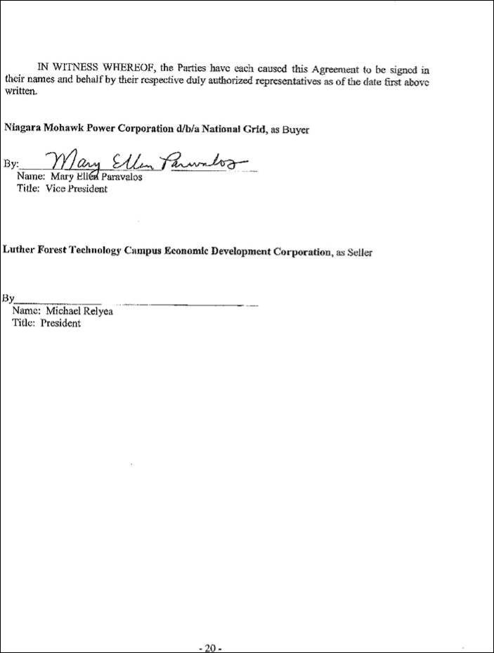
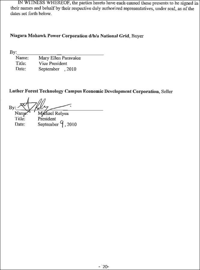
Signatures are on following page.
- 19 -
Effective Date: 9/9/2010 - Docket #: ER10-2634-000 - Page 1
NYISO Agreements --> National Grid and Luther Forest EDC
Effective Date: 9/9/2010 - Docket #: ER10-2634-000 - Page 1
NYISO Agreements --> National Grid and Luther Forest EDC
Effective Date: 9/9/2010 - Docket #: ER10-2634-000 - Page 1
NYISO Agreements --> National Grid and Luther Forest EDC
Service Agreement No. 1631
EXHIBIT A
VESTING SCHEDULE OF FEE PARCELS
The Property listed below has been acquired by Seller either in fee or by easement with a future
interest to acquire them in fee and are to be further subdivided to provide Buyer the right to have
and enjoy ownership of certain portions of the parcels in fee simple absolute (the “Fee Parcels”).
Seller shall convey to Buyer at the Fee Closing those Fee Parcels which Buyer elects in its sole
discretion to own in fee simple absolute upon and after each of the following events: (i) Seller, at
its cost and expense, having obtained approval from the respective municipality to subdivide the
subject Fee Parcels from the remainder of Seller’s Property; and (ii) Seller having filed a
subdivision plat therefore with the respective County Clerk:
PARCEL 2-S:West of Brickyard Road (Little Dee) [SBL No. 253.00-1-55.11]
PARCEL 3-S:Brickyard Road (rear) (Hanehan)[SBL No. 253.00-1-43.31]
PARCEL 5-S:Brickyard Road (DeLaRosa) [SBL No. 253.00-1-36.1]
PARCEL 7-S:Graves Road (Wright) [SBL No. 252.00-2-8]
PARCEL 8-S:Graves Road (Benson)[SBL No. 252.00-2-15.11]
PARCEL 9-S:12 Graves Road (Gailor) [SBL No. 252.-2-15.122]
PARCEL 10-S:George Thompson Road (D.A. Collins)[SBL No. 252.00-2-3]
PARCEL 12-S:Technology Campus[SBL No. 241.00-1-3.11]
PARCEL 13-S:Luther Forest Substation [SBL No. 241.00-1-3.11]
PARCEL 1-M: (The Enclave)
Parcel D:Lot 31 [SBL No. 229.81-1-27]
PARCEL 5-M&S: Former Wright Malta Site [Portion of SBL No. 241.00-1-3.11 (Stillwater)]
- 21 -
Effective Date: 9/9/2010 - Docket #: ER10-2634-000 - Page 1
NYISO Agreements --> National Grid and Luther Forest EDC
Service Agreement No. 1631
EXHIBIT B
ASSETS
- 22 -
Effective Date: 9/9/2010 - Docket #: ER10-2634-000 - Page 1
NYISO Agreements --> National Grid and Luther Forest EDC
Service Agreement No. 1631
EXHIBIT C
EASEMENT AREAS
STILLWATER
Parcel 1-S: NYSEG (SBL# 253.00-1-42; 253.00-1-40.2; 253.00-1-43.32; 253.00-1-55.2)
All those certain tracts, pieces or parcels of land situate, lying and being in the Town of Stillwater, County of Saratoga, State of New York, lying Northwesterly of Brickyard Road bounded and described as follows:
ELECTRIC TRANSMISSION LINE EASEMENT AREA
Beginning at a point at the intersection of the division line between the lands now or formerly of
New York State Electric and Gas Corporation as described in Book 1039 of Deeds at Page 648 on
the Southeast and the lands now or formerly of The Little Dee Corporation as described in Book
1431 of Deeds at Page 556 on the Northwest with the common division line between the lands now
or formerly of New York State Electric and Gas Corporation as described in Book 1039 of Deeds at
Page 648, Book 1038 of Deeds at Page 264, and Book 977 of Deeds at Page 1126 on the Southwest
and the lands now or formerly of Luther Forest Technology Campus Economic Development
Corporation as described in Instrument No. 2007012034 and the lands now or formerly of Anthony
J. DeMarco, Sr. and Wendy M. DeMarco as described in Book 1101 of Deeds at Page 25 on the
Northeast and runs thence from said point of beginning South 65 deg. 50 min. 01 sec. East along
the above last mentioned common division line 626.08 feet to a point; thence through the lands
now or formerly of New York State Electric and Gas Corporation as described in Book 1039 of
Deeds at Page 648, Book 1038 of Deeds at Page 264, Book 977 of Deeds at Page 1126, and Book
705 of Deeds at Page 62 the following ten (10) courses: 1) South 07 deg. 18 min. 19 sec. East
150.70 feet to a point; 2) thence North 66 deg. 47 min. 43 sec. West 100.04 feet to a point; 3)
thence North 23 deg. 42 min. 12 sec. East 28.79 feet to a point; 4) thence North 66 deg. 10 min. 46
sec. West 544.75 feet to a point; 5) thence South 18 deg. 01 min. 14 sec. West 95.83 feet to a point;
6) thence South 35 deg. 13 min. 11 sec. East 273.32 feet to a point; 7) thence South 65 deg. 42 min.
53 sec. East 300.96 feet to a point; 8) thence North 23 deg. 42 min. 12 sec East 109.59 feet to a
point; 9) thence South 66 deg. 47 min. 43 sec. East 98.21 feet to a point; and 10) thence South 24
deg. 42 min. 57 sec. West 211.45 feet to a point on the common division line between the lands
now or formerly of New York State Electric and Gas Corporation as described in Book 705 of
Deeds at Page 62 on the Northeast and the lands now or formerly of Daniel G. Motta and Carrie S.
Shpunt-Motta as described in Book 1556 of Deeds at Page 309, lands now or formerly of James
Stanley and Susan Stanley as described in Book 1480 of Deeds at Page 115, and the lands now or
formerly of John I. MacDougal, Jr. and Dorothy H. MacDougal as described in Book 975 of Deeds
at Page 321 on the Southwest; thence North 65 deg. 50 min. 01 sec. West along the along last
mentioned common division line 422.20 feet to a point; thence North 35 deg. 13 min. 11 sec. West
through the lands now or formerly of New York State Electric and Gas Corporation 317.85 feet to a
point on the above first mentioned division line between the lands now or formerly of New York
State Electric and Gas Corporation on the Southeast and the lands now or formerly of The Little
Dee Corporation on the Northwest; thence North 22 deg. 59 min. 04 sec. East along the said above
- 23 -
Effective Date: 9/9/2010 - Docket #: ER10-2634-000 - Page 1
NYISO Agreements --> National Grid and Luther Forest EDC
Service Agreement No. 1631
first mentioned division line 278.21 feet to the point or place of beginning and containing 3.68 acres of land, more or less.
ACCESS EASEMENT AREA
Beginning at a point on the Northwesterly boundary of Brickyard Road (a.k.a. Stillwater Avenue
Extension), said point being located North 24 deg. 48 min. 49 sec. East 212.39 feet as measured
along said Northwesterly road boundary from its intersection with the division line between the
lands now or formerly of New York State Electric and Gas Corporation as described in Book 705
of Deeds at Page 62 on the Northeast and the lands now or formerly of Daniel G. Motta and Carrie
S. Shpunt-Motta as described in Book 1556 of Deeds at Page 309 on the Southwest and runs thence
from said point of beginning North 66 deg. 47 min 43 sec. West through the lands now or formerly
of New York State Electric and Gas Corporation in part along the Northeasterly boundary of the
hereinabove described proposed electric transmission line easement 154.02 feet to a point; thence
North 23 deg. 49 min. 42 sec. East through the lands now or formerly of New York State Electric
and Gas Corporation 100.01 feet to a point on the Southwesterly boundary of the hereinabove
described proposed electric transmission line easement; thence continuing through the lands now or
formerly of New York State Electric and Gas Corporation as described in Book in Book 705 of
Deeds at Page 62 along the above mentioned proposed electric transmission line easement the
following two (2) courses: 1) South 66 deg. 47 min. 43 sec. East 100.04 feet to a point; and 2)
thence North 07 deg. 18 min. 19 sec. West 26.70 feet to a point; thence South 66 deg. 47 min. 43 sec. East continuing through the lands now or formerly of New York State Electric and Gas Corporation 69.90 feet to a point on the above mentioned Northwesterly boundary of Brickyard Road (a.k.a. Stillwater Avenue Extension); thence South 24 deg. 48 min. 49 sec. West along the said above mentioned Northwesterly road boundary 123.05 feet to the point or place of beginning and containing 16,932± square feet of land or 0.39 acre of land, more or less.
Parcel 2-S: Little Dee (SBL#: 253.00-1-55.11)
All those certain tracts, pieces or parcels of land situate in the Town of Stillwater, County of
Saratoga, State of New York, lying generally West of Brickyard Road bounded and described as
follows:
ELECTRIC TRANSMISSION LINE EASEMENT AREA
Beginning at the point of intersection of the division line between the lands now or formerly of The
Little Dee Corporation as described in Book 1431 of Deeds at Page 556 on the South and the lands
now or formerly of Rolling Fields Realty Corp. as described in Book 1614 of Deeds at Page 137 on
the North with the division line between the said lands now or formerly of The Little Dee
Corporation on the Northwest and the lands now or formerly of New York State Electric and Gas
Corporation as described in Book 1039 of Deeds at Page 648 on the Southeast and runs thence
from said point of beginning along the last mentioned division line South 22 deg. 59 min. 04 sec.
West 302.54 feet to a point; thence through the said lands now or formerly of The Little Dee
Corporation the following three (3) courses: 1) North 64 deg. 41 min. 14 sec. West 62.67 feet to a
- 24 -
Effective Date: 9/9/2010 - Docket #: ER10-2634-000 - Page 1
NYISO Agreements --> National Grid and Luther Forest EDC
Service Agreement No. 1631
point; 2) North 25 deg. 18 min. 46 sec. East 287.89 feet to a point; and 3) North 18 deg. 01 min. 14 sec. East 3.64 feet to a point on the above first mentioned division line; thence along said above first mentioned division line South 76 deg. 39 min. 57 sec. East 51.97 feet to the point or place of beginning and containing 16,817± square feet or 0.39 acre of land, more or less.
TREE TRIMMING AND CLEARING EASEMENT AREA
Commencing at the point of intersection of the division line between the lands now or formerly of
The Little Dee Corporation as described in Book 1431 of Deeds at Page 556 on the South and the
lands now or formerly of Rolling Fields Realty Corp. as described in Book 1614 of Deeds at Page
137 on the North with the division line between the said lands now or formerly of The Little Dee
Corporation on the Northwest and the lands now or formerly of New York State Electric and Gas
Corporation as described in Book 1039 of Deeds at Page 648 on the Southeast; thence from said
point of commencement along the last mentioned division line South 22 deg. 59 min. 04 sec. West
327.56 feet to the point or place of beginning and runs thence from said point of beginning through
the said lands now or formerly of The Little Dee Corporation the following two (2) courses: 1)
North 64 deg. 41 min. 14 sec. West 88.68 feet to a point; and 2) North 25 deg. 18 min. 46 sec. East
311.30 feet to a point on the above first mentioned division line; thence along said above first
mentioned division line South 76 deg. 39 min. 57 sec. East 25.08 feet to a point; thence through the
said lands now or formerly of The Little Dee Corporation and along the Westerly, Northwesterly
and Southwesterly boundary of the hereinabove described utility easement the following three (3)
courses: 1) South 18 deg. 01 min. 14 sec. West 3.64 feet to a point; 2) South 25 deg. 18 min. 46
sec. West 287.89 feet to a point; and 3) South 64 deg. 41 min. 14 sec. East 62.67 feet to a point on
the division line between the said lands now or formerly of The Little Dee Corporation on the
Northwest and the said lands now or formerly of New York State Electric and Gas Corporation on
the Southeast; thence South 22 deg. 59 min. 04 sec. West along the last mentioned division line
25.02 feet to the point or place of beginning and containing 9,427± square feet or 0.22 acre of land, more or less.
Parcel 3-S: Former Hanehan (SBL# 253.00-1-433.31)
All those certain tracts, pieces or parcels of land situate in the Town of Stillwater, County of
Saratoga, State of New York, lying generally Northwest of Brickyard Road bounded and described
as follows:
ELECTRIC TRANSMISSION LINE EASEMENT AREA
Beginning at the point of intersection of the division line between the lands now or formerly of
- 25 -
Effective Date: 9/9/2010 - Docket #: ER10-2634-000 - Page 1
NYISO Agreements --> National Grid and Luther Forest EDC
Service Agreement No. 1631
Luther Forest Technology Campus Economic Development Corporation as described in Instrument
No. 2007012034 on the East and the lands now or formerly of Rolling Fields Realty Corp. as
described in Book 1614 of Deeds at Page 137 on the West with the division line between the said
lands now or formerly of Luther Forest Technology Campus Economic Development Corporation
on the Northeast and the lands now or formerly of New York State Electric and Gas Corporation as
described in Book 1038 of Deeds at Page 264 on the Southwest and runs thence from said point of
beginning along the above first mentioned division line the following two (2) courses: 1) North 21
deg. 44 min. 38 sec. East 232.89 feet to a point; and 2) North 04 deg. 39 min. 23 sec. East 105.30
feet to its point of intersection with the division line between the said lands now or formerly of
Luther Forest Technology Campus Economic Development Corporation on the Southeast and the
said lands now or formerly of Rolling Fields Realty Corp. on the Northwest; thence North 22 deg.
55 min. 10 sec. East along the last mentioned division line 128.05 feet to its point of intersection
with the division line between the said lands now or formerly of Luther Forest Technology Campus
Economic Development Corporation on the South and the lands now or formerly of Julian J.
Delarosa and Lydia M. Delarosa as described in Book 421 of Deeds at Page 124 on the North;
thence South 72 deg. 59 min. 18 sec. East along the last mentioned division line 25.11 feet to a
point; thence through the said lands now or formerly of Luther Forest Technology Campus
Economic Development Corporation the following two (2) courses: 1) South 02 deg. 05 min. 54
sec. West 46.40 feet to a point; and 2) South 18 deg. 01 min. 14 sec. West 422.52 feet to a point on the division line between the said lands now or formerly of Luther Forest Technology Campus Economic Development Corporation on the Northeast and the said lands now or formerly of New York State Electric and Gas Corporation on the Southwest; thence North 65 deg. 50 min. 01 sec. West along the last mentioned division line 39.78 feet to the point or place of beginning and containing 16,521± square feet or 0.38 acre of land, more or less.
TREE TRIMMING AND CLEARING EASEMENT AREA
Commencing at the point of intersection of the division line between the lands now or formerly of
Luther Forest Technology Campus Economic Development Corporation as described in Instrument
No. 2007012034 on the East and the lands now or formerly of Rolling Fields Realty Corp. as
described in Book 1614 of Deeds at Page 137 on the West with the division line between the said
lands now or formerly of Luther Forest Technology Campus Economic Development Corporation
on the Northeast and the lands now or formerly of New York State Electric and Gas Corporation as
described in Book 1038 of Deeds at Page 264 on the Southwest; thence from said point of
commencement along the last mentioned division line South 65 deg. 50 min. 01 sec. East 39.78 feet
to the point or place of beginning and runs thence from said point of beginning through the said
lands now or formerly of Luther Forest Technology Campus Economic Development Corporation
and along the Easterly boundary of the hereinabove described utility easement the following two
(2) courses: 1) North 18 deg. 01 min. 14 sec. East 422.52 feet to a point; and 2) North 02 deg. 05
min. 54 sec. East 46.40 feet to a point on the division line between the said lands now or formerly
of Luther Forest Technology Campus Economic Development Corporation on the South and the
lands now or formerly of Julian J. Delarosa and Lydia M. Delarosa as described in Book 421 of
Deeds at Page 124 on the North; thence South 72 deg. 59 min. 18 sec. East along the last mentioned
- 26 -
Effective Date: 9/9/2010 - Docket #: ER10-2634-000 - Page 1
NYISO Agreements --> National Grid and Luther Forest EDC
Service Agreement No. 1631
division line 25.87 feet to a point; thence through the said lands now or formerly of Luther Forest
Technology Campus Economic Development Corporation the following two (2) courses: 1) South
02 deg. 05 min. 54 sec. West 43.24 feet to a point; and 2) South 18 deg. 01 min. 14 sec. West 428.71 feet to a point on the division line between the said lands now or formerly of Luther Forest Technology Campus Economic Development Corporation on the Northeast and the said lands now or formerly of New York State Electric and Gas Corporation on the Southwest; thence North 65 deg. 50 min. 01 sec. West along the last mentioned division line 25.14 feet to the point or place of beginning and containing 11,761± square feet or 0.27 acre of land, more or less.
Parcel 4-S: Rolling Fields (SBL# 253.00-1-55.122)
All those certain tracts, pieces or parcels of land situate, lying and being in the Town of Stillwater, County of Saratoga, State of New York, lying Northwesterly of Brickyard Road, and being more particularly bounded and described as follows:
ELECTRIC TRANSMISSION LINE EASEMENT AREA
Beginning at a point at the intersection of the division line between the lands now or formerly of
Rolling Fields Realty Corp. as described in Book 1614 of Deeds at Page 137 on the West and the
lands now or formerly of Luther Forest Technology Campus Economic Development Corporation
as described in Instrument No. 2007012034 on the East with the common division line between the
said lands now or formerly of Rolling Fields Realty Corp. on the North and the lands now or
formerly of New York State Electric and Gas Corporation as described in Book 1039 of Deeds as
Page 648 and lands now or formerly of The Little Dee Corporation as described in Book 1431 of
Deeds at Page 556 on the South and runs thence from said point of beginning along the above last
mentioned common division line the following two (2) courses: 1) North 65 deg. 50 min. 01 sec.
West 58.99 feet to a point; and 2) North 76 deg. 39 min. 57 sec. West 51.97 feet to a point; thence
through the said lands now or formerly of Rolling Fields Realty Corp. the following two (2)
courses: 1) North 18 deg. 01 min. 14 sec. East 395.22 feet to a point; and 2) North 02 deg. 05 min.
54 sec. East 65.37 feet to a point on the division line between the said lands now or formerly of
Rolling Fields Realty Corp. on the South and the lands now or formerly of Julian J. Delarosa and
Lydia M. Delarosa as described in Book 421 of Deeds at Page 124 on the North; thence South 72
deg. 59 min. 18 sec. East along the above last mentioned division line 130.12 feet to its intersection
with the above first mentioned division line; thence along said above first mentioned division line
the following three (3) courses: 1) South 22 deg. 55 min. 10 sec. West 128.05 feet to a point; 2)
South 04 deg. 39 min. 23 sec. West 105.30 feet to a point; and 3) South 21 deg. 44 min. 38 sec.
West 232.89 feet the point or place of beginning and containing 1.21 acres of land, more or less.
- 27 -
Effective Date: 9/9/2010 - Docket #: ER10-2634-000 - Page 1
NYISO Agreements --> National Grid and Luther Forest EDC
Service Agreement No. 1631
TREE TRIMMING AND CLEARING EASEMENT AREA
Commencing at a point at the intersection of the division line between the lands now or formerly of
Rolling Fields Realty Corp. as described in Book 1614 of Deeds at Page 137 on the West and the
lands now or formerly of Luther Forest Technology Campus Economic Development Corporation
as described in Instrument No. 2007012034 on the East with the common division line between the
said lands now or formerly of Rolling Fields Realty Corp. on the North and the lands now or
formerly of New York State Electric and Gas Corporation as described in Book 1039 of Deeds as
Page 648 and lands now or formerly of The Little Dee Corporation as described in Book 1431 of
Deeds at Page 556 on the South; thence from said point of commencement along the above last
mentioned common division line the following two (2) courses: 1) North 65 deg. 50 min. 01 sec.
West 58.99 feet to a point; and 2) North 76 deg. 39 min. 57 sec. West 51.97 feet to the point or
place of beginning and runs thence from said point of beginning continuing along the last
mentioned common division line North 76 deg. 39 min. 57 sec. West 2.71 feet to a point; thence
through the said lands now or formerly of Rolling Fields Realty Corp. the following two (2)
courses: 1) North 14 deg. 50 min. 26 sec. East 390.25 feet to a point; and 2) North 02 deg. 05 min.
54 sec. East 70.92 feet to a point on the division line between the said lands now or formerly of
Rolling Fields Realty Corp. on the South and the lands now or formerly of Julian J. Delarosa and
Lydia M. Delarosa as described in Book 421 of Deeds at Page 124 on the North; thence South 72
deg. 59 min. 18 sec. East along the last mentioned division line 25.87 feet to a point; thence
through the said lands now or formerly of Rolling Fields Realty Corp. and along the Westerly
boundary of the hereinabove described utility easement the following two (2) courses: 1) South 02
deg. 05 min. 54 sec. West 65.37 feet to a point; and 2) South 18 deg. 01 min. 14 sec. West 395.22
feet to the point or place of beginning and containing 7,042± square feet or 0.16 acre of land, more
or less.
Parcel 5-S: Delarosa (SBL# 253.00-1-36.1)
All those certain tracts, pieces or parcels of land situate in the Town of Stillwater, County of
Saratoga, State of New York, lying generally West of Brickyard Road bounded and described as
follows:
ELECTRIC TRANSMISSION LINE EASEMENT AREA
Beginning at the point of intersection of the division line between the lands now or formerly of
Julian J. Delarosa and Lydia M. Delarosa as described in Book 421 of Deeds at Page 124 on the
North and the lands now or formerly of Rolling Fields Realty Corp. as described in Book 1614 of
Deeds at Page 137 on the South with the division line between the said lands now or formerly of
Rolling Fields Realty Corp. on the Northwest and the lands now or formerly of Luther Forest
Technology Campus Economic Development Corporation as described in Instrument No.
2007012034 on the Southeast and runs thence from said point of beginning along the above first
- 28 -
Effective Date: 9/9/2010 - Docket #: ER10-2634-000 - Page 1
NYISO Agreements --> National Grid and Luther Forest EDC
Service Agreement No. 1631
mentioned division line North 72 deg. 59 min. 18 sec. West 130.12 feet to a point; thence through
the said lands now or formerly of Julian J. Delarosa and Lydia M. Delarosa North 02 deg. 05 min.
54 sec. East 835.18 feet to a point on the division line between the said lands now or formerly of
Julian J. Delarosa and Lydia M. Delarosa on the South and the lands now or formerly of Country
Club Acres, Inc. as described in Book 1507 of Deeds at Page 592 lands formerly of Robert
VanPatten as described in Book 913 of Deeds at Page 436 on the North; thence South 73 deg. 28
min. 01 sec. East along the last mentioned division line 154.89 feet to a point; thence through the
said lands now or formerly of Julian J. Delarosa and Lydia M. Delarosa South 02 deg. 05 min. 54
sec. West 836.52 feet to a point on the division line between the said lands now or formerly of
Julian J. Delarosa and Lydia M. Delarosa on the North and the said lands now or formerly of
Luther Forest Technology Campus Economic Development Corporation as described in Instrument
No. 2007012034 on the South; thence North 72 deg. 59 min. 18 sec. West along the last mentioned
division line 25.11 feet to the point or place of beginning and containing 2.88 acres of land, more or
less.
TREE TRIMMING AND CLEARING EASEMENT AREA NO. 1
Commencing at the point of intersection of the division line between the lands now or formerly of
Julian J. Delarosa and Lydia M. Delarosa as described in Book 421 of Deeds at Page 124 on the
North and the lands now or formerly of Rolling Fields Realty Corp. as described in Book 1614 of
Deeds at Page 137 on the South with the division line between the said lands now or formerly of
Rolling Fields Realty Corp. on the Northwest and the lands now or formerly of Luther Forest
Technology Campus Economic Development Corporation as described in Instrument No.
2007012034 on the Southeast; thence from said point of commencement along the above first
mentioned division line North 72 deg. 59 min. 18 sec. West 130.12 feet to the point or place of
beginning and runs thence from said point of beginning continuing along said above first
mentioned division line North 72 deg. 59 min. 18 sec. West 25.87 feet to a point; thence through
the said lands now or formerly of Julian J. Delarosa and Lydia M. Delarosa North 02 deg. 05 min.
54 sec. East 834.96 feet to a point on the division line between the said lands now or formerly of
Julian J. Delarosa and Lydia M. Delarosa on the South and the lands now or formerly of Country
Club Acres, Inc. as described in Book 1507 of Deeds at Page 592 lands formerly of Robert
VanPatten as described in Book 913 of Deeds at Page 436 on the North; thence South 73 deg. 28
min. 01 sec. East along the last mentioned division line 25.81 feet to a point; thence through the
said lands now or formerly of Julian J. Delarosa and Lydia M. Delarosa and along the Westerly
boundary of the hereinabove described 150-foot-wide utility easement South 02 deg. 05 min. 54
sec. West 835.18 feet to the point or place of beginning and containing 20,877± square feet or 0.48
acre of land, more or less.
- 29 -
Effective Date: 9/9/2010 - Docket #: ER10-2634-000 - Page 1
NYISO Agreements --> National Grid and Luther Forest EDC
Service Agreement No. 1631
TREE TRIMMING AND CLEARING EASEMENT AREA NO. 2
Commencing at the point of intersection of the division line between the lands now or formerly of
Julian J. Delarosa and Lydia M. Delarosa as described in Book 421 of Deeds at Page 124 on the
North and the lands now or formerly of Luther Forest Technology Campus Economic Development
Corporation as described in Instrument No. 2007012034 on the South with the division line
between the said lands now or formerly of Luther Forest Technology Campus Economic
Development Corporation on the Southeast and the lands now or formerly of Rolling Fields Realty
Corp. as described in Book 1614 of Deeds at Page 137 on the Northwest; thence from said point of
commencement along the above first mentioned division line South 72 deg. 59 min. 18 sec. East
25.11 feet to the point or place of beginning and runs thence from said point of beginning through
the said lands now or formerly of Julian J. Delarosa and Lydia M. Delarosa and along the Easterly
boundary of the hereinabove described 150-foot-wide utility easement North 02 deg. 05 min. 54
sec. East 836.52 feet to a point on the division line between the said lands now or formerly of
Julian J. Delarosa and Lydia M. Delarosa on the South and the lands now or formerly of Country
Club Acres, Inc. as described in Book 1507 of Deeds at Page 592 lands formerly of Robert
VanPatten as described in Book 913 of Deeds at Page 436 on the North; thence South 73 deg. 28
min. 01 sec. East along the last mentioned division line 25.81 feet to a point; thence through the
said lands now or formerly of Julian J. Delarosa and Lydia M. Delarosa South 02 deg. 05 min. 54
sec. West 836.74 feet to a point on the above first mentioned division line; thence along said above
first mentioned division line North 72 deg. 59 min. 18 sec. West 25.87 feet to the point or place of
beginning and containing 20,916± square feet or 0.48 acre of land, more or less.
Parcel 6-S: Country Club Acres (SBL# 253.00-1-52)
All those certain tracts, pieces or parcels of land situate in the Town of Stillwater, County of Saratoga, State of New York, lying generally Southeast of Mechanicville - Stillwater Center County Road 75 bounded and described as follows:
ELECTRIC TRANSMISSION LINE EASEMENT AREA
Commencing at a point on the Northeasterly 1938 highway boundary of Mechanicville - Stillwater
Center County Road 75 as described in Book 399 of Deeds at Page 3 at its point of intersection
with the division line between the lands now or formerly of Country Club Acres, Inc. as described
in Book 1507 of Deeds at Page 592 and Instrument No. 9903192 lands formerly of Robert
VanPatten as described in Book 913 of Deeds at Page 436 on the South and the lands now or
formerly of Ronald D. Revers and Adrienne B. Revers as described in Book 972 of Deeds at Page
78 on the North; thence from said point of commencement along said Northeasterly 1938 highway
boundary of Mechanicville - Stillwater Center County Road 75 South 34 deg. 19 min. 34 sec. East
371.40 feet to the point or place of beginning and runs thence from said point of beginning through
the said lands now or formerly of Country Club Acres, Inc. the following two (2) courses: 1) South
- 30 -
Effective Date: 9/9/2010 - Docket #: ER10-2634-000 - Page 1
NYISO Agreements --> National Grid and Luther Forest EDC
Service Agreement No. 1631
72 deg. 45 min. 56 sec. East 4,059.53 feet to a point; and 2) South 02 deg. 05 min. 54 sec. West
179.81 feet to a point on the division line between the said lands now or formerly of Country Club
Acres, Inc. on the North and the lands now or formerly of Julian J. Delarosa and Lydia M. Delarosa
as described in Book 421 of Deeds at Page 124 on the South; thence North 73 deg. 28 min. 01 sec.
West along the last mentioned division line 154.89 feet to a point; thence through the said lands
now or formerly of Country Club Acres, Inc. the following two (2) courses: 1) North 02 deg. 05
min. 54 sec. East 26.38 feet to a point; and 2) North 72 deg. 45 min. 56 sec. West 3,776.59 feet to a
point on the said Northeasterly 1938 highway boundary of Mechanicville - Stillwater Center
County Road 75; thence along said Northeasterly 1938 highway boundary the following two (2)
courses: 1) North 28 deg. 48 min. 40 sec. West 134.96 feet to a point; and 2) North 34 deg. 19 min.
34 sec. West 90.60 feet to the point or place of beginning and containing 13.83 acres of land, more
or less.
TREE TRIMMING AND CLEARING EASEMENT AREA NO. 1
Commencing at a point on the Northeasterly 1938 highway boundary of Mechanicville - Stillwater
Center County Road 75 as described in Book 339 of Deeds at Page 3 at its point of intersection
with the division line between the lands now or formerly of Country Club Acres, Inc. as described
in Book 1507 of Deeds at Page 592 and Instrument No. 9903192 lands formerly of Robert
VanPatten as described in Book 913 of Deeds at Page 436 on the South and the lands now or
formerly of Ronald D. Revers and Adrienne B. Revers as described in Book 972 of Deeds at Page
78 on the North; thence from said point of commencement along said Northeasterly 1938 highway
boundary of Mechanicville - Stillwater Center County Road 75 South 34 deg. 19 min. 34 sec. East
331.19 feet to the point or place of beginning and runs thence from said point of beginning through
the said lands now or formerly of Country Club Acres, Inc. the following two (2) courses: 1) South
72 deg. 45 min. 56 sec. East 4,110.16 feet to a point; and 2) South 02 deg. 05 min. 54 sec. West
205.38 feet to a point on the division line between the said lands now or formerly of Country Club
Acres, Inc. on the North and the lands now or formerly of Julian J. Delarosa and Lydia M. Delarosa
as described in Book 421 of Deeds at Page 124 on the South; thence North 73 deg. 28 min. 01 sec.
West along the last mentioned division line 25.81 feet to a point; thence through the said lands now
or formerly of Country Club Acres, Inc. and along the Easterly and Northerly boundary of the
hereinabove described 150-foot-wide utility easement the following two (2) courses: 1) North 02
deg. 05 min. 54 sec. East 179.81 feet to a point; and 2) North 72 deg. 45 min. 56 sec. West 4,059.53
feet to a point on the above mentioned Northeasterly 1938 highway boundary of Mechanicville -
Stillwater Center County Road 75; thence along said Northeasterly 1938 highway boundary North
34 deg. 19 min. 34 sec. West 40.21 feet to the point or place of beginning and containing 2.45 acres of land, more or less.
- 31 -
Effective Date: 9/9/2010 - Docket #: ER10-2634-000 - Page 1
NYISO Agreements --> National Grid and Luther Forest EDC
Service Agreement No. 1631
TREE TRIMMING AND CLEARING EASEMENT AREA NO. 2
Commencing at a point on the Northeasterly 1938 highway boundary of Mechanicville - Stillwater
Center County Road 75 as described in Book 399 of Deeds at Page 3 at its point of intersection
with the division line between the lands now or formerly of Country Club Acres, Inc. as described
in Book 1507 of Deeds at Page 592 and Instrument No. 9903192 lands formerly of Robert
VanPatten as described in Book 913 of Deeds at Page 436 on the South and the lands now or
formerly of Ronald D. Revers and Adrienne B. Revers as described in Book 972 of Deeds at Page
78 on the North; thence from said point of commencement along said Northeasterly 1938 highway
boundary of Mechanicville - Stillwater Center County Road 75 the following two (2) courses: 1)
South 34 deg. 19 min. 34 sec. East 462.00 feet to a point; and 2) South 28 deg. 48 min. 40 sec. East
134.96 feet to the point or place of beginning and runs thence from said point of beginning through
the said lands now or formerly of Country Club Acres, Inc. and along the Southerly and Westerly
boundary of the hereinabove described 150-foot-wide utility easement the following two (2)
courses: 1) South 72 deg. 45 min. 56 sec. East 3,776.59 feet to a point; and 2) South 02 deg. 05
min. 54 sec. West 26.38 feet to a point on the common division line between the said lands now or
formerly of Country Club Acres, Inc. on the North and the lands now or formerly of Julian J.
Delarosa and Lydia M. Delarosa as described in Book 421 of Deeds at Page 124 and lands now or
formerly of Robert G. Meyer as described in Book 964 of Deeds at Page 47 on the South; thence
North 73 deg. 28 min. 01 sec. West along the last mentioned common division line 2,605.52 feet to
its point of intersection with the division line between the said lands now or formerly of Country
Club Acres, Inc. on the North and the lands now or formerly of Edward C. Tomlinson and Jo Ann
M. Tomlinson as described in Book 964 of Deeds at Page 933 on the South; thence North 72 deg.
46 min. 46 sec. West along the last mentioned division line 912.21 feet to a point; thence through
the said lands now or formerly of Country Club Acres, Inc. the following two (2) courses: 1) North
08 deg. 26 min. 34 sec. East 32.97 feet to a point; and 2) North 72 deg. 45 min. 56 sec. West 264.50
feet to a point on the Easterly highway boundary of Mechanicville - Stillwater Center County Road
75 as established as a 3-rod right-of-way; thence along said Easterly highway boundary in a
Northerly direction along a curve to the left having a radius of 741.18 feet, an arc length of 2.12
feet and a chord bearing of North 21 deg. 13 min. 22 sec. West 2.12 feet to its point of intersection
with the Southeasterly 1938 highway boundary of Mechanicville - Stillwater Center County Road
75; thence along said Southeasterly 1938 highway boundary North 55 deg. 40 min. 26 sec. East
20.31 feet to its point of intersection with the Northeasterly 1938 highway boundary of
Mechanicville - Stillwater Center County Road 75; thence along said Northeasterly 1938 highway boundary North 28 deg. 48 min. 40 sec. West 10.71 feet to the point or place of beginning and containing 3.83 acres of land, more or less.
TOGETHER WITH all those certain tracts, pieces or parcels of land situate, lying and being in the Town of Stillwater, County of Saratoga, State of New York, lying generally East of County Road 75, being an easement 30 feet in width the centerline of which is described as follows:
- 32 -
Effective Date: 9/9/2010 - Docket #: ER10-2634-000 - Page 1
NYISO Agreements --> National Grid and Luther Forest EDC
Service Agreement No. 1631
ACCESS ROAD EASEMENT AREA “F”
Beginning at a point on the Northeasterly boundary of County Road 75, said point being distant
South 34 deg. 19 min. 34 sec. East 254.04 feet as measured along the Northeasterly boundary of
County Road 75 from its intersection with the division line between the lands now or formerly of
Country Club Acres, Inc. as described in Book 1507 of Deeds at Page 592 (Instrument No.
9903192) lands formerly of Robert Van Patten as described in Book 913 of Deeds at Page 436 on
the South and the lands now or formerly of Ronald D. Revers and Adrienne B. Revers as described
in Book 972 of Deeds at Page 78 on the North and runs thence from said point of beginning along
the centerline of the proposed 30-foot-wide Access Road Easement “F” through the said lands now
or formerly of Country Club Acres, Inc. the following ten (10) courses: 1) North 60 deg. 45 min.
46 sec. East 36.13 feet to a point of curvature; 2) in an Easterly direction along a curve to the right
having a radius of 140.00 feet, a chord bearing of North 84 deg. 25 min. 39 sec. East and a chord
distance of 112.39 feet, an arc length of 115.65 feet to a point of tangency; 3) South 71 deg. 54
min. 27 sec. East 116.14 feet to a point; 4) South 73 deg. 16 min. 51 sec. East 684.63 feet to a
point; 5) South 71 deg. 33 min. 21 sec. East 413.62 feet to a point; 6) South 77 deg. 27 min. 38 sec.
East 108.28 feet to a point, said point being the point of beginning of the hereinafter described 30-
foot-wide Access Road Easement “F-1”; 7) South 59 deg. 39 min. 19 sec. East continuing along the
centerline of Access Road Easement “F”, a distance of 100.34 feet to a point; 8) South 62 deg. 09
min. 26 sec. East 19.39 feet to a point; 9) South 21 deg. 42 min. 09 sec. West 95.83 feet to a point;
and 10) South 34 deg. 27 min. 15 sec. West 26.59 feet to a point on the Northerly boundary of a
proposed 150±-foot-wide utility easement, said point being situate South 72 deg. 45 min. 56 sec.
East 1,460.19 feet from the Northwest corner of said 150±-foot-wide utility easement.
Being a strip of land 30 feet in width, 15 feet each side of and parallel to the hereinabove described centerline and being approximately 1,709 feet in length.
ACCESS ROAD EASEMENT AREA “F-1”
Beginning at the Easterly terminus of the hereinabove described Course 6 of Access Road
Easement “F” and runs thence from said point of beginning along the centerline of the 30-foot-wide
Access Road Easement “F-1” through the lands now or formerly of Country Club Acres, Inc. the
following nine (9) courses: 1) North 81 deg. 05 min. 29 sec. East 100.14 feet to a point of
curvature; 2) in an Easterly direction along a curve to the left having a radius of 300.00 feet, a
chord bearing of North 69 deg. 21 min. 36 sec. East and a chord distance of 121.99 feet, an arc
length of 122.85 feet to a point of tangency; 3) North 57 deg. 37 min. 44 sec. East 65.54 feet to a
point of curvature; 4) in an Easterly direction along a curve to the right having a radius of 100.00
feet, a chord bearing of North 82 deg. 34 min. 18 sec. East and a chord distance of 84.34 feet, an
arc length of 87.07 feet to a point of tangency; 5) South 72 deg. 29 min. 09 sec. East 232.89 feet to
- 33 -
Effective Date: 9/9/2010 - Docket #: ER10-2634-000 - Page 1
NYISO Agreements --> National Grid and Luther Forest EDC
Service Agreement No. 1631
a point of curvature; 6) in a Southeasterly direction along a curve to the right having a radius of 250.00 feet, a chord bearing of South 59 deg. 32 min. 36 sec. East and a chord distance of 111.98 feet, an arc length of 112.94 feet to a point; 7) South 46 deg. 36 min. 04 sec. East 101.89 feet to a point; 8) South 33 deg. 13 min. 21 sec. East 172.22 feet to a point; and 9) South 08 deg. 50 min. 42 sec. East 168.86 feet to a point on the Northerly boundary of a proposed 150±-foot-wide utility easement, said point being situate South 72 deg. 45 min. 56 sec. East 2,313.45 feet from the Northwest corner of said 150±-foot-wide utility easement.
Being a strip of land 30 feet in width, 15 feet each side of and parallel to the hereinabove described centerline and being approximately 1,185 feet in length.
Parcel 6.5-S: County Route 75 (SBL# unassigned)
All those certain tracts, pieces or parcels of land situate in the Town of Stillwater, County of Saratoga, State of New York, being a portion of Mechanicville - Stillwater Center County Road 75 bounded and described as follows:
ELECTRIC TRANSMISSION LINE EASEMENT AREA
Commencing at a point on the Southwesterly highway boundary of Mechanicville - Stillwater
Center County Road 75 as described in Book 399 of Deeds at Page 3 at its point of intersection
with the division line between the lands now or formerly of Luther Forest Technology Campus
Economic Development Corporation as described in Book 1763 of Deeds at Page 143 on the East
and other lands now or formerly of Luther Forest Technology Campus Economic Development
Corporation as described in Instrument No. 2007003873 on the West; thence from said point of
commencement along said Southwesterly highway boundary of Mechanicville - Stillwater Center
County Road 75 South 33 deg. 47 min. 53 sec. East 53.30 feet to the point or place of beginning
and runs thence from said point of beginning through and across the road bed of Mechanicville -
Stillwater Center County Road 75 South 72 deg. 45 min. 56 sec. East 110.04 feet to a point on the
Northeasterly 1938 highway boundary of Mechanicville - Stillwater Center County Road 75;
thence along said Northeasterly highway boundary the following two (2) courses: 1) South 34 deg.
19 min. 34 sec. East 90.60 feet to a point; and 2) South 28 deg. 48 min. 40 sec. East 134.96 feet to a
point; thence through and across the road bed of Mechanicville - Stillwater Center County Road 75
North 72 deg. 45 min. 56 sec. West 93.42 feet to a point on the Westerly highway boundary of
Mechanicville - Stillwater Center County Road 75; thence along the Westerly and Southwesterly
highway boundary of Mechanicville - Stillwater Center County Road 75 the following two (2)
courses: 1) North 20 deg. 16 min. 02 sec. West 1.92 feet to a point; and 2) North 33 deg. 47 min.
53 sec. West 236.10 feet to the point or place of beginning and containing 15,794± square feet or
0.36 acre of land, more or less.
- 34 -
Effective Date: 9/9/2010 - Docket #: ER10-2634-000 - Page 1
NYISO Agreements --> National Grid and Luther Forest EDC
Service Agreement No. 1631
TREE TRIMMING AND CLEARING EASEMENT AREA NO. 1
Commencing at a point on the Southwesterly highway boundary of Mechanicville - Stillwater
Center County Road 75 as described in Book 399 of Deeds at Page 3 at its point of intersection
with the division line between the lands now or formerly of Luther Forest Technology Campus
Economic Development Corporation as described in Book 1763 of Deeds at Page 143 on the East
and other lands now or formerly of Luther Forest Technology Campus Economic Development
Corporation as described in Instrument No. 2007003873 on the West; thence from said point of
commencement along said Southwesterly highway boundary South 33 deg. 47 min. 53 sec. East
13.55 feet to the point or place of beginning and runs thence from said point of beginning through
and across the road bed of Mechanicville - Stillwater Center County Road 75 South 72 deg. 45 min.
56 sec. East 109.45 feet to a point on the Northeasterly 1938 highway boundary of Mechanicville -
Stillwater Center County Road 75; thence along said Northeasterly highway boundary South 34 deg. 19 min. 34 sec. East 40.21 feet to a point on the Northerly boundary of the hereinabove described utility easement; thence through and across the road bed of Mechanicville - Stillwater Center County Road 75 and along the Northerly boundary of the hereinabove described utility easement North 72 deg. 45 min. 56 sec. West 110.04 feet to a point on said Southwesterly highway boundary of Mechanicville - Stillwater Center County Road 75; thence along said Southwesterly highway boundary North 33 deg. 47 min. 53 sec. West 39.75 feet to the point or place of beginning and containing 2,744± square feet or 0.06 acre of land, more or less.
TREE TRIMMING AND CLEARING EASEMENT AREA NO. 2
Commencing at a point on the Southwesterly highway boundary of Mechanicville - Stillwater
Center County Road 75 as described in Book 399 of Deeds at Page 3 at its point of intersection
with the division line between the lands now or formerly of Luther Forest Technology Campus
Economic Development Corporation as described in Book 1763 of Deeds at Page 143 on the East
and other lands now or formerly of Luther Forest Technology Campus Economic Development
Corporation as described in Instrument No. 2007003873 on the West; thence from said point of
commencement along the Southwesterly and Westerly road boundary of Mechanicville - Stillwater
Center County Road 75 the following two (2) courses: 1) South 33 deg. 47 min. 53 sec. East
289.40 feet to a point; and 2) South 20 deg. 16 min. 02 sec. East 1.92 feet to the point or place of
beginning and runs thence from said point of beginning through and across the road bed of
Mechanicville - Stillwater Center County Road 75 and along the Southerly boundary of the
hereinabove described proposed utility easement South 72 deg. 45 min. 56 sec. East 93.42 feet to a
point on the Northeasterly 1938 highway boundary of Mechanicville - Stillwater Center County
Road 75; thence along the Northeasterly and Southeasterly 1938 highway boundary of
Mechanicville - Stillwater Center County Road 75 the following two (2) courses: 1) South 28 deg.
48 min. 40 sec. East 10.71 feet to a point; and 2) South 55 deg. 40 min. 26 sec. West 20.31 feet to a
- 35 -
Effective Date: 9/9/2010 - Docket #: ER10-2634-000 - Page 1
NYISO Agreements --> National Grid and Luther Forest EDC
Service Agreement No. 1631
point on the Easterly highway boundary of Mechanicville - Stillwater Center County Road 75;
thence along said Easterly highway boundary in a Southerly direction along a curve to the right
having a radius of 741.18 feet, an arc length of 2.12 feet and a chord bearing of South 21 deg. 13
min. 22 sec. East 2.12 feet to a point; thence through and across the road bed of Mechanicville -
Stillwater Center County Road 75 North 72 deg. 45 min. 56 sec. West 70.64 feet to a point on the
Westerly highway boundary of Mechanicville - Stillwater Center County Road 75; thence along
said Westerly highway boundary North 20 deg. 16 min. 02 sec. West 31.51 feet to the point or
place of beginning and containing 2,140± square feet or 0.05 acre of land, more or less.
Parcel 7-S: Former Wright (SBL# 252.00-2-8)
All those certain tracts, pieces or parcels of land situate in the Town of Stillwater, County of Saratoga, State of New York, lying Southwesterly of Mechanicville - Stillwater Center County Road 75 bounded and described as follows:
ELECTRIC TRANSMISSION LINE EASEMENT AREA
Commencing at a point on the Southwesterly 1938 highway boundary of Mechanicville - Stillwater
Center County Road 75 as described in Book 399 of Deeds at Page 3 at its point of intersection
with the division line between the lands now or formerly of Luther Forest Technology Campus
Economic Development Corporation as described in Book 1763 of Deeds at Page 143 on the East
and other lands now or formerly of Luther Forest Technology Campus Economic Development
Corporation as described in Instrument No. 2007003873 on the West; thence from said point of
commencement along said division line South 16 deg. 07 min. 26 sec. West 33.53 feet to the point
or place of beginning and runs thence from said point of beginning through the said lands now or
formerly of Luther Forest Technology Campus Economic Development Corporation as described
in Book 1763 of Deeds at Page 143 South 72 deg. 45 min. 56 sec. East 40.80 feet to a point on the
Southwesterly 1938 highway boundary of Mechanicville - Stillwater Center County Road 75;
thence along said Southwesterly 1938 highway boundary the following two (2) courses: 1) South
33 deg. 47 min. 53 sec. East 236.10 feet to a point; and 2) South 20 deg. 16 min. 02 sec. East 1.92
feet to a point; thence through the said lands now or formerly of Luther Forest Technology Campus
Economic Development Corporation as described in Book 1763 of Deeds at Page 143 North 72
deg. 45 min. 56 sec. West 222.62 feet to a point on the above first mentioned division line; thence
along said above first mentioned division line North 16 deg. 07 min. 26 sec. East 150.03 feet to the
point or place of beginning and containing 19,810± square feet of land or 0.45 acre of land, more or
less.
- 36 -
Effective Date: 9/9/2010 - Docket #: ER10-2634-000 - Page 1
NYISO Agreements --> National Grid and Luther Forest EDC
Service Agreement No. 1631
TREE TRIMMING AND CLEARING EASEMENT AREA NO. 1
Commencing at a point on the Southwesterly 1938 highway boundary of Mechanicville - Stillwater
Center County Road 75 as described in Book 399 of Deeds at Page 3 at its point of intersection
with the division line between lands now or formerly of Luther Forest Technology Campus
Economic Development Corporation as described in Book 1763 of Deeds at Page 143 on the East
and other lands now or formerly of Luther Forest Technology Campus Economic Development
Corporation as described in Instrument No. 2007003873 on the West and thence from said point of
commencement along said division line South 16 deg. 07 min. 26 sec. West 8.53 feet to the point or
place of beginning and runs thence from said point of beginning through the said lands now or
formerly of Luther Forest Technology Campus Economic Development Corporation as described
in Book 1763 of Deeds at Page 143 South 72 deg. 45 min. 56 sec. East 10.37 feet to a point on the
above mentioned Southwesterly 1938 highway boundary of Mechanicville - Stillwater Center
County Road 75; thence South 33 deg. 47 min. 53 sec. East along said Southwesterly 1938
highway boundary 39.75 feet to a point on the Northerly boundary of the hereinabove described
150-foot-wide utility easement to be granted to National Grid; thence through the said lands now or
formerly of Luther Forest Technology Campus Economic Development Corporation as described
in Book 1763 of Deeds at Page 143 and along the Northerly boundary of the hereinabove described
150-foot-wide utility easement North 72 deg. 45 min. 56 sec. West 40.80 feet to a point on the
above first mentioned division line; thence along said above first mentioned division line North 16
deg. 07 min. 26 sec. East 25.00 feet to the point or place of beginning and containing 640± square
feet or 0.01 acre of land, more or less.
TREE TRIMMING AND CLEARING EASEMENT AREA NO. 2
Commencing at a point on the Southwesterly 1938 highway boundary of Mechanicville - Stillwater
Center County Road 75 as described in Book 399 of Deeds at Page 3 at its point of intersection
with the division line between the lands now or formerly of Luther Forest Technology Campus
Economic Development Corporation as described in Book 1763 of Deeds at Page 143 on the East
and other lands now or formerly of Luther Forest Technology Campus Economic Development
Corporation as described in Instrument No. 2007003873 on the West; thence from said point of
commencement along said division line South 16 deg. 07 min. 26 sec. West 183.56 feet to the point
or place of beginning, said point being on the Southerly boundary of the hereinabove described
150-foot-wide utility easement to be granted to National Grid and runs thence from said point of
beginning along said Southerly boundary of the hereinabove described 150-foot-wide utility
easement South 72 deg. 45 min. 56 sec. East 222.62 feet to a point on the Westerly 1938 highway
boundary of Mechanicville - Stillwater Center County Road 75; thence along said Westerly 1938
highway boundary South 20 deg. 16 min. 02 sec. East 31.51 feet to a point; thence through the said
lands now or formerly of Luther Forest Technology Campus Economic Development Corporation
as described in Book 1763 of Deeds at Page 143 North 72 deg. 45 min. 56 sec. West 241.32 feet to
a point on the above first mentioned division line; thence along said above first mentioned division
- 37 -
Effective Date: 9/9/2010 - Docket #: ER10-2634-000 - Page 1
NYISO Agreements --> National Grid and Luther Forest EDC
Service Agreement No. 1631
line North 16 deg. 07 min. 26 sec. East 25.00 feet to the point or place of beginning and containing 5,799± square feet or 0.13 acre of land, more or less.
Parcel 8-S: Former Benson (SBL# 252.00-2-15.11)
All those certain tracts, pieces or parcels of land situate in the Town of Stillwater, County of Saratoga, State of New York, lying generally West of Mechanicville - Stillwater Center County Road 75 bounded and described as follows:
ELECTRIC TRANSMISSION LINE EASEMENT AREA
Commencing at a point on the Southwesterly 1938 highway boundary of Mechanicville - Stillwater
Center County Road 75 as described in Book 399 of Deeds at Page 3 at its point of intersection
with the division line between the lands now or formerly of Luther Forest Technology Campus
Economic Development Corporation as described in Instrument No. 2007003873 on the West and
other lands now or formerly of Luther Forest Technology Campus Economic Development
Corporation as described in Book 1763 of Deeds at Page 143 on the East; thence from said point of
commencement along said division line South 16 deg. 07 min. 26 sec. West 33.53 feet to the point
or place of beginning and runs thence from said point of beginning continuing along the above first
mentioned division line South 16 deg. 07 min. 26 sec. West 150.03 feet to a point; thence through
the said lands now or formerly of Luther Forest Technology Campus Economic Development
Corporation as described in Instrument No. 2007003873 the following three (3) courses: 1) North
72 deg. 45 min. 56 sec. West 97.16 feet to a point; 2) South 20 deg. 12 min. 43 sec. West 2,680.43
feet to a point; and 3) North 73 deg. 09 min. 19 sec. West 1,421.67 feet to a point on the division
line between the said lands now or formerly of Luther Forest Technology Campus Economic
Development Corporation as described in Instrument No. 2007003873 on the Southeast and other
lands now or formerly of Luther Forest Technology Campus Economic Development Corporation
as described in Instrument No. 2008001335 on the Northwest; thence North 27 deg. 36 min. 51 sec.
East along the last mentioned division line 152.69 feet to a point; thence through the said lands now
or formerly of Luther Forest Technology Campus Economic Development Corporation as
described in Instrument No. 2007003873 the following three (3) courses: 1) South 73 deg. 09 min.
19 sec. East 1,251.71 feet to a point; 2) North 20 deg. 12 min. 43 sec. East 2,681.40 feet to a point; and 3) South 72 deg. 45 min. 56 sec. East 236.65 feet to the point or place of beginning and containing 14.41 acres of land, more or less.
- 38 -
Effective Date: 9/9/2010 - Docket #: ER10-2634-000 - Page 1
NYISO Agreements --> National Grid and Luther Forest EDC
Service Agreement No. 1631
TREE TRIMMING AND CLEARING EASEMENT AREA NO. 1
Commencing at a point on the Southwesterly 1938 highway boundary of Mechanicville - Stillwater
Center County Road 75 as described in Book 399 of Deeds at Page 3 at its point of intersection
with the division line between the lands now or formerly of Luther Forest Technology Campus
Economic Development Corporation as described in Instrument No. 2007003873 on the West and
other lands now or formerly of Luther Forest Technology Campus Economic Development
Corporation as described in Book 1763 of Deeds at Page 143 on the East; thence from said point of
commencement along said division line South 16 deg. 07 min. 26 sec. West 183.56 feet to the point
or place of beginning and runs thence from said point of beginning continuing along the above first
mentioned division line South 16 deg. 07 min. 26 sec. West 25.00 feet to a point; thence through
the said lands now or formerly of Luther Forest Technology Campus Economic Development
Corporation as described in Instrument No. 2007003873 the following two (2) courses: 1) North
72 deg. 45 min. 56 sec. West 73.91 feet to a point; and 2) South 20 deg. 12 min. 43 sec. West
1,694.49 feet to a point on the common division line between the said lands now or formerly of
Luther Forest Technology Campus Economic Development Corporation as described in Instrument
No. 2007003873 on the West and the lands now or formerly of William R. Ritter, Jr. and Tina M.
Ritter as described in Book 1536 of Deeds at Page 260, lands now or formerly of Elizabeth S.
Defibaugh as described in Book 1363 of Deeds at Page 478, lands now or formerly of Mark Becker
and Joyce V. Becker as described in Instrument No. 2007002257, lands now or formerly of Gerald
V. Mormile III and Michele M. Mormile as described in Book 1340 of Deeds at Page 149 and lands
now or formerly of Christine Hoogkamp as described in Book 1646 of Deeds at Page 124 on the
East; thence South 20 deg. 12 min. 43 sec. West along the last mentioned common division line
985.78 feet to its point of intersection with the division line between the said lands now or formerly
of Luther Forest Technology Campus Economic Development Corporation as described in
Instrument No. 2007003873 on the North and the lands now or formerly of Peter Carriero and
Mary E. Carriero as described in Book 1029 of Deeds at Page 57 on the South; thence North 73
deg. 09 min. 19 sec. West along the last mentioned division line 1,450.00 feet to its point of
intersection with the division line between the lands now or formerly of Luther Forest Technology
Campus Economic Development Corporation as described in Instrument No. 2007003873 on the
Southeast and other lands now or formerly of Luther Forest Technology Campus Economic
Development Corporation as described in Instrument No. 2008001335 on the Northwest; thence
North 27 deg. 36 min. 51 sec. East along the last mentioned division line 25.45 feet to a point on
the Southerly boundary of the hereinabove described 150-foot-wide utility easement; thence
through the said lands now or formerly of Luther Forest Technology Campus Economic
Development Corporation as described in Instrument No. 2007003873 and along said Southerly
boundary of the hereinabove described 150-foot-wide utility easement South 73 deg. 09 min. 19
sec. East 1,421.67 feet to a point on the Easterly boundary of the hereinabove described 150-foot-
wide utility easement; thence continuing through the said lands now or formerly of Luther Forest
Technology Campus Economic Development Corporation as described in Instrument No.
2007003873 and along said Easterly boundary of the hereinabove described 150-foot-wide utility
easement North 20 deg. 12 min. 43 sec. East 2,680.43 feet to a point on Southerly boundary of the
hereinabove described 150-foot-wide utility easement; thence continuing through the said lands
now or formerly of Luther Forest Technology Campus Economic Development Corporation and
along said Southerly boundary of the hereinabove described 150-foot-wide utility easement South
- 39 -
Effective Date: 9/9/2010 - Docket #: ER10-2634-000 - Page 1
NYISO Agreements --> National Grid and Luther Forest EDC
Service Agreement No. 1631
72 deg. 45 min. 56 sec. East 97.16 feet to the point or place of beginning and containing 2.41 acres of land, more or less.
TREE TRIMMING AND CLEARING EASEMENT AREA NO. 2
Commencing at a point on the Southwesterly 1938 highway boundary of Mechanicville - Stillwater
Center County Road 75 as described in Book 399 of Deeds at Page 3 at its point of intersection
with the division line between the lands now or formerly of Luther Forest Technology Campus
Economic Development Corporation as described in Instrument No. 2007003873 on the West and
other lands now or formerly of Luther Forest Technology Campus Economic Development
Corporation as described in Book 1763 of Deeds at Page 143 on the East; thence from said point of
commencement along said division line South 16 deg. 07 min. 26 sec. West 8.53 feet to the point or
place of beginning and runs thence from said point of beginning continuing along the above first
mentioned division line South 16 deg. 07 min. 26 sec. West 25.00 feet to a point on the Northerly
boundary of the hereinabove described 150-foot-wide utility easement; thence through the said
lands now or formerly of Luther Forest Technology Campus Economic Development Corporation
as described in Instrument No. 2007003873 and along said Northerly boundary of the hereinabove
described 150-foot-wide utility easement North 72 deg. 45 min. 56 sec. West 236.65 feet to a point
on the Westerly boundary of the hereinabove described 150-foot-wide utility easement; thence
continuing through the said lands now or formerly of Luther Forest Technology Campus Economic
Development Corporation as described in Instrument No. 2007003873 and along said Westerly
boundary of the hereinabove described 150-foot-wide utility easement South 20 deg. 12 min. 43
sec. West 2,681.40 feet to a point on the Northerly boundary of the hereinabove described 150-
foot-wide utility easement; thence continuing through the said lands now or formerly of Luther
Forest Technology Campus Economic Development Corporation as described in Instrument No.
2007003873 and along said Northerly boundary of the hereinabove described 150-foot-wide utility
easement North 73 deg. 09 min. 19 sec. West 1,251.71 feet to a point on the division line between
the said lands now or formerly of Luther Forest Technology Campus Economic Development
Corporation as described in Instrument No. 2007003873 on the Southeast and other lands now or
formerly of Luther Forest Technology Campus Economic Development Corporation as described
in Instrument No. 2008001335 on the Northwest; thence North 27 deg. 36 min. 51 sec. East along
the last mentioned division line 25.45 feet to a point; thence through the said lands now or formerly
of Luther Forest Technology Campus Economic Development Corporation as described in
Instrument No. 2007003873 the following three (3) courses: 1) South 73 deg. 09 min. 19 sec. East
1,223.38 feet to a point; 2) North 20 deg. 12 min. 43 sec. East 2,681.56 feet to a point; and 3) South
72 deg. 45 min. 56 sec. East 259.90 feet to the point or place of beginning and containing 2.39 acres of land, more or less.
EXCEPTING from the immediately preceding Parcel 8-S Electric Transmission Line Easement
Area and Tree Trimming and Clearing Easement Area No. 1 and No. 2 and reserving unto Luther
Forest Technology Campus Economic Development Corporation and its successors and assigns a
- 40 -
Effective Date: 9/9/2010 - Docket #: ER10-2634-000 - Page 1
NYISO Agreements --> National Grid and Luther Forest EDC
Service Agreement No. 1631
permanent easement for pedestrian and vehicular ingress and egress across the same at points and over passageways to be determined by Luther Forest Technology Campus Economic Development Corporation or its successors or assigns in its sole and absolute discretion.
ACCESS EASEMENT AREA
COMMENCING at a point on the Westerly road boundary of Mechanicville - Stillwater Center
County Road 75 at its point of intersection with the division line between the lands now or formerly
of Luther Forest Technology Campus Economic Development Corporation as described in
Instrument No. 2007003873 lands formerly of Jeffrey L. Benson and Bruce D. Benson on the South
and other lands now or formerly of Luther Forest Technology Campus Economic Development
Corporation as described in Book 1763 of Deeds at Page 143 on the North; thence from said point
of commencement along said Westerly road boundary of Mechanicville - Stillwater Center County
Road 75 South 07 deg. 52 min. 04 sec. East 15.30 feet to the point or place of beginning and runs
thence from said point of beginning through the said lands now formerly of Luther Forest
Technology Campus Economic Development Corporation as described in Instrument No.
2007003873 the following four (4) courses: 1) North 86 deg. 27 min. 34 sec. West 436.00 feet to a
point; 2) North 13 deg. 04 min. 49 sec. West 77.00 feet to a point; 3) North 51 deg. 11 min. 03 sec.
West 30.15 feet to a point on the Easterly boundary of 25-Foot-Wide Danger Tree Trimming and
Clearing Easement No. 1, said point being situate North 20 deg. 12 min. 43 sec. East as measured
along said Easterly boundary of said 25-Foot-Wide Danger Tree Trimming and Clearing Easement
No. 1 1,393.33 feet from its point of intersection with the division line between the said lands now
or formerly of Luther Forest Technology Campus Economic Development Corporation as
described in Instrument No. 2007003873 on the North and the lands now or formerly of William R.
Ritter, Jr. and Tina M. Ritter as described in Book 1536 of Deeds at Page 260 on the South and 4)
North 66 deg. 08 min. 50 sec. West through said 25-Foot-Wide Danger Tree Trimming and
Clearing Easement No. 1 a distance of 25.05 feet to a point on the Easterly boundary of a 150-Foot-
Wide proposed utility easement to be granted to National Grid and being the point of terminus of
the hereinabove described access easement.
Being a strip of land 30 feet in width and 568± feet in length as measured along its centerline to be used for ingress and egress.
Parcel 9-S: Former Gailor (SBL# 252.00-2-15.122)
All those certain tracts, pieces or parcels of land situate in the Town of Stillwater, County of Saratoga, State of New York, lying generally West of Mechanicville - Stillwater Center County Road 75 and generally East of George Thompson Road bounded and described as follows:
- 41 -
Effective Date: 9/9/2010 - Docket #: ER10-2634-000 - Page 1
NYISO Agreements --> National Grid and Luther Forest EDC
Service Agreement No. 1631
ELECTRIC TRANSMISSION LINE EASEMENT AREA
Commencing at a point on the common division line between the lands now or formerly of Luther
Forest Technology Campus Economic Development Corporation as described in Instrument No.
2008001335 on the North and the lands now or formerly of Peter Carriero and Mary E. Carriero as
described in Book 1029 of Deeds at Page 57 and lands now or formerly of D.A. Collins
Construction Co., Inc. as described in Book 835 of Deeds at Page 503 on the South at its point of
intersection with the division line between the said lands now or formerly of Luther Forest
Technology Campus Economic Development Corporation as described in Instrument No.
2008001335 on the Northwest and other lands now or formerly of Luther Forest Technology
Campus Economic Development Corporation as described in Instrument No. 2007003873 on the
Southeast; thence from said point of commencement along the last mentioned division line North
27 deg. 36 min. 51 sec. East 25.45 feet to the point or place of beginning and runs thence from said
point of beginning through the said lands now or formerly of Luther Forest Technology Campus
Economic Development Corporation as described in Instrument No. 2008001335 the following two
(2) courses: 1) North 73 deg. 09 min. 19 sec. West 969.29 feet to a point; and 2) North 42 deg. 56
min. 46 sec. West 1,053.35 feet to a point on the division line between the said lands now or
formerly of Luther Forest Technology Campus Economic Development Corporation as described
in Instrument No. 2008001335 on the East and the lands now or formerly of D.A. Collins
Construction Co., Inc. as described in Book 835 of Deeds at Page 503 on the West; thence North 19
deg. 18 min. 00 sec. East along the last mentioned division line 169.50 feet to a point; thence
through the said lands now or formerly of Luther Forest Technology Campus Economic
Development Corporation as described in Instrument No. 2008001335 the following two (2)
courses: 1) South 42 deg. 56 min. 46 sec. East 1,091.79 feet to a point; and 2) South 73 deg. 09
min. 19 sec. East 957.33 feet to a point on the division line between the said lands now or formerly
of Luther Forest Technology Campus Economic Development Corporation as described in
Instrument No. 2008001335 on the Northwest and other lands now or formerly of Luther Forest
Technology Campus Economic Development Corporation as described in Instrument No.
2007003873 on the Southeast; thence South 27 deg. 36 min. 51 sec. West along the last mentioned
division line 152.69 feet to the point or place of beginning and containing 7.01 acres of land, more
or less.
TREE TRIMMING AND CLEARING EASEMENT AREA NO. 1
Beginning at the point of intersection of the division line between the lands now or formerly of
Luther Forest Technology Campus Economic Development Corporation as described in Instrument
No. 2008001335 on the Northwest and other lands now or formerly of Luther Forest Technology
Campus Economic Development Corporation as described in Instrument No. 2007003873 on the
Southeast with the common division line between the said lands now or formerly of Luther Forest
Technology Campus Economic Development Corporation as described in Instrument No.
- 42 -
Effective Date: 9/9/2010 - Docket #: ER10-2634-000 - Page 1
NYISO Agreements --> National Grid and Luther Forest EDC
Service Agreement No. 1631
2008001335 on the North and the lands now or formerly of Peter Carriero and Mary E. Carriero as
described in Book 1029 of Deeds at Page 57 and lands now or formerly of D.A. Collins
Construction Co., Inc. as described in Book 835 of Deeds at Page 503 on the South and runs thence
from said point of beginning along the last mentioned common division line the following two (2)
courses: 1) North 73 deg. 37 min. 21 sec. West 670.47 feet to a point; and 2) North 73 deg. 17 min.
12 sec. West 290.30 feet to a point; thence through the said lands now or formerly of Luther Forest
Technology Campus Economic Development Corporation as described in Instrument No.
2008001335 North 42 deg. 56 min. 46 sec. West 1,059.12 feet to a point on the division line
between the said lands now or formerly of Luther Forest Technology Campus Economic
Development Corporation as described in Instrument No. 2008001335 on the East and the lands
now or formerly of D.A. Collins Construction Co., Inc. as described in Book 835 of Deeds at Page
503 on the West; thence North 19 deg. 18 min. 00 sec. East along the last mentioned division line
28.25 feet to a point on the Southwesterly boundary of the hereinabove described 150-foot-wide
utility easement; thence through the said lands now or formerly of Luther Forest Technology
Campus Economic Development Corporation as described in Instrument No. 2008001335 and
along the Southwesterly and Southerly boundary of the hereinabove described 150-foot-wide
utility easement the following two (2) courses: 1) South 42 deg. 56 min. 46 sec. East 1,053.35 feet
to a point; and 2) South 73 deg. 09 min. 19 sec. East 969.29 feet to a point on above first mentioned
division line; thence along said above first mentioned division line South 27 deg. 36 min. 51 sec.
West 25.45 feet to the point or place of beginning and containing 1.24 acres of land, more or less.
TREE TRIMMING AND CLEARING EASEMENT AREA NO. 2
Commencing at the point of intersection of the division line between the lands now or formerly of
Luther Forest Technology Campus Economic Development Corporation as described in Instrument
No. 2008001335 on the Northwest and other lands now or formerly of Luther Forest Technology
Campus Economic Development Corporation as described in Instrument No. 2007003873 on the
Southeast with the common division line between the said lands now or formerly of Luther Forest
Technology Campus Economic Development Corporation as described in Instrument No.
2008001335 on the North and the lands now or formerly of Peter Carriero and Mary E. Carriero as
described in Book 1029 of Deeds at Page 57 and lands now or formerly of D.A. Collins
Construction Co., Inc. as described in Book 835 of Deeds at Page 503 on the South; thence from
said point of commencement along the above first mentioned division line North 27 deg. 36 min.
51 sec. East 178.14 feet to the point or place of beginning and runs thence from said point of
beginning through the said lands now or formerly of Luther Forest Technology Campus Economic
Development Corporation as described in Instrument No. 2008001335 and along the Northerly and
Northeasterly boundary of the hereinabove described 150-foot-wide utility easement the following
two (2) courses: 1) North 73 deg. 09 min. 19 sec. West 957.33 feet to a point; and 2) North 42 deg.
56 min. 46 sec. West 1,091.79 feet to a point on the division line between the said lands now or
formerly of Luther Forest Technology Campus Economic Development Corporation as described
in Instrument No. 2008001335 on the Southeast and the lands now or formerly of D.A. Collins
Construction Co., Inc. as described in Book 835 of Deeds at Page 503 on the Northwest; thence
North 19 deg. 18 min. 00 sec. East along the last mentioned division line 28.25 feet to a point;
- 43 -
Effective Date: 9/9/2010 - Docket #: ER10-2634-000 - Page 1
NYISO Agreements --> National Grid and Luther Forest EDC
Service Agreement No. 1631
thence through the said lands now or formerly of Luther Forest Technology Campus Economic Development Corporation as described in Instrument No. 2008001335 the following two (2) courses: 1) South 42 deg. 56 min. 46 sec. East 1,098.20 feet to a point; and 2) South 73 deg. 09 min. 19 sec. East 955.34 feet to a point on above first mentioned division line; thence along said above first mentioned division line South 27 deg. 36 min. 51 sec. West 25.45 feet to the point or place of beginning and containing 1.18 acres of land, more or less.
EXCEPTING from the immediately preceding Parcel 9-S Electric Transmission Line Easement Area and Tree Trimming and Clearing Easement Area No. 1 and No. 2 and reserving unto Luther Forest Technology Campus Economic Development Corporation and its successors and assigns a permanent easement for pedestrian and vehicular ingress and egress across the same at points and over passageways to be determined by Luther Forest Technology Campus Economic Development Corporation or its successors or assigns in its sole and absolute discretion.
Parcel 10-S: D.A. Collins (SBL# 252.00-2-3)
All those certain tracts, pieces or parcels of land situate in the Town of Stillwater, County of Saratoga, State of New York, lying generally Southeast of George Thompson Road bounded and described as follows:
ELECTRIC TRANSMISSION LINE EASEMENT AREA
Commencing at the point of intersection of the division line between the lands now or formerly of
D.A. Collins Construction Co., Inc. as described in Book 835 of Deeds at Page 503 on the West
and the lands now or formerly of Luther Forest Technology Campus Economic Development
Corporation as described in Instrument No. 2008001335 on the East with the division line between
the said lands now or formerly of Luther Forest Technology Campus Economic Development
Corporation on the South and the lands now or formerly of Dean E. Mayes and Maryclaire T.
Mayes as described in Book 1390 of Deeds at Page 659 on the North; thence from said point of
commencement along the above first mentioned division line South 19 deg. 18 min. 00 sec. West
1,042.80 feet to the point or place of beginning and runs thence from said point of beginning
continuing along said above first mentioned division line South 19 deg. 18 min. 00 sec. West
169.50 feet to a point; thence through the said lands now or formerly of D.A. Collins Construction
Co., Inc. and through the road bed of George Thompson Road as established as a 3-rod right-of-
way the following two (2) courses: 1) North 42 deg. 56 min. 46 sec. West 818.99 feet to a point;
and 2) North 72 deg. 16 min. 29 sec. West 951.32 feet to a point on the centerline of George
Thompson Road; thence along the centerline of George Thompson Road the following two (2)
courses: 1) North 23 deg. 33 min. 24 sec. East 66.05 feet to a point; and 2) North 24 deg. 27 min.
50 sec. East 84.87 feet to a point; thence through the road bed of George Thompson Road and
through the said lands now or formerly of D.A. Collins Construction Co., Inc. the following two (2)
- 44 -
Effective Date: 9/9/2010 - Docket #: ER10-2634-000 - Page 1
NYISO Agreements --> National Grid and Luther Forest EDC
Service Agreement No. 1631
courses: 1) South 72 deg. 16 min. 29 sec. East 973.90 feet to a point; and 2) South 42 deg. 56 min.
46 sec. East 779.31 feet to the point or place of beginning and containing 6.07 acres of land, more
or less.
ACCESS EASEMENT AREA
Together with a 20-foot-wide access easement from Graves Road Southerly to the above described 150 foot wide utility easement approximately 2,513± feet in length and a portion of the 20-foot-
wide Access Road Easement “A” as described in Instrument No. 2008029777.
TREE TRIMMING AND CLEARING EASEMENT AREA NO. 1
Commencing at the point of intersection of the division line between the lands now or formerly of
D.A. Collins Construction Co., Inc. as described in Book 835 of Deeds at Page 503 on the West
and the lands now or formerly of Luther Forest Technology Campus Economic Development
Corporation as described in Instrument No. 2008001335 on the East with the division line between
the said lands now or formerly of Luther Forest Technology Campus Economic Development
Corporation on the South and the lands now or formerly of Dean E. Mayes and Maryclaire T.
Mayes as described in Book 1390 of Deeds at Page 659 on the North; thence from said point of
commencement along the above first mentioned division line South 19 deg. 18 min. 00 sec. West
1,014.55 feet to the point or place of beginning and runs thence from said point of beginning along
said above first mentioned division line South 19 deg. 18 min. 00 sec. West 28.25 feet to a point;
thence through the said lands now or formerly of D.A. Collins Construction Co., Inc. and through
the road bed of George Thompson Road and along the Northeasterly and Northerly boundary of the
hereinabove described 150-foot-wide utility easement the following two (2) courses: 1) North 42
deg. 56 min. 46 sec. West 779.31 feet to a point; and 2) North 72 deg. 16 min. 29 sec. West 973.90
feet to a point on the centerline of George Thompson Road; thence along the centerline of George
Thompson Road North 24 deg. 27 min. 50 sec. East 25.17 feet to a point; thence through the road
bed of George Thompson Road and through the said lands now or formerly of D.A. Collins
Construction Co., Inc. the following two (2) courses: 1) South 72 deg. 16 min. 29 sec. East 977.49
feet to a point; and 2) South 42 deg. 56 min. 46 sec. East 772.69 feet to the point or place of beginning and containing 1.01 acres of land, more or less.
TREE TRIMMING AND CLEARING EASEMENT AREA NO. 2
Commencing at the point of intersection of the division line between the lands now or formerly of
D.A. Collins Construction Co., Inc. as described in Book 835 of Deeds at Page 503 on the West
and the lands now or formerly of Luther Forest Technology Campus Economic Development
- 45 -
Effective Date: 9/9/2010 - Docket #: ER10-2634-000 - Page 1
NYISO Agreements --> National Grid and Luther Forest EDC
Service Agreement No. 1631
Corporation as described in Instrument No. 2008001335 on the East with the division line between
the said lands now or formerly of Luther Forest Technology Campus Economic Development
Corporation on the South and the lands now or formerly of Dean E. Mayes and Maryclaire T.
Mayes as described in Book 1390 of Deeds at Page 659 on the North; thence from said point of
commencement along the above first mentioned division line South 19 deg. 18 min. 00 sec. West
1,212.30 feet to the point or place of beginning and runs thence from said point of beginning
continuing along said above first mentioned division line South 19 deg. 18 min. 00 sec. West 28.25
feet to a point; thence through the said lands now or formerly of D.A. Collins Construction Co.,
Inc. and through the road bed of George Thompson Road the following two (2) courses: 1) North
42 deg. 56 min. 46 sec. West 825.60 feet to a point; and 2) North 72 deg. 16 min. 29 sec. West
947.33 feet to a point on the centerline of George Thompson Road; thence along the centerline of
George Thompson Road North 23 deg. 33 min. 24 sec. East 25.13 feet to a point on the Southerly
boundary of the hereinabove described 150-foot-wide utility easement; thence through the road bed
of George Thompson Road and through the said lands now or formerly of D.A. Collins
Construction Co., Inc. and along the Southerly and Southwesterly boundary of the hereinabove
described 150-foot-wide utility easement the following two (2) courses: 1) South 72 deg. 16 min.
29 sec. East 951.32 feet to a point; and 2) South 42 deg. 56 min. 46 sec. East 818.99 feet to the point or place of beginning and containing 1.02 acres of land, more or less.
Parcel 11-S: The Luther Forest Corporation (SBL# 242.00-1-96.1)
All that certain tract, piece or parcel of land situate, lying and being in the Town of Stillwater, County of Saratoga, State of New York, lying Northwesterly of George Thompson Road, crossing Elmore Robinson Road and Easterly of Cold Spring Road shown as “Proposed Easement No. 1” (hereinafter referred to as the “ETL Easement”)on that certain map made and prepared by C.T. Male Associates, P.C. entitled “Proposed Easement Map Portion Of Lands Now Or Formerly Of The Luther Forest Corporation To Be Granted To Luther Forest Technology Campus Economic Development Corporation Electric Transmission Line, Town of Stillwater, County of Saratoga, State of New York,” Dwg. No. 07-306, Sheets 1 and 2 of 2, dated March 10, 2009, last revised March 4, 2010, filed in the Saratoga County Clerk’s Office on March 4, 2010 as Map No. M201044 (the “Map”), bounded and described as follows:
ELECTRIC TRANSMISSION LINE EASEMENT AREA
Beginning at a point at the intersection of the centerline of George Thompson Road with the
division line between the lands now or formerly of The Luther Forest Corporation as described in
Book 978 of Deeds at Page 1053 on the North and the lands now or formerly of Johanna M. Dyer
as described in Book 1247 of Deeds at Page 285 on the South and runs thence from said point of
beginning along said division line the following four (4) courses: 1) North 72 deg. 10 min. 12 sec.
West 743.12 feet to a point; 2) thence North 73 deg. 26 min. 31 sec. West 293.18 feet to a point; 3)
thence North 74 deg. 53 min. 27 sec. West 282.48 feet to a point; and 4) thence North 73 deg. 09
min. 33 sec. West 62.93 feet to a point; thence through the lands now or formerly of The Luther
Forest Corporation the following two (2) courses: 1) North 27 deg. 09 min. 27 sec. West 877.52
feet to a point; and 2) thence North 54 deg. 12 min. 06 sec. West 1,414.18 feet to a point on the
- 46 -
Effective Date: 9/9/2010 - Docket #: ER10-2634-000 - Page 1
NYISO Agreements --> National Grid and Luther Forest EDC
Service Agreement No. 1631
common division line between the lands now or formerly of The Luther Forest Corporation on the
East and the lands now or formerly of Vincent Krasuski, Jr. as described in Book 1507 of Deeds at
Page 592 and lands now or formerly of the City of Mechanicville as shown on the Map on the
West; thence along the above last mentioned common division line the following three (3) courses:
1) North 19 deg. 27 min. 15 sec. East 654.99 feet to a point; 2) thence North 41 deg. 27 min. 15
sec. East 670.15 feet to a point; and 3) thence North 22 deg. 23 min. 04 sec. East 118.00 feet to a
point; thence through the lands now or formerly of The Luther Forest Corporation the following
eight (8) courses: 1) North 22 deg. 23 min. 04 sec. East 193.55 feet to a point; 2) thence North 15
deg. 11 min. 42 sec. East 570.68 feet to a point; 3) thence North 04 deg. 03 min. 03 sec. East
1,510.40 feet to a point; 4) thence North 30 deg. 38 min. 44 sec. East crossing the centerline of
Elmore Robinson Road at 265.19 feet, a total course distance of 1,095.81 feet to a point; 5) thence
North 15 deg. 11 min. 42 sec. East 2,386.75 feet to a point; 6) thence North 41 deg. 55 min. 03 sec.
West 2,943.73 feet to a point; 7) thence North 75 deg. 49 min. 12 sec. West 2,362.48 feet to a
point; and 8) thence South 85 deg. 44 min. 55 sec. West 2,058.17 feet to a point on the centerline of
Cold Spring Road; thence North 21 deg. 01 min. 50 sec. West along the centerline of Cold Spring
Road 156.67 feet to a point; thence through the lands now or formerly of The Luther Forest
Corporation as shown on the Map the following seven (7) courses: 1) North 85 deg. 44 min. 55
sec. East 2,127.73 feet to a point; 2) thence South 75 deg. 49 min. 12 sec. East 2,432.53 feet to a
point; 3) thence South 41 deg. 55 min. 03 sec. East 3,071.08 feet to a point; 4) thence South 15 deg.
11 min. 42 sec. West 2,488.73 feet to a point; 5) thence South 30 deg. 38 min. 44 sec. West passing
through the centerline of Elmore Robinson Road at 765.08 feet, a total course distance of 1,080.71
feet to a point; 6) thence South 04 deg. 03 min. 03 sec. West 199.77 feet to a point; and 7) thence
South 73 deg. 41 min. 34 sec. East 25.58 feet to a point, said point being at the intersection of the
division line between the lands now or formerly of The Luther Forest Corporation on the North and
the lands now or formerly of Timothy Brothers as described in Book 1675 of Deeds at Page 426 on
the South with the division line between the lands now or formerly of The Luther Forest
Corporation on the West and the lands now or formerly of Timothy Brothers on the East; thence
South 04 deg. 03 min. 03 sec. West along the above last mentioned division line 1,881.63 feet to its
intersection with the division line between the lands now or formerly of The Luther Forest
Corporation on the South and the lands now or formerly of Timothy Brothers on the North with the
division line between the lands now or formerly of The Luther Forest Corporation on the West and
the lands now or formerly of Timothy Brothers on the East; thence through the lands now or
formerly of The Luther Forest Corporation the following six (6) courses: 1) North 80 deg. 20 min.
54 sec. West 140.62 feet to a point; 2) thence South 22 deg. 23 min. 04 sec. West 1,342.87 feet to a
point; 3) thence South 36 deg. 48 min. 50 sec. West 186.22 feet to a point; 4) thence South 54 deg.
12 min. 06 sec. East 1,188.85 feet to a point; 5) thence South 27 deg. 09 min. 27 sec. East 788.00 feet to a point; and 6) thence South 72 deg. 16 min. 29 sec. East 1,383.04 feet to a point on the above mentioned centerline of George Thompson Road; thence along the centerline of George Thompson Road the following two (2) courses: 1) South 24 deg. 27 min. 50 sec. West 84.87 feet to a point; and 2) thence South 23 deg. 33 min. 24 sec. West 92.55 feet to the point or place of beginning and containing 69.72 acres of land, more or less.
Together with four (4) permanent, non-exclusive easements for the purpose of tree trimming and
clearing from those certain tracts, pieces or parcels of land situate on both sides of, parallel to and
contiguous with the hereinabove described ETL Easement, shown as “Danger Tree Trimming
- 47 -
Effective Date: 9/9/2010 - Docket #: ER10-2634-000 - Page 1
NYISO Agreements --> National Grid and Luther Forest EDC
Service Agreement No. 1631
Easement No. 1”, “Danger Tree Trimming Easement No. 2”, “Danger Tree Trimming Easement
No. 3”, “Danger Tree Trimming Easement No. 4” on the Map, bounded and described as follows:
Tree Trimming and Clearing Easement Area No. 1
Beginning at a point at the intersection of the Northerly boundary of the hereinabove described
ETL Easement with the centerline of Cold Spring Road and runs thence from said point of
beginning North 21 deg. 01 min. 50 sec. West along the centerline of Cold Spring Road 26.11 feet
to a point; thence through the lands now or formerly of The Luther Forest Corporation as described
in Book 978 of Deeds at Page 1053 parallel to and 25 feet distant from the hereinabove described
ETL Easement the following six (6) courses: 1) North 85 deg. 44 min. 55 sec. East 2,139.33 feet to
a point; 2) thence South 75 deg. 49 min. 12 sec. East 2,444.21 feet to a point; 3) thence South 41
deg. 55 min. 03 sec. East 3,092.31 feet to a point; 4) thence South 15 deg. 11 min. 42 sec. West
2,505.73 feet to a point; 5) thence South 30 deg. 38 min. 44 sec. West crossing Elmore Robinson
Road 1,078.19 feet to a point; and 6) thence South 04 deg. 03 min. 03 sec. West 199.29 feet to a
point on the division line between the lands now or formerly of The Luther Forest Corporation on
the North and the lands now or formerly of Timothy Brothers as described in Book 1675 of Deeds
at Page 426 on the South; thence North 73 deg. 41 min. 34 sec. West 25.58 feet to a point on the
Easterly boundary of the hereinabove described ETL Easement; thence along the Easterly and
Northeasterly boundary of said ETL Easement the following six (6) courses: 1) North 04 deg. 03
min. 03 sec. East 199.77 feet to a point; 2) thence North 30 deg. 38 min. 44 sec. East crossing
Elmore Robinson Road 1,080.71 feet to a point; 3) thence North 15 deg. 11 min. 42 sec. East
2,488.73 feet to a point; 4) thence North 41 deg. 55 min. 03 sec. West 3,071.08 feet to a point; 5)
thence North 75 deg. 49 min. 12 sec. West 2,432.53 feet to a point; and 6) thence South 85 deg. 44
min. 55 sec. West 2,127.73 feet to the point or place of beginning and containing 6.56 acres of land,
more or less.
Tree Trimming and Clearing Easement Area No. 2
Beginning at a point at the intersection of the centerline of Cold Spring Road with the Southerly
boundary of the hereinabove described ETL Easement and runs thence from said point of beginning
along the Southerly and Southwesterly boundary of said ETL Easement the following eight (8)
courses: 1) North 85 deg. 44 min. 55 sec. East 2,058.17 feet to a point; 2) thence South 75 deg. 49
min. 12 sec. East 2,362.48 feet to a point; 3) thence South 41 deg. 55 min. 03 sec. East 2,943.73
feet to a point; 4) thence South 15 deg. 11 min. 42 sec. West 2,386.75 feet to a point; 5) thence
South 30 deg. 38 min. 44 sec. West crossing Elmore Robinson Road 1,095.81 feet to a point; 6)
thence South 04 deg. 03 min. 03 sec. West 1,510.40 feet to a point; 7) thence South 15 deg. 11 min.
42 sec. West 570.68 feet to a point; and 8) thence South 22 deg. 23 min. 04 sec. West 193.55 feet to
its intersection with the division line between the lands now or formerly of The Luther Forest
Corporation as described in Book 978 of Deeds at Page 1053 on the East and the lands now or
- 48 -
Effective Date: 9/9/2010 - Docket #: ER10-2634-000 - Page 1
NYISO Agreements --> National Grid and Luther Forest EDC
Service Agreement No. 1631
formerly of the City of Mechanicville on the West; thence North 11 deg. 32 min. 45 sec. West
along the above last mentioned division line 44.79 feet to a point; thence through the lands now or
formerly of The Luther Forest Corporation parallel to and distant 25 feet Westerly and
Southwesterly of the hereinabove described ETL Easement the following eight (8) courses: 1)
North 22 deg. 23 min. 04 sec. East 154.81 feet to a point; 2) thence North 15 deg. 11 min. 42 sec.
East 566.67 feet to a point; 3) thence North 04 deg. 03 min. 03 sec. East 1,513.87 feet to a point; 4)
thence North 30 deg. 38 min. 44 sec. East crossing Elmore Robinson Road 1,098.32 feet to a point;
5) thence North 15 deg. 11 min. 42 sec. East 2,369.75 feet to a point; 6) thence North 41 deg. 55
min. 03 sec. West 2,922.50 feet to a point; 7) thence North 75 deg. 49 min. 12 sec. West 2,350.80
feet to a point; and 8) thence South 85 deg. 44 min. 55 sec. West 2,046.57 feet to a point in the
centerline of Cold Spring Road; thence North 21 deg. 01 min. 50 sec. West along the centerline of
Cold Spring Road 26.11 feet to the point or place of beginning and containing 7.50 acres of land,
more or less.
Tree Trimming and Clearing Easement Area No. 3
Beginning at a point at the intersection of the centerline of George Thompson Road with the
Northerly boundary of the hereinabove described ETL Easement and runs thence from said point of
beginning along the Northerly, Northeasterly and Southeasterly boundary of said ETL Easement
the following five (5) courses: 1) North 72 deg. 16 min. 29 sec. West 1,383.04 feet to a point; 2)
thence North 27 deg. 09 min. 27 sec. West 788.00 feet to a point; 3) thence North 54 deg. 12 min.
06 sec. West 1,188.85 feet to a point; 4) thence North 36 deg. 48 min. 50 sec. East 186.22 feet to a
point; and 5) thence North 22 deg. 23 min. 04 sec. East 1,342.87 feet to its intersection with the
division line between the hereinabove described ETL Easement on the North and the lands now or
formerly of The Luther Forest Corporation as described in Book 978 of Deeds at Page 1053 on the
South; thence South 80 deg. 20 min. 54 sec. East along the above last mentioned division line 25.63
feet to a point; thence through the lands now or formerly of The Luther Forest Corporation
generally parallel to and distant 25 feet Easterly, Northeasterly and Northerly of the hereinabove
described ETL Easement the following five (5) courses: 1) South 22 deg. 23 min. 04 sec. West
1,351.68 feet to a point; 2) thence South 36 deg. 48 min. 50 sec. West 163.94 feet to a point; 3)
thence South 54 deg. 12 min. 06 sec. East 1,169.42 feet to a point; 4) thence South 27 deg. 09 min.
27 sec. East 783.63 feet to a point; and 5) thence South 72 deg. 16 min. 29 sec. East 1,375.61 feet to a point on the above mentioned centerline of George Thompson Road; thence South 24 deg. 27 min. 50 sec. West along the centerline of George Thompson Road 25.17 feet to the point or place of beginning and containing 2.79 acres of land, more or less.
Tree Trimming and Clearing Easement Area No. 4
Beginning at a point at the intersection of the division line between the hereinabove described ETL
Easement on the Northeast and the lands now or formerly of The Luther Forest Corporation as
- 49 -
Effective Date: 9/9/2010 - Docket #: ER10-2634-000 - Page 1
NYISO Agreements --> National Grid and Luther Forest EDC
Service Agreement No. 1631
described in Book 978 of Deeds at Page 1053 on the North and the lands now or formerly of
Johanna M. Dyer as described in Book 1247 of Deeds at Page 285 on the South and runs thence
from said point of beginning North 73 deg. 09 min. 33 sec. West along the above last mentioned
division line 34.75 feet to a point; thence through the lands now or formerly of The Luther Forest
Corporation parallel to and distant 25 feet Southwesterly of the hereinabove described ETL
Easement the following two (2) courses: 1) North 27 deg. 09 min. 27 sec. West 847.37 feet to a
point; and 2) thence North 54 deg. 12 min. 06 sec. West 1,400.84 feet to a point on the division line
between the lands now or formerly of The Luther Forest Corporation on the East and lands now or
formerly of Vincent Krasuski, Jr. as described in Book 1507 of Deeds at Page 592 on the West;
thence North 19 deg. 27 min. 15 sec. East along the above last mentioned division line 26.05 feet to
its intersection with the Southwesterly boundary of the hereinabove described ETL Easement;
thence along the Southwesterly boundary of said ETL Easement the following two (2) courses: 1)
South 54 deg. 12 min. 06 sec. East 1,414.18 feet to a point; and 2) thence South 27 deg. 09 min. 27
sec. East 877.52 feet to the point or place of beginning and containing 1.30 acres of land, more or
less.
Together with six (6) permanent, non-exclusive easements for pedestrian and vehicular ingress and egress upon, over, across and through those certain tracts, pieces or parcels of land shown as “Access Road “H””, “Access Road “I””, “Access Road “J””, “Access Road “N””, “Access Road “S”” and “Access Road “T”” on the Map, bounded and described as follows:
Access Road Area “H”
Being a strip of land 20 feet in width running Southwesterly from George Thompson Road through the lands now or formerly of The Luther Forest Corporation to a point on the Northerly boundary of the hereinabove described ETL Easement and being approximately 3,355 feet in length.
Access Road Area “I”
Being a strip of land 20 feet in width running Southerly from the hereinabove described Access
Road “H” to the Northeasterly boundary of the hereinabove described ETL Easement and being
approximately 261 feet in length North of said ETL Easement and 416 feet in length South of said
ETL Easement.
- 50 -
Effective Date: 9/9/2010 - Docket #: ER10-2634-000 - Page 1
NYISO Agreements --> National Grid and Luther Forest EDC
Service Agreement No. 1631
Access Road Area “J”
Being a strip of land 20 feet in width running Northerly from the hereinabove described Access Road “H” to the Easterly boundary of the hereinabove described ETL Easement and being approximately 1,410 feet in length, the northwesterlymost portion of which may be relocated by the Grantee and its successors and assigns as mining of that area may, from time to time, be expanded by the Grantor or its successors and assigns.
Access Road Area “N”
Being a strip of land 20 feet in width running Westerly from George Thompson Road to the hereinabove described Access Road “H” and being approximately 690 feet in length.
Access Road Area “S”
Being a strip of land 20 feet in width running Easterly and Northerly from Cold Spring Road to the ETL Easement and being approximately 3,049 feet in length.
Access Road Area “T”
Being a strip of land 20 feet in width running Northwesterly and Easterly from the hereinabove described ETL Easement and being 259 feet in length and approximately 1,350 feet north of Elmore Robinson Road.
EXCEPTING AND RESERVING from the hereinabove described Easement and Access Roads all those certain parcels of land conveyed by The Luther Forest Corporation to The Town of Stillwater by Warranty Deed dated May 15, 2009, recorded in the Saratoga County Clerk’s Office on May 29, 2009 as Document No. 2009018427.
SUBJECT TO the right of The Luther Forest Corporation and its successors and assigns to cross
and re-cross by pedestrian and vehicular means the hereinabove described ETL Easement over
- 51 -
Effective Date: 9/9/2010 - Docket #: ER10-2634-000 - Page 1
NYISO Agreements --> National Grid and Luther Forest EDC
Service Agreement No. 1631
those areas shown as “60’ Wide Crossing Easement 1”, “60’ Wide Crossing Easement 2”, “60’
Wide Crossing Easement 3”, “60’ Wide Crossing Easement 4”, “60’ Wide Crossing Easement 5”,
“60’ Wide Crossing Easement 6”, “60’ Wide Crossing Easement 7”, “60’ Wide Crossing Easement
8”, and “60’ Wide Crossing Easement 9” on the Map, and otherwise pursuant to the terms,
provisions and conditions of that certain Easement Agreement dated as of March 5, 2010, by and
between The Luther Forest Corporation, as Grantor, and Luther Forest Technology Campus
Economic Development Corporation, as Grantee, recorded in the Saratoga County Clerk’s Office
on March 24, 2010 as Document No. 2010009449, which crossing points are bounded and
described as follows:
60’ Wide Crossing Easement Area 1
All that certain tract, piece or parcel of land situate in the Town of Stillwater, County of Saratoga, State of New York, lying Easterly of Cold Spring Road, and being more particularly bounded and described as follows:
Beginning at a point on the Northerly right-of-way line of the above described ETL Easement, said
point being situate North 85 deg. 44 min. 55 sec. East as measured along said Northerly right-of-
way line 411.58 feet from its point of intersection with the centerline of Cold Spring Road as field
located in 2005 and runs thence from said point of beginning along said Northerly right-of-way line
North 85 deg. 44 min. 55 sec. East 60.42 feet to a point; thence through and across said ETL
Easement South 11 deg. 02 min. 00 sec. East 151.06 feet to a point on the Southerly right-of-way
line of said ETL Easement; thence South 85 deg. 44 min. 55 sec. West along said Southerly right-
of-way line 60.42 feet to a point; thence through and across said ETL Easement North 11 deg. 02
min. 00 sec. West 151.06 feet to the point or place of beginning and containing 9,063± square feet
or 0.20 acre of land, more or less.
60’ Wide Crossing Easement Area 2
All that certain tract, piece or parcel of land situate in the Town of Stillwater, County of Saratoga, State of New York, lying Easterly of Cold Spring Road, and being more particularly bounded and described as follows:
Commencing at a point in the centerline of Cold Spring Road as field located in 2005 at its point of
intersection with the Northerly right-of-way line of the above described ETL Easement; thence
from said point of commencement along said Northerly right-of-way line the following two (2)
courses: 1) North 85 deg. 44 min. 55 sec. East 2,127.73 feet to a point; and 2) South 75 deg. 49
min. 12 sec. East 1,033.85 feet to the point or place of beginning and runs thence from said point of
beginning and continuing along said Northerly right-of-way line South 75 deg. 49 min. 12 sec. East
60.00 feet to a point; thence through and across said ETL Easement South 14 deg. 10 min. 48 sec.
- 52 -
Effective Date: 9/9/2010 - Docket #: ER10-2634-000 - Page 1
NYISO Agreements --> National Grid and Luther Forest EDC
Service Agreement No. 1631
West 150.00 feet to a point on the Southerly right-of-way line of said ETL Easement; thence along
said Southerly right-of-way line North 75 deg. 49 min. 12 sec. West 60.00 feet to a point; thence
through and across said ETL Easement North 14 deg. 10 min. 48 sec. East 150.00 feet to the point
or place of beginning and containing 9,000± square feet or 0.21 acre of land, more or less.
60’ Wide Crossing Easement Area 3
All that certain tract, piece or parcel of land situate in the Town of Stillwater, County of Saratoga, State of New York, lying Easterly of Cold Spring Road, and being more particularly bounded and described as follows:
Commencing at a point in the centerline of Cold Spring Road at its point of intersection with the
Northerly right-of-way line of the above described ETL Easement; thence from said point of
commencement along the Northerly and Northeasterly right-of-way line of said ETL Easement the
following three (3) courses: 1) North 85 deg. 44 min. 55 sec. East 2,127.73 feet to a point; 2) South
75 deg. 49 min. 12 sec. East 2,432.53 feet to a point; and 3) South 41 deg. 55 min. 03 sec. East
410.84 feet to the point or place of beginning and runs thence from said point of beginning and
continuing along said Northeasterly right-of-way line South 41 deg. 55 min. 03 sec. East 60.00 feet
to a point; thence through and across said ETL Easement South 48 deg. 04 min. 57 sec. West
150.00 feet to a point on the Southwesterly right-of-way line of said ETL Easement; thence along
said Southwesterly right-of-way line North 41 deg. 55 min. 03 sec. West 60.00 feet to a point;
thence through and across said ETL Easement North 48 deg. 04 min. 57 sec. East 150.00 feet to the
point or place of beginning and containing 9,000± square feet or 0.21 acre of land, more or less.
60’ Wide Crossing Easement Area 4
All that certain tract, piece or parcel of land situate in the Town of Stillwater, County of Saratoga, State of New York, lying Easterly of Cold Spring Road, and being more particularly bounded and described as follows:
Commencing at a point in the centerline of Cold Spring Road as field located in 2005 at its point of
intersection with the Northerly right-of-way line of the above described ETL Easement; thence
from said point of commencement along the Northerly and Northeasterly right-of-way line of said
ETL Easement the following three (3) courses: 1) North 85 deg. 44 min. 55 sec. East 2,127.73 feet
to a point; 2) South 75 deg. 49 min. 12 sec. East 2,432.53 feet to a point; and 3) South 41 deg. 55
min. 03 sec. East 2,180.93 feet to the point or place of beginning and runs thence from said point of
beginning and continuing along said Northeasterly right-of-way line South 41 deg. 55 min. 03 sec.
East 69.39 feet to a point; thence through and across said ETL Easement South 78 deg. 13 min. 51
sec. West 173.47 feet to a point on the Southwesterly right-of-way line of said ETL Easement;
thence along said Southwesterly right-of-way line North 41 deg. 55 min. 03 sec. West 69.39 feet to
- 53 -
Effective Date: 9/9/2010 - Docket #: ER10-2634-000 - Page 1
NYISO Agreements --> National Grid and Luther Forest EDC
Service Agreement No. 1631
a point; thence through and across said ETL Easement North 78 deg. 13 min. 51 sec. East 173.47
feet to the point or place of beginning and containing 10,408± square feet or 0.24 acre of land, more
or less.
60’ Wide Crossing Easement Area 5
All that certain tract, piece or parcel of land situate in the Town of Stillwater, County of Saratoga, State of New York, lying Northerly of Elmore Robinson Road, and being more particularly bounded and described as follows:
Commencing at a point in the centerline of Elmore Robinson Road at its point of intersection with
the Southeasterly right-of-way line of the above described ETL Easement; thence from said point
of commencement along the Southeasterly and Easterly right-of-way line of said ETL Easement the
following two (2) courses: 1) North 30 deg. 38 min. 44 sec. East 765.08 feet to a point; and 2)
North 15 deg. 11 min. 42 sec. East 1,730.50 feet to the point or place of beginning and runs thence from said point of beginning through and across said ETL Easement North 74 deg. 48 min. 18 sec. West 150.00 feet to a point on the Westerly right-of-way line of said ETL Easement; thence along said Westerly right-of-way line North 15 deg. 11 min. 42 sec. East 60.00 feet to a point; thence through and across said ETL Easement South 74 deg. 48 min. 18 sec. East 150.00 feet to a point on the Easterly right-of-way line of said ETL Easement; thence South 15 deg. 11 min. 42 sec. West along said Easterly right-of-way line 60.00 feet to the point or place of beginning and containing 9,000± square feet or 0.21 acre of land, more or less.
60’ Wide Crossing Easement Area 6
All that certain tract, piece or parcel of land situate in the Town of Stillwater, County of Saratoga, State of New York, lying Northerly of Elmore Robinson Road, and being more particularly bounded and described as follows:
Commencing at a point in the centerline of Elmore Robinson Road at its point of intersection with
the Southeasterly right-of-way line of the above described ETL Easement; thence from said point
of commencement along the Southeasterly and Easterly right-of-way line of said ETL Easement the
following two (2) courses: 1) North 30 deg. 38 min. 44 sec. East 765.08 feet to a point; and 2)
North 15 deg. 11 min. 42 sec. East 249.03 feet to the point or place of beginning and runs thence
from said point of beginning through and across said ETL Easement North 74 deg. 48 min. 18 sec.
West 150.00 feet to a point on the Westerly right-of-way line of said ETL Easement; thence North
15 deg. 11 min. 42 sec. East along said Westerly right-of-way line 60.00 feet to a point; thence
through and across said ETL Easement South 74 deg. 48 min. 18 sec. East 150.00 feet to a point on
the above mentioned Easterly right-of-way line; thence South 15 deg. 11 min. 42 sec. West along
said Easterly right-of-way line 60.00 feet the point or place of beginning and containing 9,000±
- 54 -
Effective Date: 9/9/2010 - Docket #: ER10-2634-000 - Page 1
NYISO Agreements --> National Grid and Luther Forest EDC
Service Agreement No. 1631
square feet or 0.21 acre of land, more or less.
60’ Wide Crossing Easement Area 7
All that certain tract, piece or parcel of land situate in the Town of Stillwater, County of Saratoga, State of New York, lying Southerly of Elmore Robinson Road, and being more particularly bounded and described as follows:
Commencing at a point in the centerline of Elmore Robinson Road at its point of intersection with
the Southeasterly right-of-way line of the above described ETL Easement; thence from said point
of commencement along the Southeasterly, Easterly and Northerly right-of-way line of said ETL
Easement the following four (4) courses: 1) South 30 deg. 38 min. 44 sec. West 315.63 feet to a
point; 2) South 04 deg. 03 min. 03 sec. West 199.77 feet to a point; 3) South 73 deg. 41 min. 34
sec. East 25.58 feet to a point; and 4) South 04 deg. 03 min. 03 sec. West 167.58 feet to the point or
place of beginning and runs thence from said point of beginning continuing along the Easterly
right-of-way line of said ETL Easement and along the division line between the lands now or
formerly of The Luther Forest Corporation on the West and the lands now or formerly of Timothy
Brothers as described in Book 1675 of Deeds at Page 426 on the East South 04 deg. 03 min. 03 sec.
West 60.14 feet to a point; thence through and across said ETL Easement North 89 deg. 55 min. 36
sec. West 175.42 feet to a point on the Westerly right-of-way line of said ETL Easement; thence
along said Westerly right-of-way line North 04 deg. 03 min. 03 sec. East 60.14 feet to a point;
thence through and across said ETL Easement South 89 deg. 55 min. 36 sec. East 175.42 feet to the
point or place of beginning and containing 10,525± square feet or 0.24 acre of land, more or less.
60’ Wide Crossing Easement Area 8
All that certain tract, piece or parcel of land situate in the Town of Stillwater, County of Saratoga, State of New York, lying Southerly of Elmore Robinson Road, and being more particularly bounded and described as follows:
Commencing at a point in the centerline of Elmore Robinson Road at its point of intersection with
the Southeasterly right-of-way line of the above described ETL Easement; thence from said point
of commencement along the Southeasterly, Easterly and Northerly right-of-way line of said ETL
Easement the following six (6) courses: 1) South 30 deg. 38 min. 44 sec. West 315.63 feet to a
point; 2) South 04 deg. 03 min. 03 sec. West 199.77 feet to a point; 3) South 73 deg. 41 min. 34
sec. East 25.58 feet to a point; 4) South 04 deg. 03 min. 03 sec. West and along the division line
between the lands now or formerly of The Luther Forest Corporation on the West and the lands
now or formerly of Timothy Brothers as described in Book 1675 of Deeds at Page 426 on the East
1,881.63 feet a point; 5) North 80 deg. 20 min. 54 sec. West 140.62 feet to a point; and 6) South 22
deg. 23 min. 04 sec. West 42.34 feet to the point or place of beginning and runs thence from said
- 55 -
Effective Date: 9/9/2010 - Docket #: ER10-2634-000 - Page 1
NYISO Agreements --> National Grid and Luther Forest EDC
Service Agreement No. 1631
point of beginning continuing along the Easterly right-of-way line of said ETL Easement South 22
deg. 23 min. 04 sec. West 60.26 feet to a point; thence through and across said ETL Easement
North 72 deg. 59 min. 01 sec. West 150.66 feet to a point on the Westerly right-of-way line of said
ETL Easement; thence along said Westerly right-of-way line North 22 deg. 23 min. 04 sec. East
60.26 feet to a point; thence through and across said ETL Easement South 72 deg. 59 min. 01 sec. East 150.66 feet to the point or place of beginning and containing 9,040± square feet or 0.21 acre of land, more or less.
60’ Wide Crossing Easement Area 9
All that certain tract, piece or parcel of land situate in the Town of Stillwater, County of Saratoga, State of New York, lying Northwesterly of George Thompson Road, and being more particularly bounded and described as follows:
Beginning at a point on the division line between the lands now or formerly of The Luther Forest
Corporation as described in Book 978 of Deeds at Page 1053 on the North and the lands now or
formerly of Johanna M. Dyer as described in Book 1247 of Deeds at Page 285 on the South, said
point being situate North 72 deg. 10 min. 12 sec. West as measured along said division line and
along the Southerly right-of-way line of the above described ETL Easement 492.57 feet from its
intersection with the centerline of George Thompson Road; thence along said Southerly right-of-
way line and along the above mentioned division line North 72 deg. 10 min. 12 sec. West 60.00
feet to a point; thence through and across said ETL Easement North 17 deg. 43 min. 46 sec. East
175.35 feet to a point on the Northerly right-of-way line of said ETL Easement; thence South 72
deg. 16 min. 29 sec. East along said Northerly right-of-way line 60.00 to a point; thence through
and across said ETL Easement South 17 deg. 43 min. 46 sec. West 175.46 to the point or place of
beginning and containing 10,524± square feet or 0.24 acre of land, more or less.
Parcel 12-S: Technology Campus- Stillwater (SBL# 241.00-1-3.11)
All those certain tracts, pieces or parcels of land situate in the Town of Stillwater, County of Saratoga, State of New York, lying Westerly of Cold Spring Road as shown on a map entitled “Road And Utility Corridor Consolidation Map Lands Now Or Formerly Of Luther Forest Technology Campus Prepared For Luther Forest Technology Campus Economic Development Corporation,” prepared by C.T. Male Associates, P.C., dated April 20, 2007, last revised July 16, 2007 and filed in the Saratoga County Clerk’s Office on April 21, 2008 as Map No. L-730, and being more particularly bounded and described as follows:
ELECTRIC TRANSMISSION LINE EASEMENT AREA
Commencing at the point of intersection of the division line between the lands now or formerly of
- 56 -
Effective Date: 9/9/2010 - Docket #: ER10-2634-000 - Page 1
NYISO Agreements --> National Grid and Luther Forest EDC
Service Agreement No. 1631
Luther Forest Technology Campus Economic Development Corporation as described in Book 1725
of Deeds at Page 95 on the East and the lands now or formerly of Globalfoundries U.S. Inc. as
described in Instrument No. 2009020320 on the West with the division line between the said lands
now or formerly of Luther Forest Technology Campus Economic Development Corporation as
described in Book 1725 of Deeds at Page 95 on the South and the said lands now or formerly of
Globalfoundries U.S. Inc. on the North; thence from said point of commencement on a tie course
through the proposed substation presently under construction North 70 deg. 09 min. 47 sec. East
500.85 feet to the point or place of beginning of the hereinafter described Utility Easement No. 2
and runs thence from said point of beginning through the said lands now or formerly of Luther
Forest Technology Campus Economic Development Corporation as described in Book 1725 of
Deeds at Page 95 the following three (3) courses: 1) North 89 deg. 59 min. 11 sec. East 170.38 feet
to a point; 2) South 28 deg. 48 min. 40 sec. East 559.23 feet to a point; and 3) North 85 deg. 44
min. 55 sec. East 235.03 feet to a point on the centerline of Cold Spring Road as field located in
2005; thence along the centerline of Cold Spring Road South 21 deg. 01 min. 50 sec. East 156.67
feet to a point; thence through the said lands now or formerly of Luther Forest Technology Campus
Economic Development Corporation as described in Book 1725 of Deeds at Page 95 the following
three (3) courses: 1) South 85 deg. 44 min. 55 sec. West 376.63 feet to a point; 2) North 28 deg. 48
min. 40 sec. West 414.63 feet to a point; and 3) South 89 deg. 59 min. 11 sec. West 147.14 feet to a
point on the existing chain-link fence around the proposed substation presently under construction
as field located on April 1, 2010; thence through the said lands now or formerly of Luther Forest
Technology Campus Economic Development Corporation as described in Book 1725 of Deeds at
Page 95 and along said existing chain-link fence the following three (3) courses: 1) North 00 deg.
33 min. 59 sec. East 181.05 feet to a point; 2) North 23 deg. 56 min. 37 sec. West 24.16 feet to a point; and 3) North 00 deg. 03 min. 23 sec. East 80.30 feet to the point or place of beginning and containing 3.75 acres of land, more or less.
TREE TRIMMING AND CLEARING EASEMENT AREA NO. 1
Beginning at the Point of Beginning of the hereinabove described Utility Easement and runs thence
from said point of beginning through the lands now or formerly of Luther Forest Technology
Campus Economic Development Corporation as described in Book 1725 of Deeds at Page 95 and
along the existing chain-link fence around the proposed substation presently under construction as
field located on April 1, 2010 North 00 deg. 03 min. 23 sec. East 25.00 feet to a point; thence
through the said lands now or formerly of Luther Forest Technology Campus Economic
Development Corporation as described in Book 1725 of Deeds at Page 95 the following three (3)
courses: 1) North 89 deg. 59 min. 11 sec. East 185.14 feet to a point; 2) South 28 deg. 48 min. 40
sec. East 557.95 feet to a point; and 3) North 85 deg. 44 min. 55 sec. East 211.43 feet to a point on
the centerline of Cold Spring Road as field located in 2005; thence along the centerline of Cold
Spring Road South 21 deg. 01 min. 50 sec. East 26.11 feet to a point; thence through the said lands
now or formerly of Luther Forest Technology Campus Economic Development Corporation as
described in Book 1725 of Deeds at Page 95 and along the Northerly and Northeasterly boundary
of the hereinabove described Utility Easement No. 2 the following three (3) courses: 1) South 85
deg. 44 min. 55 sec. West 235.03 feet to a point; 2) North 28 deg. 48 min. 40 sec. West 559.23 feet
- 57 -
Effective Date: 9/9/2010 - Docket #: ER10-2634-000 - Page 1
NYISO Agreements --> National Grid and Luther Forest EDC
Service Agreement No. 1631
to a point; and 3) South 89 deg. 59 min. 11 sec. West 170.38 feet to the point or place of beginning and containing 23,990± square feet or 0.55 acre of land, more or less.
TREE TRIMMING AND CLEARING EASEMENT AREA NO. 2
Commencing at the Point of Beginning of the hereinabove described Utility Easement; thence from
said point of commencement along the Westerly and Southwesterly boundary of the hereinabove
described Utility Easement No. 2 the following three (3) courses: 1) South 00 deg. 03 min. 23 sec.
West 80.30 feet to a point; 2) South 23 deg. 56 min. 37 sec. East 24.16 feet to a point; and 3) South
00 deg. 33 min. 59 sec. West 181.05 feet to the point or place of beginning and runs thence from
said point of beginning through the lands now or formerly of Luther Forest Technology Campus
Economic Development Corporation as described in Book 1725 of Deeds at Page 95 and along the
Southerly and Southwesterly boundary of the hereinabove described Utility Easement No. 2 the
following three (3) courses: 1) North 89 deg. 59 min. 11 sec. East 147.14 feet to a point; 2) South
28 deg. 48 min. 40 sec. East 414.63 feet to a point; and 3) North 85 deg. 44 min. 55 sec. East 376.63 feet to a point on the centerline of Cold Spring Road as field located in 2005; thence along the centerline of Cold Spring Road South 21 deg. 01 min. 50 sec. East 26.11 feet to a point; thence through the said lands now or formerly of Luther Forest Technology Campus Economic Development Corporation as described in Book 1725 of Deeds at Page 95 the following three (3) courses: 1) South 85 deg. 44 min. 55 sec. West 400.23 feet to a point; 2) North 28 deg. 48 min. 40 sec. West 415.91 feet to a point; and 3) South 89 deg. 59 min. 11 sec. West 132.61 feet to a point on the existing chain-link fence around the proposed substation presently under construction as field located on April 1, 2010; thence continuing through the said lands now or formerly of Luther Forest Technology Campus Economic Development Corporation and along said existing chain-link fence North 00 deg. 33 min. 59 sec. East 25.00 feet to the point or place of beginning and containing 23,589± square feet or 0.54 acre of land, more or less.
Parcel 13-S: Luther Forest Substation- Stillwater (SBL# 241.00-1-3.11)
All that certain tract, piece or parcel of land situate in the Town of Stillwater, County of Saratoga, State of New York, lying West of Cold Spring Road as dedicated to the Town of Stillwater in Instrument No. 2009010261 as shown on a map entitled “Major Subdivision Lands Now Or Formerly Of Luther Forest Technology Campus Economic Development Corporation,” Town of Stillwater, Saratoga County, New York, prepared by C.T. Male Associates, P.C., dated December 22, 2008, last revised January 20, 2009 and filed in the Saratoga County Clerk’s Office on June 9, 2009 as Map No. M200987, bounded and described as follows:
Commencing at a point on the Westerly 2008 highway boundary of Cold Spring Road as described
in Instrument No. 2009010261 at its point of intersection with the division line between Lot 2 lands
now or formerly of Luther Forest Technology Campus Economic Development Corporation as
- 58 -
Effective Date: 9/9/2010 - Docket #: ER10-2634-000 - Page 1
NYISO Agreements --> National Grid and Luther Forest EDC
Service Agreement No. 1631
described in Book 1725 of Deeds at Page 95 on the South and Lot 1 lands now or formerly of
GlobalFoundries U.S., Inc. as described in Instrument No. 2009020320 on the North; thence from
said point of commencement along said division line North 90 deg. 00 min. 00 sec. West 908.92
feet to its point of intersection with the division line between said Lot 2 lands now or formerly of
Luther Forest Technology Campus Economic Development Corporation on the East and Lot 1
lands now or formerly of GlobalFoundries U.S., Inc. on the West; thence South 00 deg. 00 min. 00
sec. East along the last mentioned division line 487.58 feet to its point of intersection with the
division line between said Lot 2 lands now or formerly of Luther Forest Technology Campus
Economic Development Corporation on the South and said Lot 1 lands now or formerly of
GlobalFoundries U.S., Inc. on the North; thence through Lot 2 lands now or formerly of Luther
Forest Technology Campus Economic Development Corporation South 89 deg. 57 min. 39 sec.
East 29.08 feet to the point or place of beginning and runs thence from said point of beginning
through Lot 2 lands now or formerly of Luther Forest Technology Campus Economic Development
Corporation the following seven (7) courses: 1) North 00 deg. 30 min. 09 sec. East 285.00 feet to a
point; 2) South 89 deg. 28 min. 46 sec. East 439.68 feet to a point; 3) South 00 deg. 03 min. 23 sec.
West 191.31 feet to a point; 4) South 23 deg. 56 min. 37 sec. East 24.16 feet to a point; 5) South 00
deg. 33 min. 59 sec. West 371.92 feet to a point; 6) North 89 deg. 28 min. 46 sec. West 450.76 feet
to a point; and 7) North 00 deg. 30 min. 09 sec. East 300.22 feet to the point or place of beginning
and containing 6.01 acres of land, more or less.
Parcel 14-S: Luther Forest Substation (Gap Parcels)- Stillwater (SBL# 241.00-1-3.11)
All those certain tracts, pieces or parcels of land situate in the Town of Stillwater, County of Saratoga, State of New York, lying West of Cold Spring Road as dedicated to the Town of Stillwater in Instrument No. 2009010261 as shown on a map entitled “Major Subdivision Lands Now Or Formerly Of Luther Forest Technology Campus Economic Development Corporation,” Town of Stillwater, Saratoga County, New York, prepared by C.T. Male Associates, P.C., dated December 22, 2008, last revised January 20, 2009 and filed in the Saratoga County Clerk’s Office on June 9, 2009 as Map No. M200987,bounded and described as follows:
ELECTRIC TRANSMISSION LINE EASEMENT AREAS
Commencing at a point on the Westerly 2008 highway boundary of Cold Spring Road as described
in Instrument No. 2009010261 at its point of intersection with the division line between Lot 2 lands
now or formerly of Luther Forest Technology Campus Economic Development Corporation as
described in Book 1725 of Deeds at Page 95 on the South and Lot 1 lands now or formerly of
GlobalFoundries U.S., Inc. as described in Instrument No. 2009020320 on the North; thence from
said point of commencement along said division line North 90 deg. 00 min. 00 sec. West 908.92
feet to its point of intersection with the division line between said Lot 2 lands now or formerly of
Luther Forest Technology Campus Economic Development Corporation on the East and said Lot 1
lands now or formerly of GlobalFoundries U.S., Inc. on the West; thence South 00 deg. 00 min. 00
sec. East along the last mentioned division line 244.35 feet the point or place of beginning and runs
thence from said point of beginning through said Lot 2 lands now or formerly of Luther Forest
Technology Campus Economic Development Corporation North 77 deg. 44 min. 29 sec. East 32.00
- 59 -
Effective Date: 9/9/2010 - Docket #: ER10-2634-000 - Page 1
NYISO Agreements --> National Grid and Luther Forest EDC
Service Agreement No. 1631
feet to a point on the Westerly easement boundary of the electric substation to be granted to
National Grid; thence along said Westerly easement boundary South 00 deg. 30 min. 09 sec. West
51.41 feet to a point; thence continuing through said Lot 2 lands now or formerly of Luther Forest
Technology Campus Economic Development Corporation North 74 deg. 23 min. 23 sec. West
32.00 feet to a point on the division line between said Lot 2 lands now or formerly of Luther Forest
Technology Campus Economic Development Corporation on the East and said Lot 1 lands now or
formerly of GlobalFoundries U.S., Inc. on the West; thence North 00 deg. 00 min. 00 sec. East
along the last mentioned division line 36.00 feet to the point or place of beginning and containing
1,357± square feet or 0.03 acre of land, more or less; together with the following described parcel
Commencing at a point on the Westerly 2008 highway boundary of Cold Spring Road as described
in Instrument No. 2009010261 at its point of intersection with the division line between Lot 2 lands
now or formerly of Luther Forest Technology Campus Economic Development Corporation as
described in Book 1725 of Deeds at Page 95 on the South and Lot 1 lands now or formerly of
GlobalFoundries U.S., Inc. as described in Instrument No. 2009020320 on the North; thence from
said point of commencement along said division line North 90 deg. 00 min. 00 sec. West 908.92
feet to its point of intersection with the division line between said Lot 2 lands now or formerly of
Luther Forest Technology Campus Economic Development Corporation on the East and said Lot 1
lands now or formerly of GlobalFoundries U.S., Inc. on the West; thence South 00 deg. 00 min. 00
sec. East along the last mentioned division line 487.58 feet to its point of intersection with the
division line between said Lot 2 lands now or formerly of Luther Forest Technology Campus
Economic Development Corporation on the South and said Lot 1 lands now or formerly of
GlobalFoundries U.S., Inc. on the North; thence North 89 deg. 57 min. 39 sec. West along the last
mentioned division line 15.64 feet to the point or place of beginning and runs thence from said
point of beginning through said Lot 2 lands now or formerly of Luther Forest Technology Campus
Economic Development Corporation the following two (2) courses: 1) South 02 deg. 18 min. 13
sec. West 188.00 feet to a point; and 2) North 83 deg. 35 min. 50 sec. East 51.00 feet to a point on
the Westerly easement boundary of the electric substation to be granted to National Grid; thence
along said Westerly easement boundary South 00 deg. 30 min. 09 sec. West 57.00 feet to a point;
thence continuing through said Lot 2 lands now or formerly of Luther Forest Technology Campus
Economic Development Corporation the following two (2) courses: 1) North 84 deg. 16 min. 29
sec. West 93.00 feet to a point; and 2) North 01 deg. 31 min. 01 sec. West 230.00 feet to a point on the division line between said Lot 2 lands now or formerly of Luther Forest Technology Campus Economic Development Corporation on the South and said Lot 1 lands now or formerly of GlobalFoundries U.S., Inc. on the North; thence South 89 deg. 57 min. 39 sec. East along the last mentioned division line 56.00 feet to the point or place of beginning and containing 13,841± square feet or 0.32 acre of land, more or less.
CONTIGUOUS DESCRIPTION
The above Electric Transmission Line Easement Area and Tree Trimming and Clearing Easement Areas described at Parcel 1-S through Parcel 12-S, inclusive, exclusive of Parcel 13-S and Parcel 14-S, are bounded and described in a contiguous fashion as follows:
All those certain tracts, pieces or parcels of land situate in the Town of Stillwater, County of
Saratoga, State of New York, lying East of the Luther Forest Substation on Cold Spring Road and
- 60 -
Effective Date: 9/9/2010 - Docket #: ER10-2634-000 - Page 1
NYISO Agreements --> National Grid and Luther Forest EDC
Service Agreement No. 1631
West of Brickyard Road, and being more particularly bounded and described as follows:
Commencing at the point of intersection of the division line between the lands now or formerly of
Luther Forest Technology Campus Economic Development Corporation as described in Book 1725
of Deeds at Page 95 on the East and the lands now or formerly of Globalfoundries U.S. Inc. as
described in Instrument No. 2009020320 on the West with the division line between the said lands
now or formerly of Luther Forest Technology Campus Economic Development Corporation as
described in Book 1725 of Deeds at Page 95 on the South and the said lands now or formerly of
Globalfoundries U.S. Inc. on the North; thence from said point of commencement on a tie course
through the Luther Forest Substation presently under construction North 70 deg. 09 min. 47 sec.
East 500.85 feet to the point or place of beginning of the hereinafter described proposed utility
easement to be granted to National Grid and runs thence from said point of beginning through the
said lands now or formerly of Luther Forest Technology Campus Economic Development
Corporation as described in Book 1725 of Deeds at Page 95 the following three (3) courses: 1)
North 89 deg. 59 min. 11 sec. East 170.38 feet to a point; 2) South 28 deg. 48 min. 40 sec. East
559.23 feet to a point; and 3) North 85 deg. 44 min. 55 sec. East 235.03 feet to a point on the
centerline of Cold Spring Road as field located in 2005; thence continuing through the road bed of
Cold Spring Road and through the lands now or formerly of The Luther Forest Corporation as
described in Book 978 of Deeds at Page 1053 the following five (5) courses: 1) North 85 deg. 44
min. 55 sec. East 2,127.73 feet to a point; 2) South 75 deg. 49 min. 12 sec. East 2,432.53 feet to a
point; 3) South 41 deg. 55 min. 03 sec. East 3,071.08 feet to a point; 4) South 15 deg. 11 min. 42
sec. West 2,488.73 feet to a point; and 5) South 30 deg. 38 min. 44 sec. West 765.08 feet to a point
on the centerline of Elmore Robinson Road; thence continuing through the road bed of Elmore
Robinson Road and through the said lands now or formerly of The Luther Forest Corporation as
described in Book 978 of Deeds at Page 1053 the following three (3) courses: 1) South 30 deg. 38
min. 44 sec. West 315.63 feet to a point; 2) South 04 deg. 03 min. 03 sec. West 199.77 feet to a
point; and 3) South 73 deg. 41 min. 34 sec. East 25.58 feet to a point on the division line between
the said lands now or formerly of The Luther Forest Corporation on the West and the lands now or
formerly of Timothy Brothers as described in Book 1675 of Deeds at Page 426 on the East; thence
South 04 deg. 03 min. 03 sec. West along the last mentioned division line 1,881.63 feet to a point;
thence through the said lands now or formerly of The Luther Forest Corporation as described in
Book 978 of Deeds at Page 1053 the following six (6) courses: 1) North 80 deg. 20 min. 54 sec.
West 140.62 feet to a point; 2) South 22 deg. 23 min. 04 sec. West 1,342.87 feet to a point; 3)
South 36 deg. 48 min. 50 sec. West 186.22 feet to a point; 4) South 54 deg. 12 min. 06 sec. East
1,188.85 feet to a point; 5) South 27 deg. 09 min. 27 sec. East 788.00 feet to a point; and 6) South
72 deg. 16 min. 29 sec. East 1,383.04 feet to a point on the centerline of George Thompson Road;
thence continuing through the road bed of George Thompson Road and through the lands now or
formerly of D.A. Collins Construction Co., Inc. as described in Book 835 of Deeds at Page 503 the
following two (2) courses: 1) South 72 deg. 16 min. 29 sec. East 973.90 feet to a point; and 2)
South 42 deg. 56 min. 46 sec. East 779.31 feet to a point on the division line between the said lands
now or formerly of D.A. Collins Construction Co., Inc. on the West and the lands now or formerly
of Luther Forest Technology Campus Economic Development Corporation as described in
Instrument No. 2008001335 on the East; thence through the said lands now or formerly of Luther
Forest Technology Campus Economic Development Corporation as described in Instrument No.
2008001335 the following two (2) courses: 1) South 42 deg. 56 min. 46 sec. East 1,091.79 feet to a
- 61 -
Effective Date: 9/9/2010 - Docket #: ER10-2634-000 - Page 1
NYISO Agreements --> National Grid and Luther Forest EDC
Service Agreement No. 1631
point; and 2) South 73 deg. 09 min. 19 sec. East 957.33 feet to a point on the division line between
the said lands now or formerly of Luther Forest Technology Campus Economic Development
Corporation as described in Instrument No. 2008001335 on the West and other lands now or
formerly of Luther Forest Technology Campus Economic Development Corporation as described
in Instrument No. 2007003873 on the East; thence through the said lands now or formerly of
Luther Forest Technology Campus Economic Development Corporation as described in Instrument
No. 2007003873 the following three (3) courses: 1) South 73 deg. 09 min. 19 sec. East 1,251.71
feet to a point; 2) North 20 deg. 12 min. 43 sec. East 2,681.40 feet to a point; and 3) South 72 deg.
45 min. 56 sec. East 236.65 feet to a point on the division line between the said lands now or
formerly of Luther Forest Technology Campus Economic Development Corporation as described
in Instrument No. 2007003873 on the West and other lands now or formerly of Luther Forest
Technology Campus Economic Development Corporation as described in Book 1763 of Deeds at
Page 143 on the East; thence through the said lands now or formerly of Luther Forest Technology
Campus Economic Development Corporation as described in Book 1763 of Deeds at Page 143
South 72 deg. 45 min. 56 sec. East 40.80 feet to a point on the Southwesterly road boundary of
Mechanicville - Stillwater Center County Road 75; thence through and across the road bed of
Mechanicville - Stillwater Center County Road 75 South 72 deg. 45 min. 56 sec. East 110.04 feet
to a point on the Northeasterly road boundary of Mechanicville - Stillwater Center County Road
75; thence through the lands now or formerly of Country Club Acres Inc. as described in Book
1507 of Deeds at Page 592 lands formerly of Robert Van Patten as described in Book 913 of Deeds
at Page 436 the following two (2) courses: 1) South 72 deg. 45 min. 56 sec. East 4,059.53 feet to a
point; and 2) South 02 deg. 05 min. 54 sec. West 179.81 feet to a point on the division line between
the said lands now or formerly of Country Club Acres Inc. on the North and the lands now or
formerly of Julian J. Delarosa and Lydia M. Delarosa as described in Book 421 of Deeds at Page
124 on the South; thence through the said lands now or formerly of Julian J. Delarosa and Lydia M.
Delarosa South 02 deg. 05 min. 54 sec. West 836.52 feet to a point on the division line between the
said lands now or formerly of Julian J. Delarosa and Lydia M. Delarosa on the North and the lands
now or formerly of Luther Forest Technology Campus Economic Development Corporation as
described in Instrument No. 2007012034 on the South; thence through the said lands now or
formerly of Luther Forest Technology Campus Economic Development Corporation as described
in Instrument No. 2007012034 the following two (2) courses: 1) South 02 deg. 05 min. 54 sec.
West 46.40 feet to a point; and 2) South 18 deg. 01 min. 14 sec. West 422.52 feet to a point on the
common division line between the said lands now or formerly of Luther Forest Technology
Campus Economic Development Corporation as described in Instrument No. 2007012034 and
lands now or formerly of Anthony J. Demarco, Sr. and Wendy M. Demarco as described in Book
1101 of Deeds at Page 25 on the Northeast and the lands now or formerly of New York State
Electric and Gas Corporation (existing Mulberry Substation) as described in Book 1038 of Deeds at
Page 264 and Book 977 of Deeds at Page 1126 on the Southwest; thence South 65 deg. 50 min. 01
sec. East along the last mentioned common division line 527.31 feet to a point; thence through the
said lands now or formerly of New York State Electric and Gas Corporation (existing Mulberry
Substation) as described in Book 977 of Deeds at Page 1126, Book 705 of Deeds at Page 62, Book
1038 of Deeds at Page 264 and Book 1039 of Deeds at Page 648 the following ten (10) courses: 1)
South 07 deg. 18 min. 19 sec. East 150.70 feet to a point; 2) North 66 deg. 47 min. 43 sec. West
100.04 feet to a point; 3) North 23 deg. 42 min. 12 sec. East 28.79 feet to a point; 4) North 66 deg.
10 min. 46 sec. West 544.75 feet to a point; 5) South 18 deg. 01 min. 14 sec. West 95.83 feet to a
point; 6) South 35 deg. 13 min. 11 sec. East 273.32 feet to a point; 7) South 65 deg. 42 min. 53 sec.
- 62 -
Effective Date: 9/9/2010 - Docket #: ER10-2634-000 - Page 1
NYISO Agreements --> National Grid and Luther Forest EDC
Service Agreement No. 1631
East 300.96 feet to a point; 8) North 23 deg. 42 min. 12 sec. East 109.59 feet to a point; 9) South 66
deg. 47 min. 43 sec. East 98.21 feet to a point; and 10) South 24 deg. 42 min. 57 sec. West 211.45
feet to a point on the common division line between the said lands now or formerly of New York
State Electric and Gas Corporation (existing Mulberry Substation) as described in Book 705 of
Deeds at Page 62 on the Northeast and the lands now or formerly of Daniel G. Motta and Carrie S.
Shpunt-Motta as described in Book 1556 of Deeds at Page 309, lands now or formerly of James
Stanley and Susan Stanley as described in Book 1480 of Deeds at Page 115 (Instrument No.
9803153) and lands now or formerly of John I. Mac Dougal, Jr. and Dorothy H. Mac Dougal as
described in Book 975 of Deeds at Page 321 on the Southwest; thence North 65 deg. 50 min. 01
sec. West along the last mentioned common division line 422.20 feet to a point; thence through the
said lands now or formerly of New York State Electric and Gas Corporation (existing Mulberry
Substation) as described in Book 705 of Deeds at Page 62, Book 1038 of Deeds at Page 264 and
Book 1039 of Deeds at Page 648 North 35 deg. 13 min. 11 sec. West 317.85 feet to a point on the
division line between the said lands now or formerly of New York State Electric and Gas
Corporation (existing Mulberry Substation) as described in Book 1039 of Deeds at Page 648 on the
Southeast and the lands now or formerly of The Little Dee Corporation as described in Book 1431
of Deeds at Page 556 on the Northwest; thence South 22 deg. 59 min. 04 sec. West along the last
mentioned division line 24.33 feet to a point; thence through the said lands now or formerly of The
Little Dee Corporation the following three (3) courses: 1) North 64 deg. 41 min. 14 sec. West
62.67 feet to a point; 2) North 25 deg. 18 min. 46 sec. East 287.89 feet to a point; 3) North 18 deg.
01 min. 14 sec. East 3.64 feet to a point on the division line between the said lands now or formerly
of The Little Dee Corporation on the South and the lands now or formerly of Rolling Fields Realty
Corp. as described in Book 1614 of Deeds at Page 137 on the North; thence through the said lands
now or formerly of Rolling Fields Realty Corp. the following two (2) courses: 1) North 18 deg. 01
min. 14 sec. East 395.22 feet to a point; and 2) North 02 deg. 05 min. 54 sec. East 65.37 feet to a
point on the division line between the said lands now or formerly of Rolling Fields Realty Corp. on
the South and the lands now or formerly of Julian J. Delarosa and Lydia M. Delarosa as described
in Book 421 of Deeds at Page 124 on the North; thence through the said lands now or formerly of
Julian J. Delarosa and Lydia M. Delarosa North 02 deg. 05 min. 54 sec. East 835.18 feet to a point
on the division line between the said lands now or formerly of Julian J. Delarosa and Lydia M.
Delarosa on the South and the said lands now or formerly of Country Club Acres Inc. as described
in Book 1507 of Deeds at Page 592 lands formerly of Robert Van Patten as described in Book 913
of Deeds at Page 436 on the North; thence through the said lands now or formerly of Country Club
Acres Inc. the following two (2) courses: 1) North 02 deg. 05 min. 54 sec. East 26.38 feet to a
point; and 2) North 72 deg. 45 min. 56 sec. West 3,776.59 feet to a point on the Northeasterly road
boundary of Mechanicville - Stillwater Center County Road 75; thence through the road bed of
Mechanicville - Stillwater Center County Road 75 North 72 deg. 45 min. 56 sec. West 93.42 feet to
a point on the Southwesterly road boundary of Mechanicville - Stillwater Center County Road 75;
thence through the lands now or formerly of Luther Forest Technology Campus Economic
Development Corporation as described in Book 1763 of Deeds at Page 143 North 72 deg. 45 min.
56 sec. West 222.62 feet to a point on the division line between the said lands now or formerly of
Luther Forest Technology Campus Economic Development Corporation as described in Book 1763
of Deeds at Page 143 on the East and other lands now or formerly of Luther Forest Technology
Campus Economic Development Corporation as described in Instrument No. 2007003873 on the
West; thence through the said lands now or formerly of Luther Forest Technology Campus
Economic Development Corporation as described in Instrument No. 2007003873 the following
- 63 -
Effective Date: 9/9/2010 - Docket #: ER10-2634-000 - Page 1
NYISO Agreements --> National Grid and Luther Forest EDC
Service Agreement No. 1631
three (3) courses: 1) North 72 deg. 45 min. 56 sec. West 97.16 feet to a point; 2) South 20 deg. 12
min. 43 sec. West 2,680.43 feet to a point; and 3) North 73 deg. 09 min. 19 sec. West 1,421.67 feet
to a point on the division line between the said lands now or formerly of Luther Forest Technology
Campus Economic Development Corporation as described in Instrument No. 2007003873 on the
Southeast and other lands now or formerly of Luther Forest Technology Campus Economic
Development Corporation as described in Instrument No. 2008001335 on the Northwest; thence
through the said lands now or formerly of Luther Forest Technology Campus Economic
Development Corporation as described in Instrument No. 2008001335 the following two (2)
courses: 1) North 73 deg. 09 min. 19 sec. West 969.29 feet to a point; and 2) North 42 deg. 56 min.
46 sec. West 1,053.35 feet to a point on the division line between the said lands now or formerly of
Luther Forest Technology Campus Economic Development Corporation as described in Instrument
No. 2008001335 on the East and the lands now or formerly of D.A. Collins Construction Co., Inc.
as described in Book 835 of Deeds at Page 503 on the West; thence through the said lands now or
formerly of D.A. Collins Construction Co., Inc. and through the road bed of George Thompson
Road the following two (2) courses: 1) North 42 deg. 56 min. 46 sec. West 818.99 feet to a point;
and 2) North 72 deg. 16 min. 29 sec. West 951.32 to a point on the centerline of George Thompson
Road; thence along the centerline of George Thompson Road South 23 deg. 33 min. 24 sec. West
26.49 feet to a point on the division line between the lands now or formerly of The Luther Forest
Corporation as described in Book 978 of Deeds at Page 1053 on the North and the lands now or
formerly of Johanna M. Dyer as described in Book 1247 of Deeds at Page 285 on the South; thence
through the road bed of George Thompson Road and along the last mentioned division line the
following four (4) courses: 1) North 72 deg. 10 min. 12 sec. West 743.12 feet to a point; 2) North
73 deg. 26 min. 31 sec. West 293.18 feet to a point; 3) North 74 deg. 53 min. 27 sec. West 282.48
feet to a point; and 4) North 73 deg. 09 min. 33 sec. West 62.93 feet to a point; thence through the
said lands now or formerly of The Luther Forest Corporation as described in Book 978 of Deeds at
Page 1053 the following two (2) courses: 1) North 27 deg. 09 min. 27 sec. West 877.52 feet to a
point; and 2) North 54 deg. 12 min. 06 sec. West 1,414.18 feet to a point on the common division
line between the said lands now or formerly of The Luther Forest Corporation as described in Book
978 of Deeds at Page 1053 on the East and the lands now or formerly of Vincent Krasuski, Jr. as
described in Book 1507 of Deeds at Page 592 and lands now or formerly of the City of
Mechanicville (Reservoir) on the West; thence North 19 deg. 27 min. 15 sec. East along the last
mentioned common division line 654.99 feet to its point of intersection with the division line
between the said lands now or formerly of The Luther Forest Corporation as described in Book 978
of Deeds at Page 1053 on the Southeast and the said lands now or formerly of the City of
Mechanicville (Reservoir) on the Northwest; thence North 41 deg. 27 min. 15 sec. East along the
last mentioned division line 670.15 feet to its point of intersection with the division line between
the said lands now or formerly of The Luther Forest Corporation on the East and the said lands now
or formerly of the City of Mechanicville (Reservoir) on the West; thence North 22 deg. 23 min. 04
sec. East along the last mentioned division line 118.00 feet to a point; thence through the said lands
now or formerly of The Luther Forest Corporation as described in Book 978 of Deeds at Page 1053
the following four (4) courses: 1) North 22 deg. 23 min. 04 sec. East 193.55 feet to a point; 2)
North 15 deg. 11 min. 42 sec. East 570.68 feet to a point; 3) North 04 deg. 03 min. 03 sec. East
1,510.40 feet to a point; and 4) North 30 deg. 38 min. 44 sec. East 265.19 feet to a point on the
centerline of Elmore Robinson Road; thence continuing through the road bed of Elmore Robinson
Road and through the said lands now or formerly of The Luther Forest Corporation as described in
Book 978 of Deeds at Page 1053 the following five (5) courses: 1) North 30 deg. 38 min. 44 sec.
- 64 -
Effective Date: 9/9/2010 - Docket #: ER10-2634-000 - Page 1
NYISO Agreements --> National Grid and Luther Forest EDC
Service Agreement No. 1631
East 830.62 feet to a point; 2) North 15 deg. 11 min. 42 sec. East 2,386.75 feet to a point; 3) North
41 deg. 55 min. 03 sec. West 2,943.73 feet to a point; 4) North 75 deg. 49 min. 12 sec. West
2,362.48 feet to a point; and 5) South 85 deg. 44 min. 55 sec. West 2,058.17 feet to a point on the
centerline of Cold Spring Road as field located in 2005; thence continuing through the road bed of
Cold Spring Road and through the lands now or formerly of Luther Forest Technology Campus
Economic Development Corporation as described in Book 1725 of Deeds at Page 95 the following
three (3) courses: 1) South 85 deg. 44 min. 55 sec. West 376.63 feet to a point; 2) North 28 deg. 48
min. 40 sec. West 414.63 feet to a point; and 3) South 89 deg. 59 min. 11 sec. West 147.14 feet to a point on the existing chain-link fence around the Luther Forest Substation presently under construction as field located on April 1, 2010; thence continuing through the said lands now or formerly of Luther Forest Technology Campus Economic Development Corporation as described in Book 1725 of Deeds at Page 95 and along said existing chain-link fence the following three (3) courses: 1) North 00 deg. 33 min. 59 sec. East 181.05 feet to a point; 2) North 23 deg. 56 min. 37 sec. West 24.16 feet to a point; and 3) North 00 deg. 03 min. 23 sec. East 80.30 feet to the point or place of beginning and containing 124.13 acres of land, more or less.
Together with five (5) permanent non-exclusive easements for the purpose of tree trimming and clearing from those certain tracts, pieces or parcels of land situate on both sides of and contiguous with the hereinabove described utility easement, bounded and described as follows:
TREE TRIMMING AND CLEARING EASEMENT AREA NO. 1
Commencing at the point of intersection of the division line between the lands now or formerly of
Luther Forest Technology Campus Economic Development Corporation as described in Book 1725
of Deeds at Page 95 on the East and the lands now or formerly of Globalfoundries U.S. Inc. as
described in Instrument No. 2009020320 on the West with the division line between the said lands
now or formerly of Luther Forest Technology Campus Economic Development Corporation as
described in Book 1725 of Deeds at Page 95 on the South and the said lands now or formerly of
Globalfoundries U.S. Inc. on the North; thence from said point of commencement on a tie course
through the Luther Forest Substation presently under construction North 70 deg. 09 min. 47 sec.
East 500.85 feet to the point of beginning of the hereinafter described 25-Foot-Wide Danger Tree
Trimming and Clearing Easement No. 1 and runs thence from said point of beginning through the
said lands now or formerly of Luther Forest Technology Campus Economic Development
Corporation as described in Book 1725 of Deeds at Page 95 and along the existing chain-link fence
around the Luther Forest Substation presently under construction as field located on April 1, 2010
North 00 deg. 03 min. 23 sec. East 25.00 feet to a point; thence through the said lands now or
formerly of Luther Forest Technology Campus Economic Development Corporation as described
in Book 1725 of Deeds at Page 95 the following three (3) courses: 1) North 89 deg. 59 min. 11 sec.
East 185.14 feet to a point; 2) South 28 deg. 48 min. 40 sec. East 557.95 feet to a point; and 3)
North 85 deg. 44 min. 55 sec. East 211.43 feet to a point on the centerline of Cold Spring Road as
field located in 2005; thence continuing through the road bed of Cold Spring Road and through the
- 65 -
Effective Date: 9/9/2010 - Docket #: ER10-2634-000 - Page 1
NYISO Agreements --> National Grid and Luther Forest EDC
Service Agreement No. 1631
lands now or formerly of The Luther Forest Corporation as described in Book 978 of Deeds at Page
1053 the following five (5) courses: 1) North 85 deg. 44 min. 55 sec. East 2,139.33 feet to a point;
2) South 75 deg. 49 min. 12 sec. East 2,444.21 feet to a point; 3) South 41 deg. 55 min. 03 sec. East
3,092.31 feet to a point; 4) South 15 deg. 11 min. 42 sec. West 2,505.73 feet to a point; and 5)
South 30 deg. 38 min. 44 sec. West 754.16 feet to a point on the centerline of Elmore Robinson
Road; thence continuing through the road bed of Elmore Robinson Road and through the said lands
now or formerly of The Luther Forest Corporation as described in Book 978 of Deeds at Page 1053
the following two (2) courses: 1) South 30 deg. 38 min. 44 sec. West 324.03 feet to a point; and 2)
South 04 deg. 03 min. 03 sec. West 199.29 feet to a point on the Northerly boundary of the
hereinabove described proposed utility easement to be granted to National Grid; thence along said
Northerly boundary North 73 deg. 41 min. 34 sec. West 25.58 feet to a point on the Easterly
boundary of the hereinabove described proposed utility easement to be granted to National Grid;
thence along said Easterly boundary the following two (2) courses: 1) North 04 deg. 03 min. 03
sec. East 199.77 feet to a point; and 2) North 30 deg. 38 min. 44 sec. East 315.63 feet to a point on
the centerline of Elmore Robinson Road; thence continuing through the road bed of Elmore
Robinson Road and along the Southeasterly, Easterly, Northeasterly and Northerly boundary of the
hereinabove described proposed utility easement to be granted to National Grid the following five
(5) courses: 1) North 30 deg. 38 min. 44 sec. East 765.08 feet to a point; 2) North 15 deg. 11 min.
42 sec. East 2,488.73 feet to a point; 3) North 41 deg. 55 min. 03 sec. West 3,071.08 feet to a point;
4) North 75 deg. 49 min. 12 sec. West 2,432.53 feet to a point; and 5) South 85 deg. 44 min. 55 sec.
West 2,127.73 feet to a point on the centerline of Cold Spring Road as field located in 2005; thence
continuing through the road bed of Cold Spring Road and through the lands now or formerly of
Luther Forest Technology Campus Economic Development Corporation as described in Book 1725
of Deeds at Page 95 and along the Northerly and Northeasterly boundary of the hereinabove
described proposed utility easement to be granted to National Grid the following three (3) courses:
1) South 85 deg. 44 min. 55 sec. West 235.03 feet to a point; 2) North 28 deg. 48 min. 40 sec. West 559.23 feet to a point; and 3) South 89 deg. 59 min. 11 sec. West 170.38 feet to the point or place of beginning and containing 7.11 acres of land, more or less.
TREE TRIMMING AND CLEARING EASEMENT AREA NO. 2
Commencing at the point of intersection of the division line between the lands now or formerly of
Luther Forest Technology Campus Economic Development Corporation as described in Book 1725
of Deeds at Page 95 on the East and the lands now or formerly of Globalfoundries U.S. Inc. as
described in Instrument No. 2009020320 on the West with the division line between the said lands
now or formerly of Luther Forest Technology Campus Economic Development Corporation as
described in Book 1725 of Deeds at Page 95 on the South and the said lands now or formerly of
Globalfoundries U.S. Inc. on the North; thence from said point of commencement on a tie course
through the Luther Forest Substation presently under construction North 70 deg. 09 min. 47 sec.
East 500.85 feet to a point on the Westerly boundary of the hereinabove described proposed utility
easement to be granted to National Grid; thence along said Westerly boundary and along the
existing chain-link fence around the Luther Forest Substation presently under construction as field
located on April 1, 2010 the following three (3) courses: 1) South 00 deg. 03 min. 23 sec. West
- 66 -
Effective Date: 9/9/2010 - Docket #: ER10-2634-000 - Page 1
NYISO Agreements --> National Grid and Luther Forest EDC
Service Agreement No. 1631
80.30 feet to a point; 2) South 23 deg. 56 min. 37 sec. East 24.16 feet to a point; and 3) South 00
deg. 33 min. 59 sec. West 181.05 feet to the point or place of beginning and runs thence from said
point of beginning through the said lands now or formerly of Luther Forest Technology Campus
Economic Development Corporation as described in Book 1725 of Deeds at Page 95 and along the
Southerly and Southwesterly boundary of hereinabove described proposed utility easement to be
granted to National Grid the following three (3) courses: 1) North 89 deg. 59 min. 11 sec. East
147.14 feet to a point; 2) South 28 deg. 48 min. 40 sec. East 414.63 feet to a point; and 3) North 85
deg. 44 min. 55 sec. East 376.63 feet to a point on the centerline of Cold Spring Road as field
located in 2005; thence continuing through the road bed of Cold Spring Road and through the lands
now or formerly of The Luther Forest Corporation as described in Book 978 of Deeds at Page 1053
and along the Southerly, Southwesterly Westerly and Northwesterly boundary of the hereinabove
described proposed utility easement to be granted to National Grid the following five (5) courses:
1) North 85 deg. 44 min. 55 sec. East 2,058.17 feet to a point; 2) South 75 deg. 49 min. 12 sec. East
2,362.48 feet to a point; 3) South 41 deg. 55 min. 03 sec. East 2,943.73 feet to a point; 4) South 15
deg. 11 min. 42 sec. West 2,386.75 feet to a point; and 5) South 30 deg. 38 min. 44 sec. West
830.62 feet to a point on the centerline of Elmore Robinson Road; thence continuing through the
road bed of Elmore Robinson Road and through the said lands now or formerly of The Luther
Forest Corporation as described in Book 978 of Deeds at Page 1053 and along the Northwesterly
and Westerly boundary of the hereinabove described proposed utility easement to be granted to
National Grid the following four (4) courses: 1) South 30 deg. 38 min. 44 sec. West 265.19 feet to
a point; 2) South 04 deg. 03 min. 03 sec. West 1,510.40 feet to a point; 3) South 15 deg. 11 min. 42
sec. West 570.68 feet to a point; and 4) South 22 deg. 23 min. 04 sec. West 193.55 feet to a point
on the division line between the lands now or formerly of The Luther Forest Corporation as
described in Book 978 of Deeds at Page 1053 on the East and the lands now or formerly of the City
of Mechanicville (Reservoir) on the West; thence North 11 deg. 32 min. 45 sec. West along the last
mentioned division line 44.79 feet to a point; thence through the said lands now or formerly of The
Luther Forest Corporation as described in Book 978 of Deeds at Page 1053 the following four (4)
courses: 1) North 22 deg. 23 min. 04 sec. East 154.81 feet to a point; 2) North 15 deg. 11 min. 42
sec. East 566.67 feet to a point; 3) North 04 deg. 03 min. 03 sec. East 1,513.87 feet to a point; and
4) North 30 deg. 38 min. 44 sec. East 256.78 feet to a point on the centerline of Elmore Robinson
Road; thence continuing through the road bed of Elmore Robinson Road and through the said lands
now or formerly of The Luther Forest Corporation as described in Book 978 of Deeds at Page 1053
the following five (5) courses: 1) North 30 deg. 38 min. 44 sec. East 841.54 feet to a point; 2)
North 15 deg. 11 min. 42 sec. East 2,369.75 feet to a point; 3) North 41 deg. 55 min. 03 sec. West
2,922.50 feet to a point; 4) North 75 deg. 49 min. 12 sec. West 2,350.80 feet to a point; and 5)
South 85 deg. 44 min. 55 sec. West 2,046.57 feet to a point on the centerline of Cold Spring Road
as field located in 2005; thence continuing through the road bed of Cold Spring Road and through
the lands now or formerly of Luther Forest Technology Campus Economic Development
Corporation as described in Book 1725 of Deeds at Page 95 the following three (3) courses: 1)
South 85 deg. 44 min. 55 sec. West 400.23 feet to a point; 2) North 28 deg. 48 min. 40 sec. West
415.91 feet to a point; and 3) South 89 deg. 59 min. 11 sec. West 132.61 feet to a point on the
existing chain-link fence around the Luther Forest Substation presently under construction as field
located on April 1, 2010; thence continuing through the said lands now or formerly of Luther
Forest Technology Campus Economic Development Corporation as described in Book 1725 of
Deeds at Page 95 and along said existing chain-link fence North 00 deg. 33 min. 59 sec. East 25.00
feet to the point or place of beginning and containing 8.04 acres of land, more or less.
- 67 -
Effective Date: 9/9/2010 - Docket #: ER10-2634-000 - Page 1
NYISO Agreements --> National Grid and Luther Forest EDC
Service Agreement No. 1631
TREE TRIMMING AND CLEARING EASEMENT AREA NO. 3
Commencing at the point of intersection of the division line between the lands now or formerly of
The Luther Forest Corporation as described in Book 978 of Deeds at Page 1053 on the West and
the lands now or formerly of Timothy Brothers as described in Book 1675 of Deeds at Page 426 on
the East with the division line between the said lands now or formerly of The Luther Forest
Corporation as described in Book 978 of Deeds at Page 1053 on the South and the said lands now
or formerly of Timothy Brothers on the North; thence from said point of commencement through
the said lands now or formerly of The Luther Forest Corporation as described in Book 978 of
Deeds at Page 1053 North 80 deg. 20 min. 54 sec. West 114.99 feet to the point or place of
beginning and runs thence from said point of beginning through the said lands now or formerly of
The Luther Forest Corporation as described in Book 978 of Deeds at Page 1053 the following five
(5) courses: 1) South 22 deg. 23 min. 04 sec. West 1,351.68 feet to a point; 2) South 36 deg. 48
min. 50 sec. West 163.94 feet to a point; 3) South 54 deg. 12 min. 06 sec. East 1,169.42 feet to a
point; 4) South 27 deg. 09 min. 27 sec. East 783.63 feet to a point; and 5) South 72 deg. 16 min. 29
sec. East 1,375.61 feet to a point on the centerline of George Thompson Road; thence continuing
through the road bed of George Thompson Road and through the lands now or formerly of D.A.
Collins Construction Co., Inc. as described in Book 835 of Deeds at Page 503 the following two (2)
courses: 1) South 72 deg. 16 min. 29 sec. East 977.49 feet to a point; and 2) South 42 deg. 56 min.
46 sec. East 772.69 feet to a point on the division line between the said lands now or formerly of
D.A. Collins Construction Co., Inc. as described in Book 835 of Deeds at Page 503 on the West
and the lands now or formerly of Luther Forest Technology Campus Economic Development
Corporation as described in Instrument No. 2008001335 on the East; thence continuing through the
said lands now or formerly of Luther Forest Technology Campus Economic Development
Corporation as described in Instrument No. 2008001335 the following two (2) courses: 1) South
42 deg. 56 min. 46 sec. East 1,098.20 feet to a point; and 2) South 73 deg. 09 min. 19 sec. East
955.34 feet to a point on the division line between the said lands now or formerly of Luther Forest
Technology Campus Economic Development Corporation as described in Instrument No.
2008001335 on the West and other lands now or formerly of Luther Forest Technology Campus
Economic Development Corporation as described in Instrument No. 2007003873 on the East;
thence through the said lands now or formerly of Luther Forest Technology Campus Economic
Development Corporation as described in Instrument No. 2007003873 the following three (3)
courses: 1) South 73 deg. 09 min. 19 sec. East 1,223.38 feet to a point; 2) North 20 deg. 12 min. 43
sec. East 2,681.56 feet to a point; and 3) South 72 deg. 45 min. 56 sec. East 259.90 feet to a point
on the division line between the said lands now or formerly of Luther Forest Technology Campus
Economic Development Corporation as described in Instrument No. 2007003873 on the West and
other lands now or formerly of Luther Forest Technology Campus Economic Development
Corporation as described in Book 1763 of Deeds at Page 143 on the East; thence through the said
lands now or formerly of Luther Forest Technology Campus Economic Development Corporation
as described in Book 1763 of Deeds at Page 143 South 72 deg. 45 min. 56 sec. East 10.37 feet to a
point on the Southwesterly road boundary of Mechanicville - Stillwater Center County Road 75;
thence through and across the road bed of Mechanicville - Stillwater Center County Road 75 South
72 deg. 45 min. 56 sec. East 109.45 feet to a point on the Northeasterly road boundary of
- 68 -
Effective Date: 9/9/2010 - Docket #: ER10-2634-000 - Page 1
NYISO Agreements --> National Grid and Luther Forest EDC
Service Agreement No. 1631
Mechanicville - Stillwater Center County Road 75; thence through the lands now or formerly of
Country Club Acres Inc. as described in Book 1507 of Deeds at Page 592 lands formerly of Robert
Van Patten as described in Book 913 of Deeds at Page 436 the following two (2) courses: 1) South
72 deg. 45 min. 56 sec. East 4,110.16 feet to a point; and 2) South 02 deg. 05 min. 54 sec. West
205.38 feet to a point on the division line between the said lands now or formerly of Country Club
Acres Inc. on the North and the lands now or formerly of Julian J. Delarosa and Lydia M. Delarosa
as described in Book 421 of Deeds at Page 124 on the South; thence through the said lands now or
formerly of Julian J. Delarosa and Lydia M. Delarosa South 02 deg. 05 min. 54 sec. West 836.74
feet to a point on the division line between the said lands now or formerly of Julian J. Delarosa and
Lydia M. Delarosa on the North and the lands now or formerly of Luther Forest Technology
Campus Economic Development Corporation as described in Instrument No. 2007012034 on the
South; thence through the said lands now or formerly of Luther Forest Technology Campus
Economic Development Corporation as described in Instrument No. 2007012034 the following two
(2) courses: 1) South 02 deg. 05 min. 54 sec. West 43.24 feet to a point; and 2) South 18 deg. 01
min. 14 sec. West 428.71 feet to a point on the division line between the said lands now or formerly
of Luther Forest Technology Campus Economic Development Corporation as described in
Instrument No. 2007012034 and on the Northeast and the lands now or formerly of New York State
Electric and Gas Corporation (existing Mulberry Substation) as described in Book 1038 of Deeds at
Page 264 on the Southwest; thence North 65 deg. 50 min. 01 sec. West along the last mentioned
division line 25.14 feet to a point on the Easterly boundary of the hereinabove described proposed
utility easement to be granted to National Grid; thence through the said lands now or formerly of
Luther Forest Technology Campus Economic Development Corporation as described in Instrument
No. 2007012034 and along said Easterly boundary the following two (2) courses: 1) North 18 deg.
01 min. 14 sec. East 422.52 feet to a point; and 2) North 02 deg. 05 min. 54 sec. East 46.40 feet to a
point on the division line between the said lands now or formerly of Luther Forest Technology
Campus Economic Development Corporation as described in Instrument No. 2007012034 on the
South and the lands now or formerly of Julian J. Delarosa and Lydia M. Delarosa as described in
Book 421 of Deeds at Page 124 on the North; thence through the said lands now or formerly of
Julian J. Delarosa and Lydia M. Delarosa and along the Easterly boundary of the hereinabove
described proposed utility easement to be granted to National Grid North 02 deg. 05 min. 54 sec.
East 836.52 feet to a point on the division line between the said lands now or formerly of Julian J.
Delarosa and Lydia M. Delarosa on the South and the said lands now or formerly of Country Club
Acres Inc. on the North; thence through the said lands now or formerly of Country Club Acres Inc.
and along the Easterly and Northerly boundary of the hereinabove described proposed utility
easement to be granted to National Grid the following two (2) courses: 1) North 02 deg. 05 min. 54
sec. East 179.81 feet to a point; and 2) North 72 deg. 45 min. 56 sec. West 4,059.53 feet to a point
on the Northeasterly road boundary of Mechanicville - Stillwater Center County Road 75; thence
through and across Mechanicville - Stillwater Center County Road 75 North 72 deg. 45 min. 56
sec. West 110.04 feet to a point on the Southwesterly road boundary of Mechanicville - Stillwater
Center County Road 75; thence through the said lands now or formerly of Luther Forest
Technology Campus Economic Development Corporation as described in Book 1763 of Deeds at
Page 143 North 72 deg. 45 min. 56 sec. West 40.80 feet to a point on the division line between the
said lands now or formerly of Luther Forest Technology Campus Economic Development
Corporation as described in Book 1763 of Deeds at Page 143 on the East and other lands now or
formerly of Luther Forest Technology Campus Economic Development Corporation as described
in Instrument No. 2007003873 on the West; thence through the said lands now or formerly of
- 69 -
Effective Date: 9/9/2010 - Docket #: ER10-2634-000 - Page 1
NYISO Agreements --> National Grid and Luther Forest EDC
Service Agreement No. 1631
Luther Forest Technology Campus Economic Development Corporation as described in Instrument
No. 2007003873 and along the Northerly and Westerly boundary of the hereinabove described
proposed utility easement to be granted to National Grid the following three (3) courses: 1) North
72 deg. 45 min. 56 sec. West 236.65 feet to a point; 2) South 20 deg. 12 min. 43 sec. West 2,681.40
feet to a point; and 3) North 73 deg. 09 min. 19 sec. West 1,251.71 feet to a point on the division
line between the said lands now or formerly of Luther Forest Technology Campus Economic
Development Corporation as described in Instrument No. 2007003873 on the East and other lands
now or formerly of Luther Forest Technology Campus Economic Development Corporation as
described in Instrument No. 2008001335 on the West; thence continuing through the said lands
now or formerly of Luther Forest Technology Campus Economic Development Corporation as
described in Instrument No. 2008001335 and along the Northerly and Northeasterly boundary of
the hereinabove described proposed utility easement to be granted to National Grid the following
two (2) courses: 1) North 73 deg. 09 min. 19 sec. West 957.33 feet to a point; and 2) North 42 deg.
56 min. 46 sec. West 1,091.79 feet to a point on the division line between the said lands now or
formerly of Luther Forest Technology Campus Economic Development Corporation as described
in Instrument No. 2008001335 on the East and the lands now or formerly of D.A. Collins
Construction Co., Inc. as described in Book 835 of Deeds at Page 503 on the West; thence through
the said lands now or formerly of D.A. Collins Construction Co., Inc. and along the Northeasterly
and Northerly boundary of the hereinabove described proposed utility easement to be granted to
National Grid the following two (2) courses: 1) North 42 deg. 56 min. 46 sec. West 779.31 feet to
a point; and 2) North 72 deg. 16 min. 29 sec. West 973.90 feet to a point on the centerline of
George Thompson Road; thence continuing through the road bed of George Thompson Road and
through the lands now or formerly of The Luther Forest Corporation as described in Book 978 of
Deeds at Page 1053 and along the Northerly, Northeasterly, Southeasterly, Easterly and Southerly
boundary of the hereinabove described proposed utility easement to be granted to National Grid the
following six (6) courses: 1) North 72 deg. 16 min. 29 sec. West 1,383.04 feet to a point; 2) North
27 deg. 09 min. 27 sec. West 788.00 feet to a point; 3) North 54 deg. 12 min. 06 sec. West 1,188.85 feet to a point; 4) North 36 deg. 48 min. 50 sec. East 186.22 feet to a point; 5) North 22 deg. 23 min. 04 sec. East 1,342.87 feet; and 6) South 80 deg. 20 min. 54 sec. East 25.63 feet to the point or place of beginning and containing 10.65 acres of land, more or less.
TREE TRIMMING AND CLEARING EASEMENT AREA NO. 4
Beginning at a point on the division line between the lands now or formerly of The Luther Forest
Corporation as described in Book 978 of Deeds at Page 1053 on the East and the lands now or
formerly of Vincent Krasuski, Jr. as described in Book 1507 of Deeds at Page 592 on the West,
said point being situate South 19 deg. 27 min. 15 sec. West as measured along the above first
mentioned division line 54.99 feet from its point of intersection with the division line between the
said lands now or formerly of Vincent Krasuski, Jr. on the South and the lands now or formerly of
the City of Mechanicville (Reservoir) on the North and runs thence from said point of beginning
through the said lands now or formerly of The Luther Forest Corporation as described in Book 978
of Deeds at Page 1053 and along the Southwesterly boundary of the hereinabove described
proposed utility easement to be granted to National Grid the following two (2) courses: 1) South
- 70 -
Effective Date: 9/9/2010 - Docket #: ER10-2634-000 - Page 1
NYISO Agreements --> National Grid and Luther Forest EDC
Service Agreement No. 1631
54 deg. 12 min. 06 sec. East 1,414.18 feet to a point; and 2) South 27 deg. 09 min. 27 sec. East
877.52 feet to a point on the division line between the said lands now or formerly of The Luther
Forest Corporation as described in Book 978 of Deeds at Page 1053 on the North and the lands now
or formerly of Johanna M. Dyer as described in Book 1247 of Deeds at Page 285 on the South;
thence North 73 deg. 09 min. 33 sec. West along the last mentioned division line 34.75 feet to a
point; thence through the said lands now or formerly of The Luther Forest Corporation as described
in Book 978 of Deeds at Page 1053 the following two (2) courses: 1) North 27 deg. 09 min. 27 sec.
West 847.37 feet to a point; and 2) North 54 deg. 12 min. 06 sec. West 1,400.84 feet to a point on
the above first mentioned division line; thence along said above first mentioned division line North
19 deg. 27 min. 15 sec. East 26.05 feet to the point or place of beginning and containing 1.30 acres of land, more or less.
TREE TRIMMING AND CLEARING EASEMENT AREA NO. 5
Commencing at a point on the centerline of George Thompson Road at its point of intersection with
the division line between the lands now or formerly of The Luther Forest Corporation as described
in Book 978 of Deeds at Page 1053 on the North and the lands now or formerly of Johanna M.
Dyer as described in Book 1247 of Deeds at Page 285 on the South; thence from said point of
commencement along the centerline of George Thompson Road North 23 deg. 33 min. 24 sec. East
26.49 feet to the point or place of beginning and runs thence from said point of beginning through
the road bed of George Thompson Road and through the lands now or formerly of D.A. Collins
Construction Co., Inc. as described in Book 835 of Deeds at Page 503 and along the Southerly and
Southwesterly boundary of the hereinabove described proposed utility easement to be granted to
National Grid the following two (2) courses: 1) South 72 deg. 16 min. 29 sec. East 951.32 feet to a
point; and 2) South 42 deg. 56 min. 46 sec. East 818.99 feet to a point on the division line between
the said lands now or formerly of D.A. Collins Construction Co., Inc. on the West and the lands
now or formerly of Luther Forest Technology Campus Economic Development Corporation as
described in Instrument No. 2008001335 on the East; thence through the said lands now or
formerly of Luther Forest Technology Campus Economic Development Corporation as described
in Instrument No. 2008001335 and along the Southwesterly and Southerly boundary of the
hereinabove described proposed utility easement to be granted to National Grid the following two
(2) courses: 1) South 42 deg. 56 min. 46 sec. East 1,053.35 feet to a point; and 2) South 73 deg. 09
min. 19 sec. East 969.29 feet to a point on the division line between the said lands now or formerly
of Luther Forest Technology Campus Economic Development Corporation as described in
Instrument No. 2008001335 on the West and other lands now or formerly of Luther Forest
Technology Campus Economic Development Corporation as described in Instrument No.
2007003873 on the East; thence through the said lands now or formerly of Luther Forest
Technology Campus Economic Development Corporation as described in Instrument No.
2007003873 and along the Southerly and Easterly boundary of the hereinabove described proposed
utility easement to be granted to National Grid the following three (3) courses: 1) South 73 deg. 09
min. 19 sec. East 1,421.67 feet to a point; 2) North 20 deg. 12 min. 43 sec. East 2,680.43 feet to a
point; and 3) South 72 deg. 45 min. 56 sec. East 97.16 feet to a point on the division line between
the said lands now or formerly of Luther Forest Technology Campus Economic Development
Corporation as described in Instrument No. 2007003873 on the West and other lands now or
- 71 -
Effective Date: 9/9/2010 - Docket #: ER10-2634-000 - Page 1
NYISO Agreements --> National Grid and Luther Forest EDC
Service Agreement No. 1631
formerly of Luther Forest Technology Campus Economic Development Corporation as described
in Book 1763 of Deeds at Page 143 on the East; thence through the said lands now or formerly of
Luther Forest Technology Campus Economic Development Corporation as described in Book 1763
of Deeds at Page 143 South 72 deg. 45 min. 56 sec. East 222.62 feet to a point on the
Southwesterly road boundary of Mechanicville - Stillwater Center County Road 75; thence through
and across the road bed of Mechanicville - Stillwater Center County Road 75 South 72 deg. 45 min.
56 sec. East 93.42 feet to a point on the Northeasterly road boundary of Mechanicville - Stillwater
Center County Road 75; thence through the lands now or formerly of Country Club Acres Inc. as
described in Book 1507 of Deeds at Page 592 lands formerly of Robert Van Patten as described in
Book 913 of Deeds at Page 436 and along the Southerly and Westerly boundary of the hereinabove
described proposed utility easement to be granted to National Grid the following two (2) courses:
1) South 72 deg. 45 min. 56 sec. East 3,776.59 feet to a point; and 2) South 02 deg. 05 min. 54 sec.
West 26.38 feet to a point on the division line between the said lands now or formerly of Country
Club Acres Inc. on the North and the lands now or formerly of Julian J. Delarosa and Lydia M.
Delarosa as described in Book 421 of Deeds at Page 124 on the South; thence through the said
lands now or formerly of Julian J. Delarosa and Lydia M. Delarosa and along the Westerly
boundary of the hereinabove described proposed utility easement to be granted to National Grid
South 02 deg. 05 min. 54 sec. West 835.18 feet to a point on the division line between the said
lands now or formerly of Julian J. Delarosa and Lydia M. Delarosa on the North and the lands now
or formerly of Rolling Fields Realty Corp. as described in Book 1614 of Deeds at Page 137 on the
South; thence through the said lands now or formerly of Rolling Fields Realty Corp. and along the
Westerly boundary of the hereinabove described proposed utility easement to be granted to
National Grid the following two (2) courses: 1) South 02 deg. 05 min. 54 sec. West 65.37 feet to a
point; and 2) South 18 deg. 01 min. 14 sec. West 395.22 feet to a point on the division line between
the said lands now or formerly of Rolling Fields Realty Corp. on the North and the lands now or
formerly of The Little Dee Corporation as described in Book 1431 of Deeds at Page 556 on the
South; thence through the said lands now or formerly of The Little Dee Corporation and along the
Westerly and Southerly boundary of the hereinabove described proposed utility easement to be
granted to National Grid the following three (3) courses: 1) South 18 deg. 01 min, 14 sec. West
3.64 feet to a point; 2) South 25 deg. 18 min. 46 sec. West 287.89 feet to a point; and 3) South 64
deg. 41 min. 14 sec. East 62.67 feet to a point on the division line between the said lands now or
formerly of The Little Dee Corporation on the Northwest and the lands now or formerly of New
York State Electric and Gas Corporation as described in Book 1039 of Deeds at Page 648 on the
Southeast; thence South 22 deg. 59 min. 04 sec. West along the last mentioned division line 25.02
feet to a point; thence through the said lands now or formerly of The Little Dee Corporation the
following two (2) courses: 1) North 64 deg. 41 min. 14 sec. West 88.68 feet to a point; and 2)
North 25 deg. 18 min. 46 sec. East 311.30 feet to a point on the division line between the said lands
now or formerly of The Little Dee Corporation on the South and the said lands now or formerly of
Rolling Fields Realty Corp. as described in Book 1614 of Deeds at Page 137 on the North; thence
South 76 deg. 39 min. 57 sec. East along the last mentioned division line 22.38 feet to a point;
thence through the said lands now or formerly of Rolling Fields Realty Corp. the following two (2)
courses: 1) North 14 deg. 50 min. 26 sec. East 390.25 feet to a point; and 2) North 02 deg. 05 min.
54 sec. East 70.92 feet to a point on the division line between the said lands now or formerly of
Rolling Fields Realty Corp. on the South and the lands now or formerly of Julian J. Delarosa and
Lydia M. Delarosa as described in Book 421 of Deeds at Page 124 on the North; thence through the
said lands now or formerly of Julian J. Delarosa and Lydia M. Delarosa North 02 deg. 05 min. 54
- 72 -
Effective Date: 9/9/2010 - Docket #: ER10-2634-000 - Page 1
NYISO Agreements --> National Grid and Luther Forest EDC
Service Agreement No. 1631
sec. East 834.96 feet to a point on the common division line between the said lands now or
formerly of Country Club Acres Inc. on the North and the said lands now or formerly of Julian J.
Delarosa and Lydia M. Delarosa, lands now or formerly of Robert G. Meyer as described in Book
964 of Deeds at Page 47 and lands now or formerly of Edward C. Tomlinson and Jo Ann M.
Tomlinson as described in Book 964 of Deeds at Page 933 on the South; thence along the last
mentioned common division the following two (2) courses: 1) North 73 deg. 28 min. 01 sec. West
2,579.71 feet to a point; and 2) North 72 deg. 46 min. 46 sec. West 912.21 feet to a point; thence
through the said lands now or formerly of Country Club Acres Inc. the following two (2) courses:
1) North 08 deg. 26 min. 34 sec. East 32.97 feet to a point; and 2) North 72 deg. 45 min. 56 sec.
West 264.50 feet to a point on the Northwesterly road boundary of Mechanicville - Stillwater
Center County Road 75; thence through and across Mechanicville - Stillwater Center County Road
75 North 72 deg. 45 min. 56 sec. West 70.64 feet to a point on the Southwesterly road boundary of
Mechanicville - Stillwater Center County Road 75; thence through the lands now or formerly of
Luther Forest Technology Campus Economic Development Corporation as described in Book 1763
of Deeds at Page 143 North 72 deg. 45 min. 56 sec. West 241.32 feet to a point on the division line
between the said lands now or formerly of Luther Forest Technology Campus Economic
Development Corporation as described in Book 1763 of Deeds at Page 143 on the East and other
lands now or formerly of Luther Forest Technology Campus Economic Development Corporation
as described in Instrument No. 2007003873 on the West; thence through the said lands now or
formerly of Luther Forest Technology Campus Economic Development Corporation as described
in Instrument No. 2007003873 the following two (2) courses: 1) North 72 deg. 45 min. 56 sec.
West 73.91 feet to a point; and 2) South 20 deg. 12 min. 43 sec. West 1,694.49 feet to its point of
intersection with the common division line between the said lands now or formerly of Luther Forest
Technology Campus Economic Development Corporation as described in Instrument No.
2007003873 on the West and the lands now or formerly of William R. Ritter, Jr. and Tina M. Ritter
as described in Book 1536 of Deeds at Page 260, lands now or formerly of Elizabeth S. Defibaugh
as described in Book 1363 of Deeds at Page 478, lands now or formerly of Mark Becker and Joyce
V. Becker as described in Instrument No. 2007002257, lands now or formerly of Gerald V.
Mormile III and Michele M. Mormile as described in Book 1340 of Deeds at Page 149 and lands
now or formerly of Christine Hoogkamp as described in Book 1646 of Deeds at Page 124 on the
East; thence South 20 deg. 12 min. 43 sec. West along the last mentioned common division line
985.78 feet to its point of intersection with the division line between the said lands now or formerly
of Luther Forest Technology Campus Economic Development Corporation as described in
Instrument No. 2007003873 on the North and the lands now or formerly of Peter Carriero and
Mary E. Carriero as described in Book 1029 of Deeds at Page 57 on the South; thence North 73
deg. 09 min. 19 sec. West 1,450.00 feet to its point of intersection with the common division line
between the lands now or formerly of Luther Forest Technology Campus Economic Development
Corporation as described in Instrument No. 2008001335 on the North and the said lands now or
formerly of Peter Carriero and Mary E. Carriero and lands now or formerly of D.A. Collins
Construction Co., Inc. as described in Book 835 of Deeds at Page 503 on the South; thence along
the last mentioned common division line the following two (2) courses: 1) North 73 deg. 37 min.
21 sec. West 670.47 feet to a point; and 2) North 73 deg. 17 min. 12 sec. West 290.30 feet to a
point; thence through the said lands now or formerly of Luther Forest Technology Campus
Economic Development Corporation as described in Instrument No. 2008001335 North 42 deg. 56
min. 46 sec. West 1,059.12 feet to a point on the division line between the said lands now or
formerly of Luther Forest Technology Campus Economic Development Corporation as described
- 73 -
Effective Date: 9/9/2010 - Docket #: ER10-2634-000 - Page 1
NYISO Agreements --> National Grid and Luther Forest EDC
Service Agreement No. 1631
in Instrument No. 2008001335 on the East and the lands now or formerly of D.A. Collins
Construction Co., Inc. as described in Book 835 of Deeds at Page 503 on the West; thence through
the said lands now or formerly of D.A. Collins Construction Co., Inc. the following two (2)
courses: 1) North 42 deg. 56 min. 46 sec. West 825.60 feet to a point; and 2) North 72 deg. 16 min.
29 sec. West 947.33 feet to a point on the centerline of George Thompson Road; thence along the centerline of George Thompson Road North 23 deg. 33 min. 24 sec. East 25.13 feet to the point or place of beginning and containing 9.54 acres of land, more or less.
TOGETHER WITH permanent non-exclusive easements for the purpose of pedestrian and vehicular ingress and egress over those access roads bounded and described above in Parcel 1-S through Parcel 12-S, inclusive;
EXCEPTING AND RESERVING from the hereinabove described Easements and Access Roads all those certain parcels of land conveyed by The Luther Forest Corporation to The Town of Stillwater by Warranty Deed dated May 15, 2009, recorded in the Saratoga County Clerk’s Office on May 29, 2009 as Document No. 2009018427;
EXCEPTING from the hereinabove described Easements and reserving unto Luther Forest Technology Campus Economic Development Corporation and its successors and assigns a permanent easement for pedestrian and vehicular ingress and egress across the portions thereof consisting of Parcels 8-S and 9-S at points and over passageways to be determined by Luther Forest Technology Campus Economic Development Corporation or its successors or assigns in its sole and absolute discretion; and
SUBJECT TO the right of The Luther Forest Corporation and its successors and assigns to cross and re-cross by pedestrian and vehicular means the hereinabove described Easements over those areas shown as “60’ Wide Crossing Easement 1”, “60’ Wide Crossing Easement 2”, “60’ Wide Crossing Easement 3”, “60’ Wide Crossing Easement 4”, “60’ Wide Crossing Easement 5”, “60’ Wide Crossing Easement 6”, “60’ Wide Crossing Easement 7”, “60’ Wide Crossing Easement 8”, and “60’ Wide Crossing Easement 9” bounded and described above in Parcel 11-S, and otherwise pursuant to the terms, provisions and conditions of that certain Easement Agreement dated as of March 5, 2010, by and between The Luther Forest Corporation, as Grantor, and Luther Forest Technology Campus Economic Development Corporation, as Grantee, recorded in the Saratoga County Clerk’s Office on March 24, 2010 as Document No. 2010009449.
- 74 -
Effective Date: 9/9/2010 - Docket #: ER10-2634-000 - Page 1
NYISO Agreements --> National Grid and Luther Forest EDC
Service Agreement No. 1631
MALTA
Parcels 1-M: Lands now or formerly of The Enclave at Malta, LLC
All those certain tracts, pieces or parcels of land situate, lying and being in the Town of Malta,
County of Saratoga, State of New York, lying Westerly of U. S. Route 9 and New York State Route
67 (Mechanicville-Malta S.H. No. 610) and Easterly of Interstate Route 87 (Adirondack Northway, F.I.S.H. No. 502-2-2, Clifton Park-Malta Section), and being more particularly bounded and described as follows:
Parcel A: 5.87± ACRE PARCEL (Substation Parcel- East of Northway and West of Vettura Court- portion of SBL# 229.00-3-42.1 and portion of Lot 60- portion of SBL# 229.81-1-36)
Beginning at a point at the intersection of the division line between the lands now or formerly of
Park Place at Malta, LLC as described in Instrument No. 2008035250 on the North and the lands
now or formerly of Regency Realty Associates, LLC, Bucks Realty Associates, LLC, Capital
Realty Associates, LLC and 311 East 11th Street Associates, LLC as described in Book 1720 of
Deeds at Page 127 on the South with the Easterly highway boundary of Interstate Route 87
(Adirondack Northway, F.I.S.H. No. 502-2-2, Clifton Park-Malta Section) and runs thence from
said point of beginning along the above mentioned Easterly highway boundary the following three
(3) courses: 1) North 02 deg. 26 min. 34 sec. East 289.53 feet to a point; 2) North 02 deg. 27 min.
45 sec. West 343.58 feet to a point; and 3) North 02 deg. 32 min. 55 sec. West 100.17 feet to a
point; thence North 84 deg. 08 min. 55 sec. East through the said lands now or formerly of Park
Place at Malta, LLC along the Northerly boundary of an easement previously granted to Niagara
Mohawk Power Corporation for drainage and utilities as described in Book 1264 of Deeds at Page
122, a distance of 237.92 feet to a point on the division line between the said lands now or formerly
of Park Place at Malta, LLC on the West and the lands now or formerly of National Grid lands
formerly of Niagara Mohawk Power Corporation as described in Book 1264 of Deeds at Page 122
on the East; thence South 04 deg. 26 min. 23 sec. East along the above last mentioned division line
100.03 feet to its intersection with the division line between the said lands now or formerly of Park
Place at Malta, LLC on the South and the said lands now or formerly of National Grid on the
North, said division line being the Northerly boundary of the existing Niagara Mohawk Spier Falls
- Rotterdam Tap To Ballston Tap To Malta 115KV Transmission Line right-of-way as described in
Book 1281 of Deeds at Page 276; thence North 84 deg. 08 min. 55 sec. East along the above last
mentioned division line 110.50 feet to a point; thence continuing through the said lands now or
formerly of Park Place at Malta, LLC and through Lot 60 Veturra Court as shown on a map
entitled “Park Place At Malta N.Y.S. Route 9, Town Of Malta, Saratoga County, Subdivision Plan-
1 And Subdivision Plan-2,” dated April 26, 2005, last revised August 11, 2005 and filed in the
Saratoga County Clerk’s Office on October 6, 2005 as Map Nos. P337F, P337G and P337 the
following two (2) courses: 1) South 00 deg. 51 min. 48 sec. East 261.98 feet to a point; and 2)
South 87 deg. 06 min. 51 sec. East 171.75 feet to a point on the Westerly boundary of Vettura
Court; thence South 12 deg. 06 min. 39 sec. West along the Westerly boundary of Vettura Court
73.63 feet to its point of intersection with the common division line between Lot 60 Vettura Court
and said lands now or formerly of Park Place at Malta, LLC on the North and Lot 23 Vettura Court
on the South; thence North 77 deg. 53 min. 21 sec. West along the last mentioned common division
- 75 -
Effective Date: 9/9/2010 - Docket #: ER10-2634-000 - Page 1
NYISO Agreements --> National Grid and Luther Forest EDC
Service Agreement No. 1631
line 141.41 feet to its point of intersection with the common division line between the said lands
now or formerly of Park Place at Malta, LLC on the West and Lot 23, Lot 24 and Lot 25 Vettura
Court on the East; thence South 01 deg. 50 min. 06 sec. West along the last mentioned common
division line 315.44 feet to a point on the above first mentioned division line; thence South 83 deg.
36 min. 56 sec. West along said above first mentioned division line 361.39 feet to the point or place of beginning and containing 5.87 acres of land, more or less.
Parcel B: 0.11± ACRE PARCEL (portion of Vettura Court- portion of SBL# 229.81-1-99)
Beginning at a point on the Easterly road boundary of Vettura Court at its point of intersection with
the division line between Lot 31 Vettura Court on the North and Lot 30 Vettura Court on the South
as shown on a map entitled “Park Place At Malta N.Y.S. Route 9, Town Of Malta, Saratoga
County, New York Subdivision Plan-1 And Subdivision Plan-2,” dated April 26, 2005, last revised
August 11, 2005 and filed in the Saratoga County Clerk’s Office on October 6, 2005 as Map Nos.
P337F, P337G and P337 and runs thence from said point of beginning through the road bed of
Vettura Court South 87 deg. 39 min. 39 sec. West 89.68 feet to a point on the Westerly road
boundary of Vettura Court at its point of intersection with the division line between Lot 23 Vettura
Court on the South and Lot 60 Vettura Court on the North; thence North 12 deg. 06 min. 39 sec.
East along said Westerly road boundary of Vettura Court 73.63 feet to a point; thence through and
across the road bed of Vettura Court South 87 deg. 06 min. 51 sec. East 54.63 feet to a point on the
Easterly road boundary of Vettura Court at its point of intersection with the division line between
said Lot 31 Vettura Court on the South and Lot 32 Vettura Court on the North; thence along said
Easterly road boundary in a Southerly direction along a curve to the left having a radius of 125.00
feet, an arc length of 48.00 feet and a chord bearing of South 13 deg. 16 min. 49 sec. East 47.70
feet to a point of tangency on the Northeasterly road boundary of Vettura Court; thence along said
Northeasterly road boundary South 24 deg. 16 min. 49 sec. East 21.01 feet to the point or place of
beginning and containing 4,790± square feet or 0.11 acre of land, more or less.
Parcel C: 0.91± ACRE PARCEL (South Alley- portion of SBL #229.81-1-98; portion of Lot 32- portion of SBL# 229.81-1-26; and portion of Lot 33- portion of SBL# 229.81-1-25)
Beginning at a point on the Westerly boundary of Phaeton Lane at its point of intersection with the
common division line between lands now or formerly of Park Place at Malta, LLC (South Alley)
as shown on a map entitled “Park Place At Malta N.Y.S. Route 9, Town Of Malta, Saratoga
County, Subdivision Plan-1 And Subdivision Plan-2,” dated April 26, 2005, last revised August 11,
2005 and filed in the Saratoga County Clerk’s Office on October 6, 2005 as Map Nos. P337F,
P337G and P337 on the North and the lands now or formerly of Donald C. Greene as described in
Book 1106 of Deeds at Page 423 and lands now or formerly of Regency Realty Associates, LLC,
Bucks Realty Associates, LLC, Capital Realty Associates, LLC and 311 East 11th Street Associates,
LLC as described in Book 1720 of Deeds at Page 127 on the South and runs thence from said point
of beginning South 84 deg. 01 min. 56 sec. West along the above last mentioned common division
line 1,302.47 feet to its point of intersection with the division line between the said lands now or
formerly of Park Place at Malta, LLC on the East and Lot 31 Vettura Court being lands now or
formerly of Luther Forest Technology Campus Economic Development Corporation as described
- 76 -
Effective Date: 9/9/2010 - Docket #: ER10-2634-000 - Page 1
NYISO Agreements --> National Grid and Luther Forest EDC
Service Agreement No. 1631
in Instrument No. 2007043119 on the West; thence along the last mentioned division line North 05
deg. 58 min. 04 sec. West 19.59 feet to its point of intersection with the division line between Lot
32 lands now or formerly of Park Place at Malta, LLC as shown on the above mentioned filed
subdivision map on the North and said Lot 31 on the South; thence South 88 deg. 50 min. 39 sec.
West along the last mentioned division line 160.31 feet to a point on the Easterly boundary of
Vettura Court; thence through said Lot 32 and Lot 33 Vettura Court lands now or formerly of Park
Place at Malta, LLC North 85 deg. 07 min. 21 sec. East 159.77 feet to its point of intersection with
the common division line between the said lands now or formerly of Park Place at Malta, LLC
(South Alley) on the South and the lands designated as a private alley, Lots 34 through 45, private
alley, and Lots 46 through 57 consecutively as shown on the above described filed subdivision map
on the North; thence North 84 deg. 01 min. 56 sec. East along the last mentioned common division
line 1,300.29 feet to a point on the above mentioned Westerly boundary of Phaeton Lane; thence
South 10 deg. 07 min. 04 sec. East along said Westerly road boundary 30.08 feet to the point or
place of beginning and containing 39,873± square feet or 0.91 acre of land, more or less.
Parcel D: 0.21± ACRE PARCEL (Lot 31- SBL# 229.81-1-27)
All that certain tract, piece or parcel of land situate in the Town of Malta, County of Saratoga, State of New York, lying Easterly of Vettura Court known as Lot 31 Vettura Court as shown on a map entitled “Park Place At Malta, N.Y.S. Route 9, Town Of Malta, Saratoga County, New York, Subdivision Plan-1 And Subdivision Plan-2,” dated April 26, 2005, last revised August 11, 2005 and filed in the Saratoga County Clerk’s Office on October 6, 2005 as Map Nos. P337F, P337G and P337, bounded and described as follows:
Beginning at a point on the Easterly road boundary of Vettura Court at its point of intersection with
the division line between Lot 31 Vettura Court on the South and Lot 32 Vettura Court on the North
and runs thence from said point of beginning North 88 deg. 50 min. 39 sec. East 160.31 feet to its
point of intersection with the common division line between said Lot 31 Vettura Court on the West
and the lands now or formerly of Park Place at Malta, LLC as described in Instrument No.
2008035250, lands designated as “South Alley” as shown on the above described map, and lands
now or formerly of Regency Realty Associates, LLC, Bucks Realty Associates, LLC, Capital
Realty Associates, LLC and 311 East 11th Street Associates, LLC as described in Book 1720 of
Deeds at Page 127 on the East; thence along the last mentioned common division line the following
two (2) courses: 1) South 05 deg. 58 min. 04 sec. East 19.59 feet to a point; and 2) South 07 deg.
27 min. 44 sec. East 30.38 feet to its point of intersection with the division line between said Lot 31
Vettura Court on the North and Lot 30 Vettura Court on the South; thence South 82 deg. 32 min. 16
sec. West along the last mentioned division line 147.91 feet to a point on the Northeasterly road
boundary of Vettura Court; thence along the Northeasterly and Easterly road boundary of Vettura
Court the following two (2) courses: 1) North 24 deg. 16 min. 49 sec. West 21.01 feet to a point of
curvature; and 2) in a Northerly direction along a curve to the right having a radius of 125.00 feet,
an arc length of 48.00 feet and a chord bearing of North 13 deg. 16 min. 49 sec. West 47.70 feet to
the point or place of beginning and containing 9,143± square feet or 0.21 acre of land, more or less.
Bearings are based on the New York State Plane Coordinate System, East Zone, NAD 1983/96.
- 77 -
Effective Date: 9/9/2010 - Docket #: ER10-2634-000 - Page 1
NYISO Agreements --> National Grid and Luther Forest EDC
Service Agreement No. 1631
Parcels 2-M: Lands now or formerly of Greene
Parcel A: .08± ACRE PARCEL (2400 Route 9- portion of SBL# 240.00-2-61.1)
All that certain tract, piece or parcel of land situate, lying and being in the Town of Malta, County
of Saratoga, State of New York, lying Westerly of U.S. Route 9 and New York State Route 67
(Mechanicville-Malta S.H. No. 610), being a portion of Lot 3 as shown on that certain map entitled
“Subdivision Map Lands Now Or Formerly Of Donald C. Greene 2400 Route 9 To Be Conveyed
To Luther Forest Technology Campus Economic Development Corporation, Town of Malta,
County of Saratoga, State of New York”, Drawing Number 06-698 prepared by C.T. Male
Associates, P.C., dated October 30, 2006, last revised May 27, 2008, and filed in the Saratoga
County Clerk’s Office on July 1, 2008 as Map No. L-731, bounded and described as follows:
Beginning at a point at the intersection of the division line between Lot 3 lands now or formerly of
Donald C. Greene as described in Book 1106 of Deeds at Page 423 as shown of the above
referenced map on the South and the lands now or formerly of Park Place at Malta LLC as
described in Instrument No. 2008035250 lands formerly of The Enclave at Malta, LLC as described
in Book 1732 of Deeds at Page 47 (Instrument No. 2006001181) on the North with the division line
between said Lot 3 on the West and Lot 2 lands now or formerly of The Enclave at Malta, LLC as
described in Instrument No. 2008027748 on the East, said Lot 2 and Lot 3 as shown on the above
referenced map and runs thence from said point of beginning South 10 deg. 07 min. 03 sec. East
along the above last mentioned division line between Lot 3 on the West and Lot 2 on the East 70.00
feet to a point; thence North 62 deg. 21 min. 49 sec. West through said Lot 3, a distance of 126.15
feet to a point on the above first mentioned division line between said Lot 3 on the South and the
said lands now or formerly of Park Place at Malta LLC on the North; thence North 84 deg. 01 min.
56 sec. East along said above first mentioned division line 100.00 feet to the point or place of beginning and containing 3,491± square feet or 0.08 acre of land, more or less.
Parcel B: .28± ACRE PARCEL (Phaeton Lane- portion of SBL# 229.82-1-97)
All that certain tract, piece or parcel of land situate, lying and being in the Town of Malta, County
of Saratoga, State of New York, lying Westerly of U.S. Route 9 and New York State Route 67
(Mechanicville-Malta S.H. No. 610), being a portion of Lot 2 as shown on on that certain map
entitled “Subdivision Map Lands Now Or Formerly Of Donald C. Greene 2400 Route 9 To Be
Conveyed To Luther Forest Technology Campus Economic Development Corporation, Town of
Malta, County of Saratoga, State of New York”, Drawing Number 06-698, prepared by C.T. Male
Associates, P.C., dated October 30, 2006, last revised May 27, 2008, and filed in the Saratoga
County Clerk’s Office on July 1, 2008 as Map No. L- 731, bounded and described as follows:
- 78 -
Effective Date: 9/9/2010 - Docket #: ER10-2634-000 - Page 1
NYISO Agreements --> National Grid and Luther Forest EDC
Service Agreement No. 1631
Beginning at a point on the Westerly boundary of U.S. Route 9 and New York State Route 67
(Mechanicville-Malta S.H. No. 610), said point being distant South 08 deg. 13 min. 12 sec. East
79.33 feet as measured along the Westerly boundary of said state highway from its intersection
with the division line between Lot 2 as shown on the above referenced map on the South and the
lands now or formerly of The Enclave at Malta, LLC as described in Instrument No. 2008028137
lands formerly of Malta Trails L.L.C. as described in Book 1630 of Deeds at Page 146 on the North
and runs thence from said point of beginning South 08 deg. 13 min. 12 sec. East along the Westerly
boundary of said state highway 28.52 feet to a point; thence South 84 deg. 31 min. 16 sec. West
through said Lot 2, a distance of 99.76 feet to a point on the division line between said Lot 2 on the
North and Lot 3 as shown on the above referenced map on the South; thence along the above last
mentioned division line the following three (3) courses: 1) South 80 deg. 09 min. 23 sec. West
44.37 feet to a point; 2) South 82 deg. 55 min. 50 sec. West 121.48 feet to a point; and 3) South 81 deg. 47 min. 21 sec. West 25.21 feet to a point; thence North 62 deg. 49 min. 29 sec. West through said Lot 2, a distance of 104.96 feet to a point on the division line between said Lot 2 on the East and said Lot 3 on the West; thence North 10 deg. 07 min. 03 sec. West along the above last mentioned division line 37.71 feet to a point; thence through said Lot 2 the following three (3) courses: 1) South 62 deg. 49 min. 29 sec. East 80.72 feet to a point of curvature; 2) in an Easterly direction along a curve to the left having a radius of 90.00 feet, a chord bearing of South 79 deg. 09 min. 06 sec. East and a chord distance of 50.60 feet, an arc length of 51.29 feet to a point of tangency; and 3) North 84 deg. 31 min. 16 sec. East 264.16 feet to the point or place of beginning and containing 12,403± square feet or 0.28 acre of land, more or less.
Parcel 3-M is for informational only and is not insured under the policy to be issued pursuant to this Commitment for Title Insurance:
Parcel 3-M:.08± ACRE PARCEL (Portion of U.S. Route 9 and NYS Route 67- SBL #
unassigned)
All that certain tract, piece or parcel of land situate in the Town of Malta, County of Saratoga, State
of New York, being a portion of the bed of U.S. Route 9 (New York State Route 67, Mechanicville
- Malta S.H. No. 610), and being more particularly bounded and described as follows:
Beginning at a point at the intersection of the Easterly boundary of U.S. Route 9 (New York State
Route 67, Mechanicville - Malta S.H. No. 610) with the Southerly boundary of Stonebreak Road as
described in Book 1009 of Deeds at Page 621, said point being the Northwesterly corner of the
lands now or formerly of the Town of Malta (Road and Utility Corridor No. 1) as described in
Instrument No. 2008014342 as shown on a map entitled “Road And Utility Corridor Consolidation
Map Lands Now Or Formerly Of Luther Forest Technology Campus Prepared For Luther Forest
Technology Campus Economic Development Corporation,” Town of Malta, County of Saratoga,
State of New York, prepared by C.T. Male Associates, P.C. dated April 20, 2007, last revised July
- 79 -
Effective Date: 9/9/2010 - Docket #: ER10-2634-000 - Page 1
NYISO Agreements --> National Grid and Luther Forest EDC
Service Agreement No. 1631
16, 2007 and filed in the Saratoga County Clerk's Office on April 21, 2008 as Map No. L730 and
runs thence from said point of beginning along said Easterly boundary of U.S. Route 9 (New York
State Route 67, Mechanicville - Malta S.H. No. 610) South 08 deg. 30 min. 08 sec. East 12.92 feet
to a point; thence South 89 deg. 18 min. 43 sec. West 107.98 feet through and across the bed of
U.S. Route 9 (New York State Route 67, Mechanicville - Malta S.H. No. 610) to a point on the
Westerly boundary of said state highway and the Easterly boundary of the lands now or formerly of
The Enclave at Malta, LLC as described in Instrument No. 2008027748 Lot 2 as shown on a map
entitled “Subdivision Map Lands Now Or Formerly Of Donald C. Greene 2400 Route 9 To Be
Conveyed To Luther Forest Technology Campus Economic Development Corporation,” prepared
by C.T. Male Associates, P.C. dated October 30, 2006, last revised May 27, 2008 and filed in the
Saratoga County Clerk's Office on July 1, 2008 as Map No. L731; thence North 08 deg. 13 min. 12
sec. West along the Westerly boundary of said state highway 28.52 feet to a point; thence North 84
deg. 31 min. 16 sec. East through and across the bed of said state highway 106.98 feet to a point on
the Easterly boundary of said U.S. Route 9 (New York State Route 67, Mechanicville - Malta S.H.
No. 610); thence South 08 deg. 30 min. 08 sec. East along the above first mentioned Easterly
highway boundary 24.64 feet to the point or place of beginning and containing 3,533± square feet
or 0.08 acre of land, more or less.
Parcels 4-M: Stonebreak Road and Utility Corridor
All those certain tracts, pieces or parcels of land situate, lying and being in the Town of Malta, County of Saratoga, State of New York, lying Easterly of U.S. Route 9 and NYS Route 67 (Mechanicville - Malta S.H. No. 610) bounded and described as follows:
Parcel A: 0.30± ACRE PARCEL (Portion of Old Stonebreak Road- SBL# unassigned)
Beginning at a point at the intersection of the Southerly boundary of Stonebreak Road as described
in Book 1009 of Deeds at Page 621 with the Easterly boundary of U.S. Route 9 and NYS Route 67
(Mechanicville-Malta S.H. No. 610) said point being the Northwesterly corner of the lands now or
formerly of the Town of Malta as described in Instrument No. 2008014342 and shown on a map
entitled “Road And Utility Corridor Consolidation Map Lands Now Or Formerly Of Luther Forest
Technology Campus Prepared For Luther Forest Technology Campus Economic Development
Corporation,” Town of Malta, County of Saratoga, State of New York, prepared by C.T. Male
Associates, P.C. dated April 20, 2007, last revised July 16, 2007 and filed in the Saratoga County
Clerk's Office on April 21, 2008 as Map No. L730 and runs thence from said point of beginning
North 08 deg. 30 min. 08 sec. West along the Easterly boundary of U.S. Route 9 and NYS Route 67
(Mechanicville-Malta S.H. No. 610), a distance of 24.64 feet to a point; thence through the bed of
Stonebreak Road the following two (2) courses: 1) North 84 deg. 31 min. 16 sec. East 436.07 feet
to a point of curvature; and 2) in an Easterly direction along a curve to the right having a radius of
1,000.00 feet, a chord bearing of North 88 deg. 00 min. 41 sec. East and a chord distance of 121.75
feet, an arc length of 121.83 feet to a point on the Easterly boundary of Stonebreak Road; thence
South 00 deg. 24 min. 32 sec. East along the Easterly boundary of Stonebreak Road 16.78 feet to its
intersection with the above first mentioned Southerly boundary of Stonebreak Road; thence along
- 80 -
Effective Date: 9/9/2010 - Docket #: ER10-2634-000 - Page 1
NYISO Agreements --> National Grid and Luther Forest EDC
Service Agreement No. 1631
said Southerly road boundary the following two (2) courses: 1) in a Westerly direction along a
curve to the left having a radius of 350.00 feet, a chord bearing of South 86 deg. 57 min. 21 sec. West and a chord distance of 32.21 feet, an arc length of 32.22 feet to a point of tangency; and 2) thence South 84 deg. 19 min. 06 sec. West 522.63 feet to the point or place of beginning and containing 12,863± square feet or 0.30 acre of land, more or less.
Parcel B:17.99± ACRE PARCEL (Stonebreak Road and Utility Corridor Nos. 1 & 2- portion
of SBL# 241.00-1-98)
Beginning at a point at the intersection of the Easterly boundary of U.S. Route 9 and NYS Route 67
(Mechanicville - Malta S.H. No. 610) with the Southerly boundary of Stonebreak Road as
described in Book 1009 of Deeds at Page 621, said point being the Northwesterly corner of the
lands now or formerly of the Town of Malta as described in Instrument No. 2008014342 as shown
on a map entitled “Road And Utility Corridor Consolidation Map Lands Now Or Formerly Of
Luther Forest Technology Campus Prepared For Luther Forest Technology Campus Economic
Development Corporation,” Town of Malta, County of Saratoga, State of New York, prepared by
C.T. Male Associates, P.C. dated April 20, 2007, last revised July 16, 2007 and filed in the
Saratoga County Clerk's Office on April 21, 2008 as Map No. L730 and runs thence from said
point of beginning along said Southerly boundary of Stonebreak Road the following two (2)
courses: 1) North 84 deg. 19 min. 06 sec. East 522.63 feet to a point of curvature; and 2) in an
Easterly direction along a curve to the right having a radius of 350.00 feet, a chord bearing of North
86 deg. 57 min. 21 sec. East and a chord distance of 32.21 feet, an arc length of 32.22 feet to its
intersection with the Easterly boundary of Stonebreak Road; thence North 00 deg. 24 min. 32 sec.
West along said Easterly boundary of Stonebreak Road 16.78 feet to a point on the division line
between the Easterly boundary of Stonebreak Road on the West and the said lands now or formerly
of the Town of Malta on the East; thence through the said lands now or formerly of the Town of
Malta (Road and Utility Corridor No. 1) along the Northeasterly boundary of a 30-foot-wide
proposed utility easement the following fifteen (15) courses: 1) in an Easterly direction along a
curve to the right having a radius of 1,000.00 feet, a chord bearing of South 81 deg. 58 min. 32 sec.
East and a chord distance of 227.20 feet, an arc length of 227.69 feet to a point of reverse
curvature; 2) in an Easterly direction along a curve to the left having a radius of 91.31 feet, a chord
bearing of South 88 deg. 27 min. 01 sec. East and a chord distance of 41.07 feet, an arc length of
41.43 feet to a point of tangency; 3) North 78 deg. 33 min. 07 sec. East 69.53 feet to a point of
curvature; 4) in an Easterly direction along a curve to the right having a radius of 108.75 feet, a
chord bearing of South 86 deg. 45 min. 13 sec. East and a chord distance of 55.17 feet, an arc
length of 55.78 feet to a point of tangency; 5) South 72 deg. 03 min. 32 sec. East 387.24 feet to a
point of curvature; 6) in a Southeasterly direction along a curve to the right having a radius of
2,643.55 feet, a chord bearing of South 63 deg. 26 min. 14 sec. East and a chord distance of 792.60
feet, an arc length of 795.60 feet to a point of tangency; 7) South 54 deg. 48 min. 55 sec. East 98.90
feet to a point of curvature; 8) in a Southeasterly direction along a curve to the left having a radius
of 756.45 feet, a chord bearing of South 66 deg. 21 min. 28 sec. East and a chord distance of 302.72
feet, an arc length of 304.78 feet to a point of reverse curvature; 9) in a Southeasterly direction
along a curve to the right having a radius of 86.71 feet, a chord bearing of South 61 deg. 27 min. 01
- 81 -
Effective Date: 9/9/2010 - Docket #: ER10-2634-000 - Page 1
NYISO Agreements --> National Grid and Luther Forest EDC
Service Agreement No. 1631
sec. East and a chord distance of 49.11 feet, an arc length of 49.79 feet to a point of tangency; 10)
South 45 deg. 00 min. 00 sec. East 53.19 feet to a point of curvature; 11) in a Southeasterly
direction along a curve to the left having a radius of 91.25 feet, a chord bearing of South 61 deg. 23
min. 00 sec. East and a chord distance of 51.48 feet, an arc length of 52.18 feet to a point of
tangency; 12) South 77 deg. 46 min. 01 sec. East 190.47 feet to a point of curvature; 13) in an
Easterly direction along a curve to the right having a radius of 108.75 feet, a chord bearing of South
68 deg. 46 min. 22 sec. East and a chord distance of 34.00 feet, an arc length of 34.14 feet to a
point of tangency; 14) South 59 deg. 46 min. 44 sec. East 69.86 feet to a point; and 15) South 69
deg. 27 min. 15 sec. East 34.18 feet to a point on the Westerly boundary of a 125-foot-wide portion
of the proposed utility easement; thence North 08 deg. 16 min. 50 sec. East continuing through
Road and Utility Corridor No. 1 lands now or formerly of the Town of Malta 7.05 feet to a point on
the Northerly boundary of said proposed 125-foot-wide utility easement; thence South 81 deg. 43
min. 10 sec. East continuing through Road and Utility Corridor No. 1 and along the Northerly
boundary of said proposed 125-foot-wide utility easement 243.70 feet to a point; thence South 68
deg. 14 min. 28 sec. East continuing through Road and Utility Corridor No. 1 and along the
Southwesterly boundary of the Northeasterly portion of the lands now or formerly of Fox Wander
East Neighborhood Association, Inc. as described in Book 1248 of Deeds at Page 300, a distance of
555.77 feet to a point; thence South 55 deg. 28 min. 52 sec. East along the Southwesterly boundary
of the Northeasterly portion of the lands now or formerly of Fox Wander East Neighborhood
Association, Inc., lands now or formerly of Thomas J. Farone Homebuilders, Inc. as described in
Instrument No. 2008012128 and lands now or formerly of Luther Forest Technology Campus
Economic Development Corporation as described in Book 1725 of Deeds at Page 95 crossing into
Road and Utility Corridor No. 2, a distance of 1,185.91 feet to a point; thence continuing through
Road and Utility Corridor No. 2 lands now or formerly of the Town of Malta along the Northerly
and Northwesterly boundary of the proposed 125-foot-wide utility easement the following four (4)
courses: 1) North 83 deg. 58 min. 57 sec. East 527.63 feet to a point; 2) North 76 deg. 07 min. 25
sec. East 477.84 feet to a point; 3) North 52 deg. 16 min. 52 sec. East 976.19 feet to a point; and 4)
North 30 deg. 23 min. 44 sec. East through said Road and Utility Corridor No. 2 and along the
Southeasterly boundary of the lands now or formerly of Luther Forest Technology Campus
Economic Development Corporation as described in the Book 1725 of Deeds at Page 95, a distance
of 497.34 feet to a point; thence continuing through Road and Utility Corridor No. 2, lands now or
formerly of the Town of Malta and along the Northwesterly boundary of the proposed 125-foot-
wide utility easement the following three (3) courses: 1) North 47 deg. 01 min. 43 sec. East 520.97
feet to a point; 2) North 68 deg. 28 min. 23 sec. East 442.18 feet to a point; and 3) North 39 deg. 03
min. 40 sec. East 160.01 feet to a point on the Easterly boundary of East Connector Road a.k.a.
Rocket Drive; thence along said Easterly road boundary the following two (2) courses: 1) in a
Southerly direction along a curve to the right having a radius of 100.00 feet, a chord bearing of
South 05 deg. 58 min. 10 sec. West and a chord distance of 5.76 feet, an arc length of 5.77 feet to a
point; and 2) South 35 deg. 11 min. 08 sec. East 126.61 feet to a point on the Southeasterly
boundary of the proposed 125-foot-wide utility easement; thence along the Southeasterly and
Southerly boundary of the proposed 125-foot-wide utility easement through said Road and Utility
Corridor No. 2, lands now or formerly of the Town of Malta the following three (3) courses: 1)
South 39 deg. 03 min. 40 sec. West 153.61 feet to a point; 2) South 68 deg. 28 min. 23 sec. West
451.32 feet to a point; and 3) South 47 deg. 01 min. 43 sec. West 479.03 feet to a point; thence
continuing along the Southeasterly and Southerly boundary of the proposed 125-foot-wide utility
easement along the Southerly boundary of said Road and Utility Corridor No. 2 lands now or
- 82 -
Effective Date: 9/9/2010 - Docket #: ER10-2634-000 - Page 1
NYISO Agreements --> National Grid and Luther Forest EDC
Service Agreement No. 1631
formerly of the Town of Malta the following five (5) courses: 1) South 30 deg. 23 min. 44 sec.
West 503.27 feet to a point; 2) South 52 deg. 16 min. 52 sec. West along the Southeasterly
boundary of Road and Utility Corridor No. 2 a distance of 1,026.71 feet to a point; 3) South 76 deg.
07 min. 25 sec. West continuing along the Southerly boundary of said Road and Utility Corridor
No. 2 a distance of 512.84 feet to a point; 4) South 83 deg. 58 min. 57 sec. West 582.37 feet to a
point; and 5) North 55 deg. 28 min. 52 sec. West along the Southwesterly boundary of Road and
Utility Corridor No. 2 lands now or formerly of the Town of Malta along the Southwesterly
boundary of the proposed 125-foot-wide utility easement and entering Road and Utility Corridor
No. 1, a distance of 1,218.09 feet to a point; thence North 68 deg. 14 min. 28 sec. West continuing
along the Southwesterly boundary of the proposed 125-foot-wide utility easement and along the
Northeasterly boundary of the Southwesterly portion of the lands now or formerly of Fox Wander
East Neighborhood Association, Inc. as described in Book 1248 of Deeds at Page 300 and through
Road and Utility Corridor No. 1, a distance of 527.02 feet to a point; thence North 81 deg. 43 min.
10 sec. West along the Northerly boundary of the lands now or formerly of Fox Wander East
Neighborhood Association, Inc. 228.93 feet to its intersection with the Westerly boundary of the
125-foot-wide portion of said proposed utility easement; thence North 08 deg. 16 min. 50 sec. East
continuing through Road and Utility Corridor No. 1, lands now or formerly of the Town of Malta
87.25 feet to a point, said point being on the Easterly terminus of the 30-foot-wide portion of the
proposed utility easement; thence continuing through Road and Utility Corridor No. 1 lands now or
formerly of the Town of Malta along the Southwesterly and Southerly boundary of the proposed
30-foot-wide utility easement the following sixteen (16) courses: 1) North 69 deg. 27 min. 15 sec.
West 43.24 feet to a point; 2) North 59 deg. 46 min. 44 sec. West 72.40 feet to a point of curvature;
3) in a Westerly direction along a curve to the left having a radius of 78.75 feet, a chord bearing of
North 68 deg. 46 min. 22 sec. West and a chord distance of 24.62 feet, an arc length of 24.72 feet to
a point of tangency; 4) North 77 deg. 46 min. 01 sec. West 190.47 feet to a point of curvature; 5) in
a Northwesterly direction along a curve to the right having a radius of 121.25 feet, a chord bearing
of North 61 deg. 23 min. 00 sec. West and a chord distance of 68.40 feet, an arc length of 69.34
feet to a point of tangency; 6) North 45 deg. 00 min. 00 sec. West 53.19 feet to a point of curvature;
7) in a Northwesterly direction along a curve to the left having a radius of 56.71 feet, a chord
bearing of North 61 deg. 27 min. 01 sec. West and a chord distance of 32.12 feet, an arc length of
32.56 feet to a point of reverse curvature; 8) in a Northwesterly direction along a curve to the right
having a radius of 786.45 feet, a chord bearing of North 66 deg. 21 min. 28 sec. West and a chord
distance of 314.73 feet, an arc length of 316.87 feet to a point of tangency; 9) North 54 deg. 48
min. 55 sec. West 98.90 feet to a point of curvature; 10) in a Northwesterly direction along a curve
to the left having a radius of 2,613.55 feet, a chord bearing of North 63 deg. 26 min. 14 sec. West
and a chord distance of 783.61 feet, an arc length of 786.57 feet to a point of tangency; 11) North
72 deg. 03 min. 32 sec. West 387.24 feet to a point of curvature; 12) in a Westerly direction along a
curve to the left having a radius of 78.75 feet, a chord bearing of North 86 deg. 45 min. 13 sec.
West and a chord distance of 39.95 feet, an arc length of 40.39 feet to a point of tangency; 13)
South 78 deg. 33 min. 07 sec. West 69.53 feet to a point of curvature; 14) in a Westerly direction
along a curve to the right having a radius of 121.31 feet, a chord bearing of North 88 deg. 30 min.
06 sec. West and a chord distance of 54.36 feet, an arc length of 54.82 feet to a point of reverse
curvature; 15) in a Westerly direction along a curve to the left having a radius of 970.00 feet, a
chord bearing of North 85 deg. 58 min. 29 sec. West and a chord distance of 350.86 feet, an arc
length of 352.80 feet to a point of tangency; and 16) South 83 deg. 36 min. 21 sec. West 420.47
feet to a point on the above first mentioned Easterly boundary of U.S. Route 9 and NYS Route 67
- 83 -
Effective Date: 9/9/2010 - Docket #: ER10-2634-000 - Page 1
NYISO Agreements --> National Grid and Luther Forest EDC
Service Agreement No. 1631
(Mechanicville - Malta S.H. No. 610); thence North 08 deg. 30 min. 08 sec. West along said above first mentioned Easterly highway boundary 12.92 feet to the point or place of beginning and containing 17.99 acres of land, more or less.
Parcel 5 M & S: 12.65± ACRE PARCEL (former Wright-Malta Site- portion of SBL#
230.00-1-76.1 (Malta) and SBL #241.00-1-3.11 (Stillwater))
All that certain tract, piece or parcel of land situate in the Town of Malta and Town of Stillwater, County of Saratoga, State of New York, lying Easterly of Stonebreak Road Extension and Westerly of Cold Spring Road as shown on a map entitled “Road And Utility Corridor Consolidation Map Lands Now Or Formerly Of Luther Forest Technology Campus Prepared For Luther Forest Technology Campus Economic Development Corporation,” prepared by C.T. Male Associates, P.C., dated April 20, 2007, last revised July 16, 2007 and filed in the Saratoga County Clerk’s Office on April 21, 2008 as Map No. L-730, bounded and described as follows:
Commencing at the point of intersection of the Northwesterly road boundary of Proposed Road and
Utility Corridor No. 4 with the Northeasterly road boundary of Proposed Road and Utility Corridor
No. 2 (Stonebreak Road) as shown on the above described map and as described in Instrument No.
2008014342; thence from said point of commencement along said Northeasterly road boundary of
Proposed Road and Utility Corridor No. 2 and marking the Southwesterly boundary of Proposed
Road and Utility Corridor No. 4 in a Southeasterly direction along a curve to the right having a
radius of 100.00 feet, an arc length of 116.64 feet and a chord bearing of South 53 deg. 13 min. 55
sec. East 110.14 feet to its point of intersection with the Southeasterly road boundary of Proposed
Road and Utility Corridor No. 4 (Stonebreak Road Extension) at its point of intersection with the
Easterly road boundary of Proposed Road and Utility Corridor No. 2; thence along said Easterly
road boundary of Proposed Road and Utility Corridor No. 2 in a Southerly direction along a curve
to the right having a radius of 100.00 feet, an arc length of 42.13 feet and a chord bearing of South
07 deg. 45 min. 00 sec. East 41.81 feet to the point or place of beginning and runs thence from said
point of beginning through the lands now or formerly of Luther Forest Technology Campus
Economic Development Corporation as described in Book 1687 of Deeds at Page 704 the following
six (6) courses: 1) North 39 deg. 03 min. 40 sec. East 364.69 feet to a point; 2) North 41 deg. 04
min. 40 sec. East 592.67 feet to a point; 3) South 72 deg. 11 min. 00 sec. East 855.67 feet to a
point; 4) North 80 deg. 30 min. 43 sec. East 473.88 feet to a point; 5) South 82 deg. 46 min. 11 sec.
East and crossing the municipal division line between the Town of Malta on the West and the
Town of Stillwater on the East 1,416.77 feet to a point; and 6) South 85 deg. 36 min. 16 sec. East
90.53 feet to a point on the division line between the said lands now or formerly of Luther Forest
Technology Campus Economic Development Corporation as described in Book 1687 of Deeds at
Page 704 on the Southwest and the lands now or formerly of Globalfoundries U.S. Inc. as described
in Instrument No. 2009020320 on the Northeast at its point of intersection with the division line
between other lands now or formerly of Luther Forest Technology Campus Economic
Development Corporation as described in Book 1725 of Deeds at Page 95 on the North and the said
- 84 -
Effective Date: 9/9/2010 - Docket #: ER10-2634-000 - Page 1
NYISO Agreements --> National Grid and Luther Forest EDC
Service Agreement No. 1631
lands now or formerly of Globalfoundries U.S. Inc. on the South; thence along the last mentioned
division line the following two (2) courses: 1) South 85 deg. 36 min. 16 sec. East 333.56 feet to a
point; and 2) South 89 deg. 57 min. 39 sec. East 138.84 feet to its point of intersection with the
division line between the said lands now or formerly of Luther Forest Technology Campus
Economic Development Corporation as described in Book 1725 of Deeds at Page 95 on the East
and the said lands now or formerly of Globalfoundries U.S. Inc. on the West, said point being the
point of commencement of the hereinafter described Utility Easement No. 2; thence continuing
through the said lands now or formerly of Luther Forest Technology Campus Economic
Development Corporation as described in Book 1725 of Deeds at Page 95 South 89 deg. 57 min. 39
sec. East 29.08 feet to a point on the existing chain-link fence around the proposed Luther Forest
Substation presently under construction as field located on April 1, 2010; thence through the said
lands now or formerly of Luther Forest Technology Campus Economic Development Corporation
as described in Book 1725 of Deeds at Page 95 and along said existing chain-link fence South 00
deg. 30 min. 09 sec. West 175.01 feet to a point; thence through the said lands now or formerly of
Luther Forest Technology Campus Economic Development Corporation as described in Book 1725
of Deeds at Page 95 the following two (2) courses: 1) North 89 deg. 57 min. 39 sec. West 174.65
feet to a point; and 2) North 79 deg. 03 min. 34 sec. West 316.54 feet to a point on the division line
between the said lands now or formerly of Luther Forest Technology Campus Economic
Development Corporation as described in Book 1725 of Deeds at Page 95 on the Southeast and
other said lands now or formerly of Luther Forest Technology Campus Economic Development
Corporation as described in Book 1687 of Deeds at Page 704 on the Northwest; thence continuing
through the said lands now or formerly of Luther Forest Technology Campus Economic
Development Corporation as described in Book 1687 of Deeds at Page 704 the following six (6)
courses: 1) North 79 deg. 03 min. 34 sec. West 126.46 feet to a point; 2) North 82 deg. 46 min. 11
sec. West and crossing the municipal division line between the Town of Malta on the West and the
Town of Stillwater on the East 1,393.73 feet to a point; 3) South 80 deg. 30 min. 43 sec. West
485.87 feet to a point; 4) North 72 deg. 11 min. 00 sec. West 803.71 feet to a point; 5) South 41
deg. 04 min. 40 sec. West 508.14 feet to a point; and 6) South 39 deg. 03 min. 40 sec. West 401.70
feet to a point on the above mentioned Northeasterly road boundary of Proposed Road and Utility
Corridor No. 2 (East Connector Road); thence North 35 deg. 11 min. 08 sec. West along said
Northeasterly road boundary 126.60 feet to a point on the Easterly road boundary of Proposed Road
and Utility Corridor No. 2; thence along said Easterly road boundary in a Northerly direction along
a curve to the left having a radius of 100.00 feet, an arc length of 5.77 feet and a chord bearing of
North 05 deg. 58 min. 10 sec. East 5.76 feet to the point or place of beginning and containing 12.65
acres of land, more or less.
CONTIGUOUS DESCRIPTION
The above Utility Easements described at Parcels 1-M, 2M, 4M and 5-M & S, excepting and reserving Parcel 3-M, are bounded and described in a contiguous fashion as follows:
All that certain tract, piece or parcel of land situate, lying and being in the Town of Malta and
Town of Stillwater, County of Saratoga, State of New York, lying Easterly of Interstate Route 87
(Adirondack Northway, F.I.S.H. No. 502-2-2, Clifton Park-Malta Section) and Westerly of the
- 85 -
Effective Date: 9/9/2010 - Docket #: ER10-2634-000 - Page 1
NYISO Agreements --> National Grid and Luther Forest EDC
Service Agreement No. 1631
Luther Forest Substation on Cold Spring Road, and being more particularly bounded and described as follows:
Beginning at a point at the intersection of the division line between the lands now or formerly of
Park Place at Malta, LLC as described in Instrument No. 2008035250 on the North and the lands
now or formerly of Regency Realty Associates, LLC, Bucks Realty Associates, LLC, Capital
Realty Associates, LLC and 311 East 11th Street Associates, LLC as described in Book 1720 of
Deeds at Page 127 on the South with the Easterly highway boundary of Interstate Route 87
(Adirondack Northway, F.I.S.H. No. 502-2-2, Clifton Park-Malta Section) and runs thence from
said point of beginning along the above mentioned Easterly highway boundary the following three
(3) courses: 1) North 02 deg. 26 min. 34 sec. East 289.53 feet to a point; 2) North 02 deg. 27 min.
45 sec. West 343.58 feet to a point; and 3) North 02 deg. 32 min. 55 sec. West 100.17 feet to a
point; thence North 84 deg. 08 min. 55 sec. East through the said lands now or formerly of Park
Place at Malta, LLC along the Northerly boundary of an easement previously granted to Niagara
Mohawk Power Corporation for drainage and utilities as described in Book 1264 of Deeds at Page
122, a distance of 237.92 feet to a point on the division line between the said lands now or formerly
of Park Place at Malta, LLC on the West and the lands now or formerly of National Grid lands
formerly of Niagara Mohawk Power Corporation as described in Book 1264 of Deeds at Page 122
on the East; thence South 04 deg. 26 min. 23 sec. East along the above last mentioned division line
100.03 feet to its intersection with the division line between the said lands now or formerly of Park
Place at Malta, LLC on the South and the said lands now or formerly of National Grid on the
North, said division line being the Northerly boundary of the existing Niagara Mohawk Spier Falls
- Rotterdam Tap To Ballston Tap To Malta 115KV Transmission Line right-of-way as described in
Book 1281 of Deeds at Page 276; thence North 84 deg. 08 min. 55 sec. East along the above last
mentioned division line 110.50 feet to a point; thence through the said lands now or formerly of
Park Place at Malta, LLC the following two (2) courses: 1) South 00 deg. 51 min. 48 sec. East
261.98 feet to a point; and 2) South 87 deg. 06 min. 51 sec. East 171.75 feet to a point on the
Westerly boundary of Vettura Court as shown on a map entitled “Park Place At Malta N.Y.S.
Route 9, Town Of Malta, Saratoga County, Subdivision Plan-1 And Subdivision Plan-2,” dated
April 26, 2005, last revised August 11, 2005 and filed in the Saratoga County Clerk’s Office on
October 6, 2005 as Map Nos. P337F, P337G and P337; thence through and across the road bed of
Vettura Court South 87 deg. 06 min. 51 sec. East 54.63 feet to a point on the Easterly road
boundary of Vettura Court; thence through Lot 32 and Lot 33 Vettura Court lands now or formerly
of Park Place At Malta, LLC North 85 deg. 07 min. 21 sec. East 159.77 feet to its point of
intersection with the common division line between the said lands now or formerly the Park Place
at Malta, LLC (South Alley) on the South and lands designated as a private alley, Lots 34 through
45, a private alley and Lots 46 through 57 consecutively as shown on the above referenced map on
the North; thence North 84 deg. 01 min. 56 sec. East along the last mentioned common division
line 1,300.29 feet to a point on the Westerly boundary of Phaeton Lane as proposed; thence South
10 deg. 07 min. 04 sec. East along said Westerly boundary of Phaeton Lane 30.08 feet to its point
of intersection with the division line between Lot 3 lands to be retained by Donald C. Greene as
described in Book 1106 of Deeds at Page 423 as shown on a map entitled “Subdivision Map Lands
Now Or Formerly Of Donald C. Greene 2400 Route 9 To Be Conveyed To Luther Forest
Technology Campus Economic Development Corporation,” Town of Malta, County of Saratoga,
State of New York, prepared by C.T. Male Associates, P.C., dated October 30, 2006, last revised
April 10, 2007, and filed in the Saratoga County Clerk’s Office on December 18, 2007 as Map No.
- 86 -
Effective Date: 9/9/2010 - Docket #: ER10-2634-000 - Page 1
NYISO Agreements --> National Grid and Luther Forest EDC
Service Agreement No. 1631
L723 on the West and Lot 2 lands now or formerly of The Enclave at Malta, LLC as described in
Instrument No. 2008027748 on the East; thence South 10 deg. 07 min. 03 sec. East along the last
mentioned division line 18.29 feet to a point; thence through said Lot 2 the following three (3)
courses: 1) South 62 deg. 49 min. 29 sec. East 80.72 feet to a point of curvature; 2) in an Easterly
direction along a curve to the left having a radius of 90.00 feet, a chord bearing of South 79 deg. 09
min. 06 sec. East and a chord distance of 50.60 feet, an arc length of 51.29 feet to a point of
tangency; and 3) North 84 deg. 31 min. 16 sec. East 264.16 feet to a point on the Westerly
boundary of U.S. Route 9 and New York State Route 67 (Mechanicville-Malta S.H. No. 610);
thence North 84 deg. 31 min. 16 sec. East through and across the bed of said state highway 106.98
feet to a point on the Easterly boundary of U.S. Route 9 (New York State Route 67, Mechanicville
- Malta S.H. No. 610); thence through the road bed of Stonebreak Road the following two (2)
courses: 1) North 84 deg. 31 min. 16 sec. East 436.07 feet to a point of curvature; and 2) in an
Easterly direction along a curve to the right having a radius of 1,000.00 feet, a chord bearing of
North 88 deg. 00 min. 41 sec. East and a chord distance of 121.75 feet, an arc length of 121.83 feet
to a point on the division line between the Easterly boundary of Stonebreak Road on the West and
the lands now or formerly of the Town of Malta as described in Instrument No. 2008014342 as
shown on a map entitled “Road And Utility Corridor Consolidation Map Lands Now Or Formerly
Of Luther Forest Technology Campus Prepared For Luther Forest Technology Campus Economic
Development Corporation,” Town of Malta, County of Saratoga, State of New York, prepared by
C.T. Male Associates, P.C. dated April 20, 2007, last revised July 16, 2007 and filed in the
Saratoga County Clerk's Office on April 21, 2008 as Map No. L-730 on the East; thence through
the said lands now or formerly of the Town of Malta (Road and Utility Corridor No. 1) along the
Northeasterly boundary of a 30-foot-wide proposed utility easement the following fifteen (15)
courses: 1) in an Easterly direction along a curve to the right having a radius of 1,000.00 feet, a
chord bearing of South 81 deg. 58 min. 32 sec. East and a chord distance of 227.20 feet, an arc
length of 227.69 feet to a point of reverse curvature; 2) in an Easterly direction along a curve to the
left having a radius of 91.31 feet, a chord bearing of South 88 deg. 27 min. 01 sec. East and a chord
distance of 41.07 feet, an arc length of 41.43 feet to a point of tangency; 3) North 78 deg. 33 min.
07 sec. East 69.53 feet to a point of curvature; 4) in an Easterly direction along a curve to the right
having a radius of 108.75 feet, a chord bearing of South 86 deg. 45 min. 13 sec. East and a chord
distance of 55.17 feet, an arc length of 55.78 feet to a point of tangency; 5) South 72 deg. 03 min.
32 sec. East 387.24 feet to a point of curvature; 6) in a Southeasterly direction along a curve to the
right having a radius of 2,643.55 feet, a chord bearing of South 63 deg. 26 min. 14 sec. East and a
chord distance of 792.60 feet, an arc length of 795.60 feet to a point of tangency; 7) South 54 deg.
48 min. 55 sec. East 98.90 feet to a point of curvature; 8) in a Southeasterly direction along a curve
to the left having a radius of 756.45 feet, a chord bearing of South 66 deg. 21 min. 28 sec. East and
a chord distance of 302.72 feet, an arc length of 304.78 feet to a point of reverse curvature; 9) in a
Southeasterly direction along a curve to the right having a radius of 86.71 feet, a chord bearing of
South 61 deg. 27 min. 01 sec. East and a chord distance of 49.11 feet, an arc length of 49.79 feet to
a point of tangency; 10) South 45 deg. 00 min. 00 sec. East 53.19 feet to a point of curvature; 11) in
a Southeasterly direction along a curve to the left having a radius of 91.25 feet, a chord bearing of
South 61 deg. 23 min. 00 sec. East and a chord distance of 51.48 feet, an arc length of 52.18 feet to
a point of tangency; 12) South 77 deg. 46 min. 01 sec. East 190.47 feet to a point of curvature; 13)
in an Easterly direction along a curve to the right having a radius of 108.75 feet, a chord bearing of
South 68 deg. 46 min. 22 sec. East and a chord distance of 34.00 feet, an arc length of 34.14 feet to
a point of tangency; 14) South 59 deg. 46 min. 44 sec. East 69.86 feet to a point; and 15) South 69
- 87 -
Effective Date: 9/9/2010 - Docket #: ER10-2634-000 - Page 1
NYISO Agreements --> National Grid and Luther Forest EDC
Service Agreement No. 1631
deg. 27 min. 15 sec. East 34.18 feet to a point on the Westerly boundary of a 125-foot-wide portion
of the proposed utility easement; thence North 08 deg. 16 min. 50 sec. East continuing through
Road and Utility Corridor No. 1 lands now or formerly of the Town of Malta 7.05 feet to a point on
the Northerly boundary of the proposed 125-foot-wide utility easement; thence South 81 deg. 43
min. 10 sec. East continuing through Road and Utility Corridor No. 1 and along the Northerly
boundary of said proposed 125-foot-wide utility easement 243.70 feet to a point; thence South 68
deg. 14 min. 28 sec. East continuing through Road and Utility Corridor No. 1 and along the
Southwesterly boundary of the Northeasterly portion of the lands now or formerly of Fox Wander
East Neighborhood Association, Inc. as described in Book 1248 of Deeds at Page 300, a distance of
555.77 feet to a point; thence South 55 deg. 28 min. 52 sec. East along the Southwesterly boundary
of the Northeasterly portion of the lands now or formerly of Fox Wander East Neighborhood
Association, Inc., lands now or formerly of Thomas J. Farone Homebuilders, Inc. as described in
Instrument No. 2008012128 and lands now or formerly of Luther Forest Technology Campus
Economic Development Corporation as described in Book 1725 of Deeds at Page 95 crossing into
Road and Utility Corridor No. 2, a distance of 1,185.91 feet to a point; thence continuing through
Road and Utility Corridor No. 2 lands now or formerly of the Town of Malta along the Northerly
and Northwesterly boundary of the proposed 125-foot-wide utility easement the following four (4)
courses: 1) North 83 deg. 58 min. 57 sec. East 527.63 feet to a point; 2) North 76 deg. 07 min. 25
sec. East 477.84 feet to a point; 3) North 52 deg. 16 min. 52 sec. East 976.19 feet to a point; and 4)
North 30 deg. 23 min. 44 sec. East through said Road and Utility Corridor No. 2 and along the
Southeasterly boundary of the lands now or formerly of Luther Forest Technology Campus
Economic Development Corporation as described in the Book 1725 of Deeds at Page 95, a distance
of 497.34 feet to a point; thence continuing through Road and Utility Corridor No. 2, lands now or
formerly of the Town of Malta and along the Northwesterly boundary of the proposed 125-foot-
wide utility easement the following three (3) courses: 1) North 47 deg. 01 min. 43 sec. East 520.97
feet to a point; 2) North 68 deg. 28 min. 23 sec. East 442.18 feet to a point; and 3) North 39 deg. 03
min. 40 sec. East 160.01 feet to a point on the Easterly boundary of East Connector Road a.k.a.
Rocket Drive; thence through the lands now or formerly of Luther Forest Technology Campus
Economic Development Corporation as described in Book 1687 of Deeds at Page 704 the following
six (6) courses: 1) North 39 deg. 03 min. 40 sec. East 364.69 feet to a point; 2) North 41 deg. 04
min. 40 sec. East 592.67 feet to a point; 3) South 72 deg. 11 min. 00 sec. East 855.67 feet to a
point; 4) North 80 deg. 30 min. 43 sec. East 473.88 feet to a point; 5) South 82 deg. 46 min. 11 sec.
East and crossing the municipal division line between the Town of Malta on the West and the
Town of Stillwater on the East 1,416.77 feet to a point; and 6) South 85 deg. 36 min. 16 sec. East
90.53 feet to a point on the division line between the said lands now or formerly of Luther Forest
Technology Campus Economic Development Corporation as described in Book 1687 of Deeds at
Page 704 on the Southwest and the lands now or formerly of Globalfoundries U.S. Inc. as described
in Instrument No. 2009020320 on the Northeast at its point of intersection with the division line
between other lands now or formerly of Luther Forest Technology Campus Economic
Development Corporation as described in Book 1725 of Deeds at Page 95 on the South and the said
lands now or formerly of Globalfoundries U.S. Inc. on the North; thence along the last mentioned
division line the following two (2) courses: 1) South 85 deg. 36 min. 16 sec. East 333.56 feet to a
point; and 2) South 89 deg. 57 min. 39 sec. East 138.84 feet to its point of intersection with the
division line between the said lands now or formerly of Luther Forest Technology Campus
Economic Development Corporation as described in Book 1725 of Deeds at Page 95 on the East
and the said lands now or formerly of Globalfoundries U.S. Inc. on the West; thence continuing
- 88 -
Effective Date: 9/9/2010 - Docket #: ER10-2634-000 - Page 1
NYISO Agreements --> National Grid and Luther Forest EDC
Service Agreement No. 1631
through the said lands now or formerly of Luther Forest Technology Campus Economic
Development Corporation as described in Book 1725 of Deeds at Page 95 South 89 deg. 57 min. 39
sec. East 29.08 feet to a point on the existing chain-link fence around the proposed Luther Forest
Substation presently under construction as field located on April 1, 2010; thence through the said
lands now or formerly of Luther Forest Technology Campus Economic Development Corporation
as described in Book 1725 of Deeds at Page 95 and along said existing chain-link fence South 00
deg. 30 min. 09 sec. West 175.01 feet to a point; thence through the said lands now or formerly of
Luther Forest Technology Campus Economic Development Corporation as described in Book 1725
of Deeds at Page 95 the following two (2) courses: 1) North 89 deg. 57 min. 39 sec. West 174.65
feet to a point; and 2) North 79 deg. 03 min. 34 sec. West 316.54 feet to a point on the division line
between the said lands now or formerly of Luther Forest Technology Campus Economic
Development Corporation as described in Book 1725 of Deeds at Page 95 on the Southeast and said
other lands now or formerly of Luther Forest Technology Campus Economic Development
Corporation as described in Book 1687 of Deeds at Page 704 on the Northwest; thence continuing
through the said lands now or formerly of Luther Forest Technology Campus Economic
Development Corporation as described in Book 1687 of Deeds at Page 704 the following six (6)
courses: 1) North 79 deg. 03 min. 34 sec. West 126.46 feet to a point; 2) North 82 deg. 46 min. 11
sec. West and crossing the municipal division line between the Town of Malta on the West and the
Town of Stillwater on the East 1,393.73 feet to a point; 3) South 80 deg. 30 min. 43 sec. West
485.87 feet to a point; 4) North 72 deg. 11 min. 00 sec. West 803.71 feet to a point; 5) South 41
deg. 04 min. 40 sec. West 508.14 feet to a point; and 6) South 39 deg. 03 min. 40 sec. West 401.70
feet to a point on the above mentioned Northeasterly road boundary of Road and Utility Corridor
No. 2 (East Connector Road a.k.a. Rocket Drive); thence along the Southeasterly and Southerly
boundary of the proposed 125-foot-wide utility easement through said Road and Utility Corridor
No. 2, lands now or formerly of the Town of Malta the following three (3) courses: 1) South 39
deg. 03 min. 40 sec. West 153.61 feet to a point; 2) South 68 deg. 28 min. 23 sec. West 451.32 feet
to a point; and 3) South 47 deg. 01 min. 43 sec. West 479.03 feet to a point; thence continuing
along the Southeasterly and Southerly boundary of the proposed 125-foot-wide utility easement
along the Southerly boundary of said Road and Utility Corridor No. 2 lands now or formerly of the
Town of Malta the following five (5) courses: 1) South 30 deg. 23 min. 44 sec. West 503.27 feet to
a point; 2) South 52 deg. 16 min. 52 sec. West along the Southeasterly boundary of Road and
Utility Corridor No. 2 a distance of 1,026.71 feet to a point; 3) South 76 deg. 07 min. 25 sec. West
continuing along the Southerly boundary of said Road and Utility Corridor No. 2 a distance of
512.84 feet to a point; 4) South 83 deg. 58 min. 57 sec. West 582.37 feet to a point; and 5) North 55
deg. 28 min. 52 sec. West along the Southwesterly boundary of Road and Utility Corridor No. 2
lands now or formerly of the Town of Malta along the Southwesterly boundary of the proposed
125-foot-wide utility easement and entering Road and Utility Corridor No. 1, a distance of 1,218.09
feet to a point; thence North 68 deg. 14 min. 28 sec. West continuing along the Southwesterly
boundary of the proposed 125-foot-wide utility easement and along the Northerly boundary of the
lands now or formerly of Fox Wander East Neighborhood Association, Inc. as described in Book
1248 of Deeds at Page 300 and through Road and Utility Corridor No. 1, a distance of 527.02 feet
to a point; thence North 81 deg. 43 min. 10 sec. West along the Northerly boundary of the lands
now or formerly of Fox Wander East Neighborhood Association, Inc. 228.93 feet to its intersection
with the Westerly boundary of the 125-foot-wide portion of said proposed utility easement; thence
North 08 deg. 16 min. 50 sec. East continuing through Road and Utility Corridor No. 1, lands now
or formerly of the Town of Malta 87.25 feet to a point, said point being on the Easterly terminus of
- 89 -
Effective Date: 9/9/2010 - Docket #: ER10-2634-000 - Page 1
NYISO Agreements --> National Grid and Luther Forest EDC
Service Agreement No. 1631
the 30-foot-wide portion of the proposed utility easement; thence continuing through Road and
Utility Corridor No. 1 lands now or formerly of the Town of Malta along the Southwesterly and
Southerly boundary of the proposed 30-foot-wide utility easement the following sixteen (16)
courses: 1) North 69 deg. 27 min. 15 sec. West 43.24 feet to a point; 2) North 59 deg. 46 min. 44
sec. West 72.40 feet to a point of curvature; 3) in a Westerly direction along a curve to the left
having a radius of 78.75 feet, a chord bearing of North 68 deg. 46 min. 22 sec. West and a chord
distance of 24.62 feet, an arc length of 24.72 feet to a point of tangency; 4) North 77 deg. 46 min.
01 sec. West 190.47 feet to a point of curvature; 5) in a Northwesterly direction along a curve to the
right having a radius of 121.25 feet, a chord bearing of North 61 deg. 23 min. 00 sec. West and a
chord distance of 68.40 feet, an arc length of 69.34 feet to a point of tangency; 6) North 45 deg. 00
min. 00 sec. West 53.19 feet to a point of curvature; 7) in a Northwesterly direction along a curve
to the left having a radius of 56.71 feet, a chord bearing of North 61 deg. 27 min. 01 sec. West and
a chord distance of 32.12 feet, an arc length of 32.56 feet to a point of reverse curvature; 8) in a
Northwesterly direction along a curve to the right having a radius of 786.45 feet, a chord bearing of
North 66 deg. 21 min. 28 sec. West and a chord distance of 314.73 feet, an arc length of 316.87 feet
to a point of tangency; 9) North 54 deg. 48 min. 55 sec. West 98.90 feet to a point of curvature; 10)
in a Northwesterly direction along a curve to the left having a radius of 2,613.55 feet, a chord
bearing of North 63 deg. 26 min. 14 sec. West and a chord distance of 783.61 feet, an arc length of
786.57 feet to a point of tangency; 11) North 72 deg. 03 min. 32 sec. West 387.24 feet to a point of
curvature; 12) in a Westerly direction along a curve to the left having a radius of 78.75 feet, a chord
bearing of North 86 deg. 45 min. 13 sec. West and a chord distance of 39.95 feet, an arc length of
40.39 feet to a point of tangency; 13) South 78 deg. 33 min. 07 sec. West 69.53 feet to a point of
curvature; 14) in a Westerly direction along a curve to the right having a radius of 121.31 feet, a
chord bearing of North 88 deg. 30 min. 06 sec. West and a chord distance of 54.36 feet, an arc
length of 54.82 feet to a point of reverse curvature; 15) in a Westerly direction along a curve to the
left having a radius of 970.00 feet, a chord bearing of North 85 deg. 58 min. 29 sec. West and a
chord distance of 350.86 feet, an arc length of 352.80 feet to a point of tangency; and 16) South 83
deg. 36 min. 21 sec. West 420.47 feet to a point on the above mentioned Easterly boundary of U.S.
Route 9 and NYS Route 67 (Mechanicville - Malta S.H. No. 610); thence South 89 deg. 18 min. 43
sec. West through and across the bed of U.S. Route 9 (New York State Route 67, Mechanicville -
Malta S.H. No. 610), a distance of 107.98 feet to a point on the Westerly boundary of said state
highway and the Easterly boundary of the lands now or formerly of The Enclave at Malta, LLC as
described in Instrument No. 2008027748; thence South 84 deg. 31 min. 16 sec. West through Lot 2
as shown on a map entitled “Subdivision Map Lands Now Or Formerly Of Donald C. Greene 2400
Route 9 To Be Conveyed To Luther Forest Technology Campus Economic Development
Corporation,” prepared by C.T. Male Associates, P.C. dated October 30, 2006, last revised May 27,
2008 and filed in the Saratoga County Clerk's Office on July 1, 2008 as Map No. L731, a distance
of 99.76 feet to a point on the division line between said Lot 2 on the North and Lot 3 on the South;
thence along the above last mentioned division line the following three (3) courses: 1) South 80
deg. 09 min. 23 sec. West 44.37 feet to a point; 2) South 82 deg. 55 min. 50 sec. West 121.48 feet
to a point; and 3) South 81 deg. 47 min. 21 sec. West 25.21 feet to a point; thence North 62 deg. 49
min. 29 sec. West through said Lot 2, a distance of 104.96 feet to a point on the division line
between said Lot 2 on the East and said Lot 3 on the West; thence South 10 deg. 07 min. 03 sec.
East along the last mentioned division line 14.00 feet to a point; thence North 62 deg. 21 min. 49
sec. West through said Lot 3 lands now or formerly of Donald C. Greene 126.15 feet to a point on
the common division line between said Lot 3 and the said lands now or formerly of Regency Realty
- 90 -
Effective Date: 9/9/2010 - Docket #: ER10-2634-000 - Page 1
NYISO Agreements --> National Grid and Luther Forest EDC
Service Agreement No. 1631
Associates, LLC, Bucks Realty Associates, LLC, Capital Realty Associates, LLC and 311 East 11th
Street Associates, LLC as described in Book 1720 of Deeds at Page 127 on the South and the lands
now or formerly of Park Place at Malta, LLC (South Alley) as described in Instrument No.
2008035250 on the North; thence South 84 deg. 01 min. 56 sec. West along the above last
mentioned common division line 1,202.47 feet to its intersection with the division line between the
lands now or formerly of Luther Forest Technology Campus Economic Development Corporation
as described in Instrument No. 2007043119 being Lot 31 Vetture Court as shown on a map entitled
“Park Place At Malta N.Y.S. Route 9, Town of Malta, Saratoga County, Subdivision Plan-1 and
Subdivision Plan-2,” dated April 26, 2005, last revised August 11, 2005 and filed in the Saratoga
County Clerk’s Office on October 6, 2005 as Map Nos. P337F, P337G and P337 on the West and
the said lands now or formerly of Regency Realty Associates, LLC, Bucks Realty Associates, LLC,
Capital Realty Associates, LLC and 311 East 11th Street Associates, LLC on the East; thence along
the last mentioned division line South 07 deg. 27 min. 44 sec. East 30.38 feet to its point of
intersection with the division line between said Lot 31 Vettura Court on the North and Lot 30
Vettura Court on the South; thence South 82 deg. 32 min. 16 sec. West along the last mentioned
division line 147.91 feet to a point on the Northeasterly road boundary of Vettura Court; thence
through the road bed of Vettura Court South 87 deg. 39 min. 39 sec. West 89.68 feet to a point on
the Westerly road boundary of Vettura Court at its point of intersection with the division line
between Lot 23 Vettura Court on the South and Lot 60 Vettura Court lands now or formerly of Park
Place at Malta, LLC on the North; thence North 77 deg. 53 min. 21 sec. West along the last
mentioned division line 141.41 feet to its point of intersection with the common division line
between said lands now or formerly of Park Place at Malta, LLC on the West and Lot 23, Lot 24
and Lot 25 Vettura Court on the East; thence South 01 deg. 50 min. 06 sec. West along the last
mentioned common division line 315.44 feet to a point on the above first mentioned division line
between the said lands now or formerly of Park Place at Malta, LLC on the North and the said
lands now or formerly of Regency Realty Associates, LLC, Bucks Realty Associates, LLC, Capital
Realty Associates, LLC and 311 East 11th Street Associates, LLC on the South; thence South 83
deg. 36 min. 56 sec. West along said above first mentioned division line 361.39 feet to the point or
place of beginning and containing 38.49 acres of land, more or less.
Excepting and reserving therefrom Parcel 3-M which is bounded and described as follows:
Parcel 3-M:.08± ACRE PARCEL (Portion of U.S. Route 9 and NYS Route 67- SBL #
unassigned)
All that certain tract, piece or parcel of land situate in the Town of Malta, County of Saratoga, State
of New York, being a portion of the bed of U.S. Route 9 (New York State Route 67, Mechanicville
- Malta S.H. No. 610), and being more particularly bounded and described as follows:
Beginning at a point at the intersection of the Easterly boundary of U.S. Route 9 (New York State
Route 67, Mechanicville - Malta S.H. No. 610) with the Southerly boundary of Stonebreak Road as
described in Book 1009 of Deeds at Page 621, said point being the Northwesterly corner of the
lands now or formerly of the Town of Malta (Road and Utility Corridor No. 1) as described in
Instrument No. 2008014342 as shown on a map entitled “Road And Utility Corridor Consolidation
- 91 -
Effective Date: 9/9/2010 - Docket #: ER10-2634-000 - Page 1
NYISO Agreements --> National Grid and Luther Forest EDC
Service Agreement No. 1631
Map Lands Now Or Formerly Of Luther Forest Technology Campus Prepared For Luther Forest
Technology Campus Economic Development Corporation,” Town of Malta, County of Saratoga,
State of New York, prepared by C.T. Male Associates, P.C. dated April 20, 2007, last revised July
16, 2007 and filed in the Saratoga County Clerk's Office on April 21, 2008 as Map No. L730 and
runs thence from said point of beginning along said Easterly boundary of U.S. Route 9 (New York
State Route 67, Mechanicville - Malta S.H. No. 610) South 08 deg. 30 min. 08 sec. East 12.92 feet
to a point; thence South 89 deg. 18 min. 43 sec. West 107.98 feet through and across the bed of
U.S. Route 9 (New York State Route 67, Mechanicville - Malta S.H. No. 610) to a point on the
Westerly boundary of said state highway and the Easterly boundary of the lands now or formerly of
The Enclave at Malta, LLC as described in Instrument No. 2008027748 Lot 2 as shown on a map
entitled “Subdivision Map Lands Now Or Formerly Of Donald C. Greene 2400 Route 9 To Be
Conveyed To Luther Forest Technology Campus Economic Development Corporation,” prepared
by C.T. Male Associates, P.C. dated October 30, 2006, last revised May 27, 2008 and filed in the
Saratoga County Clerk's Office on July 1, 2008 as Map No. L731; thence North 08 deg. 13 min. 12
sec. West along the Westerly boundary of said state highway 28.52 feet to a point; thence North 84
deg. 31 min. 16 sec. East through and across the bed of said state highway 106.98 feet to a point on
the Easterly boundary of said U.S. Route 9 (New York State Route 67, Mechanicville - Malta S.H.
No. 610); thence South 08 deg. 30 min. 08 sec. East along the above first mentioned Easterly
highway boundary 24.64 feet to the point or place of beginning and containing 3,533± square feet
or 0.08 acre of land, more or less.
- 92 -
Effective Date: 9/9/2010 - Docket #: ER10-2634-000 - Page 1
NYISO Agreements --> National Grid and Luther Forest EDC
Service Agreement No. 1631
EXHIBIT D
FORM OF EASEMENT AGREEMENTS
AND TREE TRIMMING EASEMENT AGREEMENTS
- 93 -
Effective Date: 9/9/2010 - Docket #: ER10-2634-000 - Page 1
NYISO Agreements --> National Grid and Luther Forest EDC
Service Agreement No. 1631
ASSIGNMENT OF EASEMENT AGREEMENTS
AND GRANT OF EASEMENTS
This Assignment of Easement Agreements and Grant of Easements made and entered into as of the 10th day of September, 2010 by and between:
LUTHER FOREST TECHNOLOGY CAMPUS ECONOMIC DEVELOPMENT CORPORATION, a corporation duly formed and validly existing in accordance with the Not-For-
Profit Corporation Law of the State of New York, having its principal executive office located at 28 Clinton Street, Saratoga Springs, New York 12866 (“LFTCEDC”); and
NIAGARA MOHAWK POWER CORPORATION d/b/a NATIONAL GRID, a corporation
duly organized and validly existing under the laws of the State of New York, having its principal
executive office located at 300 Erie Boulevard West, Syracuse, New York 13202-4289 (“National
Grid”).
Recitals:
LFTCEDC is the developer of the Luther Forest Technology Campus in the Towns of Malta and Stillwater, New York (the “Technology Campus”). Further to its development of the Technology Campus, LFTCEDC has acquired a right of way for an electric transmission line (the “ETL”) running westerly from the New York State Gas & Electric Corporation Mulberry Substation located on Brickyard Road in Stillwater to the Luther Forest Substation located within the grounds of the Technology Campus, west of Cold Spring Road in Stillwater within which LFTCEDC has constructed electric transmission facilities defined below.
The ETL is comprised of fourteen (14) separate parcels some of which were acquired by LFTCEDC in fee (the “Fee Parcels”) and some of which were acquired by easement (the “Easement Parcels”). Title to the Fee Parcels and the Easement Parcels is vested in the manner as set forth in the Vesting Schedule attached hereto as Exhibit “A”.
LFTCEDC desires by this Agreement to place National Grid in ownership and control of the ETL and all of the electric transmission facilities therein constructed by LFTCEDC: (a) by granting to National Grid all of its right, title and interest in and to the Easement Parcels, to be accomplished by an assignment of the easement agreements itemized in the Vesting Schedule (collectively, the “Easement Agreements”); and (b) by granting to National Grid easements over the Fee Parcels in the manner hereinafter appearing.
NOW, THEREFORE, in consideration of Ten Dollars ($10.00) and other good and valuable consideration, the receipt and sufficiency of which are hereby mutually acknowledged, the parties covenant and agree as follows:
- 94 -
Effective Date: 9/9/2010 - Docket #: ER10-2634-000 - Page 1
NYISO Agreements --> National Grid and Luther Forest EDC
Service Agreement No. 1631
1.Assignment and Assumption of Easement Agreements:
A.LFTCEDC hereby assigns, releases and quitclaims to National Grid all of its right,
title and interest in and to the Easement Agreements to National Grid, without recourse.
B. National Grid hereby accepts the assignment of the Easement Agreements made
hereby and agrees to perform and fulfill all of the terms, covenants, conditions and obligations required to be performed or fulfilled by LFTCEDC under the Easement Agreements.
C. National Grid hereby agrees to indemnify, protect, defend and hold LFTCEDC
harmless from and against any and all liabilities, losses, costs, damages and expenses (including reasonable attorneys' fees) directly or indirectly arising out of or related to any breach or default in National Grid's obligations hereunder or under the Easement Agreements.
D.The assignment made hereby is not intended to confer upon National Grid any
greater rights or privileges than LFTCEDC received from the grantors under the
Easement Agreements.
2.Grant of Easements over Fee Parcels:
A.LFTCEDC hereby grants and releases to National Grid, its successors and assigns
forever, the following easements (collectively, the “Easements”):
1. Electric Transmission Line Easement: A permanent easement (a) to develop,
construct, operate, maintain and replace electric power utility facilities; and
(b) to construct, reconstruct, operate, add to, repair, relocate, maintain,
inspect, patrol and remove a line or lines of buried or above ground wires
and cables and a line or lines of poles or towers or both, with wires and
cables strung upon and from the same, and all associated structures,
crossarms, transformers, counterpoise wires or cables, guys, stubs, anchors,
brace poles, ducts, conduits, foundations, riser poles, antennae, braces,
fittings, equipment and appurtenances, as National Grid may now or shall
from time to time deem necessary, for the transmission and distribution of
high and low voltage electric energy and for the transmission of intelligence
and communications, any of which may be erected and/or constructed at the
same or different times, (all of which are collectively referred to as the
“Facilities”) upon, over, across, and through Parcels 3-S, 7-S, 8-S, 9-S, 12-S
and 13-S, inclusive, the land area described on the property description
attached hereto as Exhibit “B” entitled “Electric Transmission Line
Easement Area” (the “ETL Easement Areas”);
2. Tree Trimming and Clearing Easement: A perpetual right and easement to
trim all trees, limbs, brush, above or below ground structures or other
obstructions, either mechanically or by the use of approved herbicides, upon,
- 95 -
Effective Date: 9/9/2010 - Docket #: ER10-2634-000 - Page 1
NYISO Agreements --> National Grid and Luther Forest EDC
Service Agreement No. 1631
over, across, and through Parcels 3-S, 7-S, 8-S, 9-S and 12-S, inclusive,
within the land area described on the property description attached hereto as
Exhibit “B” entitled “Tree Trimming and Clearing Easement Area” (the
“Clearing Easement Areas”) which, in the sole opinion of National Grid,
may be likely to fall upon the Facilities or to interfere with the satisfactory
operation thereof; and
3. Access Easement: A permanent, non-exclusive easement for vehicular and
pedestrian ingress and egress to access the respective ETL and Facilities for
the foregoing purposes upon, over, across and through Parcel 8-S within the
land area described on the property description attached hereto as Exhibit
“B” entitled “Access Easement Area” (the “Access Easement Area”) (the
ETL Easement Areas, the Clearing Easement Areas, and the Access
Easement Area are referred to collectively as the “Easement Areas”).
B.Each of the Easements granted in Section 2.A. above shall be and is hereby granted
pursuant to the following provisions:
1. National Grid shall have the perpetual right: (a) to renew, replace, add to and
otherwise change the Facilities and each and every part thereof and all appurtenances thereto and the location thereof within ETL Easement Areas; and (b) to excavate and/or change the grade of the ETL Easement Areas as is reasonable, necessary and proper in connection with the exercise of the foregoing rights granted.
2. LFTCEDC covenants and agrees with National Grid that no act shall be
permitted within the Easement Areas that is inconsistent with the Easements
hereby granted, no buildings or structures, or replacements thereof or
additions thereto, swimming pools, or obstructions shall be erected or
constructed above or below grade within the Easement Areas, no trees shall
be planted, and no excavating, mining, or blasting shall be undertaken within
the Easement Areas without the prior written consent of National Grid, the
Easements shall not be modified nor the Easement Areas relocated by
LFTCEDC without National Grid’s prior written consent, which consent
National Grid may withhold in its sole and absolute discretion and the
present grade or ground level of the Easement Areas shall not be changed by
LFTCEDC by excavation or filling.
3. LFTCEDC covenants and agrees as follows: that it is seized of the Easement
Areas in fee simple and has good right to grant and convey the abovedescribed rights, privileges and Easements; that the Easement Areas are free from encumbrances; that National Grid shall quietly enjoy the Easement Areas; that LFTCEDC will execute or procure any further necessary assurance of title to the Easement Areas and that Assignor will forever warrant title to the Easement Areas.
- 96 -
Effective Date: 9/9/2010 - Docket #: ER10-2634-000 - Page 1
NYISO Agreements --> National Grid and Luther Forest EDC
Service Agreement No. 1631
4. National Grid accepts the Grant of Easements subject to the state of facts an
accurate, current survey and/ or inspection of the premises would reveal and subject to all easements, covenants, conditions and restrictions of record to the extent the same are currently in force and effect.
5. The Facilities located now or in the future within the Easement Areas at all
times subsequent to the date of this Agreement shall be and shall remain the property of the National Grid and shall be maintained and serviced exclusively by National Grid.
6. National Grid covenants and agrees that, in the event the surface of any of
the Easement Areas is disturbed at any time and from time to time by National Grid or any party acting on behalf of National Grid, then National Grid, at its sole cost and expense, within a reasonable time, shall repair and restore the surface as reasonably required by LFTCEDC.
7.As to their respective obligations hereunder, the parties agree to comply with
all applicable codes, rules, regulations and laws.
3.Miscellaneous:
A.National Grid are hereby expressly given and granted the right to assign the
Easements, or any part thereof, or interest therein, and the same shall be divisible between or among two or more owners, as to any right or rights created hereunder, so that each assignee or owner shall have the full right, privilege, and authority herein granted, to be owned and enjoyed either in common or severally.
B. The Grant of Easements made in Section 2 hereof shall at all times be deemed to be
and shall be a continuing covenant running with the Fee Parcels and shall inure to and be binding upon the successors, heirs, legal representatives, and assigns of the parties named in this document.
C. LFTCEDC makes no warranty or representation of any kind whatsoever in
connection with the Easements Agreements assigned by Section 1 or in connection with the Facilities that have been constructed by LFTCEDC within the ETL, except as are expressly set forth herein.
D. The assignment and grant made herein does not constitute all or substantially all of
the assets of the LFTCEDC and has been duly authorized by LFTCEDC in accordance with is organizational documents.
- 97 -
Effective Date: 9/9/2010 - Docket #: ER10-2634-000 - Page 1
NYISO Agreements --> National Grid and Luther Forest EDC
Service Agreement No. 1631
IN WITNESS WHEREOF, the parties have executed this Assignment of Easement Agreements and Grant of Easement as of the date and year first above written.
Effective Date: 9/9/2010 - Docket #: ER10-2634-000 - Page 1
NYISO Agreements --> National Grid and Luther Forest EDC
Niagara Mohawk Power Corporation d/b/a National Grid
By: _________________________________
Mary Ellen Paravalos, Vice President
STATE OF
ss.:
COUNTY OF
Luther Forest Technology Campus
Economic Development Corporation
By: __________________________
Michael Relyea, President
Effective Date: 9/9/2010 - Docket #: ER10-2634-000 - Page 1
NYISO Agreements --> National Grid and Luther Forest EDC
On the ____ day of September, 2010, before me, the undersigned, a notary public in and for said
state, personally appeared Mary Ellen Paravalos, personally known to me or proved to me on the
basis of satisfactory evidence to be the individual whose name is subscribed to the within
instrument and acknowledged to me that he executed the same in his capacity, and that by his
signature on the instrument, the individual, or the person upon behalf of which the individual acted,
executed the instrument.
____________________________ Notary Public
STATE OF NEW YORK
ss.:
COUNTY OF ALBANY
On the ____ day of September, 2010, before me, the undersigned, a notary public in and for said
state, personally appeared Michael Relyea, personally known to me or proved to me on the basis of
satisfactory evidence to be the individual whose name is subscribed to the within instrument and
acknowledged to me that he executed the same in his capacity, and that by his signature on the
instrument, the individual, or the person upon behalf of which the individual acted, executed the
instrument.
____________________________ Notary Public
- 98 -
Effective Date: 9/9/2010 - Docket #: ER10-2634-000 - Page 1
NYISO Agreements --> National Grid and Luther Forest EDC
Service Agreement No. 1631
EXHIBIT “A”
VESTING SCHEDULE
EASEMENT PARCELS:
PARCEL 1-S: (NYSEG)
Property A: Brickyard Road [SBL No. 253.00-1-42]
Fee Title: New York State Electric & Gas Corporation, by deed from Frank Kabli and Mary Kabli, dated April 28, 1961 and recorded May 8, 1961 in the Saratoga County Clerk’s Office in Book 705 at page 62.
Property B: Brickyard Road [253.00-1-40.2]
Fee Title: New York State Electric & Gas Corporation, by deed from Margaret M. Stanley and Sharon T. Pregent, dated December 12, 1977 and recorded December 14, 1977 in the Saratoga County Clerk’s Office in Book 977 at page 1126.
Property C: Brickyard Road [SBL No. 253.00-1-43.32]
Fee Title: New York State Electric & Gas Corporation, by deed from John E. Cowin, dated February 1, 1983 and recorded February 1, 1983 in the Saratoga County Clerk’s Office in Book 1038 at page 264.
Property D: Brickyard Road [SBL No. 253.00-1-55.2]
Fee Title: New York State Electric & Gas Corporation, by deed from Elting R. Doughty, dated February 25, 1983 and recorded March 29, 1983 in the Saratoga County Clerk’s Office in Book 1039 at page 648.
Portions of Properties A-D:
Easement:Luther Forest Technology Campus Economic Development Corporation, by
Easement dated April 19, 2010 by and between New York State Electric & Gas Corporation and
Luther Forest Technology Campus Economic Development Corporation, recorded June 1, 2010 in
the Saratoga County Clerk’s Office as Instrument No. 2010016774.
PARCEL 2-S:West of Brickyard Road (Little Dee) [SBL No. 253.00-1-55.11]
Fee Title:The Little Dee Corporation, by deed from Elting R. Doughty and Mary A. Doughty,
dated October 21, 1985 and recorded in the Saratoga County Clerk’s Office November 18, 1985 in
Book 1103 at page 61, as corrected by correction deed dated March 13, 1996 in Book 1431 page
556.
- 99 -
Effective Date: 9/9/2010 - Docket #: ER10-2634-000 - Page 1
NYISO Agreements --> National Grid and Luther Forest EDC
Service Agreement No. 1631
Easement:Luther Forest Technology Campus Economic Development Corporation, by
easement from The Little Dee Corp., dated October 25, 2008 and recorded August 21, 2009 in the
Saratoga County Clerk’s Office as Instrument No. 2009030020.
PARCEL 4-S:Brickyard Road (Rolling Fields) [SBL No. 253.00-1-55.122]
Fee Title:Recyck Auto, Inc., by deed from Rolling Fields Realty Corp., dated December 8,
2009 and recorded December 21, 2009 in the Saratoga County Clerk’s Office as Instrument No.
2009045102.
Easement:Luther Forest Technology Campus Economic Development Corporation by
easement from Rolling Fields Realty Corp. Inc., dated May 1, 2008 and recorded August 21, 2009
in the Saratoga County Clerk’s Office as Instrument No. 2009030019.
PARCEL 5-S:Brickyard Road (DeLaRosa) [SBL No. 253.00-1-36.1]
Fee Title:Julian DeLaRosa and Barbara Horstmyer, being all of the distributees of Lydia M.
DeLaRosa who took title together with her husband, Julian DeLaRosa, by deeds from Frank Kabli and Mary Kabli dated October 28, 1943 and recorded October 28, 1943 in the Saratoga County Clerk’s Office in Book 421 at page 124, and from Samuel M. Pinsley dated November 22, 1960 and recorded in the Saratoga County Clerk’s Office February 26, 1960 in Book 699 at page 160; said Julian DeLaRosa having died on March 26, 1987, leaving Lydia M. DeLaRosa as surviving tenant by the entirety, said Lydia DeLaRosa having died on February 2, 2008.
Easement:Luther Forest Technology Campus Economic Development Corporation by
easement from Julian J. DeLaRosa and Florence DeLaRosa, his wife, and Barbara D. Horstmyer,
dated March 14, 2008 and recorded August 21, 2009 in the Saratoga County Clerk’s Office as
Instrument No. 2009030018.
PARCEL 6-S:County Road 75 (Country Club) [SBL No. 253.00-1-52]
Fee Title:Country Club Acres, Inc., by Executor’s Deed from Robert Van Patten, Jr., and
Victor Vrigian, as co-executors of the Estate of Robert Van Patten, dated December 1, 1998 and recorded December 10, 1998 in the Saratoga County Clerk’s Office in Book 1505 at page 605, as corrected by deed recorded December 31, 1998 in Book 1507 at page 592.
Easement: Luther Forest Technology Campus Economic Development Corporation by
easement from Country Club Acres, Inc., dated May 2, 2008 and recorded May 23, 2008 in the
Saratoga County Clerk’s Office as Instrument No. 2008018540, corrected by Corrective Easement
dated May 26, 2010 and recorded June 3, 2010 in the Saratoga County Clerk’s Office as Instrument
No. 2010017217.
- 100 -
Effective Date: 9/9/2010 - Docket #: ER10-2634-000 - Page 1
NYISO Agreements --> National Grid and Luther Forest EDC
Service Agreement No. 1631
PARCEL 6.5-S:Bed of County Road 75 (SBL No. unassigned)
Fee Title:Saratoga County, by deed from Romeyn Gailor and Elizabeth C. Gailor dated
November 14, 1938 and recorded November 23, 1938 in the Saratoga County Clerk’s Office in
Book 399 at page 3.
Easement:Luther Forest Technology Campus Economic Development Corporation by
easement from The County of Saratoga, dated June 17, 2010 and recorded July 20, 2010 in the
Saratoga County Clerk’s Office as Instrument No. 2010022818
PARCEL 10-S:George Thompson Road (D.A. Collins)[SBL No. 252.00-2-3]
Fee Title:D.A. Collins Construction Co., Inc., by deed from John T. Graves dated August 15,
1968 and recorded August 16, 1968 in the Saratoga County Clerk’s Office in Book 835 at page
503.
Easement:Luther Forest Technology Campus Economic Development Corporation, by
easement from D.A. Collins Construction Co., Inc., dated August 19, 2008 and recorded August 27,
2008 in the Saratoga County Clerk’s Office as Instrument No. 2008029777.
PARCEL 11-S:Elmore Robinson Road (Mackay) [SBL No. 242.00-1-96.1]
Fee Title:The Luther Forest Corporation, by deed from Margaret C. Luther dated January 3,
1978 and recorded in the Saratoga County Clerk’s Office in Book 978 at page 1053, and by deed
from William R. Mackay and Carol Mackay, as Executors of the Estate of Thomas F. Luther, dated
January 3, 1978 and recorded in the Saratoga County Clerk’s Office in Book 978 at page 1063.
Easement: Luther Forest Technology Campus Economic Development Corporation, by easement from The Luther Forest Corporation dated March 5, 2010 and recorded March 24, 2010 in the Saratoga County Clerk’s Office as Instrument No. 2010009449.
- 101 -
Effective Date: 9/9/2010 - Docket #: ER10-2634-000 - Page 1
NYISO Agreements --> National Grid and Luther Forest EDC
Service Agreement No. 1631
FEE PARCELS:
PARCEL 3-S:Brickyard Road (rear) (Hanehan)[SBL No. 253.00-1-43.31]
Fee Title:Luther Forest Technology Campus Economic Development Corporation, by deed
from Jacquelyn R. Hanehan dated March 1, 2007 and recorded March 23, 2007 in the Saratoga
County Clerk’s Office as Instrument No. 200701234.
PARCEL 7-S:Graves Road (Wright) [SBL No. 252.00-2-8]
Fee Title:Luther Forest Technology Campus Economic Development Corporation, by deed
from Thomas W. Wright and Kimberley J. Wright dated July 11, 2006 and recorded July 20, 2006
in the Saratoga County Clerk’s Office in Book 1763 at page 143.
PARCEL 8-S:Graves Road (Benson)[SBL No. 252.00-2-15.11]
Fee Title:Luther Forest Technology Campus Economic Development Corporation by deed
from Jeffrey L. Benson and Bruce O. Benson dated December 22, 2006 and recorded January 29,
2007 in the Saratoga County Clerk’s Office as Instrument No. 2007003873.
PARCEL 9-S:12 Graves Road (Gailor) [SBL No. 252.-2-15.122]
Fee Title:Luther Forest Technology Campus Economic Development Corporation, by deed
from Victor W. Gailor dated December 14, 2007 and recorded January 14, 2008 in the Saratoga
County Clerk’s Office as Instrument No. 2008001335.
PARCEL 12-S:Technology Campus[SBL No. 241.00-1-3.11]
Fee Title:Luther Forest Technology Campus Economic Development Corporation, by deed
from The Luther Forest Corporation dated July 12, 2010 and recorded July 14, 2005 in Book 1725
at page 95.
PARCEL 13-S:Luther Forest Substation [SBL No. 241.00-1-3.11]
Fee Title:Luther Forest Technology Campus Economic Development Corporation, by deed
from The Luther Forest Corporation dated July 12, 2010 and recorded July 14, 2005 in Book 1725 at page 95.
- 102 -
Effective Date: 9/9/2010 - Docket #: ER10-2634-000 - Page 1
NYISO Agreements --> National Grid and Luther Forest EDC
Service Agreement No. 1631
EXHIBIT B
Property Description
Easements Over Fee Parcels
Parcel 3-S: Former Hanehan (SBL# 253.00-1-433.31)
All those certain tracts, pieces or parcels of land situate in the Town of Stillwater, County of
Saratoga, State of New York, lying generally Northwest of Brickyard Road bounded and described
as follows:
ELECTRIC TRANSMISSION LINE EASEMENT AREA
Beginning at the point of intersection of the division line between the lands now or formerly of
Luther Forest Technology Campus Economic Development Corporation as described in Instrument
No. 2007012034 on the East and the lands now or formerly of Rolling Fields Realty Corp. as
described in Book 1614 of Deeds at Page 137 on the West with the division line between the said
lands now or formerly of Luther Forest Technology Campus Economic Development Corporation
on the Northeast and the lands now or formerly of New York State Electric and Gas Corporation as
described in Book 1038 of Deeds at Page 264 on the Southwest and runs thence from said point of
beginning along the above first mentioned division line the following two (2) courses: 1) North 21
deg. 44 min. 38 sec. East 232.89 feet to a point; and 2) North 04 deg. 39 min. 23 sec. East 105.30
feet to its point of intersection with the division line between the said lands now or formerly of
Luther Forest Technology Campus Economic Development Corporation on the Southeast and the
said lands now or formerly of Rolling Fields Realty Corp. on the Northwest; thence North 22 deg.
55 min. 10 sec. East along the last mentioned division line 128.05 feet to its point of intersection
with the division line between the said lands now or formerly of Luther Forest Technology Campus
Economic Development Corporation on the South and the lands now or formerly of Julian J.
Delarosa and Lydia M. Delarosa as described in Book 421 of Deeds at Page 124 on the North;
thence South 72 deg. 59 min. 18 sec. East along the last mentioned division line 25.11 feet to a
point; thence through the said lands now or formerly of Luther Forest Technology Campus
Economic Development Corporation the following two (2) courses: 1) South 02 deg. 05 min. 54
sec. West 46.40 feet to a point; and 2) South 18 deg. 01 min. 14 sec. West 422.52 feet to a point on the division line between the said lands now or formerly of Luther Forest Technology Campus Economic Development Corporation on the Northeast and the said lands now or formerly of New York State Electric and Gas Corporation on the Southwest; thence North 65 deg. 50 min. 01 sec. West along the last mentioned division line 39.78 feet to the point or place of beginning and containing 16,521± square feet or 0.38 acre of land, more or less.
TREE TRIMMING AND CLEARING EASEMENT AREA
Commencing at the point of intersection of the division line between the lands now or formerly of
Luther Forest Technology Campus Economic Development Corporation as described in Instrument
No. 2007012034 on the East and the lands now or formerly of Rolling Fields Realty Corp. as
- 103 -
Effective Date: 9/9/2010 - Docket #: ER10-2634-000 - Page 1
NYISO Agreements --> National Grid and Luther Forest EDC
Service Agreement No. 1631
described in Book 1614 of Deeds at Page 137 on the West with the division line between the said
lands now or formerly of Luther Forest Technology Campus Economic Development Corporation
on the Northeast and the lands now or formerly of New York State Electric and Gas Corporation as
described in Book 1038 of Deeds at Page 264 on the Southwest; thence from said point of
commencement along the last mentioned division line South 65 deg. 50 min. 01 sec. East 39.78 feet
to the point or place of beginning and runs thence from said point of beginning through the said
lands now or formerly of Luther Forest Technology Campus Economic Development Corporation
and along the Easterly boundary of the hereinabove described utility easement the following two
(2) courses: 1) North 18 deg. 01 min. 14 sec. East 422.52 feet to a point; and 2) North 02 deg. 05
min. 54 sec. East 46.40 feet to a point on the division line between the said lands now or formerly
of Luther Forest Technology Campus Economic Development Corporation on the South and the
lands now or formerly of Julian J. Delarosa and Lydia M. Delarosa as described in Book 421 of
Deeds at Page 124 on the North; thence South 72 deg. 59 min. 18 sec. East along the last mentioned
division line 25.87 feet to a point; thence through the said lands now or formerly of Luther Forest
Technology Campus Economic Development Corporation the following two (2) courses: 1) South
02 deg. 05 min. 54 sec. West 43.24 feet to a point; and 2) South 18 deg. 01 min. 14 sec. West 428.71 feet to a point on the division line between the said lands now or formerly of Luther Forest Technology Campus Economic Development Corporation on the Northeast and the said lands now or formerly of New York State Electric and Gas Corporation on the Southwest; thence North 65 deg. 50 min. 01 sec. West along the last mentioned division line 25.14 feet to the point or place of beginning and containing 11,761± square feet or 0.27 acre of land, more or less.
Parcel 7-S: Former Wright (SBL# 252.00-2-8)
All those certain tracts, pieces or parcels of land situate in the Town of Stillwater, County of Saratoga, State of New York, lying Southwesterly of Mechanicville - Stillwater Center County Road 75 bounded and described as follows:
ELECTRIC TRANSMISSION LINE EASEMENT AREA
Commencing at a point on the Southwesterly 1938 highway boundary of Mechanicville - Stillwater
Center County Road 75 as described in Book 399 of Deeds at Page 3 at its point of intersection
with the division line between the lands now or formerly of Luther Forest Technology Campus
Economic Development Corporation as described in Book 1763 of Deeds at Page 143 on the East
and other lands now or formerly of Luther Forest Technology Campus Economic Development
Corporation as described in Instrument No. 2007003873 on the West; thence from said point of
commencement along said division line South 16 deg. 07 min. 26 sec. West 33.53 feet to the point
or place of beginning and runs thence from said point of beginning through the said lands now or
formerly of Luther Forest Technology Campus Economic Development Corporation as described
in Book 1763 of Deeds at Page 143 South 72 deg. 45 min. 56 sec. East 40.80 feet to a point on the
Southwesterly 1938 highway boundary of Mechanicville - Stillwater Center County Road 75;
thence along said Southwesterly 1938 highway boundary the following two (2) courses: 1) South
33 deg. 47 min. 53 sec. East 236.10 feet to a point; and 2) South 20 deg. 16 min. 02 sec. East 1.92
feet to a point; thence through the said lands now or formerly of Luther Forest Technology Campus
- 104 -
Effective Date: 9/9/2010 - Docket #: ER10-2634-000 - Page 1
NYISO Agreements --> National Grid and Luther Forest EDC
Service Agreement No. 1631
Economic Development Corporation as described in Book 1763 of Deeds at Page 143 North 72
deg. 45 min. 56 sec. West 222.62 feet to a point on the above first mentioned division line; thence
along said above first mentioned division line North 16 deg. 07 min. 26 sec. East 150.03 feet to the
point or place of beginning and containing 19,810± square feet of land or 0.45 acre of land, more or
less.
TREE TRIMMING AND CLEARING EASEMENT AREA NO. 1
Commencing at a point on the Southwesterly 1938 highway boundary of Mechanicville - Stillwater
Center County Road 75 as described in Book 399 of Deeds at Page 3 at its point of intersection
with the division line between lands now or formerly of Luther Forest Technology Campus
Economic Development Corporation as described in Book 1763 of Deeds at Page 143 on the East
and other lands now or formerly of Luther Forest Technology Campus Economic Development
Corporation as described in Instrument No. 2007003873 on the West and thence from said point of
commencement along said division line South 16 deg. 07 min. 26 sec. West 8.53 feet to the point or
place of beginning and runs thence from said point of beginning through the said lands now or
formerly of Luther Forest Technology Campus Economic Development Corporation as described
in Book 1763 of Deeds at Page 143 South 72 deg. 45 min. 56 sec. East 10.37 feet to a point on the
above mentioned Southwesterly 1938 highway boundary of Mechanicville - Stillwater Center
County Road 75; thence South 33 deg. 47 min. 53 sec. East along said Southwesterly 1938
highway boundary 39.75 feet to a point on the Northerly boundary of the hereinabove described
150-foot-wide utility easement to be granted to National Grid; thence through the said lands now or
formerly of Luther Forest Technology Campus Economic Development Corporation as described
in Book 1763 of Deeds at Page 143 and along the Northerly boundary of the hereinabove described
150-foot-wide utility easement North 72 deg. 45 min. 56 sec. West 40.80 feet to a point on the
above first mentioned division line; thence along said above first mentioned division line North 16
deg. 07 min. 26 sec. East 25.00 feet to the point or place of beginning and containing 640± square
feet or 0.01 acre of land, more or less.
TREE TRIMMING AND CLEARING EASEMENT AREA NO. 2
Commencing at a point on the Southwesterly 1938 highway boundary of Mechanicville - Stillwater
Center County Road 75 as described in Book 399 of Deeds at Page 3 at its point of intersection
with the division line between the lands now or formerly of Luther Forest Technology Campus
Economic Development Corporation as described in Book 1763 of Deeds at Page 143 on the East
and other lands now or formerly of Luther Forest Technology Campus Economic Development
Corporation as described in Instrument No. 2007003873 on the West; thence from said point of
commencement along said division line South 16 deg. 07 min. 26 sec. West 183.56 feet to the point
or place of beginning, said point being on the Southerly boundary of the hereinabove described
150-foot-wide utility easement to be granted to National Grid and runs thence from said point of
beginning along said Southerly boundary of the hereinabove described 150-foot-wide utility
easement South 72 deg. 45 min. 56 sec. East 222.62 feet to a point on the Westerly 1938 highway
boundary of Mechanicville - Stillwater Center County Road 75; thence along said Westerly 1938
highway boundary South 20 deg. 16 min. 02 sec. East 31.51 feet to a point; thence through the said
lands now or formerly of Luther Forest Technology Campus Economic Development Corporation
as described in Book 1763 of Deeds at Page 143 North 72 deg. 45 min. 56 sec. West 241.32 feet to
a point on the above first mentioned division line; thence along said above first mentioned division
- 105 -
Effective Date: 9/9/2010 - Docket #: ER10-2634-000 - Page 1
NYISO Agreements --> National Grid and Luther Forest EDC
Service Agreement No. 1631
line North 16 deg. 07 min. 26 sec. East 25.00 feet to the point or place of beginning and containing 5,799± square feet or 0.13 acre of land, more or less.
Parcel 8-S: Former Benson (SBL# 252.00-2-15.11)
All those certain tracts, pieces or parcels of land situate in the Town of Stillwater, County of Saratoga, State of New York, lying generally West of Mechanicville - Stillwater Center County Road 75 bounded and described as follows:
ELECTRIC TRANSMISSION LINE EASEMENT AREA
Commencing at a point on the Southwesterly 1938 highway boundary of Mechanicville - Stillwater
Center County Road 75 as described in Book 399 of Deeds at Page 3 at its point of intersection
with the division line between the lands now or formerly of Luther Forest Technology Campus
Economic Development Corporation as described in Instrument No. 2007003873 on the West and
other lands now or formerly of Luther Forest Technology Campus Economic Development
Corporation as described in Book 1763 of Deeds at Page 143 on the East; thence from said point of
commencement along said division line South 16 deg. 07 min. 26 sec. West 33.53 feet to the point
or place of beginning and runs thence from said point of beginning continuing along the above first
mentioned division line South 16 deg. 07 min. 26 sec. West 150.03 feet to a point; thence through
the said lands now or formerly of Luther Forest Technology Campus Economic Development
Corporation as described in Instrument No. 2007003873 the following three (3) courses: 1) North
72 deg. 45 min. 56 sec. West 97.16 feet to a point; 2) South 20 deg. 12 min. 43 sec. West 2,680.43
feet to a point; and 3) North 73 deg. 09 min. 19 sec. West 1,421.67 feet to a point on the division
line between the said lands now or formerly of Luther Forest Technology Campus Economic
Development Corporation as described in Instrument No. 2007003873 on the Southeast and other
lands now or formerly of Luther Forest Technology Campus Economic Development Corporation
as described in Instrument No. 2008001335 on the Northwest; thence North 27 deg. 36 min. 51 sec.
East along the last mentioned division line 152.69 feet to a point; thence through the said lands now
or formerly of Luther Forest Technology Campus Economic Development Corporation as
described in Instrument No. 2007003873 the following three (3) courses: 1) South 73 deg. 09 min.
19 sec. East 1,251.71 feet to a point; 2) North 20 deg. 12 min. 43 sec. East 2,681.40 feet to a point; and 3) South 72 deg. 45 min. 56 sec. East 236.65 feet to the point or place of beginning and containing 14.41 acres of land, more or less.
TREE TRIMMING AND CLEARING EASEMENT AREA NO. 1
Commencing at a point on the Southwesterly 1938 highway boundary of Mechanicville - Stillwater
Center County Road 75 as described in Book 399 of Deeds at Page 3 at its point of intersection
with the division line between the lands now or formerly of Luther Forest Technology Campus
Economic Development Corporation as described in Instrument No. 2007003873 on the West and
other lands now or formerly of Luther Forest Technology Campus Economic Development
Corporation as described in Book 1763 of Deeds at Page 143 on the East; thence from said point of
commencement along said division line South 16 deg. 07 min. 26 sec. West 183.56 feet to the point
- 106 -
Effective Date: 9/9/2010 - Docket #: ER10-2634-000 - Page 1
NYISO Agreements --> National Grid and Luther Forest EDC
Service Agreement No. 1631
or place of beginning and runs thence from said point of beginning continuing along the above first
mentioned division line South 16 deg. 07 min. 26 sec. West 25.00 feet to a point; thence through
the said lands now or formerly of Luther Forest Technology Campus Economic Development
Corporation as described in Instrument No. 2007003873 the following two (2) courses: 1) North
72 deg. 45 min. 56 sec. West 73.91 feet to a point; and 2) South 20 deg. 12 min. 43 sec. West
1,694.49 feet to a point on the common division line between the said lands now or formerly of
Luther Forest Technology Campus Economic Development Corporation as described in Instrument
No. 2007003873 on the West and the lands now or formerly of William R. Ritter, Jr. and Tina M.
Ritter as described in Book 1536 of Deeds at Page 260, lands now or formerly of Elizabeth S.
Defibaugh as described in Book 1363 of Deeds at Page 478, lands now or formerly of Mark Becker
and Joyce V. Becker as described in Instrument No. 2007002257, lands now or formerly of Gerald
V. Mormile III and Michele M. Mormile as described in Book 1340 of Deeds at Page 149 and lands
now or formerly of Christine Hoogkamp as described in Book 1646 of Deeds at Page 124 on the
East; thence South 20 deg. 12 min. 43 sec. West along the last mentioned common division line
985.78 feet to its point of intersection with the division line between the said lands now or formerly
of Luther Forest Technology Campus Economic Development Corporation as described in
Instrument No. 2007003873 on the North and the lands now or formerly of Peter Carriero and
Mary E. Carriero as described in Book 1029 of Deeds at Page 57 on the South; thence North 73
deg. 09 min. 19 sec. West along the last mentioned division line 1,450.00 feet to its point of
intersection with the division line between the lands now or formerly of Luther Forest Technology
Campus Economic Development Corporation as described in Instrument No. 2007003873 on the
Southeast and other lands now or formerly of Luther Forest Technology Campus Economic
Development Corporation as described in Instrument No. 2008001335 on the Northwest; thence
North 27 deg. 36 min. 51 sec. East along the last mentioned division line 25.45 feet to a point on
the Southerly boundary of the hereinabove described 150-foot-wide utility easement; thence
through the said lands now or formerly of Luther Forest Technology Campus Economic
Development Corporation as described in Instrument No. 2007003873 and along said Southerly
boundary of the hereinabove described 150-foot-wide utility easement South 73 deg. 09 min. 19
sec. East 1,421.67 feet to a point on the Easterly boundary of the hereinabove described 150-foot-
wide utility easement; thence continuing through the said lands now or formerly of Luther Forest
Technology Campus Economic Development Corporation as described in Instrument No.
2007003873 and along said Easterly boundary of the hereinabove described 150-foot-wide utility
easement North 20 deg. 12 min. 43 sec. East 2,680.43 feet to a point on Southerly boundary of the
hereinabove described 150-foot-wide utility easement; thence continuing through the said lands
now or formerly of Luther Forest Technology Campus Economic Development Corporation and
along said Southerly boundary of the hereinabove described 150-foot-wide utility easement South
72 deg. 45 min. 56 sec. East 97.16 feet to the point or place of beginning and containing 2.41 acres of land, more or less.
TREE TRIMMING AND CLEARING EASEMENT AREA NO. 2
Commencing at a point on the Southwesterly 1938 highway boundary of Mechanicville - Stillwater
Center County Road 75 as described in Book 399 of Deeds at Page 3 at its point of intersection
with the division line between the lands now or formerly of Luther Forest Technology Campus
Economic Development Corporation as described in Instrument No. 2007003873 on the West and
- 107 -
Effective Date: 9/9/2010 - Docket #: ER10-2634-000 - Page 1
NYISO Agreements --> National Grid and Luther Forest EDC
Service Agreement No. 1631
other lands now or formerly of Luther Forest Technology Campus Economic Development
Corporation as described in Book 1763 of Deeds at Page 143 on the East; thence from said point of
commencement along said division line South 16 deg. 07 min. 26 sec. West 8.53 feet to the point or
place of beginning and runs thence from said point of beginning continuing along the above first
mentioned division line South 16 deg. 07 min. 26 sec. West 25.00 feet to a point on the Northerly
boundary of the hereinabove described 150-foot-wide utility easement; thence through the said
lands now or formerly of Luther Forest Technology Campus Economic Development Corporation
as described in Instrument No. 2007003873 and along said Northerly boundary of the hereinabove
described 150-foot-wide utility easement North 72 deg. 45 min. 56 sec. West 236.65 feet to a point
on the Westerly boundary of the hereinabove described 150-foot-wide utility easement; thence
continuing through the said lands now or formerly of Luther Forest Technology Campus Economic
Development Corporation as described in Instrument No. 2007003873 and along said Westerly
boundary of the hereinabove described 150-foot-wide utility easement South 20 deg. 12 min. 43
sec. West 2,681.40 feet to a point on the Northerly boundary of the hereinabove described 150-
foot-wide utility easement; thence continuing through the said lands now or formerly of Luther
Forest Technology Campus Economic Development Corporation as described in Instrument No.
2007003873 and along said Northerly boundary of the hereinabove described 150-foot-wide utility
easement North 73 deg. 09 min. 19 sec. West 1,251.71 feet to a point on the division line between
the said lands now or formerly of Luther Forest Technology Campus Economic Development
Corporation as described in Instrument No. 2007003873 on the Southeast and other lands now or
formerly of Luther Forest Technology Campus Economic Development Corporation as described
in Instrument No. 2008001335 on the Northwest; thence North 27 deg. 36 min. 51 sec. East along
the last mentioned division line 25.45 feet to a point; thence through the said lands now or formerly
of Luther Forest Technology Campus Economic Development Corporation as described in
Instrument No. 2007003873 the following three (3) courses: 1) South 73 deg. 09 min. 19 sec. East
1,223.38 feet to a point; 2) North 20 deg. 12 min. 43 sec. East 2,681.56 feet to a point; and 3) South
72 deg. 45 min. 56 sec. East 259.90 feet to the point or place of beginning and containing 2.39 acres of land, more or less.
EXCEPTING from the immediately preceding Parcel 8-S Electric Transmission Line Easement Area and Tree Trimming and Clearing Easement Area No. 1 and No. 2 and reserving unto LFTCEDC and its successors and assigns a permanent easement for pedestrian and vehicular ingress and egress across the same at points and over passageways to be determined by LFTCEDC or its successors or assigns in its sole and absolute discretion.
ACCESS EASEMENT AREA
COMMENCING at a point on the Westerly road boundary of Mechanicville - Stillwater Center
County Road 75 at its point of intersection with the division line between the lands now or formerly
of Luther Forest Technology Campus Economic Development Corporation as described in
Instrument No. 2007003873 lands formerly of Jeffrey L. Benson and Bruce D. Benson on the South
and other lands now or formerly of Luther Forest Technology Campus Economic Development
Corporation as described in Book 1763 of Deeds at Page 143 on the North; thence from said point
of commencement along said Westerly road boundary of Mechanicville - Stillwater Center County
Road 75 South 07 deg. 52 min. 04 sec. East 15.30 feet to the point or place of beginning and runs
thence from said point of beginning through the said lands now formerly of Luther Forest
Technology Campus Economic Development Corporation as described in Instrument No.
- 108 -
Effective Date: 9/9/2010 - Docket #: ER10-2634-000 - Page 1
NYISO Agreements --> National Grid and Luther Forest EDC
Service Agreement No. 1631
2007003873 the following four (4) courses: 1) North 86 deg. 27 min. 34 sec. West 436.00 feet to a
point; 2) North 13 deg. 04 min. 49 sec. West 77.00 feet to a point; 3) North 51 deg. 11 min. 03 sec.
West 30.15 feet to a point on the Easterly boundary of 25-Foot-Wide Danger Tree Trimming and
Clearing Easement No. 1, said point being situate North 20 deg. 12 min. 43 sec. East as measured
along said Easterly boundary of said 25-Foot-Wide Danger Tree Trimming and Clearing Easement
No. 1 1,393.33 feet from its point of intersection with the division line between the said lands now
or formerly of Luther Forest Technology Campus Economic Development Corporation as
described in Instrument No. 2007003873 on the North and the lands now or formerly of William R.
Ritter, Jr. and Tina M. Ritter as described in Book 1536 of Deeds at Page 260 on the South and 4)
North 66 deg. 08 min. 50 sec. West through said 25-Foot-Wide Danger Tree Trimming and
Clearing Easement No. 1 a distance of 25.05 feet to a point on the Easterly boundary of a 150-Foot-
Wide proposed utility easement to be granted to National Grid and being the point of terminus of
the hereinabove described access easement.
Being a strip of land 30 feet in width and 568± feet in length as measured along its centerline to be used for ingress and egress.
Parcel 9-S: Former Gailor (SBL# 252.00-2-15.122)
All those certain tracts, pieces or parcels of land situate in the Town of Stillwater, County of Saratoga, State of New York, lying generally West of Mechanicville - Stillwater Center County Road 75 and generally East of George Thompson Road bounded and described as follows:
ELECTRIC TRANSMISSION LINE EASEMENT AREA
Commencing at a point on the common division line between the lands now or formerly of Luther
Forest Technology Campus Economic Development Corporation as described in Instrument No.
2008001335 on the North and the lands now or formerly of Peter Carriero and Mary E. Carriero as
described in Book 1029 of Deeds at Page 57 and lands now or formerly of D.A. Collins
Construction Co., Inc. as described in Book 835 of Deeds at Page 503 on the South at its point of
intersection with the division line between the said lands now or formerly of Luther Forest
Technology Campus Economic Development Corporation as described in Instrument No.
2008001335 on the Northwest and other lands now or formerly of Luther Forest Technology
Campus Economic Development Corporation as described in Instrument No. 2007003873 on the
Southeast; thence from said point of commencement along the last mentioned division line North
27 deg. 36 min. 51 sec. East 25.45 feet to the point or place of beginning and runs thence from said
point of beginning through the said lands now or formerly of Luther Forest Technology Campus
Economic Development Corporation as described in Instrument No. 2008001335 the following two
(2) courses: 1) North 73 deg. 09 min. 19 sec. West 969.29 feet to a point; and 2) North 42 deg. 56
min. 46 sec. West 1,053.35 feet to a point on the division line between the said lands now or
formerly of Luther Forest Technology Campus Economic Development Corporation as described
in Instrument No. 2008001335 on the East and the lands now or formerly of D.A. Collins
Construction Co., Inc. as described in Book 835 of Deeds at Page 503 on the West; thence North 19
deg. 18 min. 00 sec. East along the last mentioned division line 169.50 feet to a point; thence
- 109 -
Effective Date: 9/9/2010 - Docket #: ER10-2634-000 - Page 1
NYISO Agreements --> National Grid and Luther Forest EDC
Service Agreement No. 1631
through the said lands now or formerly of Luther Forest Technology Campus Economic
Development Corporation as described in Instrument No. 2008001335 the following two (2)
courses: 1) South 42 deg. 56 min. 46 sec. East 1,091.79 feet to a point; and 2) South 73 deg. 09
min. 19 sec. East 957.33 feet to a point on the division line between the said lands now or formerly
of Luther Forest Technology Campus Economic Development Corporation as described in
Instrument No. 2008001335 on the Northwest and other lands now or formerly of Luther Forest
Technology Campus Economic Development Corporation as described in Instrument No.
2007003873 on the Southeast; thence South 27 deg. 36 min. 51 sec. West along the last mentioned
division line 152.69 feet to the point or place of beginning and containing 7.01 acres of land, more
or less.
TREE TRIMMING AND CLEARING EASEMENT AREA NO. 1
Beginning at the point of intersection of the division line between the lands now or formerly of
Luther Forest Technology Campus Economic Development Corporation as described in Instrument
No. 2008001335 on the Northwest and other lands now or formerly of Luther Forest Technology
Campus Economic Development Corporation as described in Instrument No. 2007003873 on the
Southeast with the common division line between the said lands now or formerly of Luther Forest
Technology Campus Economic Development Corporation as described in Instrument No.
2008001335 on the North and the lands now or formerly of Peter Carriero and Mary E. Carriero as
described in Book 1029 of Deeds at Page 57 and lands now or formerly of D.A. Collins
Construction Co., Inc. as described in Book 835 of Deeds at Page 503 on the South and runs thence
from said point of beginning along the last mentioned common division line the following two (2)
courses: 1) North 73 deg. 37 min. 21 sec. West 670.47 feet to a point; and 2) North 73 deg. 17 min.
12 sec. West 290.30 feet to a point; thence through the said lands now or formerly of Luther Forest
Technology Campus Economic Development Corporation as described in Instrument No.
2008001335 North 42 deg. 56 min. 46 sec. West 1,059.12 feet to a point on the division line
between the said lands now or formerly of Luther Forest Technology Campus Economic
Development Corporation as described in Instrument No. 2008001335 on the East and the lands
now or formerly of D.A. Collins Construction Co., Inc. as described in Book 835 of Deeds at Page
503 on the West; thence North 19 deg. 18 min. 00 sec. East along the last mentioned division line
28.25 feet to a point on the Southwesterly boundary of the hereinabove described 150-foot-wide
utility easement; thence through the said lands now or formerly of Luther Forest Technology
Campus Economic Development Corporation as described in Instrument No. 2008001335 and
along the Southwesterly and Southerly boundary of the hereinabove described 150-foot-wide
utility easement the following two (2) courses: 1) South 42 deg. 56 min. 46 sec. East 1,053.35 feet
to a point; and 2) South 73 deg. 09 min. 19 sec. East 969.29 feet to a point on above first mentioned
division line; thence along said above first mentioned division line South 27 deg. 36 min. 51 sec.
West 25.45 feet to the point or place of beginning and containing 1.24 acres of land, more or less.
TREE TRIMMING AND CLEARING EASEMENT AREA NO. 2
Commencing at the point of intersection of the division line between the lands now or formerly of
Luther Forest Technology Campus Economic Development Corporation as described in Instrument
No. 2008001335 on the Northwest and other lands now or formerly of Luther Forest Technology
Campus Economic Development Corporation as described in Instrument No. 2007003873 on the
Southeast with the common division line between the said lands now or formerly of Luther Forest
- 110 -
Effective Date: 9/9/2010 - Docket #: ER10-2634-000 - Page 1
NYISO Agreements --> National Grid and Luther Forest EDC
Service Agreement No. 1631
Technology Campus Economic Development Corporation as described in Instrument No.
2008001335 on the North and the lands now or formerly of Peter Carriero and Mary E. Carriero as
described in Book 1029 of Deeds at Page 57 and lands now or formerly of D.A. Collins
Construction Co., Inc. as described in Book 835 of Deeds at Page 503 on the South; thence from
said point of commencement along the above first mentioned division line North 27 deg. 36 min.
51 sec. East 178.14 feet to the point or place of beginning and runs thence from said point of
beginning through the said lands now or formerly of Luther Forest Technology Campus Economic
Development Corporation as described in Instrument No. 2008001335 and along the Northerly and
Northeasterly boundary of the hereinabove described 150-foot-wide utility easement the following
two (2) courses: 1) North 73 deg. 09 min. 19 sec. West 957.33 feet to a point; and 2) North 42 deg.
56 min. 46 sec. West 1,091.79 feet to a point on the division line between the said lands now or formerly of Luther Forest Technology Campus Economic Development Corporation as described in Instrument No. 2008001335 on the Southeast and the lands now or formerly of D.A. Collins Construction Co., Inc. as described in Book 835 of Deeds at Page 503 on the Northwest; thence North 19 deg. 18 min. 00 sec. East along the last mentioned division line 28.25 feet to a point; thence through the said lands now or formerly of Luther Forest Technology Campus Economic Development Corporation as described in Instrument No. 2008001335 the following two (2) courses: 1) South 42 deg. 56 min. 46 sec. East 1,098.20 feet to a point; and 2) South 73 deg. 09 min. 19 sec. East 955.34 feet to a point on above first mentioned division line; thence along said above first mentioned division line South 27 deg. 36 min. 51 sec. West 25.45 feet to the point or place of beginning and containing 1.18 acres of land, more or less.
EXCEPTING from the immediately preceding Parcel 9-S Electric Transmission Line Easement Area and Tree Trimming and Clearing Easement Area No. 1 and No. 2 and reserving unto LFTCEDC and its successors and assigns a permanent easement for pedestrian and vehicular ingress and egress across the same at points and over passageways to be determined by LFTCEDC or its successors or assigns in its sole and absolute discretion.
Parcel 12-S: Technology Campus- Stillwater (SBL# 241.00-1-3.11)
All those certain tracts, pieces or parcels of land situate in the Town of Stillwater, County of Saratoga, State of New York, lying Westerly of Cold Spring Road as shown on a map entitled “Road And Utility Corridor Consolidation Map Lands Now Or Formerly Of Luther Forest Technology Campus Prepared For Luther Forest Technology Campus Economic Development Corporation,” prepared by C.T. Male Associates, P.C., dated April 20, 2007, last revised July 16, 2007 and filed in the Saratoga County Clerk’s Office on April 21, 2008 as Map No. L-730, and being more particularly bounded and described as follows:
ELECTRIC TRANSMISSION LINE EASEMENT AREA
Commencing at the point of intersection of the division line between the lands now or formerly of
Luther Forest Technology Campus Economic Development Corporation as described in Book 1725
of Deeds at Page 95 on the East and the lands now or formerly of Globalfoundries U.S. Inc. as
described in Instrument No. 2009020320 on the West with the division line between the said lands
- 111 -
Effective Date: 9/9/2010 - Docket #: ER10-2634-000 - Page 1
NYISO Agreements --> National Grid and Luther Forest EDC
Service Agreement No. 1631
now or formerly of Luther Forest Technology Campus Economic Development Corporation as
described in Book 1725 of Deeds at Page 95 on the South and the said lands now or formerly of
Globalfoundries U.S. Inc. on the North; thence from said point of commencement on a tie course
through the proposed substation presently under construction North 70 deg. 09 min. 47 sec. East
500.85 feet to the point or place of beginning of the hereinafter described Utility Easement No. 2
and runs thence from said point of beginning through the said lands now or formerly of Luther
Forest Technology Campus Economic Development Corporation as described in Book 1725 of
Deeds at Page 95 the following three (3) courses: 1) North 89 deg. 59 min. 11 sec. East 170.38 feet
to a point; 2) South 28 deg. 48 min. 40 sec. East 559.23 feet to a point; and 3) North 85 deg. 44
min. 55 sec. East 235.03 feet to a point on the centerline of Cold Spring Road as field located in
2005; thence along the centerline of Cold Spring Road South 21 deg. 01 min. 50 sec. East 156.67
feet to a point; thence through the said lands now or formerly of Luther Forest Technology Campus
Economic Development Corporation as described in Book 1725 of Deeds at Page 95 the following
three (3) courses: 1) South 85 deg. 44 min. 55 sec. West 376.63 feet to a point; 2) North 28 deg. 48
min. 40 sec. West 414.63 feet to a point; and 3) South 89 deg. 59 min. 11 sec. West 147.14 feet to a
point on the existing chain-link fence around the proposed substation presently under construction
as field located on April 1, 2010; thence through the said lands now or formerly of Luther Forest
Technology Campus Economic Development Corporation as described in Book 1725 of Deeds at
Page 95 and along said existing chain-link fence the following three (3) courses: 1) North 00 deg.
33 min. 59 sec. East 181.05 feet to a point; 2) North 23 deg. 56 min. 37 sec. West 24.16 feet to a point; and 3) North 00 deg. 03 min. 23 sec. East 80.30 feet to the point or place of beginning and containing 3.75 acres of land, more or less.
TREE TRIMMING AND CLEARING EASEMENT AREA NO. 1
Beginning at the Point of Beginning of the hereinabove described Utility Easement and runs thence
from said point of beginning through the lands now or formerly of Luther Forest Technology
Campus Economic Development Corporation as described in Book 1725 of Deeds at Page 95 and
along the existing chain-link fence around the proposed substation presently under construction as
field located on April 1, 2010 North 00 deg. 03 min. 23 sec. East 25.00 feet to a point; thence
through the said lands now or formerly of Luther Forest Technology Campus Economic
Development Corporation as described in Book 1725 of Deeds at Page 95 the following three (3)
courses: 1) North 89 deg. 59 min. 11 sec. East 185.14 feet to a point; 2) South 28 deg. 48 min. 40
sec. East 557.95 feet to a point; and 3) North 85 deg. 44 min. 55 sec. East 211.43 feet to a point on
the centerline of Cold Spring Road as field located in 2005; thence along the centerline of Cold
Spring Road South 21 deg. 01 min. 50 sec. East 26.11 feet to a point; thence through the said lands
now or formerly of Luther Forest Technology Campus Economic Development Corporation as
described in Book 1725 of Deeds at Page 95 and along the Northerly and Northeasterly boundary
of the hereinabove described Utility Easement No. 2 the following three (3) courses: 1) South 85
deg. 44 min. 55 sec. West 235.03 feet to a point; 2) North 28 deg. 48 min. 40 sec. West 559.23 feet to a point; and 3) South 89 deg. 59 min. 11 sec. West 170.38 feet to the point or place of beginning and containing 23,990± square feet or 0.55 acre of land, more or less.
TREE TRIMMING AND CLEARING EASEMENT AREA NO. 2
Commencing at the Point of Beginning of the hereinabove described Utility Easement; thence from
said point of commencement along the Westerly and Southwesterly boundary of the hereinabove
- 112 -
Effective Date: 9/9/2010 - Docket #: ER10-2634-000 - Page 1
NYISO Agreements --> National Grid and Luther Forest EDC
Service Agreement No. 1631
described Utility Easement No. 2 the following three (3) courses: 1) South 00 deg. 03 min. 23 sec.
West 80.30 feet to a point; 2) South 23 deg. 56 min. 37 sec. East 24.16 feet to a point; and 3) South
00 deg. 33 min. 59 sec. West 181.05 feet to the point or place of beginning and runs thence from
said point of beginning through the lands now or formerly of Luther Forest Technology Campus
Economic Development Corporation as described in Book 1725 of Deeds at Page 95 and along the
Southerly and Southwesterly boundary of the hereinabove described Utility Easement No. 2 the
following three (3) courses: 1) North 89 deg. 59 min. 11 sec. East 147.14 feet to a point; 2) South
28 deg. 48 min. 40 sec. East 414.63 feet to a point; and 3) North 85 deg. 44 min. 55 sec. East 376.63 feet to a point on the centerline of Cold Spring Road as field located in 2005; thence along the centerline of Cold Spring Road South 21 deg. 01 min. 50 sec. East 26.11 feet to a point; thence through the said lands now or formerly of Luther Forest Technology Campus Economic Development Corporation as described in Book 1725 of Deeds at Page 95 the following three (3) courses: 1) South 85 deg. 44 min. 55 sec. West 400.23 feet to a point; 2) North 28 deg. 48 min. 40 sec. West 415.91 feet to a point; and 3) South 89 deg. 59 min. 11 sec. West 132.61 feet to a point on the existing chain-link fence around the proposed substation presently under construction as field located on April 1, 2010; thence continuing through the said lands now or formerly of Luther Forest Technology Campus Economic Development Corporation and along said existing chain-link fence North 00 deg. 33 min. 59 sec. East 25.00 feet to the point or place of beginning and containing 23,589± square feet or 0.54 acre of land, more or less.
Parcel 13-S: Luther Forest Substation- Stillwater (SBL# 241.00-1-3.11) ELECTRIC TRANSMISSION LINE EASEMENT AREA
All that certain tract, piece or parcel of land situate in the Town of Stillwater, County of Saratoga,
State of New York, lying West of Cold Spring Road as dedicated to the Town of Stillwater in
Instrument No. 2009010261 as shown on a map entitled “Major Subdivision Lands Now Or
Formerly Of Luther Forest Technology Campus Economic Development Corporation,” Town of
Stillwater, Saratoga County, New York, prepared by C.T. Male Associates, P.C., dated December
22, 2008, last revised January 20, 2009 and filed in the Saratoga County Clerk’s Office on June 9,
2009 as Map No. M200987, and being more particularly bounded and described as follows:
COMMENCING at a point on the Westerly 2008 highway boundary of Cold Spring Road as
described in Instrument No. 2009010261 at its point of intersection with the division line between
Lot 2 lands now or formerly of Luther Forest Technology Campus Economic Development
Corporation as described in Book 1725 of Deeds at Page 95 on the South and Lot 1 lands now or
formerly of GlobalFoundries U.S., Inc. as described in Instrument No. 2009020320 on the North;
thence from said point of commencement along said division line North 90 deg. 00 min. 00 sec.
West 908.92 feet to its point of intersection with the division line between said Lot 2 lands now or
formerly of Luther Forest Technology Campus Economic Development Corporation on the East
and Lot 1 lands now or formerly of GlobalFoundries U.S., Inc. on the West; thence South 00 deg.
00 min. 00 sec. East along the last mentioned division line 487.58 feet to its point of intersection
with the division line between said Lot 2 lands now or formerly of Luther Forest Technology
Campus Economic Development Corporation on the South and said Lot 1 lands now or formerly of
GlobalFoundries U.S., Inc. on the North; thence through Lot 2 lands now or formerly of Luther
Forest Technology Campus Economic Development Corporation South 89 deg. 57 min. 39 sec.
- 113 -
Effective Date: 9/9/2010 - Docket #: ER10-2634-000 - Page 1
NYISO Agreements --> National Grid and Luther Forest EDC
Service Agreement No. 1631
East 29.08 feet to the point or place of beginning and runs thence from said point of beginning through Lot 2 lands now or formerly of Luther Forest Technology Campus Economic Development Corporation the following seven (7) courses: 1) North 00 deg. 30 min. 09 sec. East 285.00 feet to a point; 2) South 89 deg. 28 min. 46 sec. East 439.68 feet to a point; 3) South 00 deg. 03 min. 23 sec. West 191.31 feet to a point; 4) South 23 deg. 56 min. 37 sec. East 24.16 feet to a point; 5) South 00 deg. 33 min. 59 sec. West 371.92 feet to a point; 6) North 89 deg. 28 min. 46 sec. West 450.76 feet to a point; and 7) North 00 deg. 30 min. 09 sec. East 300.22 feet to the point or place of beginning and containing 6.01 acres of land, more or less.
- 114 -
Effective Date: 9/9/2010 - Docket #: ER10-2634-000 - Page 1
NYISO Agreements --> National Grid and Luther Forest EDC
Service Agreement No. 1631
ASSIGNMENT OF EASEMENT AGREEMENTS
AND GRANT OF EASEMENTS
This Assignment of Easement Agreements and Grant of Easements made and entered into as of the ___ day of November, 2010 by and between:
LUTHER FOREST TECHNOLOGY CAMPUS ECONOMIC DEVELOPMENT CORPORATION, a corporation duly formed and validly existing in accordance with the Not-For-
Profit Corporation Law of the State of New York, having its principal executive office located at 28 Clinton Street, Saratoga Springs, New York 12866 (“LFTCEDC”); and
NIAGARA MOHAWK POWER CORPORATION d/b/a NATIONAL GRID, a corporation
duly organized and validly existing under the laws of the State of New York, having its principal
executive office located at 300 Erie Boulevard West, Syracuse, New York 13202-4289 (“National
Grid”).
Recitals:
LFTCEDC is the developer of the Luther Forest Technology Campus in the Towns of Malta and Stillwater, New York (the “Technology Campus”). Further to its development of the Technology Campus, LFTCEDC has acquired a right of way for an electric transmission line (the “ETL”) running westerly from the New York State Gas & Electric Corporation Mulberry Substation located on Brickyard Road in Stillwater to the Luther Forest Substation located within the grounds of the Technology Campus, west of Cold Spring Road in Stillwater within which LFTCEDC has constructed electric transmission facilities defined below.
The ETL is comprised of five (5) separate parcels some of which were acquired by LFTCEDC in fee (the “Fee Parcels”) and some of which were acquired by easement (the “Easement Parcels”). Title to the Fee Parcels and the Easement Parcels is vested in the manner as set forth in the Vesting Schedule attached hereto as Exhibit “A”.
LFTCEDC desires by this Agreement to place National Grid in ownership and control of the ETL and all of the electric transmission facilities therein constructed by LFTCEDC: (a) by granting to National Grid all of its right, title and interest in and to the Easement Parcels, to be accomplished by an assignment of the easement agreements itemized in the Vesting Schedule (collectively, the “Easement Agreements”); and (b) by granting to National Grid easements over the Fee Parcels in the manner hereinafter appearing.
NOW, THEREFORE, in consideration of Ten Dollars ($10.00) and other good and valuable consideration, the receipt and sufficiency of which are hereby mutually acknowledged, the parties covenant and agree as follows:
- 115 -
Effective Date: 9/9/2010 - Docket #: ER10-2634-000 - Page 1
NYISO Agreements --> National Grid and Luther Forest EDC
Service Agreement No. 1631
1.Assignment and Assumption of Easement Agreements:
A.LFTCEDC hereby assigns, releases and quitclaims to National Grid all of its right,
title and interest in and to the Easement Agreements to National Grid, without recourse.
B. National Grid hereby accepts the assignment of the Easement Agreements made
hereby and agrees to perform and fulfill all of the terms, covenants, conditions and obligations required to be performed or fulfilled by LFTCEDC under the Easement Agreements.
C. National Grid hereby agrees to indemnify, protect, defend and hold LFTCEDC
harmless from and against any and all liabilities, losses, costs, damages and expenses (including reasonable attorneys' fees) directly or indirectly arising out of or related to any breach or default in National Grid's obligations hereunder or under the Easement Agreements.
D.The assignment made hereby is not intended to confer upon National Grid any
greater rights or privileges than LFTCEDC received from the grantors under the
Easement Agreements.
2.Grant of Easements over Fee Parcels:
A.LFTCEDC hereby grants and releases to National Grid, its successors and assigns
forever, the following easements (collectively, the “Easements”):
1. Electric Transmission Line Easement: A permanent easement (a) to develop,
construct, operate, maintain and replace electric power utility facilities; and
(b) to construct, reconstruct, operate, add to, repair, relocate, maintain,
inspect, patrol and remove a line or lines of buried or above ground wires
and cables and a line or lines of poles or towers or both, with wires and
cables strung upon and from the same, and all associated structures,
crossarms, transformers, counterpoise wires or cables, guys, stubs, anchors,
brace poles, ducts, conduits, foundations, riser poles, antennae, braces,
fittings, equipment and appurtenances, as National Grid may now or shall
from time to time deem necessary, for the transmission and distribution of
high and low voltage electric energy and for the transmission of intelligence
and communications, any of which may be erected and/or constructed at the
same or different times, (all of which are collectively referred to as the
“Facilities”) upon, over, across, and through Parcels 1-M, Lot D and 5-M&S,
inclusive, the land area described on the property description attached hereto
as Exhibit “B” entitled “Electric Transmission Line Easement Area” (the
“ETL Easement Areas”);
2. Tree Trimming and Clearing Easement: A perpetual right and easement to
trim all trees, limbs, brush, above or below ground structures or other
obstructions, either mechanically or by the use of approved herbicides, upon,
- 116 -
Effective Date: 9/9/2010 - Docket #: ER10-2634-000 - Page 1
NYISO Agreements --> National Grid and Luther Forest EDC
Service Agreement No. 1631
over, across, and through Parcel 5-M&S, within the land area described on
the property description attached hereto as Exhibit “B” entitled “Tree
Trimming and Clearing Easement Area” (the “Clearing Easement Areas”) which, in the sole opinion of National Grid, may be likely to fall upon the Facilities or to interfere with the satisfactory operation thereof (the ETL Easement Areas and the Clearing Easement Areas are referred to collectively as the “Easement Areas”).
B.Each of the Easements granted in Section 2.A. above shall be and is hereby granted
pursuant to the following provisions:
1. National Grid shall have the perpetual right: (a) to renew, replace, add to and
otherwise change the Facilities and each and every part thereof and all appurtenances thereto and the location thereof within ETL Easement Areas; and (b) to excavate and/or change the grade of the ETL Easement Areas as is reasonable, necessary and proper in connection with the exercise of the foregoing rights granted.
2. LFTCEDC covenants and agrees with National Grid that no act shall be
permitted within the Easement Areas that is inconsistent with the Easements
hereby granted, no buildings or structures, or replacements thereof or
additions thereto, swimming pools, or obstructions shall be erected or
constructed above or below grade within the Easement Areas, no trees shall
be planted, and no excavating, mining, or blasting shall be undertaken within
the Easement Areas without the prior written consent of National Grid, the
Easements shall not be modified nor the Easement Areas relocated by
LFTCEDC without National Grid’s prior written consent, which consent
National Grid may withhold in its sole and absolute discretion and the
present grade or ground level of the Easement Areas shall not be changed by
LFTCEDC by excavation or filling.
3. LFTCEDC covenants and agrees as follows: that it is seized of the Easement
Areas in fee simple and has good right to grant and convey the abovedescribed rights, privileges and Easements; that the Easement Areas are free from encumbrances; that National Grid shall quietly enjoy the Easement Areas; that LFTCEDC will execute or procure any further necessary assurance of title to the Easement Areas and that Assignor will forever warrant title to the Easement Areas.
4. National Grid accepts the Grant of Easements subject to the state of facts an
accurate, current survey and/ or inspection of the premises would reveal and subject to all easements, covenants, conditions and restrictions of record to the extent the same are currently in force and effect.
5. The Facilities located now or in the future within the Easement Areas at all
times subsequent to the date of this Agreement shall be and shall remain the
- 117 -
Effective Date: 9/9/2010 - Docket #: ER10-2634-000 - Page 1
NYISO Agreements --> National Grid and Luther Forest EDC
Service Agreement No. 1631
property of the National Grid and shall be maintained and serviced exclusively by National Grid.
6. National Grid covenants and agrees that, in the event the surface of any of
the Easement Areas is disturbed at any time and from time to time by National Grid or any party acting on behalf of National Grid, then National Grid, at its sole cost and expense, within a reasonable time, shall repair and restore the surface as reasonably required by LFTCEDC.
7.As to their respective obligations hereunder, the parties agree to comply with
all applicable codes, rules, regulations and laws.
3.Miscellaneous:
E.National Grid are hereby expressly given and granted the right to assign the
Easements, or any part thereof, or interest therein, and the same shall be divisible between or among two or more owners, as to any right or rights created hereunder, so that each assignee or owner shall have the full right, privilege, and authority herein granted, to be owned and enjoyed either in common or severally.
F. The Grant of Easements made in Section 2 hereof shall at all times be deemed to be
and shall be a continuing covenant running with the Fee Parcels and shall inure to and be binding upon the successors, heirs, legal representatives, and assigns of the parties named in this document.
G. LFTCEDC makes no warranty or representation of any kind whatsoever in
connection with the Easements Agreements assigned by Section 1 or in connection with the Facilities that have been constructed by LFTCEDC within the ETL, except as are expressly set forth herein.
H. The assignment and grant made herein does not constitute all or substantially all of
the assets of the LFTCEDC and has been duly authorized by LFTCEDC in accordance with is organizational documents.
- 118 -
Effective Date: 9/9/2010 - Docket #: ER10-2634-000 - Page 1
NYISO Agreements --> National Grid and Luther Forest EDC
Service Agreement No. 1631
IN WITNESS WHEREOF, the parties have executed this Assignment of Easement Agreements and Grant of Easement as of the date and year first above written.
Effective Date: 9/9/2010 - Docket #: ER10-2634-000 - Page 1
NYISO Agreements --> National Grid and Luther Forest EDC
Niagara Mohawk Power Corporation d/b/a National Grid
By: _________________________________
Mary Ellen Paravalos, Vice President
STATE OF
ss.:
COUNTY OF
Luther Forest Technology Campus
Economic Development Corporation
By: __________________________
Michael Relyea, President
Effective Date: 9/9/2010 - Docket #: ER10-2634-000 - Page 1
NYISO Agreements --> National Grid and Luther Forest EDC
On the ____ day of November, 2010, before me, the undersigned, a notary public in and for said
state, personally appeared Mary Ellen Paravalos, personally known to me or proved to me on the
basis of satisfactory evidence to be the individual whose name is subscribed to the within
instrument and acknowledged to me that he executed the same in his capacity, and that by his
signature on the instrument, the individual, or the person upon behalf of which the individual acted,
executed the instrument.
____________________________ Notary Public
STATE OF NEW YORK
ss.:
COUNTY OF SARATOGA
On the ____ day of November, 2010, before me, the undersigned, a notary public in and for said
state, personally appeared Michael Relyea, personally known to me or proved to me on the basis of
satisfactory evidence to be the individual whose name is subscribed to the within instrument and
acknowledged to me that he executed the same in his capacity, and that by his signature on the
instrument, the individual, or the person upon behalf of which the individual acted, executed the
instrument.
____________________________ Notary Public
- 119 -
Effective Date: 9/9/2010 - Docket #: ER10-2634-000 - Page 1
NYISO Agreements --> National Grid and Luther Forest EDC
Service Agreement No. 1631
EXHIBIT “A”
VESTING SCHEDULE
EASEMENT PARCELS:
PARCEL 1-M: (The Enclave)
Property A: East of Northway/West of Vettura Court [Portion of SBL No. 229.00-3-42.1 and 229.81-1-36]
Fee Title: Park Place at Malta, LLC, by deed from The Enclave at Malta, LLC, dated October 15, 2008 and recorded October 17, 2008 in the Saratoga County Clerk’s Office as Instrument No. 2008035250.
Easement: Luther Forest Technology Campus Economic Development Corporation, by
Transmission Line Easement Agreement made with The Enclave at Malta, LLC, dated November
2, 2007 and recorded November 8, 2007 in the Saratoga County Clerk’s Office as Instrument No.
2007043118.
Property B: Bed of Vettura Court [229.81-1-99]
Fee Title: Park Place at Malta, LLC, by deed from The Enclave at Malta, LLC, dated October 15, 2008 and recorded October 17, 2008 in the Saratoga County Clerk’s Office as Instrument No. 2008035250.
Easement: Luther Forest Technology Campus Economic Development Corporation, by
Transmission Line Easement Agreement made with The Enclave at Malta, LLC, dated November
2, 2007 and recorded November 8, 2007 in the Saratoga County Clerk’s Office as Instrument No.
2007043118.
Property C: Portion of Lot 32 [SBL No. 229.81-1-26] and South Alley [SBL No. 229.81-1-98]
Fee Title: Park Place at Malta, LLC, by deed from The Enclave at Malta, LLC, dated October 15, 2008 and recorded October 17, 2008 in the Saratoga County Clerk’s Office as Instrument No. 2008035250.
Easement:Luther Forest Technology Campus Economic Development Corporation, by
Transmission Line Easement Agreement made with The Enclave at Malta, LLC, dated November
2, 2007 and recorded November 8, 2007 in the Saratoga County Clerk’s Office as Instrument No.
2007043118.
PARCEL 2-M:(Donald C. Greene)
Parcel A:Portion of 2400 Route 9 [SBL No. 240-2-61.1]
- 120 -
Effective Date: 9/9/2010 - Docket #: ER10-2634-000 - Page 1
NYISO Agreements --> National Grid and Luther Forest EDC
Service Agreement No. 1631
Fee Title: Donald C. Greene by deed from Sound One Corporation, successor by merger with Taddeo Construction and Leasing Corporation, dated May 16, 1985 and recorded in the Saratoga County Clerk’s Office December 19, 1985 in Book 1106 at page 423.
Easement:Luther Forest Technology Campus Economic Development Corporation, by Grant
of Easement from Donald C. Greene dated July 1, 2008 and recorded July 24, 2008 in the Saratoga
County Clerk’s Office as Instrument No. 2008025896.
Parcel B:Phaeton Lane [SBL No. 229.82-1-97]
Fee Title:The Enclave at Malta, LLC by Warranty Deed from Luther Forest Technology
Campus Economic Development Corporation dated August 5, 2008 and recorded August 8, 2008 in
the Saratoga County Clerk’s office as Instrument No. 2008027748.
Easement:Luther Forest Technology Campus Economic Development Corporation, reserved in
Warranty Deed to The Enclave at Malta, LLC, dated August 5, 2008 and recorded August 8, 2008
in the Saratoga County Clerk’s office as Instrument No. 2008027748.
PARCEL 4-M:Stonebreak Road
Parcel A:Portion of Old Stonebreak Road [SBL No. 229.00-3-xx (unassigned)]
Fee Title:Town of Malta, by deed from William R. Mackay and Carol Luther Mackay dated
January 4, 1980 and recorded August 6, 1980 in the Saratoga County Clerk’s Office in Book 1009
at page 621.
Easement:Luther Forest Technology Campus Economic Development Corporation by Deed of
Easement from Town of Malta, dated November 17, 2008 and recorded January 12, 2009 in the
Saratoga County Clerk’s Office as Instrument No. 2009000977.
Parcel B:Stonebreak Road and Utility Corridor Nos. 1 & 2 [SBL No. 241.00-1-98]
Fee Title:Town of Malta, by Warranty Deed from Luther Forest Technology Campus
Economic Development Corporation, dated April 9, 2008 and recorded April 22, 2008 in the Saratoga County Clerk’s Office as Instrument No. 20080104342.
Easement: Luther Forest Technology Campus Economic Development Corporation, reserved in a Warranty Deed to Town of Malta dated April 9, 2008 and recorded April 22, 2008 in the Saratoga County Clerk’s Office as Instrument No. 20080104342.
FEE PARCELS:
PARCEL 1-M
Parcel D:Lot 31 [SBL No. 229.81-1-27]
- 121 -
Effective Date: 9/9/2010 - Docket #: ER10-2634-000 - Page 1
NYISO Agreements --> National Grid and Luther Forest EDC
Service Agreement No. 1631
Fee Title: Luther Forest Technology Campus Economic Development Corporation, by Warranty Deed from The Enclave at Malta, LLC, dated November 2, 2007 and recorded November 8, 2007 in the Saratoga County Clerk’s Office as Instrument No. 2007043119.
PARCEL 5-M&S: Former Wright Malta Site [Portion of SBL No. 241.00-1-3.11 (Stillwater)]
Fee Title: Luther Forest Technology Campus Economic Development Corporation, by
Quitclaim Deed from Wright-Malta Corporation, dated June 28, 2004 and recorded July 8, 2004 in
the Saratoga County Clerk’s Office as Instrument No. 200408683 in Book 1687 of Deeds at page
704; and by Warranty Deed from The Luther Forest Corporation, dated July 12, 2005 and recorded
July 14, 2005 in the Saratoga County Clerk’s Office as Instrument No. 200508437 in Book 1725 of
Deeds at Page 95.
- 122 -
Effective Date: 9/9/2010 - Docket #: ER10-2634-000 - Page 1
NYISO Agreements --> National Grid and Luther Forest EDC
Service Agreement No. 1631
EXHIBIT B
Property Description
Easements Over Fee Parcels
Parcel 1-M, Lot D
All that certain tract, piece or parcel of land situate in the Town of Malta, County of Saratoga, State of New York, lying Easterly of Vettura Court known as Lot 31 Vettura Court as shown on a map entitled “Park Place At Malta, N.Y.S. Route 9, Town Of Malta, Saratoga County, New York, Subdivision Plan-1 And Subdivision Plan-2,” dated April 26, 2005, last revised August 11, 2005 and filed in the Saratoga County Clerk’s Office on October 6, 2005 as Map Nos. P337F, P337G and P337, and being more particularly bounded and described as follows:
BEGINNING at a point on the Easterly road boundary of Vettura Court at its point of intersection
with the division line between Lot 31 Vettura Court on the South and Lot 32 Vettura Court on the
North and runs thence from said point of beginning North 88 deg. 50 min. 39 sec. East 160.31 feet
to its point of intersection with the common division line between said Lot 31 Vettura Court on the
West and the lands now or formerly of Park Place at Malta, LLC as described in Instrument No.
2008035250, lands designated as “South Alley” as shown on the above described map, and lands
now or formerly of Regency Realty Associates, LLC, Bucks Realty Associates, LLC, Capital
Realty Associates, LLC and 311 East 11th Street Associates, LLC as described in Book 1720 of
Deeds at Page 127 on the East; thence along the last mentioned common division line the following
two (2) courses: 1) South 05 deg. 58 min. 04 sec. East 79.59 feet to a point; and 2) South 07 deg.
27 min. 44 sec. East 30.38 feet to its point of intersection with the division line between said Lot 31
Vettura Court on the North and Lot 30 Vettura Court on the South; thence South 82 deg. 32 min. 16
sec. West along the last mentioned division line 147.91 feet to a point on the Northeasterly road
boundary of Vettura Court; thence along the Northeasterly and Easterly road boundary of Vettura
Court the following two (2) courses: 1) North 24 deg. 16 min. 49 sec. West 21.01 feet to a point of
curvature; and 2) in a Northerly direction along a curve to the right having a radius of 125.00 feet,
an arc length of 48.00 feet and a chord bearing of North 13 deg. 16 min. 49 sec. West 47.70 feet to
the point or place of beginning and containing 9,143± square feet or 0.21 acre of land, more or less.
Bearings are based on the New York State Plane Coordinate System, East Zone, NAD 1983/96.
Parcel 5-M&S 12.65± ACRE PARCEL (former Wright-Malta Site- portion of SBL#
230.00-1-76.1 (Malta) and SBL #241.00-1-3.11 (Stillwater))
All that certain tract, piece or parcel of land situate in the Town of Malta and Town of Stillwater, County of Saratoga, State of New York, lying Easterly of Stonebreak Road Extension and Westerly of Cold Spring Road as shown on a map entitled “Road And Utility Corridor Consolidation Map Lands Now Or Formerly Of Luther Forest Technology Campus Prepared For Luther Forest Technology Campus Economic Development Corporation,” prepared by C.T. Male Associates, P.C., dated April 20, 2007, last revised July 16, 2007 and filed in the Saratoga County Clerk’s Office on April 21, 2008 as Map No. L-730, bounded and described as follows:
Commencing at the point of intersection of the Northwesterly road boundary of Proposed Road and
- 123 -
Effective Date: 9/9/2010 - Docket #: ER10-2634-000 - Page 1
NYISO Agreements --> National Grid and Luther Forest EDC
Service Agreement No. 1631
Utility Corridor No. 4 with the Northeasterly road boundary of Proposed Road and Utility Corridor
No. 2 (Stonebreak Road) as shown on the above described map and as described in Instrument No.
2008014342; thence from said point of commencement along said Northeasterly road boundary of
Proposed Road and Utility Corridor No. 2 and marking the Southwesterly boundary of Proposed
Road and Utility Corridor No. 4 in a Southeasterly direction along a curve to the right having a
radius of 100.00 feet, an arc length of 116.64 feet and a chord bearing of South 53 deg. 13 min. 55
sec. East 110.14 feet to its point of intersection with the Southeasterly road boundary of Proposed
Road and Utility Corridor No. 4 (Stonebreak Road Extension) at its point of intersection with the
Easterly road boundary of Proposed Road and Utility Corridor No. 2; thence along said Easterly
road boundary of Proposed Road and Utility Corridor No. 2 in a Southerly direction along a curve
to the right having a radius of 100.00 feet, an arc length of 42.13 feet and a chord bearing of South
07 deg. 45 min. 00 sec. East 41.81 feet to the point or place of beginning and runs thence from said
point of beginning through the lands now or formerly of Luther Forest Technology Campus
Economic Development Corporation as described in Book 1687 of Deeds at Page 704 the following
six (6) courses: 1) North 39 deg. 03 min. 40 sec. East 364.69 feet to a point; 2) North 41 deg. 04
min. 40 sec. East 592.67 feet to a point; 3) South 72 deg. 11 min. 00 sec. East 855.67 feet to a
point; 4) North 80 deg. 30 min. 43 sec. East 473.88 feet to a point; 5) South 82 deg. 46 min. 11 sec.
East and crossing the municipal division line between the Town of Malta on the West and the
Town of Stillwater on the East 1,416.77 feet to a point; and 6) South 85 deg. 36 min. 16 sec. East
90.53 feet to a point on the division line between the said lands now or formerly of Luther Forest
Technology Campus Economic Development Corporation as described in Book 1687 of Deeds at
Page 704 on the Southwest and the lands now or formerly of Globalfoundries U.S. Inc. as described
in Instrument No. 2009020320 on the Northeast at its point of intersection with the division line
between other lands now or formerly of Luther Forest Technology Campus Economic
Development Corporation as described in Book 1725 of Deeds at Page 95 on the North and the said
lands now or formerly of Globalfoundries U.S. Inc. on the South; thence along the last mentioned
division line the following two (2) courses: 1) South 85 deg. 36 min. 16 sec. East 333.56 feet to a
point; and 2) South 89 deg. 57 min. 39 sec. East 138.84 feet to its point of intersection with the
division line between the said lands now or formerly of Luther Forest Technology Campus
Economic Development Corporation as described in Book 1725 of Deeds at Page 95 on the East
and the said lands now or formerly of Globalfoundries U.S. Inc. on the West, said point being the
point of commencement of the hereinafter described Utility Easement No. 2; thence continuing
through the said lands now or formerly of Luther Forest Technology Campus Economic
Development Corporation as described in Book 1725 of Deeds at Page 95 South 89 deg. 57 min. 39
sec. East 29.08 feet to a point on the existing chain-link fence around the proposed Luther Forest
Substation presently under construction as field located on April 1, 2010; thence through the said
lands now or formerly of Luther Forest Technology Campus Economic Development Corporation
as described in Book 1725 of Deeds at Page 95 and along said existing chain-link fence South 00
deg. 30 min. 09 sec. West 175.01 feet to a point; thence through the said lands now or formerly of
Luther Forest Technology Campus Economic Development Corporation as described in Book 1725
of Deeds at Page 95 the following two (2) courses: 1) North 89 deg. 57 min. 39 sec. West 174.65
feet to a point; and 2) North 79 deg. 03 min. 34 sec. West 316.54 feet to a point on the division line
between the said lands now or formerly of Luther Forest Technology Campus Economic
Development Corporation as described in Book 1725 of Deeds at Page 95 on the Southeast and
other said lands now or formerly of Luther Forest Technology Campus Economic Development
Corporation as described in Book 1687 of Deeds at Page 704 on the Northwest; thence continuing
- 124 -
Effective Date: 9/9/2010 - Docket #: ER10-2634-000 - Page 1
NYISO Agreements --> National Grid and Luther Forest EDC
Service Agreement No. 1631
through the said lands now or formerly of Luther Forest Technology Campus Economic
Development Corporation as described in Book 1687 of Deeds at Page 704 the following six (6)
courses: 1) North 79 deg. 03 min. 34 sec. West 126.46 feet to a point; 2) North 82 deg. 46 min. 11
sec. West and crossing the municipal division line between the Town of Malta on the West and the
Town of Stillwater on the East 1,393.73 feet to a point; 3) South 80 deg. 30 min. 43 sec. West
485.87 feet to a point; 4) North 72 deg. 11 min. 00 sec. West 803.71 feet to a point; 5) South 41
deg. 04 min. 40 sec. West 508.14 feet to a point; and 6) South 39 deg. 03 min. 40 sec. West 401.70
feet to a point on the above mentioned Northeasterly road boundary of Proposed Road and Utility
Corridor No. 2 (East Connector Road); thence North 35 deg. 11 min. 08 sec. West along said
Northeasterly road boundary 126.60 feet to a point on the Easterly road boundary of Proposed Road
and Utility Corridor No. 2; thence along said Easterly road boundary in a Northerly direction along
a curve to the left having a radius of 100.00 feet, an arc length of 5.77 feet and a chord bearing of
North 05 deg. 58 min. 10 sec. East 5.76 feet to the point or place of beginning and containing 12.65
acres of land, more or less.
- 125 -
Effective Date: 9/9/2010 - Docket #: ER10-2634-000 - Page 1
NYISO Agreements --> National Grid and Luther Forest EDC
Service Agreement No. 1631
EXHIBIT E
BILL OF SALE
Reference is made to that certain Purchase and Sale Agreement dated September 10, 2010
between Niagara Mohawk Power Corporation d/b/a/ National Grid and Luther Forest Technology
Campus Economic Development Corporation (the “Transaction Agreement”). Pursuant to the
Transaction Agreement, the undersigned Luther Forest Technology Campus Economic
Development Corporation, with its principal place of business at 28 Clinton Street, Saratoga
Springs, New York 12866 (the “Seller”), for good and valuable consideration, the receipt and
sufficiency of which are hereby acknowledged under seal, hereby conveys, grants, bargains, sells,
transfers, releases, delivers and confirms with warranty covenants, to Niagara Mohawk Power
Corporation d/b/a National Grid, a New York corporation (“Buyer”), good, clear and marketable
title, free from any defects, liens, encumbrances and claims of any kind, to the personal property
described on Annex A attached hereto and incorporated herein by reference and made a part hereof
(collectively, “Assets”), and hereby assigns, transfers, and sets over unto Buyer all of Seller’s right,
title, and interest in and to any and all of the unexpired warranties, guaranties, agreements, contract
rights, or other benefits which Seller may have received from manufacturers or suppliers relating or
pertaining thereto (collectively, “Warranties”).
It is the intent of the Seller and Buyer that this instrument transfer all of Seller’s right, title, and interest in and to the Assets and to assign any and all Warranties. In the event that this instrument does not accomplish the transfer of all of Seller’s right, title, and interest in and to the Assets and/or the assignment of all of Seller’s right, title and interest in and to any and all of the Warranties, each of the parties hereto covenants and agrees to take all steps necessary to effectuate such transfer and/or assignment and to execute, acknowledge, and deliver any and all documents or instruments as may be reasonably necessary to transfer the Assets and/or assign the Warranties to Buyer and as may be appropriate to confirm or otherwise carry out the transactions contemplated by this instrument. The provisions of this paragraph shall apply notwithstanding any other provisions of this Bill of Sale or the Transaction Agreement, and shall survive, termination, cancellation, or completion of this Bill of Sale and the Transaction Agreement.
Seller hereby covenants and agrees for the benefit of Buyer that Seller will, for Seller and
Seller’s successors and assigns, warrant and forever defend, at Seller’s sole cost and expense, the
right, title, and interest of Buyer in and to the Assets and Warranties against the lawful claims and
demands of all persons; and take all steps necessary to ensure that Buyer has the benefit of all of
Seller’s rights in and to the Warranties upon transfer of the Assets to Buyer. The provisions of this
paragraph shall survive termination, cancellation, or completion of this Bill of Sale and the
Transaction Agreement.
Seller hereby constitutes and appoints Buyer as the Seller’s true and lawful attorney, with full
power of substitution, in the Seller’s name and stead, by, on behalf of, and for the benefit of Buyer
to demand and receive any and all of the Assets transferred hereunder and to give receipts and
releases for and in respect of the same, and any part thereof, and from time to time to institute and
prosecute, for the benefit of Buyer any and all proceedings at law, in equity or otherwise, which
Buyer, and its successors or assigns, may deem proper for the collection or reduction to possession
- 126 -
Effective Date: 9/9/2010 - Docket #: ER10-2634-000 - Page 1
NYISO Agreements --> National Grid and Luther Forest EDC
Service Agreement No. 1631
of any of the Assets transferred hereunder or for the collection and enforcement of any claim or right of any kind hereby sold, assigned, conveyed, transferred, and delivered, and to do all acts and things in relation to the Assets transferred hereunder which Buyer shall deem desirable. The provisions of this paragraph shall survive termination, cancellation, or completion of this Bill of Sale and the Transaction Agreement.
To the extent that any provision of this instrument shall be held to be invalid, illegal or
unenforceable, it shall be modified so as to give as much effect to the original intent of such
provision as is consistent with applicable law and without affecting the validity, legality or
enforceability of the remaining provisions of this instrument. Each party represents and warrants to
the other that the signatory identified beneath its name below has full authority to execute this
instrument on its behalf.
This instrument and all of the provisions hereof shall be binding upon and shall inure to the benefit of the parties hereto. The parties agree that time is of the essence for the transactions contemplated by this instrument.
This instrument shall be governed by and construed in accordance with the laws of the State of
New York (regardless of the laws that might otherwise govern under New York’s applicable
principles of conflicts of laws). Venue in any action with respect to this instrument shall be in New
York; the parties agree to submit to the personal jurisdiction of courts in New York with respect to
any such actions.
This instrument may be executed in multiple counterparts, each of which shall be considered an original.
Signatures are on following page.
- 127 -
Effective Date: 9/9/2010 - Docket #: ER10-2634-000 - Page 1
NYISO Agreements --> National Grid and Luther Forest EDC
Service Agreement No. 1631
IN WITNESS WHEREOF, the parties hereto have each caused these presents to be signed in their names and behalf by their respective duly authorized representatives, under seal, as of the dates set forth below.
Niagara Mohawk Power Corporation d/b/a National Grid, Buyer
By:____________________________________
Name:Mary Ellen Paravalos
Title:Vice President
Date:September 10, 2010
Luther Forest Technology Campus Economic Development Corporation, Seller
By:____________________________________
Name:Michael Relyea
Title:President
Date:September, 2010
- 128 -
Effective Date: 9/9/2010 - Docket #: ER10-2634-000 - Page 1
NYISO Agreements --> National Grid and Luther Forest EDC
Service Agreement No. 1631
Annex A to Bill of Sale
Description of Assets
- 129 -
Effective Date: 9/9/2010 - Docket #: ER10-2634-000 - Page 1
NYISO Agreements --> National Grid and Luther Forest EDC
Service Agreement No. 1631
Effective Date: 9/9/2010 - Docket #: ER10-2634-000 - Page 1
NYISO Agreements --> National Grid and Luther Forest EDC
PO #Asset T/D QuantityUOM Procured By
103014-01T9EA
In-Service Date
Construction Completion Date
Description
145kV/40kA, 200A, HS Series, Spring/Spring
operated Synchropuff True Puffer Interrupter
Design, Dead Tank, gang Operated SF6
circuit breakers per Specification No.
TRC103014A-BKR-RD07, Version 1.0, dated 7-
30-08
10-Sep-10
31-Aug-10
Unit PriceTotal Purchase Price
$55,200.00$496,800.00
StateNew York
As Built - Final Cost
WO Summary - Created Date26-Mar-10
Project Manager Joe Procopio - TRC
Construction Supervisor Bill Wilkinson - TRC
Summary Completed by Jon Dawes - LFTC
VendorSerial #
HVB AE Power Systems, Inc.
Received Date Delivery LocationContact Name
1-Jun-09
40 Hermes RoadMargaret D
Contact NumberContact Email
585-768-8500margaretd@hasgopower.com
WarrantyShop Drawing/ManualsInstallation Cost
18 months from
shipment, or 12 months
from energization
Effective Date: 9/9/2010 - Docket #: ER10-2634-000 - Page 1
NYISO Agreements --> National Grid and Luther Forest EDC
18 months from
Effective Date: 9/9/2010 - Docket #: ER10-2634-000 - Page 1
NYISO Agreements --> National Grid and Luther Forest EDC
T2EA
103014-02
T1EA
103014-03T32EA
103014-04T6EA
103014-05T18EA
120-SFMT-40E, Synchronous Closing Circuit
Breaker
Design Adder for Bulk Power separation criteria requirements
AVR-11520 115kV Disconnect Switches with arcing horns
115kV Voltage Transormer, UT5-550-115
115kV Capacitive Voltage Transformer, TEMF
123
$117,280.00$234,560.00
Mitsubishi Electric
$17,000.00$17,000.00
$7,755.00$248,160.00
USCO Power Equipment
$7,362.50$44,175.00
Trench c/o HASGO Power
$5,529.00$99,522.00
Trench c/o HASGO Power
19-Oct-09
40 Hermes Road
19-Oct-09
Mitsubishi Electric40 Hermes Road
13,19 -May-09 1,
Oct-0940 Hermes Road
3-Jun-09
40 Hermes Road
13-May-09
40 Hermes Road
shipment, or 12 months
from energization
D. Connell845-635-8483dconnell@firstlineassociates.com
D. Connell845-635-8483dconnell@firstlineassociates.com
10 year warranty
Scott B315-777-7687scottb@elflowers.com
12 months in service or
maximum 24 months
Margaret D585-768-8500margaretd@hasgopower.comafter delivery
12 months in service or
maximum 24 months
Margaret D 585-768-8500 margaretd@hasgopower.com after delivery
Effective Date: 9/9/2010 - Docket #: ER10-2634-000 - Page 1
NYISO Agreements --> National Grid and Luther Forest EDC
103014-06
103014-07
103014-07SBR
103014-08
103014-09
103014-10
T
T
T
T
T
T
T
T
6EA
12EA
6EA
2EA
1EA
6EA
261EA
245
115kV Current and Voltage Transformers, KOTEF123ER
115kV Surge Arresters, US096A
115kV Surge Arresters, US096A
115kV 54MVAR Capacitor Banks Spares - (4) Cans, (4) fuses
115kV Dry-Type Air Core Reactors, BBC-
600/399
115kV Station Post Insulators, 115873
5" Bus Tube, 37'-0" Lengths (9,065 linear
feet)
$18,850.00$113,100.00
$1,188.50$14,262.00
$1,188.50$7,131.00
$131,065.00$262,130.00
$3,700.00$3,700.00
$3,965.00$23,790.00
$324.08$84,584.88
$474.10$116,154.50
GENERGY Corp.
Cooper Power c/o R.M. Clark Assoc.
Cooper Power c/o R.M. Clark Assoc.
Cooper Power c/o R.M. Clark Assoc.
Cooper Power c/o R.M. Clark Assoc.
Areva T&D
Seves USA
Alum-Elec Structures, Inc.
15-Jun-09
8-Jun-09
6-Jan-09
29-Jul-09
29-Jul-10
29-Jul-10
1-Jun-09
29-Apr-10
40 Hermes RoadDave Shamlian
40 Hermes RoadR. Denno
185-191 Coldsprings
Road
R. Denno
40 Hermes RoadR. Denno
40 Hermes RoadR. Denno
40 Hermes RoadKeith Hood
40 Hermes RoadDave Shockley 185-191 Coldsprings
RoadJoe Taylor
518-438-0822david@genergycorp.com
508-435-6800rdenno@rmclark.com
508-435-6800rdenno@rmclark.com
315-673-1583rdenno@rmclark.com
315-673-1583rdenno@rmclark.com
706-554-8800keith.hood@areva-td.com
419-447-3460dave.shockley@sevesusa.com
260-347-9362joetaylor@alumelec.com
12 months in service or
maximum 18 months
after delivery
12 months from
installation not to
exceed 18 months
12 months from
installation not to
exceed 18 months
5 year warranty
5 year warranty
36 months
12 months from
shipment
Effective Date: 9/9/2010 - Docket #: ER10-2634-000 - Page 1
NYISO Agreements --> National Grid and Luther Forest EDC
3" Bus Tube, 37"-)" Lengths (777 linear feet)
Effective Date: 9/9/2010 - Docket #: ER10-2634-000 - Page 1
NYISO Agreements --> National Grid and Luther Forest EDC
102014-11
T
T
103014-12T
T
102145-04T
T
103014-13
T
103014-14T
T
103014-15T
T
T
T
T
T
T
103014-16
T
T
T
T
21
1LOT
1LOT
1LOT
1LOT
1LOT
1LOT
2
2
2
116
2
3
2
112
2
2
2
2
Schedule 40, 6101 extruded aluminum alloy with T6 temper for use as electrical
condustors per attached Niagara Mohawk
symstem Specification E-1098 Rev. 6/94.
Steel structures per RFQ #10301412 for Substation Steel at Luther Forest
Change Notice for Additional Steel Quantity
Change Notice #2 for 3 Pothead Structure
Changes
Steel Pole Structures per SP-061709-102145
Relay & Control Switchboard Panels
Change Order #1 - Replace (9) Reclosing Switch Escutcheons
Aluminum High Voltage Bus Connectors
125VDC Battery Chargers
(2 sets) Wall Mounting Brackets
Deduct for using standard drawings
(116 cells) KCR-13, SAN Jar, Item #CW-
16415-S
Manuals Item #RS-1475
Manuals item #RS-1476
15' Rack, 2 Step, UBC-1994, Zone 2A RDB0803-15-EP1-P
Battery Rack Flame Terardant Molded Spacers RE02347
"Eagle " Spill Containment 44" x 188" with Plastic Liner SP44-188-L
Plastic Connector Bolt Wrench PH1612
Standard Factory Tests
Certified Standard Test/Report
$272.55$5,723.55
$301,807.00$301,807.00
$24,989.00$24,989.00
$362.00$362.00
$157,324.00$157,324.00
$596,407.81$596,407.81
$144.00$144.00
$251,654.27$251,654.27
$3,876.00$7,752.00
$158.00$316.00
-$100.00-$200.00
$532.00$61,712.00
$0.00$0.00
$5.00$15.00
$1,815.00$3,630.00
$0.00$0.00
$3,412.50$6,825.00
$8.00$16.00
$0.00$0.00
$75.00$150.00
Alum-Elec Structures, Inc.
V&S Schuler Engineering, Inc.
V&S Schuler Engineering, Inc.
V&S Schuler Engineering, Inc.
Valmont Newmark, Inc.
Keystone Electrical Manufacturing Co.
Keystone Electrical Manufacturing Co.
DMC Power.
Alcad (Hindle Power)
Alcad (Hindle Power)
Alcad (Hindle Power)
C&D Technologies
C&D Technologies
C&D Technologies
C&D Technologies
C&D Technologies
C&D Technologies
C&D Technologies
C&D Technologies
C&D Technologies
04-May-10
10,15-Mar-10
10,15-Mar-10
29-Mar-10 6-Apr-
10 6-May-10 2-
Jun-10
29-Mar-10 5-Apr-
10
29-Mar-10 5-Apr-
10
29-Mar-10 5-Apr-
10
5-May-10
5-May-10
5-May-10
5-May-10
5-May-10
4-May-10
5-May-10
5-May-10
5-May-10
185-191 Coldsprings
Road
Joe Taylor
185-191 Coldsprings
Road R. Canel
185-191 Coldsprings
RoadR. Canel 185-191 Coldsprings
RoadR. Canel 185-191 Coldsprings
RoadWendy Dalton 185-191 Coldsprings
RoadJessy Rombou 185-191 Coldsprings
Road
Jessy Rombou
185-191 Coldsprings
RoadJohn Marsten
185-191 Coldsprings
Road Vince Brown
185-191 Coldsprings
RoadVince Brown 185-191 Coldsprings
RoadVince Brown
185-191 Coldsprings
Road
John Acuri
185-191 Coldsprings
Road John Acuri
185-191 Coldsprings
RoadJohn Acuri 185-191 Coldsprings
RoadJohn Acuri 185-191 Coldsprings
RoadJohn Acuri 185-191 Coldsprings
RoadJohn Acuri 185-191 Coldsprings
RoadJohn Acuri 185-191 Coldsprings
RoadJohn Acuri 185-191 Coldsprings
RoadJohn Acuri
260-347-9362joetaylor@alumelec.com
800-728-0195rcanel@vsschuler.com
800-728-0195rcanel@vsschuler.com
800-728-0195rcanel@vsschuler.com
800-825-6668wdalton@valmont.com
515-283-2567 x216 jrombou@keystoneemc.com
515-283-2567 x216 jrombou@keystoneemc.com
678-738-0998jmarsten@dmcpower.com
716-832-4604vbrown@vjbrownco.com
716-832-4604vbrown@vjbrownco.com
716-832-4604vbrown@vjbrownco.com
508-634-4777jarcuri@firstlineassociates.com
508-634-4777jarcuri@firstlineassociates.com
508-634-4477jarcuri@firstlineassociates.com
508-634-4477jarcuri@firstlineassociates.com
508-634-4477jarcuri@firstlineassociates.com
508-634-4477jarcuri@firstlineassociates.com
508-634-4477jarcuri@firstlineassociates.com
508-634-4477jarcuri@firstlineassociates.com
508-634-4477jarcuri@firstlineassociates.com
12 months from date of
receipt
90 days after delivery
60 months after delivery
1 yr full/19 yr prorated
warranty from date of
shipment
Effective Date: 9/9/2010 - Docket #: ER10-2634-000 - Page 1
NYISO Agreements --> National Grid and Luther Forest EDC
- 130 -
Effective Date: 9/9/2010 - Docket #: ER10-2634-000 - Page 1
NYISO Agreements --> National Grid and Luther Forest EDC

Service Agreement No. 1631
Effective Date: 9/9/2010 - Docket #: ER10-2634-000 - Page 1
NYISO Agreements --> National Grid and Luther Forest EDC
T
T
1
1
Standard Drawings
Freight (Estimated)
$0.00$0.00
$4,000.00$4,000.00
C&D Technologies
C&D Technologies
185-191 Coldsprings
5-May-10
Road
185-191 Coldsprings
5-May-10
Road
John Acuri508-634-4477
John Acuri508-634-4477
jarcuri@firstlineassociates.com
jarcuri@firstlineassociates.com
Effective Date: 9/9/2010 - Docket #: ER10-2634-000 - Page 1
NYISO Agreements --> National Grid and Luther Forest EDC
103014-17T
T
T
103014-18T
T
T
103014-19T
T
103014-20
T
T
103014-21
T
T
T
T
103014-22
T
1 LOT
1
3
3
12
12
2 EA
2500 FT
9500 FT
3
3
7
96
6
75
Control cables per itemized list in attached Purchase Order Award
SEL Cable C281, 10' length
SEL Cable C281, 40' length
SEL Cable C273A, 20' length
SEL Cable C273A, 40' length
SEL Cable C273A, 60' length
Bus Differential Junction Box
Cable, Conductor, Bare, 1272 MCM, 61
Strands, Concentric Lay, All Aluminum, Class
A, 1350-H19 ASTM B231 Hard Drawn, Code
Name Narcissus
Cable, Conductor, Bare, 795 MCM, 37
Strands, Concentric Lay, All Aluminum, Class
AA, 1350-H19 ASTN B231, Code Name
Arbutus
Struthers Dunn, Item 219XBXPLM-115/125VDC,
219 Series - Industrial General Purpose Relay
Struthers Dunn, #27390, Socket
Line Stirrup, 356-T6 Alum, Clamp, 1/2" tinned cu. AAC (550-1033MCM)/ACSR(477-954MCM), Sefcor park #AHLSC-34
Spacer, Cable, 2-1272MCM AL cables, Straight,
Bolted, 8" centerline to centerline. Sefor Part
#ASPC-41-8
Spacer, Cable, 2-1272MCM AL cables, Straight,
Bolted, 8" centerline to centerline. Sefor Part
#ASPC-41-8
Spacer, Cable, 2-1272MCM AL cables, Straight, Bolted, 8" centerline to centerline, with grounding provisions. Sefcor Part #ASPC-41-8-ST
$156,734.66$156,734.66
$32.62$32.62
$41.92$125.76
$35.72$107.16
$41.92$503.04
$48.12$577.44
$1,972.37$3,944.74
$4,850.00$4,850.00
$12,015.30$12,015.30
$167.06$501.18
$14.60$43.80
$100.26$701.82
$40.04$3,843.84
$50.05$300.30
$61.80$4,635.00
RSCC Wire & Cable LLC
Schweitzer Engineering Laboratories, Inc.
Schweitzer Engineering Laboratories, Inc.
Schweitzer Engineering Laboratories, Inc.
Schweitzer Engineering Laboratories, Inc.
Schweitzer Engineering Laboratories, Inc.
Custom Sheet Metal
Southwire Company
Southwire Company
Allied Electronics Inc.
Allied Electronics Inc.
Sefcor Inc.
Sefcor Inc.
Sefcor Inc.
Sefcor Inc.
5-Jun-10
20-Apr-10
20-Apr-10
20-Apr-10
20-Apr-10
20-Apr-10
29-Mar-10
6-Apr-10
6-Apr-10
24-Mar-10
24-Mar-10
May 4,2010
20-Apr-10
18-Aug-10
4-May-10
185-191 Coldsprings
Road
185-191 Coldsprings
Road
185-191 Coldsprings
Road
185-191 Coldsprings
Road
185-191 Coldsprings
Road
185-191 Coldsprings
Road
185-191 Coldsprings
Road
185-191 Coldsprings
Road
185-191 Coldsprings
Road
185-191 Coldsprings
Road
185-191 Coldsprings
Road
185-191 Coldsprings
Road
185-191 Coldsprings
Road
185 - 191
Coldsprings Road
185-191 Coldsprings
Road
Donna Argento860-653-8396
Laurie Noyes802-463-9621
Laurie Noyes802-463-9621
Laurie Noyes802-463-9621
Laurie Noyes802-463-9621
Laurie Noyes802-463-9621
Bill Brown315-463-9105
Doug McDermont315-652-1240
Doug McDermont315-652-1240
MaryKate Swanson845-452-1470
MaryKate Swanson845-452-1470
Margaret DeBellis585-768-8500
Margaret DeBellis585-768-8500
Margaret DeBellis585-768-8500
Margaret DeBellis585-768-8500
donna.argento@r-scc.com
Laurie.Noyes@RobinsonSales.com
Laurie.Noyes@RobinsonSales.com
Laurie.Noyes@RobinsonSales.com
Laurie.Noyes@RobinsonSales.com
Laurie.Noyes@RobinsonSales.com
wcbmetalman322@aol.com
mcdermott@irby.com
mcdermott@irby.com
MaryKate.Swanson@alliedelec.com
MaryKate.Swanson@alliedelec.com
margaretd@hasgopower.com
margaretd@hasgopower.com
margaretd@hasgopower.com
margaretd@hasgopower.com
Effective Date: 9/9/2010 - Docket #: ER10-2634-000 - Page 1
NYISO Agreements --> National Grid and Luther Forest EDC
Bolted Cable Spacer, two 1272MCM Cables to
Effective Date: 9/9/2010 - Docket #: ER10-2634-000 - Page 1
NYISO Agreements --> National Grid and Luther Forest EDC
103014-23
103014-24
T
T
T
13
7
1200
station post insulator (TR2286), 5" bolt circle, 356-
T6 Aluminum Casting, Aluminum Alloy hardware, 8" cable spacing, Sefcor part #AVCA2-435-5-8
Base Plate Adapter
Cable, Conductor, Bare, 1272 MCM, 61 Strands,
Concentric Lay, All Aluminum, Class A, 1350-H19
ASTM B231 Hard Drawn, Manufacturer Nehring
Wire
$175.00$2,275.00
$1,113.00$7,791.00
$2.78$3,336.00
Sefcor Inc.
V&S Schuler Engineering, Inc.
Stuart C. Irby Co.
185-191 Coldsprings
20-Apr-10Road
185 - 191
5/18/2010 Coldsprings Road
185 - 191
6/10/2010 Coldsprings Road
Margaret DeBellis585-768-8500
Phil Rackley918-687-7701
Doug McDermont315-652-1240
margaretd@hasgopower.com
prackley@vsstp.com
mcdermott@irby.com
Effective Date: 9/9/2010 - Docket #: ER10-2634-000 - Page 1
NYISO Agreements --> National Grid and Luther Forest EDC
IRO0005415
IRO0005417
IRO0005616
T
T
T
1
1
1
Control cables per itemized list in attached Purchase Order Award
Control cables per itemized list in attached Purchase Order Award
Control cables per itemized list in attached Purchase Order Award
$35,150.00$35,150.00
$4,895.24$4,895.24
$31,231.68$31,231.68
National Grid
National Grid
National Grid
185 - 191
Coldsprings Road
185-191 Coldsprings
Road
185 - 191
7/8/2010 Coldsprings Road
Mike Stanistreet
Mike Stanistreet
Mike Stanistreet
Effective Date: 9/9/2010 - Docket #: ER10-2634-000 - Page 1
NYISO Agreements --> National Grid and Luther Forest EDC
Total Direct Purchase Materials$3,461,292.59
LFTC SubstationT1Luther Forest Substation Clearing, Surveying,Michels Power, National Grid, NYSEG,185-191 Coldsprings$4,631,840.31
ConstructionTown of Stillwater fees, Unloading Fees, IngroundGalusha & Sons Construction, CT MaleRoad
Work, Above Grade Work, Station Service, TestingAssociates, Hudson Montana
and Comissioning, Owners Rep
LFTC Wood Pole LineT1Overhead Transmission Line Constuction, ROWMichels Power, Galusha & Sons,$8,443,991.00
ConstructionClearing, NYSEG Poles at Mulberry, EnvironmentalNYSEG, LA Group, Hudson Montana
Compliance Services, Owners Rep
TRC Solutions DesignT1The design of the Luther Forest Substation will beTRC SolutionsJoe Procopio(315) 671-1604jprocopio@TRCSOLUTIONS.com$1,385,000.00
(LFTC Substation)fed from four different power sources, which will
accommodate 73 megawatts of power for the
GLOBALFOUNDRIES Site.
TRC Solutions DesignT1This design consists of running two separate woodTRC SolutionsJoe Procopio(315) 671-1604jprocopio@TRCSOLUTIONS.com$406,000.00
(Wood Pole Line)pole H-Frame lines each approximately 6.3 miles
long known as #308 and the #3 line to the LFTC
Substation from the Mulberry Substation
TRC SolutionsT1Construction Management on the LFTC SubstationTRC SolutionsJoe Procopio(315) 671-1604jprocopio@TRCSOLUTIONS.com$298,667.00
Construction Management
(Substation)
TRC SolutionsT1Construction Management on the LFTC Wood PoleTRC SolutionsJoe Procopio(315) 671-1604jprocopio@TRCSOLUTIONS.com$298,667.00
Construction ManagementLine
(Wood Pole Line)
- 131 -
Effective Date: 9/9/2010 - Docket #: ER10-2634-000 - Page 1
NYISO Agreements --> National Grid and Luther Forest EDC
Service Agreement No. 1631
EXHIBIT F
CERTIFICATE OF NON-FOREIGN STATUS
Section 1445 of the Internal Revenue Code provides that a transferee of a U.S. real property interest
must withhold tax if the transferor is a "foreign person." To inform the transferee that withholding
of such tax is not required upon the disposition of a U.S. real property interest by (the
"Transferor"), the undersigned hereby certifies the following on behalf of the Transferor:
(1)The Transferor is not a foreign corporation, foreign partnership, foreign trust, or
foreign estate (as those terms are defined in the Internal Revenue Code and Income
Tax Regulations);
(2)The Transferor's U.S. employer identification number is 20-1263893; and
(3)The Transferor's office address is 28 Clinton Street, Saratoga Springs, New York
12866.
Dated: September 9, 2010
TRANSFEROR: Luther Forest Technology Campus Economic Development Corporation
By:_______________________________
Name: Michael Relyea
Title: President
- 132 -
Effective Date: 9/9/2010 - Docket #: ER10-2634-000 - Page 1
NYISO Agreements --> National Grid and Luther Forest EDC
Service Agreement No. 1631
EXHIBIT G
PUNCH LIST OF UNDELIVERED ITEMS
• Delivery of the electronic “As-Builts” in National Grid’s standard format
• Completion of the washer replacement at Luther Forest Substation
• Satisfactory resolution of all Malta real property and asset issues and transfer documents
- 133 -
Effective Date: 9/9/2010 - Docket #: ER10-2634-000 - Page 1